.jpg)

Quick Details:
Length: Almost exactly a mile out and back.
Trail Type: Out and back with loop or point to point options.
Difficulty: DR3
Elevation Gain: About 400 feet.
Restroom: Yes there are flush toilets in Hidden Valley Park.
Dogs? No. This trail is in watershed. They are allowed in the park below.
To Get Here:
The most direct route is to take the 12300 S exit from i15. Head east. After the road curves east you will turn right on the first light which will be Wasatch Blvd. Head east again. Again, the road will curve to the north, look for Hidden Valley Park next to a Mormon Church on the right. 2860 Wasatch Blvd.
Another option is to take the 6400 s exit from i215.to Wasatch Blvd.
The Trail:

Big Willow Canyon from Hidden Valley Park.

Rules of the area. $500 dollar fine for having your dog in the watershed. Definitely not something I am going to risk.

Map showing where dogs are and are not allowed.

Little Willow Canyon. That one is a little more exciting than this one, but not by much. As I mentioned you can do both as a loop using the Bonneville Shoreline Trail as the upper connector.

Field Bindweed. These are in the Morning glory family. I have seen them growing on the edges of my neighbors yards as well. However they are not native to Utah.

At about 1/10th of a mile. You will see the dirt split off. This is the trail you want.

More trail rules.

Now, the climb!


The wildflowers are already looking great.

Oi. This is a long steep climb. I am also happy that it is overcast today because it is pretty much full sun.

Already getting a pretty good view.
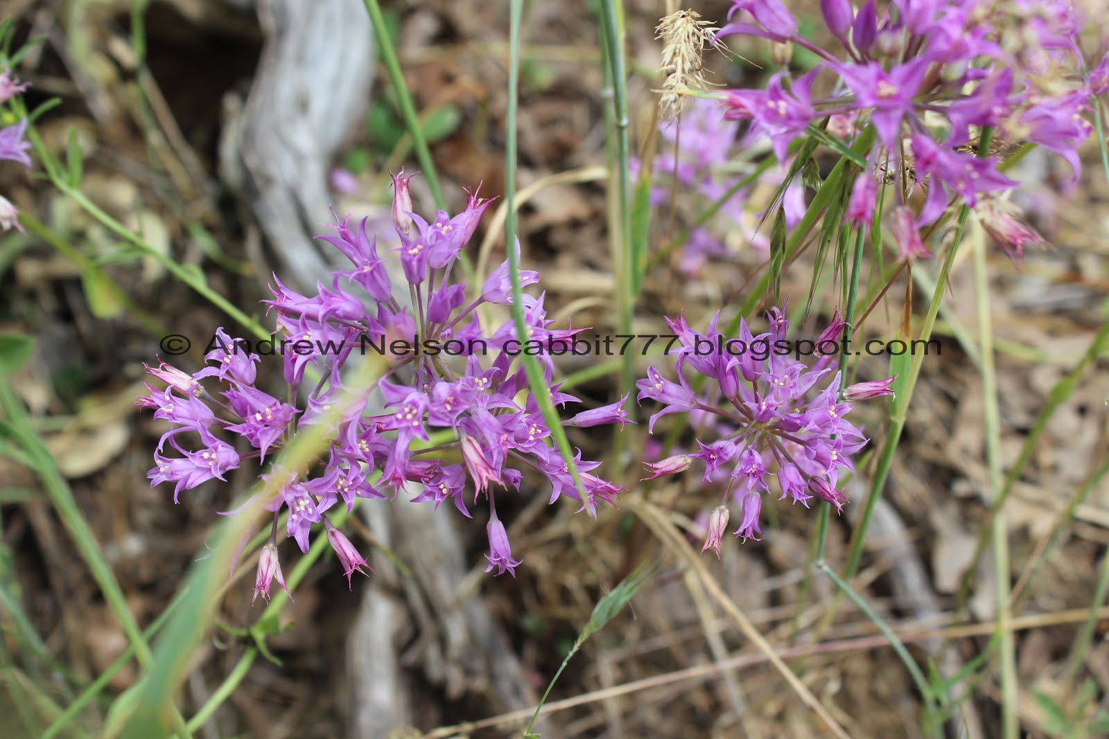
Taper-tip onions.

Lupine.

With this unusually wet and mild spring we have been enjoying very green foothills quite a bit later in the season than normal.

Bird hunting above. Little too high up to try to identify.

View below. I can see our car.

More up.

If you decide to do the loop I mentioned, this is where you will cross to the other canyon on the way down. However, we still haven’t made it to the top, so, continue following the dirt road for now.

More wildflowers.

Oi. this trail is quite the climb! But at least it is nice and wide.

More taper-tip onions. I think they are pretty.

I love these gorgeous blue butterflies and they don’t often sit open like this for me. I think I have finally identified these as Silvery Blue Butterflies.

Antelope Island in the distance. It looks a little weird from this far south.

View southwest.

More lupine.

What in the world?

There is a crack in the pipe and it is gurgling up like a little geyser.

The butterflies like the water.

Almost to the top, whew!

A little more to go, but at least it is more flat.
Also this is where you would pick up the Sawmill Trail if that is what you are after.

Well. That is comforting.

Nearing the mouth of the canyon.

More lupine.

You can hear a waterfall, but can’t really see it.


Some pretty flax.

Spillway.

Well, crap. I guess this is as far up the canyon you can go. This is almost exactly a half mile up.

Trying to get a shot up canyon.. eh.
The Bonneville Shoreline Trail does continue to the north, so we decided to go along that for just a smidge. Not too far as we have got to get back for family stuff.

Some wild snapdragon.

The BST is a little thin through here, but nice and green.

These signs are located every couple of feet through here. Don’t ruin it for everybody else and stay out!

Pretty trail.

The trail gets a little thin and steep through here.

Wonderful view though.

Panoramic.

Kennecott Mine.
We only went a little further, but it was getting time for the Family Barbecue so we decided to head on back.

Little sub peak.
Looking up into Big Willow Canyon.

Split rock.

Pretty forest.

The outflow.

A peak up above. I thought it might be Lone Peak, but I don't know for sure.
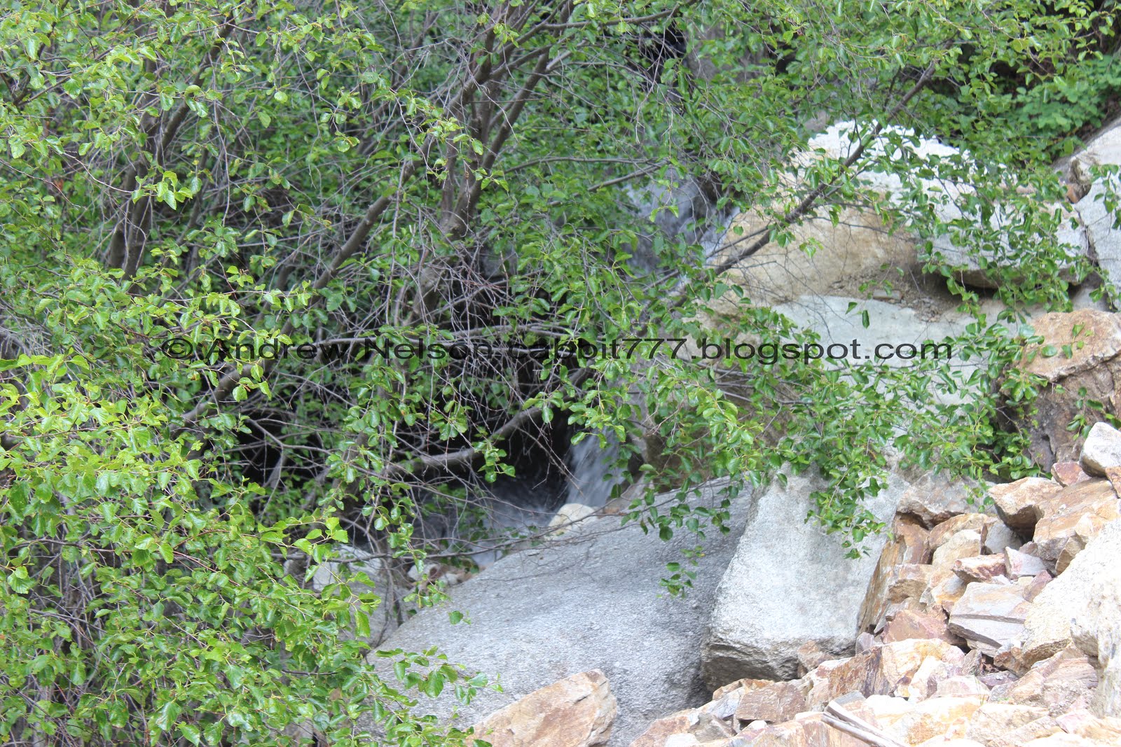
A little bit of a better view of the waterfall, but not much. Meh.

The trail back down.

I think this is a rocky mountain dusky wing.

View down.

The split pipe again.


More of the silvery blue butterflies.

I think this is a painted lady butterfly.

Another view of Kennecott Mine and Yellow Fork Canyon just to the left of it.

Another rocky mountain dusky wing.

I am not 100% sure what these tiny flowers are, but I think they might be false flax.


Wild daisies.

Hidden Valley Park below.

More of the field bindweed.

Back to the paved trail around the park.

Last look into Big Willow Canyon.
I am a little disappointed you can’t get much further into the canyon. However the views were great. The wildflowers and the butterflies were wonderful. Meh, I think it is a nice little short trail with a nice view at the end (if you go just a little further). Even with it being a little steep it was not bad though. 7 out of 10 squirrels.
As for difficulty, It is a good climb, but the trail is wide for the most part and fairly smooth. DR3.
Dogs are not allowed as it is watershed.

No comments:
Post a Comment