.jpg)

Quick Details:
Length: About 5.2 miles out and back (this includes the walk through the Washington Lake Group Site Campground).
Trail Type: Out and back.
Difficulty: DR3. It is mostly flat, with a very gradual decline towards the end.
Elevation Gain: About 400 feet.
Restroom: No, but there is one at the Crystal Lake Trailhead.
Dogs? Yes! I am not 100% clear on leash rules though. when in doubt I tend to stay leashed.
Other Info: Fee Area. $6.00 for a 3 day pass. Bring exact change or a check if you plan to use the self serve stations. Otherwise you can stop at the ranger station in Kamas to purchase it.
To Get Here:
From Kamas drive about 25 miles up the Mirror Lake Highway. Turn left following signs for Crystal Lake Trailhead. Now here you have a choice. You can park at the Crystal Lake Trailhead by taking the 2nd right, and pick the trail up from there, or continue forward and park at the Crystal Lake TH Overflow parking. Then you will walk up the road through the Washington Lake Group Campground to the end and pick up the trail there.

The new wildlife overpass at Parleys Summit (PSP (Passenger Seat Photography)). It has been wildly successful! They have a trail cam up there and have caught deer, moose, skunks, cougars and even a bear using it. So happy to hear the wildlife can safely cross the freeway here.


Jordanelle looking nice and full (PSP).

Some fun peaks along the Mirror Lake Highway (PSP).

After you turn off the main highway you have a great view of Mount Watson (PSP).

Again from the Crystal Lake Overflow Parking.
The Trail:

Apparently, when no one has a group site reserved they lock everything up (including the restrooms). There was a sign that said ‘No day use’, which I took to mean you can use this as a picnic area, but nothing that said we couldn’t pass through. I started the pedometer app here at the gate.

Some pretty fireweed.

At the end of the group camping sites you will see a staircase leading into the woods. This is the beginning of the trail.


Into the woods!

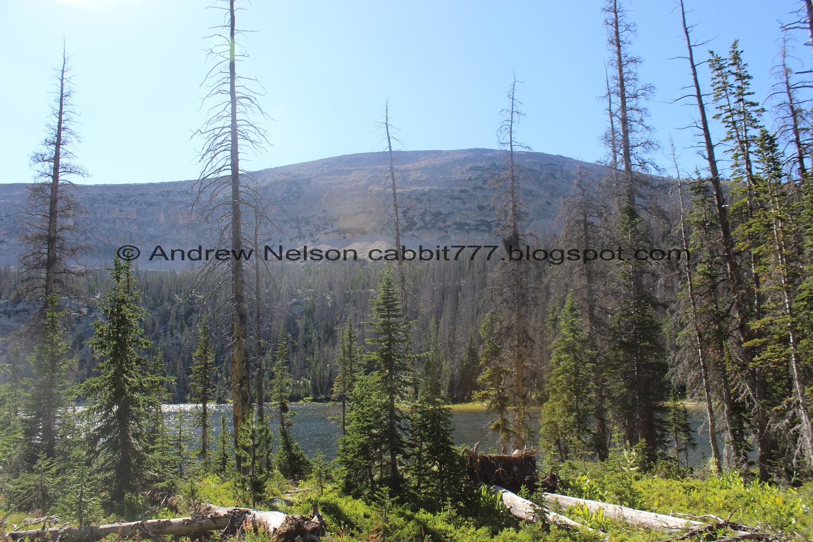
First glimpse of Washington Lake.

Washington Lake with Mount Watson above.
From here we are going to take a left and head west.

It is also signed so you know you are going the right way. However you will be generally following the shore of Washington Lake south-ish for a while.

The trail is very strong for the most part (couple spots that made me question it, but easily picked up again before long).

Little ponds.

The trail follows the shore of Washington Lake for a while. I knew this lake was big since we have camped here before, but holy crap it is massive!

Little island.

The water is nice and clear.

View of Watson Peak again.

Panoramic of Washington Lake. Again, wow this is a huge lake!

Another little island.

Another panoramic.

You know you are in the Uintas when you see a boardwalk like this.

Lovely meadow to the left.

Washington Lake to the right.

Submerged trees.

Pretty forest.

A nice little bay.

Chickweed.

Another little bridge.

Lake Washington again with the little island.

More of the pretty forest.

Some pretty Indian paint brush.

Another little bridge.

Another little pond.

Another boardwalk. This is some of what your fee goes towards. Helping to ensure you don’t have to trudge though muddy areas.

Pretty flower.

Another meadow with a pond.

Closer look of the pond.

Another little bridge.


I think we are near the end of Washington Lake.

Clever rock bridge.


I just noticed these guys blooming for the first time this year. This time though, I got close enough to finally identify it as a California corn lily.

Still hiking next to Washington Lake.


Wew! We finally made it to Tail Lake.

I am having trouble identifying these guys but I think they are pretty.

Watson Peak above Tail Lake.

The water level is high enough that Tail Lake is completely connected to Washington Lake and it makes you wonder why it is a separately named lake. I guess normally that gap is quite a bit more narrow.


Nice little meadow with a bunch of wildflowers.

Elephant heads.

More lovely forest.

Tail Lake again.

With Mount Watson again.

The little creek that runs from Shadow Lake down to Tail Lake.

From the back end of Tail Lake. I think that is Notch Mountain on the right.


More pretty woods.

It took both of us a second to understand just what we were looking at here, and I think we both said what in the world at the same time. Didn’t take long to guess it was an overturned tree.

Confirmed by taking a few more steps. I’ve seen this before, but usually there is a big root ball with it, not flat.

Here’s another one.

Muddy section. But there were plenty of rocks to step on.
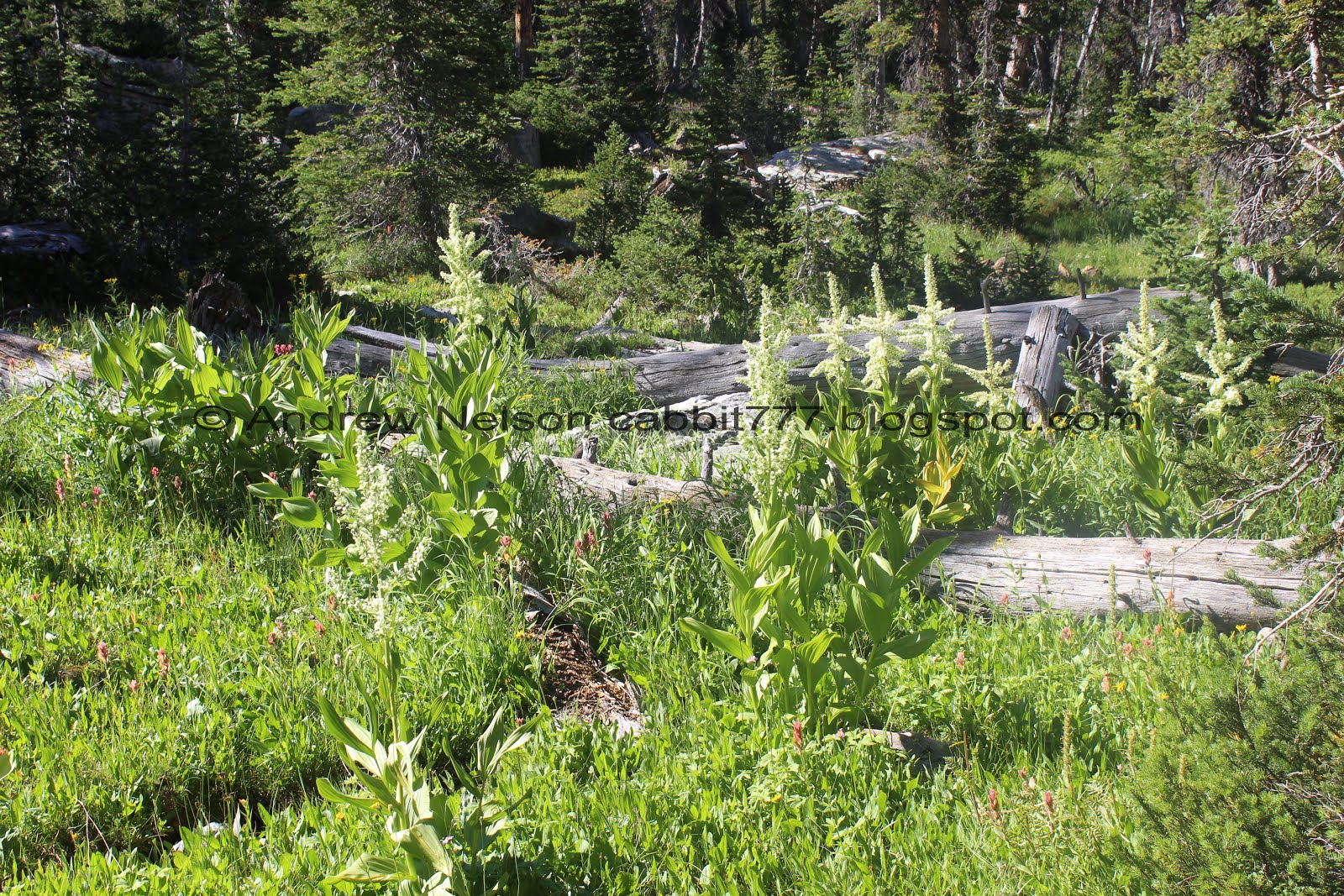
More of the California corn lilies.

The tree fall pulled up a rather large rock. There are a lot of fallen trees in this area. That is a little disturbing. Particularly with the wind today.

Bee on a corn lily.

We made it to Shadow Lake. This is about 1.6 miles along. And it looks like we still have a mile to go (that was pretty accurate).
Shadow Lake again. Not to be confused with the Shadow Lake above Park City.

The trail climbs up a little ways above Shadow Lake.

Enjoying the forest.

Neat split rock.

I really enjoy the forest, if it isn’t terribly obvious.

Looking up.

Eventually the trail starts to swing to the east.

More thick forest.

Holy crap look at the size of the boulder that tree brought up with it.

Last look at Shadow Lake.


More forest.

Another little meadow.

This is a short section that I wasn’t sure if I was still on the trail. But we just kept going strait and before I got frustrated we could see the trail again.

This boulder strewn area is the saddle you will pass through and the high point of the trail.

Big boulder.

Now we start heading downhill. It’s still a fairly mellow grade down though.

Another fallen tree.


More forest.

This is what a fallen tree gets reduced to eventually.

The way the trail was described to me I was half expecting steep switchbacks here near the end, but honestly it was pretty much like this the entire way down.


A lot of the trees through here seem pretty young. I wonder if there might have been a fire at some point. I didn’t notice any signs of one, other than the younger looking trees.

Eventually you will come to a trail split. There is a sign pointing to the right with Haystack Lake so we went that way. I wonder where the trail to the left goes? If maybe it is possibly a shorter route that connects to the Spring Canyon Rd? I don’t know.

Squirrel.

First little glimpse of Haystack Lake.

Another trail split. This one isn’t signed, but considering I can see the lake to the right, I decided that that was the way to go.

Almost there.

Haystack Lake below Haystack Mountain.

Panoramic.

Looks like some made a wooden raft and lost it.

We found a little campsite to sit down and relax at for a little bit.

The lake again.

There is a faint trail that appears to go around the lake. We didn’t do that today though.

Well we enjoyed the lake for a little bit but it was starting to get late so we decided to head on back.

This part of the trail kind of looks like it used to be an ATV trail or road.

A little lightning tree.

A weird bent one.

Pretty forest.

I could think of a couple other parts of the trail that a cairn would have been helpful rather than here. The trail was quite strong here.

More forest.

Seriously the easiest climb ever.

Tree broken by this boulder on the way down.

I am still not able to identify these.

Again, the boulder field marks the high-point of the trail.

Heading back down.

More forest.

Wild daisies.

Little meadow with some paintbrush in it.

The forest is getting nice and thick again.

First glimpse of Shadow Lake, well on the return trip.


Forest again.


Back down to the split rock.

Shadow lake.

We took the short little trail down to Shadow Lake.

From the other direction.

Continuing along.

Indian paintbrush.

First glimpse of Tail Lake.

Some great reflection.

With Mount Watson.

Back to the trail.

Still Tail Lake.

Big batch of chickweed.

Quick Panoramic of Tail Lake. Unfortunately the sun is in a terrible spot right now.

Where Tail Lake connects to Lake Washington.

Pretty forest.

Back to Lake Washington.

More forest.

Back to the neat rock bridge.


More forest.

One of the little ponds in a meadow.

Little bay.

Back to the long bridge. Almost done! This is just about the easiest trail in the world, but we are starting to feel the length of it.

Looking into the lake below.

Mount Watson again.

The little island again.

Mount Watson.

Notch Mountain.

Another panoramic.

The Washington Lake Dam. I have no idea how, but I managed to completely not notice this on the way in. I saw the sign point to Haystack Lake and I guess I just went into hyper focus mode and b-lined it towards the lake haha.
Anyway, point is if you parked in the overflow area, you will go right here. If you are at the Crystal Lake TH then continue along over the dam.


Just a short bit left.

Interesting flower, looks like maybe a goldenrod of some sort.

Back down to the Washington Lake Group Campground. Just about a quarter mile left.

Some nice fireweed.

A cute red-orange bee enjoying them as well.

Reids Peak and Bald Mountain.

Neat rock with circular stripes. Made me wonder if it was petrified wood for a minute.

Heading down the group campground road.

Mount Watson again.

Back to the gate.

Heading back down the Mirror Lake Highway (PSP).
I really, really enjoyed that trail. Several pretty lakes, a few ponds and meadows. Beautiful forest and the wildflowers are great right now. Also, fact that it was not a busy trail at all, we only ran into a few other people. Not to mention how easy going it was and the trail was. It could only be easier if it was paved. Going with 10 out of 10 squirrels today.
As for difficulty, it was a really easy going trail. Minor ups and downs but overall generally flat. The length might make it a little difficult for some but otherwise it was great. DR3.
Dogs are allowed, but I am not sure what the leash requirements are so I tend to be safe and stay leashed. Remember to clean up after your furry friends!

No comments:
Post a Comment