Lake Solitude is beautiful lake surrounded by high cliffs, located above Solitude in Big Cottonwood Canyon. The trail features wildflower, lovely sights, and a pretty good chance of seeing wildlife. We are at the beginning of a historic heat wave (Earliest in the year it has ever been over 100, and longest streak, 6 days anticipated to be over 100). So, we decided to get out of it and do something high elevation. I am glad I did, it was only 80 degrees up at Brighton. We do this one often, but it is quite lovely.
Quick Details:
Length: 3.5 miles. If you decided to not circumnavigate the lake that will drop it to 3 miles.
Trail Type: Balloon, or out and back if desired.
Difficulty: DR3. It’s certainly a climb, but its not too bad.
Elevation Gain: 415 ft.
Restroom: Yes! Last year they built new ones even.
Dogs? No. Big Cottonwood Canyon is watershed.
Other Info:
To Get Here:
Drive to the top of Big Cottonwood Canyon, park at the Solitude Nordic Center. attempt to find parking lol.
The trailhead is at the southwest corner of Silver Lake.
Heading up Big Cottonwood Canyon (Passenger Seat Photography (PSP).
Nearing the top (PSP).
The Trail:
Note: Using my old camera again due to my new one being in the shop.
As I mentioned, the trailhead is at the northwest corner of Silver Lake, so you have to walk around it. The shortest route is to go to the right, or counter clockwise.
Beaver dam.
Mount Millicent to the left.
Silver Lake and Mount Millicent.
Again.
Trailhead sign.
Into the woods!
It is absolutely beautiful up here right now.
Trail split. left leads to Twin Lakes, right is a winter skiing trail, closed in summer, you want to go forward here to get to Lake Solitude.
Old trail sign.
I love me some aspens.
Forget me nots.
Pretty flowers.
Looking across the canyon at Scott Hill.
Pretty forest.
I think this is a buttercup, maybe plain leaf buttercup.
I love this little stone staircase they put in a few years ago, after some construction rerouted the trail here.
There are 2 splits to the left right about here. I believe they both lead back to Twin Lakes. Either way, stay on the main trail to the right.
Bluebells.
There are quite a few trail splits, generally you want to stay to the left, aside from the 2 I mentioned just before this, and the main split below.
Starting to hit a more mixed forest. Looking up.
Some of these trees are massive!
There are quite a few trees that have been cut down along the trail today. I wonder if they were damaged in the ‘Windpocolypse’ of September 2020.
The ski lift at the ridge. This part of the trail makes me a little nervous, being along a steeper ridge, but It’s super short, and not as bad as I psyche myself up for it.
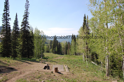
Frolf course.
Here is another spot you will take the right fork.
Back into the forest!
For the last third or so of the trail the forest is still a bit mixed, but is more conifers.
Neat candelabra looking tree.
The first of 3 scree fields. You can see the pika’s haystacks. But, we did not see any pikas, and wondered if maybe it is still too early on in the season for them (spoiler, no it is not).
Again you are going to want to veer left here. Right was the old trail, which kind of sucks. It looks like they might have rerouted it to connect to the summit trail.
The second scree field.
More pika haystacks.
It’s starting to naturalize but you can still see where the new route was cut into the mountain.
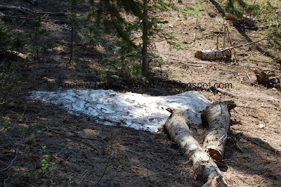
Some leftover snow. Woo!
Looking up.
Entering a stand of what appear to be lodgepole pines.
Looking up again.
Thick forest.
The third scree field is massive!
You have to walk through some of this one. Oh, and by the way, this means you are almost there.
I was just about ready to give up on seeing a pika today when we heard the alert call of one, I scrambled back and saw this cute little guy.
Then we saw a marmot!
Of course by the time I got the telephoto lens on they were both gone. But I think I had better luck on the way down.
Another small band of what I am pretty sure are lodgepole pines.
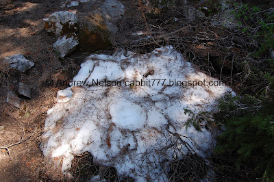
Another patch of leftover snow.
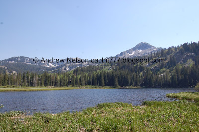
At just about 1.5 miles, we made it to the lake! Wewt!
Panoramic.
We decided to walk around the lake, which adds about a half mile.
The lake again.
Another panoramic.
Mine.
Lake.
Another snow patch.
Lake Solitude is pretty much a hanging lake. In that it exists on a ledge before a steep drop. It’s not as cool as THE Hanging Lake but still neat.
More snow up above.
Climbing up through the mine tailings.
The lake from the 'back'. I have talked about this before, front and back are entirely subjective, but I tend to think of the front as the point I generally access it first. I might even sometimes think, as in this case, the back as being the part with the cliffs behind it, and the front being open to the canyon. Again, totally subjective.
Pretty flower. Possibly a pygmy poppy.
The lake again.
Another panoramic.
The trail connects to the old service road. I swear one of these days I will take that up to the pass. Just wasn’t up to it today.
There is another mine in that wall.
The lake again.
Again.
Another panoramic.
The little offshoot to continue around the lake and back to the trail. The dirt road will wind its way back down to Solitude.
Nearing the front.
The thin area between the front of the lake and the drop off.
View below.
From the front.
A little closer.
The old trail, and a sign stating that it is closed. The old trail sucked though so I am glad they re-routed it. They did so to help control erosion, though, not necessarily to make it easier. That just came with it.
One last parting shot of the lake before we head on down.
Pretty forest.
Back to the big scree field.
We spotted the marmot again!
Cute little stinker.
He is surprisingly nimble running around the boulders. I guess you kind of have to be if it is your preferred habitat.
We hung around hoping to spot a pika again, but no luck, so we decided to move along.
The bottom of the big scree field.
Another patch of forest.
Looking up.
Hello cutey pie. I think we see deer on this trail pretty much every time we do it.
Little zoomed in.
More forest.
Then, another one, right next to us. Honestly it scared the crap out of us. I am sure the feeling was mutual.
I know they are super common, but I still love me a good deer sighting.
As she scampers away.
Back down to the middle scree field.
Oh! We have a friend.
Scamper scamper scamper.
Cute little fella.
He stuck around long enough for me to get the telephoto lens out.
I love these guys!
Pika butt!
I am probably the only person that loves these guys as much as I do, but they are super cute and fun to watch.
The scree field again.
Another patch of forest.
Back down to the lower scree field.
Haystacks.
Forest.
Back down to the frolf course.
As well as the ski lift.
Scotts Hill across the way. This peak is easy to recognize with the Mickey Mouse shaped mine tailings on the side.
Giant conifer.
Mixed forest.
More aspens.
Super pretty up here.
Back down to the Lake Solitude/Twin Lakes split. Go forward.
Looking up.
Back down to Silver Lake. I considered going around the other direction and completing that short loop as well, as it has been a minute since we did that, but wasn’t feeling it. Maybe next time. If you do that, it will add about another 1/3rd of a mile.
Pretty lake.
With Mount Millicent.
Duckies!
The outlet.
Pretty sure that is a beaver lodge.
With the beaver dam again.
Mount Millicent.
Some sort of damage to the boardwalk.
Scotts Hill from Brighton.
Heading back down Big Cottonwood Canyon (PSP).
The haze across the valley, yuck! (PSP).
This is one of my summer go to hikes. It is really just a lovely trek through a mixed forest, with some lovely wildflowers. I also enjoy the wildlife I tend to experience along the trail, and that for some reason, it is not a very busy trail. 10 out of 10 squirrels.
As for difficulty, It is generally a pretty easy going mild climb, with some rocky parts. DR3.
Dogs are not allowed as Big Cottonwood Canyon is watershed. Be sure to leave Fido at home.
.jpg)


No comments:
Post a Comment