.jpg)
The Creekview Trail in Corner Canyon is a nice trail alternate along the south side of Lower Corner Canyon that goes through some forest and offers some nice views of the canyon. To be completely honest I did not particularly care for this trail. I have issues with thin trails on steep slopes. Honestly there were only 2 parts that triggered my fear, but for most of the trail I was just stressing over it possibly being worse than it was. I could do it again now that I know, but there isn’t a whole lot to it so, meh. However, I wanted something a little shorter and easier because Landis’s foot is still recovering so it was a good option for that.

Quick Details:
Length: 2.61 loop with Lower Canyon Road. There is a shorter option if you start at the Coyote Hollow trailhead which is about 1.9 miles.
Trail Type: Out and back, several loop options.
Difficulty: DR3. It was a pretty easy climb.
Elevation Gain: About 430 ft.
Restroom: Yes year round.
Dogs? Yes, leashed. However this is right below the watershed boundary so if you are feeling adventurous, be sure to not stray above the BST.
Other Info: Once you take the Creekview turn off, this trail crosses a fast downhill bike trail, and parallels it for some time. Pay attention to the signs. If you find you are encountering a lot of bicyclists, you might be on the wrong trail! The Lower Corner Canyon Rd. is mixed use so you will see them there.
To Get Here:
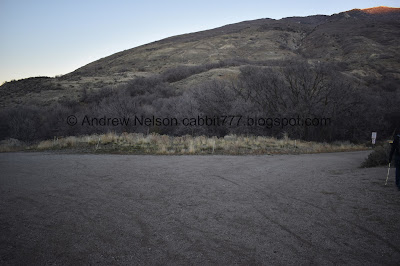
Take i15 to the Bangerter Hwy exit and head east. Go about a half mile and turn left onto 13800 S. Take that 1.7 miles it will curve to the north. Turn right on 1300 E. Immediately turn left on Highland Dr. Go about .4 miles and turn into the parking lot of the Andy Ballard Arena. You want to park near the northern end of the bicycle park.
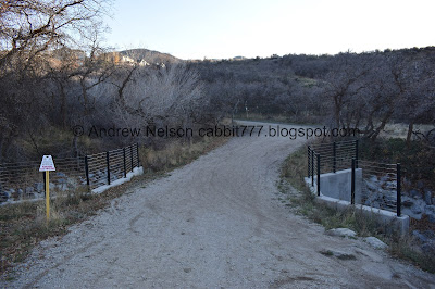
Look for the tunnel under Highland Drive. The trails on either side will get you down to it.
The Trail:

Area map. We were discussing today that we both agree that Draper has done a great job with corner canyon on having a great mix of multi use, hiking only, hiking and horse only, bike only and bike and hike and bike only trails.


The tunnel under Highland Dr.

From the other side.

Corner Canyon Creek.

Heading up the Lower Corner Canyon Road. This is mixed use, stay to the right and keep an eye out for bikes heading down on the left/north side.

There is a golf course back there.
Crossing over the creek.

The creek is dry through here.

Fast downhill bike lane. The signage is pretty good if you pay attention.

The lower canyon rd.

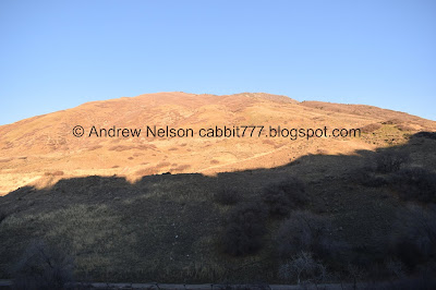
View of the valley below.

Signs advising to keep to the right.

A paramotorer.

The lower canyon rd. again.

At about 4/10ths of a mile you will reach the signed turn off for the Creekview Trail.

The mornings frost still hanging on. Guess this spot doesn’t get a lot of sun this time of year.

Heading up the hill.

More forest.

Thin trail on a steeper slope.

I can say with 100% certainty that this sign is less than a week old. It definitely was not here last week. But it looks like they have made a shortcut to make the Jungle Trail a little shorter. I imagine this is because the Jungle Trail is meant for kids.

Other side of the sign. So, you can make the journey a bit shorter by parking at the Carolina Hills Trailhead.

Creek below.

Green hillside.

Paramotorer again.

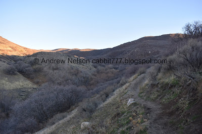
The canyon.

Forest.

The Jungle Trail. This was about 6/10ths of a mile up.

The Creekview Trail switch backs up from here.

It’s thin, and parts of the slope are a little steeper than I would like, but it’s not terrible.

The canyon below.

The valley below again.
Mount Jordan.

Where the trail crosses the Rush Downhill Trail. I have found that most mountain bikers are super careful and patient, however this is THEIR trail you are crossing here. So be sure to look left and be sure the coast is clear before crossing. I waited out 4 riders today. The first one, no actually all of them let us know how many were behind them. A practice that I really appreciate, particularly on mixed use trails.

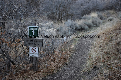
Trail sign.

Immediately after crossing the rush trail you will find a split. You want to go left. Right connects to the neighborhood. Also note: Bikes are allowed to return to the top using this trail. It’s mostly uphill so it probably isn’t an issue at all. I did not encounter any today.
One of the thinner, steeper sections I didn’t like.

Parts of the trail are very sandy. However, right now it is currently frozen solid.
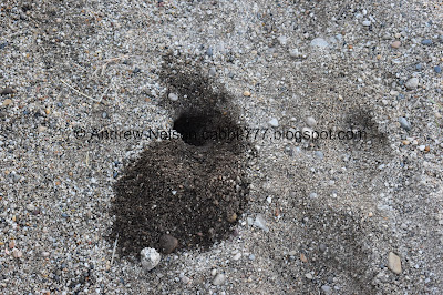
This animal den looks to be freshly excavated.

I believe this is the corner of Corner Canyon.

The trail again.

The canyon again.

Trail on the other side of the canyon.

The valley again.

For the most part this trail is just fine. The slope is not too steep.

Scrub oak.


Some more frost.

Starting to see Box Elder Peak poking up from behind the ridge.

The Silica Pit and a big rock.

The upper canyon.
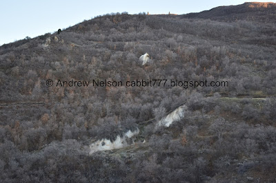
The Silica Pit again.

The Corner Canyon Crossroads.

Swinging around the corner into Coyote Hollow. This was the 2nd area I didn’t particularly like.

Finally starting to head downhill.
I didn’t realize it at the time, but we could have taken the Coyote Hollow Footpath down to the crossroads at least. Like I said, I didn’t know where it lead at the time so we decided to take the lower road back to the trailhead.


Crossing the side creek.

End of the Creekview Trail.
We could have gone back the way we came, but I decided to make a loop with the Lower Canyon Rd.

I love the little Draper City logos.

Heading down the Lower Canyon Rd. I thought this part of the road to the crossroads might be new to us, but I think we might have done it the first time we did Ghost Falls.

The side creek again.

Eventually we realized the Coyote Hollow Footpath pretty much parallels the road.

Mount Jordan. You can see Burnham Gorge on the side of it as well.

End of the Coyote Hollow Footpath.

The Rush Trail.
The Corner Canyon Crossroads.

The crossroads kiosk.

The Silica Pit and the big rock again.

Heading down the Lower Corner Canyon Rd.

It is totally counter intuitive, but when heading down the Lower Corner Canyon Rd. remember to stay to the left (south side). Fast downhill bikers will be on the right.

The beginning of the Jungle Trail. This is another option to take back to the trail head. Hit both trails in one bang! The mileage would be pretty close.

Corner Canyon Creek.


The road and some gnarly trees.

The creek again.

I say it every time we are up here, but this is the only area along the Wasatch Front I have seen warnings for poison ivy.

Water diversion thingy.

Road Split. Right leads to the Carolina Hills Trailhead, Left to the Andy Ballard Arena Trailhead.

Still heading down.

Crossing the creek, which is dry through here.

The new shortcut to the Jungle Trail is now signed. It definitely was not signed last week.

This is completely new too! Well, not the bridge, that has been there for a while. But it was previously fast downhill bike trail (we both know for sure as we witnessed several bikes cross the bridge, because it made a terrible noise!). Now it is foot traffic only, with access to the Carolina Hills Trailhead. I guess they are really trying to make the kid friendly trail more kid friendly by making it a little shorter. It’s crazy to see how much can change in a week!

Proof! The map has yet to be updated and still shows as downhill bike (yellow). This is just below the Carolina Hills Trailhead. Also the new shortcut isn't on it yet either.

Pretty pink sunset.

Heading down the road.

More sunset.

The valley below.

More sunset.

Some flowers still hanging on. Poppies?

Back to the tunnel under Highland Dr.

Last time we had to use the tunnel when it was this dark the lights were out. It was uhm, quite creepy. Glad to see that it is lighted after all.

There are little trails heading back up to the parking lot on both sides. Today we used the north one.

Heading back to the parking lot.

The valley below.

Panoramic.
Well, like I said I didn’t particularly care for this trail. It was pretty quiet, and not a lot of people, and it did offer nice views of the canyon, but otherwise it was just kind of meh. And I was just nervous about how high up we were (which is my issue, and not the trails fault haha). Anyway, 6 out of 10 squirrels today.
As for difficulty, it is a pretty mild climb and pretty easy going. DR3.
Dogs are allowed, but must remain leashed. As stated above, be advised you are near the watershed boundary. So if you decide to explore, be sure to stay below the BST.

No comments:
Post a Comment