Lake Solitude is a pretty high altitude lake locate above Solitude, in Big Cottonwood Canyon. The trail features beautiful mixed forests, wildflowers, wildlife, and a pretty lake surrounded by mountain peaks. Its a little rocky, and a bit of a climb, but it isn’t too bad. We decided to add on the rest of the Silver Lake loop as well today. This is yet another of our favorites that we do often.
Quick Details:
Length: About 1.6 Miles to the lake, and about a half mile around. So 3.2 out and back, 3.7 out, around the lake and back. Or, if you add Silver Lake it’s about 4 miles.
Trail Type: Out and back, Balloon, or double ended balloon.
Difficulty: It is a pretty mild climb, with some rocky parts. DR3.
Elevation Gain: About 600 feet.
Restroom: Yes, there are flush toilets at the TH.
Dogs? No. Big Cottonwood Canyon is watershed.
Other Info:
To Get Here:
Drive to the top of Big Cottonwood Canyon. The top is a big one way loop, you want the first area for the Solitude Nordic Center. Additional parking across the street.
The trailhead is at back, north end of Silver Lake. You can go either way, but the shorter route is right, or counter-clockwise.
Heading up Big Cottonwood Canyon (Passenger Seat Photography (PSP)).
Waiting at the construction light (PSP). I cannot wait for them to be done with this project. It is such a pain.
Fun clouds as we near the top (PSP).
The Trail:
Starting with the Silver Lake trail. As I mentioned, the shortest route to the trailhead is to the right, or counter-clockwise.
Beaver dam.
Mount Millicent and an unnamed peak.
The outlet with a beaver lodge.
You can see a school of baby fish amongst the water grasses.
Still the outlet, but looking towards the lake.
Silver Lake below Mount Millicent.
About 3/10th of a mile later you will reach the trailhead. Phew! It is still fairly accurate, even though the trail has been rerouted.
Also, the huge crowd you just dealt with around Silver Lake? Yeah, definitely a lot less crowded once you get back here.
Into the woods!
A hairy woodpecker.
Hairy woodpeckers have a twin called downy woodpeckers. Hairy woodpecker are slightly larger. But size can be a little rough to gage, particularly at a distance. The next best distinguishing feature is the length of the beak. Hairy woodpeckers beaks are long, about the size of the rest of their head. While downy woodpeckers beaks are short, about a quarter the length of the head.
I may or may not have nerded out with another birder.
Not very far up you will come to this 4 way intersection. Right has been closed for revegetation. Left leads to Twin Lakes, so that leaves us with going forward for Lake Solitude.
Old trail signs.
Then the climb starts.
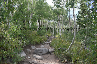
Very rocky.
View across the canyon towards Scott Hill.
Through the aspens.
I don’t know what this is, but I love that they are turning purple.
Some arnica.
Starting to hit a mixed forest.
Fun rock staircase. This came with the re-route they did a few years ago.
Oh, and a new rock staircase just above them. It is always fun to see trail improvements on some of our preferred regular trails.
Some daisies.
Entering Solitude property.
Giant freaking conifer.
I struggle a bit around this area below the chair lift. It’s a little bit of a steeper slope. But, I always manage to get myself through. There is no reasoning with the lizard brain, but I think I did a bit better today with it by just focusing on the trail.
Disc golf course.
Back into the woods.
Some pretty yellow flowers.
Another hairy woodpecker.
Look at that big ol beak!
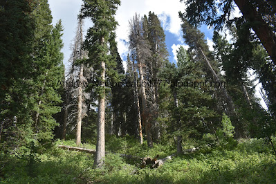
Forest.
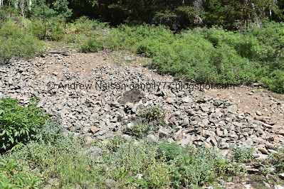
The first scree field.
I can see a few haystacks, but no signs of any picas. The haystacks are the piles of food they gather for winter.
Another 4 way trail split. You want the middle fork that is signed, and has this arrow. Left leads up to the chair lift, and right is a multi use trail that also leads to the lake. But, I haven’t checked that one out since it was rerouted. It was the original trail to the lake, but I know they closed it for revegetation when they opened this new trail. Not sure when it was rerouted and reopened.
Mixed forest.
2nd scree field. Again, haystacks, but no picas.
The original trail included a very steep scramble towards the end. This new trail is a HUGE improvement with a gentle climb.
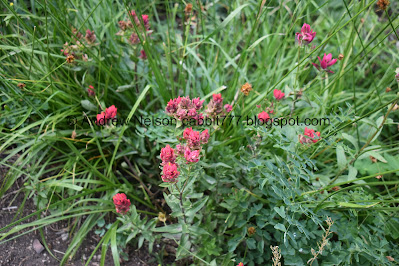
Paintbrush.
Lupine.
With a bumblebee.
Forest.
Mamma deer and fawn. We pretty much almost always see deer on this trail.
Fun little tree archway.
Thick forest. Pretty sure these are lodgepole pines.
Looking up.
Approaching the 3rd and largest scree field. Note: This means you are almost there.
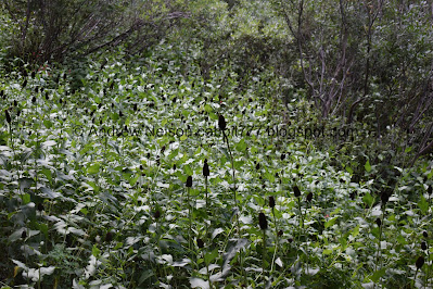
I think this is baneberry. Either way, best to not go munching random berries in the woods.
I could hear a couple picas but did not see any.
Not the best shot, but we saw a Steller’s jay that was making hawk like noises. I love these guys.
More paintbrush.
More forest.
We came across another one of those trail counters.
This one has a note explaining what it is. I have run across quite a few that don’t.
Trail Counter - this is not a camera!
This data helps to support trails.
Please do not touch. Thank You.
This project operates under a
U.S. Forest Service
Special use permit.
More forest.
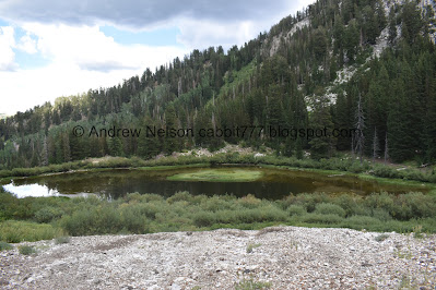
Before long we made it to the lake!
We generally seem to arrive with the sun right above that peak. Oi.
Panoramic.
We decided to walk around the lake. Its super short.
Mine tailings.
The mine.
Some big ol mushrooms.
Nearing the back end of the lake.
Loads of western cone flowers.
Some paintbrush.
The back of the lake.
More paintbrush.
View up.
Another tailings pile.
The trail actually goes right across it.
While offering a nice view of the lake.
Deer!
Another deer.
Another deer. Actually, this might be the same previous one.
The lake again.
The mine. I haven’t bothered to climb up and peer in this one yet.
Back down to the lakes level.
Smaller side trail that will get you back to the main trail.
This is kind of a hanging lake with the valley dropping severely below it.
The front of the lake.
Back to my preferred view of the lake, with some clouds covering the sun.
Panoramic.
One final view before we head back down.
Back through the woods.
The top, and biggest scree field.
Another deer.
Looking up.
Paintbrush.
Lupine with seed pods.
Back down to the middle scree field.
Ah hah! An active pica.
Pulled out the telephoto and caught him mid jump.
Hard at work gathering plants for his haystack.
Taking a quick break before he is off to gather some more.
Thistle.
Back with another load.
Another break to contemplate life.
He’s got a big one this time.
Back to the haystack.
Not sure what these are or were.
The lower scree field.
No picas, but I did spot this cute chipmunk getting it's munch on.
More forest.
These are kind of cute.
Not sure what these are either.
Back down to the ski lift.
More forest.
Lots of western cone flowers.
There are a couple really massive conifers up here.
The new upper stairs.
The lower stairs.
Conifers on the left, aspens on the right.
Lone conifer surrounded by aspens.
More aspens.
Big patch of yellow flowers.
More aspens.
View across the canyon towards Scott Hill.
Rocky trail.
Back to the 4 way split. Forward will get you back to Silver Lake.
More daisies.
Back down to Silver Lake. Which was disturbingly quiet at the moment. That changed pretty quickly though.
The quickest way back is to the left, but we decided to finish going around the lake and took the just slightly longer route to the right today.
Silver Lake.
Huh. I think I found a beaver lodge I haven’t noticed before.
Tree reflections.
The lake again.
Nice reflection.
Again.
Snuggle ducks.
The lake again.
Panoramic.
I was starting to worry we might get rained on, but we didn’t.
Another panoramic.
You can see the scree field you cross on the Twin Lakes Trail.
Silver Lake and Scott Hill.
Squirrel!
Cute little fella.
The lake again.
More forest.
Looking across the canyon towards Scott Hill again. Scott Hill is easily identified by the Mickey Mouse shaped mine tailings.
Nice reflection.
Another trail counter.
Hitting boardwalk again.
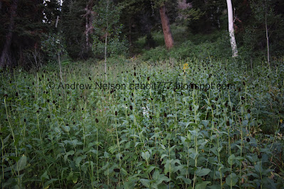
Monkshood.
The lake and it’s inlet.
With the unnamed peak.
Fun clouds.
Panoramic.
Another beaver dam.
Scott Hill again.
A sign about beavers.
Moody clouds over Mount Millicent.
Clouds above Brighton.
Where I found a nice patch of fireweeds.
A couple bumblebees.
More fun clouds.
Scott Hill again (PSP).
Heading down the canyon (PSP).
I love the newer moose crossing signs (PSP). Also, they are FINALY repaving over the trenches they dug. which were a little rough to driver over.
Random deer (PSP). Thanks for not jumping out in front of us.
I have no idea how in the hell I spotted this (PSP).
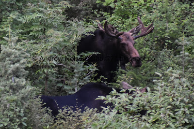
It was what I suspected, a big ol bull moose. I am glad Landis was able to safely, but quickly pull us over.
So handsome.
Oh snap! He’s not alone.
2 bull moose! I didn’t think they like to hang out together. I am guessing they must be siblings? We’ve only seen this once before.
Moving through the thick brush.
Another beaver dam.
Back to our moose friends.
Moving through the brush.
Losing sight of them.
So neat.
Then I got to view one of their backs for a moment, before the disappeared into the brush completely. Honesty, I probably could have waited for them to move some more, but we were both hungry and decided to head back down.
The creek.
Extra bonus, we got in line just as the stupid construction 1 way at a time light changed (PSP). We had to follow a long line of cars down, but we barely had to wait so that was a win.
We agreed if I saw wildlife through this section we would not be stopping.
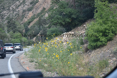
When you start seeing the roadside sunflowers, that is a good sign summer is coming to an end (PSP).
Storm Mountain (PSP).
Fun clouds above the mountains (PSP).
Faint, partial rainbow (PSP).
I really enjoy this trail, even with the short uncomfortable part. It’s really pretty, I often see wildlife, and it’s never really busy. Silver Lake on the other hand is quite busy haha. But, as a mentioned, you can minimize the time you have to deal with that. 10 out of 10 squirrels today.
As for difficulty, it is a pretty gentle climb for the most part, with some rocky sections. DR3.
Dogs are not allowed in Big Cottonwood Canyon, so be sure to leave Fido home.
.jpg)












.jpg)




.jpg)

.jpg)


.jpg)






No comments:
Post a Comment