Twin Lakes is a stunning reservoir located above Brighton in Big Cottonwood Canyon. The trail features wildflowers, an incredible view, and of course an absolutely beautiful high alpine reservoir. You also have a good chance of seeing some wildlife. The trail is a bit steep and rocky, but it’s fairly short so it’s not too bad. This is another one of our favorite trails that we do often.
Quick Details:
Length: About 2.6 miles out and back.
Trail Type: Out and back, balloon and loop options.
Difficulty: DR4
Elevation Gain: About 710 ft.
Restroom: Yes. There are flush toilets at the trailhead.
Dogs? No. Big Cottonwood Canyon is watershed.
Other Info:
To Get Here:
Drive all the way to the top of Big Cottonwood Cottonwood Canyon. Park at the Solitude Nordic Center AKA Silver Lake. The trailhead is at the back end of Silver Lake, you can go either way to get to it, but the shortest route is to the right, or counter clockwise.
Heading up the canyon (PSP).
The stupid construction is back on (PSP). They close one direction for what seems like forever to let the other direction through, then reverse it. I don’t know how long it is but it feels like forever. The sign at the bottom said through September. So hopefully they are almost done.
There are a couple patches of color to be found (PSP).
The canyon (PSP).
The Trail:
Heading around Silver Lake. Like I mention, going to the right is the quickest route to the trailhead.
Beaver dam.
Mount Millicent.
Cute little chipmunk.
The Silver Lake outlet with a beaver lodge. This is one of the headwaters of Big Cottonwood Creek.
The other side, coming out of the lake.
Silver Lake and Mount Millicent.
At about a quarter of a mile, we hit the offshoot for the 2 trails behind Silver Lake, that takes you back into the woods.
Shortly after that you come to the 4 way split. Right is a trail they are trying to revegetate. Forward takes you to Lake Solitude which while slightly longer, is quite a bit easier. and Left will take us to Twin Lakes.
It is signed, but they do tend to take the signs down in late fall though.
The trail is steep and rocky. But it is pretty.
Super pretty.
Neat tree that seems to have gotten a second chance at life.
Looking up.
Some thicker aspens.
We made it to the big scree field. I usually see picas and often marmots as well. But no luck this time.
One of my all time favorite views in the Wasatch Front.
The view again.
Closer view of the lake.
Panoramic.
Quick final view before we move on.
Some early changers.
Looking back at the scree field.
Short reprieve from the climb.
The main trail is super, super rocky. But for this upper section there is a side trail that is a lot easier.
There is a short spot that the super rocky trail is preferable to the thinner trail on the side because it is steep and sandy.
Back to the thinner trail.
When you can see Mount Millicent again it means you are close.
Little closer.
Then you can see the dam and you know you are almost there.
Looking across the canyon towards Scott Hill. Easily recognized with the Mickey Mouse shaped mine tailings.
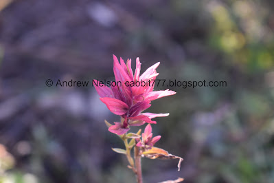
Paintbrush.
I keep finding these on a lot of the trails we like to use. It's a trail counter. Here is what it says:
Trail Counter - This is not a camera!
This data helps to support trails.
Please do not touch!
This project operates under a
U.S. Forest Service
Special Use Permit.
The final steep push below the dam.
The dam.
“No pooping in lake” snort. I hate graffiti, particularly in our natural areas, but at least this is on a man made structure.
We made it! Phew!
The dam and Mount Millicent.
Panoramic.
Mount Millicent, I am pretty sure the next one is Mount Tuscarora, and I think the next one is Mount Wolverine.
Another panoramic.
There is a scree field a little ways back that I often find picas in.
The lake through the trees.
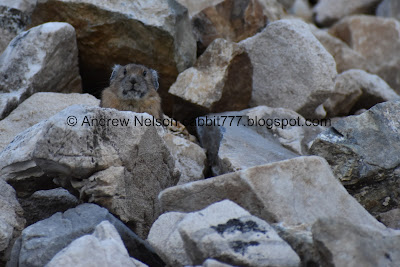
We only had a brief pica encounter, then he was gone. But also look at this ones creative haystack tucked under that slab. Neat!
This one just to show the gorgeous emerald color.
With the peaks again.
The lake and Mount Millicent.
Well, we decided to head on back.
It’s not super low, but it’s pretty low.
Trees and cliffs.
View across the canyon.
Mount Millicent.
Panoramic view.
Scott Hill across the way.
Chipmunk munching on some flowers.
Heading down.
Mixed forest.
Some daisies.
Some geraniums starting to turn.
Forest silhouette.
Coming up on the scree field.
The view of Silver Lake again.
We found another pica.
I love them.
I almost watched this hawk pick him off. I don’t know how I feel about that. I love the picas, but I also love hawks, and I know they’ve got to eat as well. I think I would have been equally horrified and fascinated.
Surprisingly he came back out.
We found a second one.
Silver lake again.
Back into the woods.
Little patch of color.
More forest.
Another small patch of color.
More aspens.
It is starting!
Silver Lake through the trees.
More aspens.
Old cabin structure.
The underbrush is starting to change.
Rocky trail.
Back to the 4 way split. Right will take us back to Silver Lake.
Found a patch of early changers.
Back down to Silver Lake. Sometimes I feel like completing the loop by going right, and sometimes I just want to get back to the car, and the shortest way to do that is to the left. Today was the latter.
Silver Lake and mount Millicent.
The outlet. Fun fact, that scree field up there is the same one we crossed on the way up and down.
Mount Millicent.
A pretty bush.
Heading down Big Cottonwood Canyon (PSP).
Downtown from 7200 South (PSP).
The Old Mill. You can see that better from the Big Cottonwood Canyon Trail.
This trail is a little bit tougher, and busier than the Lake Solitude trail because it is shorter. However it is very pretty, the lake is stunning, and I enjoy the small wildlife I tend to see along it. 9 out of 10 squirrels. Removing 1 for the steep rocky climb.
As for difficulty, it is a long hard, rocky climb. DR4.
Dogs are not allowed in Big Cottonwood Canyon. So be sure to leave Fido at home.
.jpg)


No comments:
Post a Comment