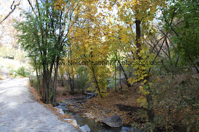
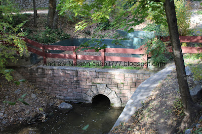
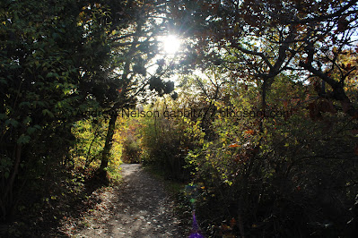
Miller Park is an absolutely stunning park set along the banks of Red Butte Creek in the heart of Sugarhouse. It features a creek, some beautiful forest, and some amazing stonework. It is a short trail that makes you forget you are in the middle of the city, and one of the few areas to enjoy Red Butte Creek. It is an area I really enjoy and come by pretty often.
Quick Details:
Length: About a mile out and back with the addition of Bonneville Glen.
Trail Type: Figure 8 or out and back.
Difficulty: Super easy going with a very mild climb. DR3.
Elevation Gain: About 100 feet.
Restroom: No.
Dogs? Yes, leashed.
Other Info:
To Get Here:
Take i80 to the 13th east exit. Head north on 13th E for about 1.5 miles. Turn right on 1300 S. 1600 Ft later turn left on 15th E. Go about 1600 ft later turn right on Bonneview Dr. There is street parking, but check the signs.
The Trail:
Bonneville Glen from above. You can skip this short section by parking a little higher up on Bonneview Dr. But, it super short, and just as pretty so I like to add it, and even kind of consider the 2 connected areas as 1.
A somewhat unique LD$ church house. Honestly I am surprised they have not torn it down to make it look like the rest of their cookie cutter church houses. They really seem to care more about consistency than history. According to that cornerstone it was built in 1949.
I love the ivy climbing up the trees.
This parking lot is for the church house, and is chained off so it cannot be used. I get it, it is their parking lot, but I mean, they need it for a few hours once a week. Seems a waste to let it sit empty the rest of the time.
Area sign with rules.
Into the glen with Red Butte Creek to the right.
Some nice color.
Big old fireplace.
So big I had to do a panoramic to capture it all.
It is super pretty through here.
Red Butte Creek. Other than Red Butte Canyon and Liberty Park, this seems to be the only public place to enjoy this creek.
Again.
More color.
Little waterfall.
A little closer.
Now we just have to climb this short hill.
The waterfall from the side.
At just under 2/10th of a mile we have reached Miller Park AKA Miller Bird Refuge.
Trail map and rules.
Information.
Some color.
Red Butte Creek below.
A neat stone staircase.
The creek below again.
A quick peek at the mountains.
More color.
More ivy climbing the trees.
It is a nice, wide, easy going path. I love the stone walls as well.
The middle bridge. We’ll come back to this as we come down the other side, but I love the stone work!
More color.
Looking back at the bridge.
The creek again.
The only thing that reminds you you are still in the city is the political posters people post on their private fences. Otherwise its easy to forget you are in the middle of the city.
More color.
Little lookout platform. With a sign about removing non-native trees to allow native trees to thrive.
More color. This is one of my favorite places to go and get some later season color.
The creek below.
Trail split. You want to keep right here. Left just connects to 9th South at the northeast end of the park.
The creek heading downstream from the northeast end of the park.
Another information sign.
Not sure if they built they fence around the tree, or if the tree forced its way haha. I am kind of leaning towards both. It looks like the upper section may have been an addition to the fence. I don’t know, just a guess.
Little amphitheater with neat stonework.
Now we will head down the other side.
Some excellent color.
Where the creek enters the park with some more incredible stonework.
Continuing along with more of the neat stonework walls.
More color.
The creek below.
Some pretty purple flowers.
Stairs.
More color.
The creek.
Caring for Miller Park.
The trail follows right by the creek through here.
It’s quite lovely.
Nice clear water. Nice to see that after the oil spill a few years ago.
Super pretty down here.
The creek again.
Pretty forest.
Forest and creek.
Little Rapid.
More creek.
More color.
Back to the middle bridge. Just look at that stonework!
Information sign.
According to the sign it was built by the Works Progress Administration (WPA) somewhere between 1935 and 1943.
Top of the bridge. It really is a fine bridge.
Looking upstream from it.
Downstream.
Back on the trail, heading uphill again.
The creek again.
More color.
Through the woods.
More color.
Looking across the gully.
More woods.
More ivy.
Color.
Down to the lower bridge.
The trail up here does not appear to go much more than another 20 feet, so time to cross.
Bird house.
This bridge isn’t as cool as the other one.
Downstream.
More stairs.
Back to the end of Miller Park and entering the Bonneville Glen.
More color.
Back down the hill along this winding path.
Back to the little waterfall as we cross over the creek again.
Downstream.
Upstream with some color.
The waterfall again.
Continuing down through the glen with some color.
It’s pretty through here too.
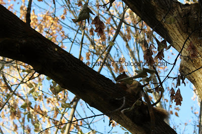
Squirrel!
Better lighting. Man they are big through here.
More color.
The creek again.
Continuing along.
Along the creek.
The big fireplace across the creek.
The creek again.
Where the creek leaves the glen. It continues downstream for a little while before going underground. It makes a brief appearance again at Liberty Park before going underground again and joining Emigration Creek and Parleys Creek. Then a very short section that has been recently daylighted just before they all join the Jordan River at the 3 Creeks Confluence.
One last look at the creek.
Some color.
The final climb up out of the glen.
I really just love this little park. It is so pretty, and I love the old architecture. It really does make you feel like you have been transported out of the city too, even though you are definitely still in it. It’s not too busy as well. 10 out of 10 squirrels.
As for difficulty, it is pretty easy going with some short ups. DR3.
Dogs are allowed, but should remain leashed.
.jpg)


.jpg)


No comments:
Post a Comment