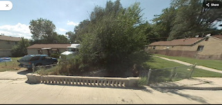
Kaleidoscope Park is a very small park located in South Salt Lake. It features a short walking path, a butterfly garden, and a little bit of Mill Creek to enjoy. The park looked somewhat new, so, as I tend to do, I played around on google maps. It looks like the south side had a house prior to 2010, after that it was removed and the park came in. The north trail seems to have been here for a while. This is a very small micro park, I recommend adding it on to Fitts Park (we did that afterwards) or something else nearby.
Quick Details:
Length: Eh, about a tenth of a mile.
Trail Type: Loop, Loop de loop, connector.
Difficulty: Pretty flat and paved. DR2.
Elevation Gain: NA
Restroom: No
Dogs? Yes, leashed.
Other Info:
To Get Here:
From i15 take the 33rd South exit heading east. Turn left on 5th East. The park will be on the left about 2/10ths of a mile later. Street parking only.
The Trail:
Park sign and rules.
Mill Creek coming out from under 5th East.
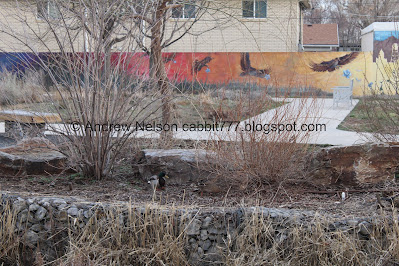
Neat mural on the south side of the park, with the south loop. We didn’t bother with that today. I am sure once the garden blooms, that might be nice but right now, not so much.
Panoramic showing the full mural.
Neat pergola and bench next to the creek.
Pollinator Habitat and Monarch Waystation.
Mill Creek again.
Downstream.
South side again.
Downstream.
Looking upstream.
From here the channelized creek flows past a few more houses before coming out again at Fitts Park, which we will be doing next.
The north side of the park has this neighborhood connector, which has been here longer than the park. It also includes this kind of worrisome cement bridge over Mill Creek. I mean, its just a thick wedge of cement hanging over the creek.
Upstream.
Downstream.
Some duck friends on the other side. I am noticing that most ducks appear to be pairing up right now. Must be mating season.
Continuing along.
Duck friends again.
The park again.
Back to where the creek emerges out from under 5th East.
This looks like a storm water drain that exits into the creek here.
The creek from 5th East.
Playing with google maps. here is the property in 2007. The connector trail to the north (right) is there.
2011, the house is gone, and it has been cleaned up, and new paths put in.
2022. Looking like what we saw today.
Well, it is a tiny little park, but it is not a bad little park. Plus, I always enjoy seeing the public reclaim access to our creeks, no matter how small they it may be. There was no one else here today either, so that was nice. 4 out of 10 squirrels.
As for difficulty, its short, flat and paved. DR2.
Dogs are allowed, leashed. Please clean up after your furry friends.
.jpg)


.jpg)


No comments:
Post a Comment