I am excited to announce I finally managed to hike up to Timpanogos Cave. This of course was merely weeks after 2 separate accidents on the trail, one fatal. I can honestly say I was terrified of this trail because of that. So I was a very nervous climber. I think this was a good thing because I made a severely conscious decision that I would come to an absolute halt, ensure I had stable footing and not move when I went to take pictures. Over cautious, a bit, but I made it safely. – Side note, now that I have hiked up and back, I no longer fear this trail. As long as you are conscious of the fact that it is dangerous, and are aware of your surroundings, it is a perfectly safe trail.
Anyway, we made our appointment, met up with Monica and headed on out to Alpine, then up to American Fork Canyon. We paid the parks and rec fee’s and then proceeded to the visitor center.

Picked up the trail head tickets and proceeded to hike. Luckily the way it works is a lot different than I thought. By “guided tour” I thought that meant your group met at the bottom and you hiked as a group up. Thankfully no, they expect the hike up to take about 2 hours and you have a 2nd appointment at the top to have the guided tour through the caves. So we got to hike at our pace. Monica is a little slower than us as she has asthma, but I think that was a good thing. She kept us a slower pace so we didn’t kill ourselves. yay.
 View further up the canyon
 Cool tree
 Hole the trail goes through

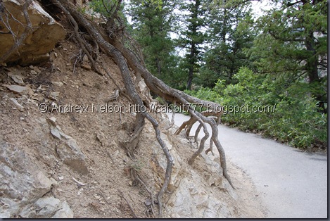 I was rather fascinated at the resiliency of tree’s. They grow out of solid rock here!
 View out of the canyon.
 After what seemed like forever, we finally get a glimpse of the cave opening, and it’s still WAY up there. hoy boy.
 We all absolutely loved these birds. After Monica talked to her mom (a bird watcher) we determined them to be Steller Jay’s. Gorgeous birds!
We finally get to the cave entrance and proceed to wait for our scheduled tour. Apparently we made good time as we were over a half hour early.
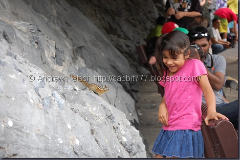 This is really a sweet picture isn’t it? I should probably just leave out what happened directly after. Meh it really is sweet the girl was wanting to pet her little friend who was curious about her, but was also nervous of it. So her “petting” was more like quick taps, or essentially hitting the poor chipmunk. I wanted to scream at her, but kept my mouth shut thinking well if it bites her, she had it coming. HAHA I am an evil person.
 Here we are at the top waiting to be let in. (thanks to Monica for the pic) We are exhausted, but anxious to go into the caves.

 One of the things that I was most impressed by was the fact that every single man made (blasted) opening they created in the cave system, a door was placed there. They explained that this was to keep the airflow as close to the natural flow as before they blasted, in an effort to keep features from drying up. I am so impressed that they thought of this and did this. As the cave system consists of 3 separate caves, connected by man made tunnels, all with doors on both ends. i.e when you left the first cave you opened the door, the group entered the man made tunnel, and before the door could be opened to the 2nd cave, the 1st one must be closed. Kind of like an airlock system. GO Spanish Fork Rangers! I am so proud!
Anyway, I got sidetracked, onto our tour Starting in the first (Hansen) Cave. Before entering the 2nd door in the little waiting room that showed the natural opening above our heads, the tour guide started out with the whole where is everybody from? We discovered that half of our group were from well, where they are from does not matter. The point is that these people would not shut up! and even though the ranger explicitly said do not touch the formations (because the oils on our skins stop the growth, essentially killing it) all of them touched everything! I wanted to scream at them, but what would it do? The old saying that American tourists are assholes? No it really should be just all tourists, no matter where they hail, are assholes. Sigh. Small irritation that did not overall ruin my trip.
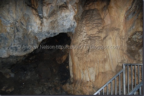


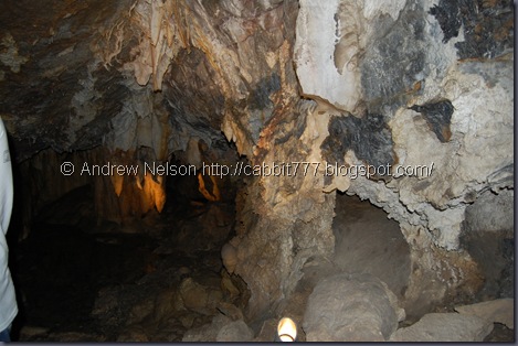 The next thing that impressed me was (as you will see in the various pictures) that they had lights on the various interesting features. To kind of point out and showcase what you were looking at. The ranger (in the parts I could hear him) would plan the various lights to go along with was he was speaking about. It’s like the worlds nerdiest light show! and I loved it. hehe. Now on to more cave shots:
 This is a cave lake, which is named, but I don’t recall it. Another random fact I learned was that the term “Lake” in a cave is kind of misleading. A lake is any body of water that is there year round. So this tiny, 8 foot max puddle is considered a lake.


 I think at this point we are in the 2nd or Middle Cave, but I really couldn’t tell you truthfully.


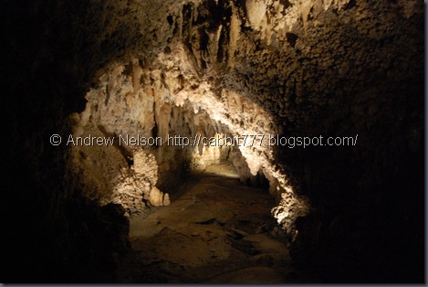 Looking back through some of my pictures, I remember trying to get the natural (well not natural but lit by the cave lights) lighting and not using the flash. Well, that resulted in quite a few ruined shots as well, I don’t hold still enough for that. hehe. But some of them turned out really nicely.
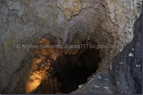
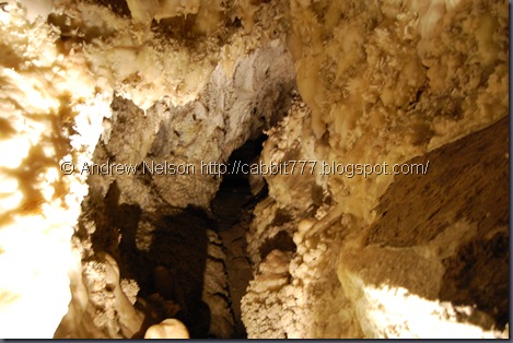


 I believe this is another lake.
 “The Heart of Timpanogos.”
 The Japanese room?, or something similar the small formations are called Soda Straws.


 By now I believe we are in the 3rd (Timpanogos) Cave.

 There are 2 named formations in this shot, the Chocolate Sunday, and the Kimodo Dragon.
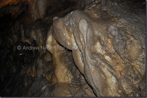 I wanna call this Pluto, but I guess it is just the Bassett Hound.
Then we made it out of the cave’s HOORAY! I survived! There were definitely some tight squeezes, enough that I was uncomfortable. I honestly have no idea how spelunkers can do caves that they barely fit in. I would absolutely have a panic attack.
 The trip back down offers another amazing view of the valley below.

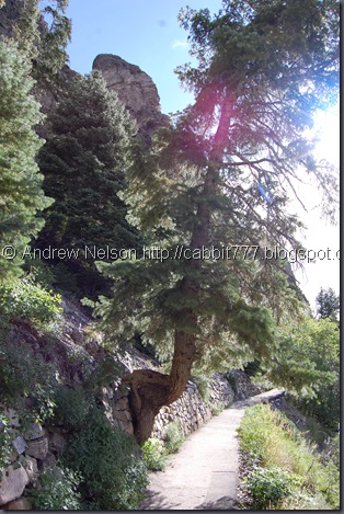 Tree growing out of the wall
 Cute chipmunk let me get super close!

 The power of nature
 And stable steady ground at last. Looking back at the sign I can’t believe I just hiked that!
 Spanish Fork River.
Sigh. I really enjoyed this hike. Absolutely gorgeous, the most amazing end prize and plenty of wildlife. I would give this trail a perfect 10 except for two things: The fee’s (park and trail) Park fee was $6.00 per car, trail was $7.50 a person. And of course how crowded it was. So my final score will be: 9 squirrels out of 10. Even with the crowds and the fee’s it is so worth doing. I loved it.
Upon seeing the amount of people on the way down I will say this. Basing the decision off of what I saw this day, the latest trip offered on Sunday seems to be a good bet. There were not very many folks coming up on our trip down so you might have a nice smaller tour. Something to think about.

.jpg)


