.jpg)

Quick Details:
Length: 5.5 Miles out and back, we did about 5.23 (ugg so close!)
Trail Type: Out and back.
Difficulty: DR4 The climb is relentless.
Elevation Gain: 1709, we ended up doing 1538
Restroom: Yes, flush toilets at the TH.
Dogs? Yes, kind of surprising for a water source, please clean up after your furry friends.
To Get Here:
From i15 take exit 269 for Route 265/University Parkway. Keep left at the fork, follow signs for UT-265 E and merge onto UT-265 E/W 1200 S/W University Pkwy. Merge onto UT-265 E/W 1200 S/W University Pkwy. Use the left 2 lanes to turn left onto W 2230 N/N 550 W. Turn left onto N Temple Dr. Continue onto E 2300 N. Turn left onto Rock Canyon Trail (which is really continuing forward as the main road curves to the right right here, but yea. You get the gist).

Heading up University Parkway we get a view of the canyon we are heading towards (PSP). I Just didn’t know for sure yet but lucky/logical guess.

BYU’s Y (PSP). That’s another trail I should check out some time.

The canyon is behind the Provo Temple (PSP).
The Trail:

The trail starts out on an old paved road. I imagine you probably used to be able to drive up a little further but that had to change due to popularity. The road splits at one point, but they appear to join together again so I don’t think it matters which side you take, but we went left.

Already I am super excited, this looks amazing!

Amazing rock formations.

Squaw Peak.

There appears to be a cave up there. And if you look really closely you can see a small dot of a climber on the cliff there.
There appear to be quite a number of caves and mines through the canyon. Definitely a lot to explore here.

The creek is diverted for water uses so it is dry down here.

Crossing the creek bed.
This canyon is incredible.

Looking back out of the canyon you can see Utah Lake.

I love the ephemeral waterfall stains it’d be cool to see them going.

More rock climbers. Totally not a sport I could ever get into.

Another little cave.

This looks more like Southern Utah than Northern.

We somehow managed to not take the main path up. So little thinner here crossing the creek bed to get back to the main trail.

I love all of the different rock formations here.

Chlorination Plant. Oh fun, fatal gas! o.O

Just look at those folds! And I think that is still Squaw Peak above.

Before long you will come to a gate. I think this is just a measure to keep cars from attempting to use the old jeep road.


More fun rock layers.

New pipeline. I call it that because there are still remnants of what appear to be an older pipeline (as you will see later).

Lovely canyon.

Our intended destination today doesn’t appear to be listed here (the campground).

Jagged cliffs to the right.

Squaw Peak to the left.

Dry creek below.

Old jeep roads are my favorite kind of trails. They are nice and wide. Even better when they stay to the bottom of the canyon as this one appears to do for most of the way.

Mossy cliff.

Little outcropping below Squaw Peak.

Another ephemeral waterfall stain.

Starting to see some plant life.

Cairn in front of a scree field.

Quite lovely up here.

What appears to be the remains of a car.

Another neat rock formation.

On the other side.

The trail.

Really enjoying the sights on this trail.

Well that is something you don’t see on too many trails, a random drinking fountain.

From what I can tell, during the warmer months it will flow continuously.

Another scree field. I think I am starting to get a sense of why it is called rock canyon. Here I was thinking it was because of all the rock concerts held here.

Another cairn.

More fun cliffs.

I never really captured it right, but this is just a relentless climb. Just constant up!

Another scree field.

Bridge 1 of 5.

In fact it is numbered. The only other trail I can think of that numbered the bridges was Hanging Lake in Colorado. Which is funny, because I was starting to think this canyon reminded me of that one.

Starting to see some snow.

The old pipeline is just a cement shell now.

More cliffs.

Fun outcropping.

Giant boulder that appears to have come from above.


Bridge 2.

This one has a sign saying it was restored in 2012 as an Eagle Scout project. I’m not sure if that meant just this one, or all of them, but they are all in good shape so, probably all. Great job guys! Always appreciate a good bridge!


Looks like there was a land slide through here.

Cliffs above. I am not sure, but I think this is the back side of Y Mountain.

I like to try and remember to look behind me occasionally.

I dub this Spiral Knob.

With a nearby spire.

Starting to see more snow.

Oh now there is some water in the creek.

Bridge 3.

Downstream.

There is a nice little cascade upstream.

Pretty forest.

I find it funny that this canyon reminded me of the one for Hanging Lake as like that canyon, the water here has a green tinge to it.

A little cave. I looked like it goes down pretty steeply so I didn’t want to get too close.

Bridge number 4.

The creek again.

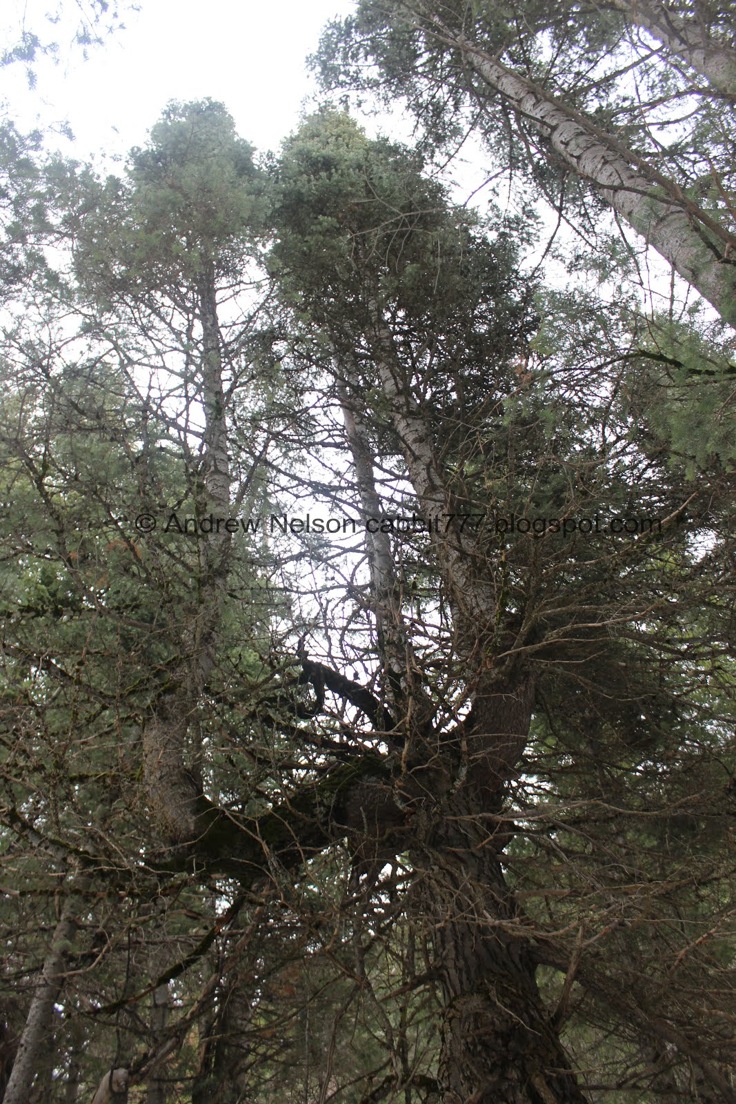
Getting more into the pines.

I think I found Rock Canyon Cave... but we didn’t go explore it.

Mossy tree.

Bridge number 5.

The creek again.

The newer pipeline again.

The creek again.

Gnarly tree.

Another one that broke off. I’m going to guess from the brutal winter we had this year. That or possibly lightning.

Whelp, looks like we trekking through the snow for the remainder of the hike.

Trail split. I wasn’t sure which way to go.

Until I saw this rock on the left split that said Squaw Peak. I wasn’t intending to go to Squaw Peak today so, right it is.

One of the several access points for the pipeline.

There are a couple segments of the trail that are seriously absolutely dead silent. It’s a little eerie. Considering I happened upon this hike from an article claiming that that the canyon is haunted, I guess it makes sense. I do tend to find new hikes in some of the weirdest ways.

The creek under the snow.

The forest.

Hahahaha. If you feel the need to leave a mark on a trail, this is the way to do it. And what better part of town to leave this mark.


Now the trail is reminding me of Mill Creek Canyon. Church Fork to be more precise.

Another peak.


More pretty forest.

Love the striped mountain backdrop.

Leaf melted into the snow. I always think this is neat. This happens because the darker color absorbs more light so it warms up and melts down.

Mossy trees.

Trail split. Right looked better, but left looked more traveled so we went left.
There is an incredible candelabra style family tree here! Almost as cool as the Candelabra Tree in The Redwoods.

Snowy forest.

I think this is a good example of what a tree well looks like. I learned that these can be a dangerous skiing hazard. Just imagine this happening all the way up in 10+ feet of snow.

Striped mountains again.

More forest.

We had been struggling in the snow for the last little bit so we decided to call it quits here. When I got home I took a look at the map and we were seriously so close that it is a little frustrating. However, the end is just a campground, so not a huge loss. Like I said, this trail is all about the journey.

Heading back down getting a nice view down canyon.

Little sub peak.

More of the snowy forest. There were quite a few spots that we really didn’t have any other choice then to foot ski down haha. It was kind of fun but also a little scary.

The creek through the snow.


I love the bright green moss.

I think this is Squaw Peak.

And I think this is still Y Mountain.

Forest again.

I was so sick of sliding around on the snow I preferred these thin rocky sides haha.

Mess of branches.

Better look at Squaw Peak.

Through the thick woods.

The creek again.

The old pipeline, this is the only section I saw that still had the pipe.

Back down to bridge 5.

Cliffs and peaks.

Mossy rock.

Closer look at the cliffs. I love the striped layers.

Bridge 4. I wanna say this is approximately halfway. It is also about where they snow on the trail started to decrease.


The creek again.

Looking down canyon. It’s crazy how narrow it is at parts.

The neat spire again.

Looks like semi recent rock falls here. Saw something similar in Bryce Canyon on the Piracy Point Overlook.

The neat spiral fold that I earlier decided to name Spiral Knob.

The front of "Spiral Knob".

Looking down the canyon again.

Back down to bridge 2.

Heading down the trail.

Bridge 1. Almost done.

Peaks above again.

This cliff looks like a face, with a bush for an eye.

View out of the canyon with Utah Lake.

Old pipeline.

The trail again.

Tree hanging onto another tree.

Back down to the drinking fountain.

Squaw Peak again.

Narrow spot.

Down canyon view with the weird face to the right again.

Lower down just rocky and awesome.

Mossy rocks.

Super tight through here.

The old pipeline with an old stone wall. This looks like the spillways in Memory Grove.

Amazing rock formations again.

View down again.

Back down to the gate. Just a little ways to go.

Amazing folds.

Utah Lake again.

Back down to the chlorination pant.

Another cool rock formation.

Little cave.

Utah Lake again.

Neat rock formations and another cave.

Now that we are back down to the trailhead, we decided to check out the interpretive center.

Some signs to tell us about the area. This kind of irks me. Important trail information is not at the beginning of the trail, but tucked away to the side. I didn't think to go off to the side to see trail info before we went up. But, eh, well, we made it.

Trail sign.

Amphitheater above.

Geology sign

With matching Squaw Peak.

Plants and animals.

There’s even a nice pavilion.

Utah Lake as we leave the park (PSP).

Mount Timpanogos on the way back (PSP).
That was one of the most incredible hikes I have done in a long time! Just a couple minutes after hiking and you are transported miles and miles away to an incredible rock wonderland which eventually gave way to a beautiful forest walk. The mouth of the canyon is quite busy with climbers, and other people, but after the first half mile the number of people seriously dropped to pretty much insignificant so we got that wonderful secluded experience as well. Going with 10 out of 10 squirrels!
As for difficulty,while is is not necessarily a steep climb, it is a relentless climb that doesn’t really let up so I found it to be a little tougher than it appears. DR4.
Dogs are allowed, leashed. Please clean up after your furry friend.

No comments:
Post a Comment