The Bear Canyon Suspension Bridge in Draper is, one of 2 suspension bridges that I am aware of along the Wasatch Front. And it is by far the more interesting one. The other one is in Creekside Park in Bountiful. It’s been a few years since we’ve done this one and I wanted something a little shorter and easier. This was a bit shorter, but not that much easier haha. But it was a great first hike of the new year.
Quick Details:
Length: About 2 miles out and back.
Trail Type: Out and back, with the option to do a balloon.
Difficulty: DR3. There is quite a bit of a climb.
Elevation Gain: About 400 feet.
Restroom: Yes, flush toilets I believe, but they are closed in winter.
Dogs? Yes, leashed. But stay below the BST and watch signs. You are skirting the edge of the watershed boundary.
Other Info: Microspikes recommended.
To Get Here:
From i15 take the 123rd S. exit and head east. Turn right on 1300 E. Take the traffic circle around to the 3rd exit onto Pioneer rd. heading east. Turn right on 200 East. Turn left into Orson smith Park.
Low clouds today (Passenger Seat Photography (PSP)).
You can see the suspension bridge from Pioneer rd. (PSP).
The Trail:
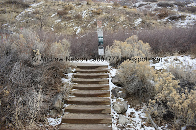
The trailhead.
Start by heading up the stairs.
Additional kiosk. I think this is new.
They have added some fencing to the areas they are trying to restore.
Heading up the sandy switchbacks.
The Jordan Narrows below Point Of The Mountain.
You can see the Kennecott Copper Mine from here.
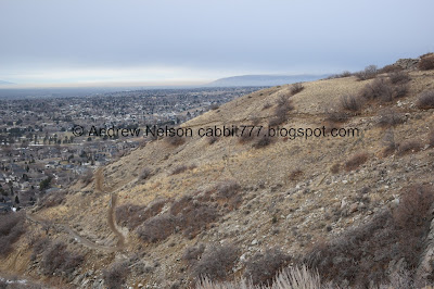
The hillside we are climbing.
Pro tip: If a side trail is covered in sticks like this it means they are trying to restore it.
Antelope Island off in the distance.
Mountains to the north.
Panoramic of the valley below.
Eventually you will hit the Aqueduct Trail. You will want to go left.
The little gully we will continue up.
About 50 ft down the Aqueduct Trail you will come to the BST Connecter. This is the easier way up, but it also means doing ALL of the climbing in the beginning. If you continue a little further down the Aqueduct Trail you can go up the other side of Bear Canyon. That gives you a little bit of a break from the climb.
Last time we did this we did the full loop, and I did mention I think I prefer to go up the other way. However, there were a couple parts on it that made me a bit nervous so today we just came up and down this. I now think this is my preferred way.
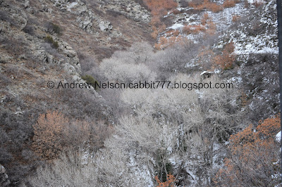
The gulley below.
Another view of Kennecott.
Heading up the switchbacks.
Oh boy. I was hoping that this trail was exposed enough to not have a lot of snow. I decided to put the microspikes on. This was the worst spot though.
More climb.
It’s weird the soil here is obviously very wet, but its not muddy.
Fun split rocks.
Eventually the trail mellows out a bit. You gain almost all of the elevation in the first half mile going this way.
The hills above.
Still some inversion holding on.
Another panoramic.
The neat split rock again.
Landis saw someone on that trail above and asked if that was where we were going. I was glad to inform him no, we are pretty much done climbing. That is the Cherry Canyon Trail.
Now we are officially on the BST.
The split for the Cherry Canyon Trail.
The split rock again.
The BST is on a wide bench and is pretty flat through here.
The inversion above downtown again.
First glimpse of the bridge towers peaking out.
Getting closer.
There it is, in all it’s glory.
Closer.
Dedication plaque. It was completed in 2015 with donations from residents and friends of Draper city. It is 185 feet across.
I don’t recall where I saw this particular stat, but it is 130 feet high.
The bridge.
Last time I was able to cross the entire thing and wasn’t too nervous. Today it was swinging a little bit and the microspikes felt weird against the wood. I imagine if I had taken them off I would’ve been fine.
I did make it a few feet out. Looking down Bear Canyon.
Up canyon.
One last view before heading back.
You can take this side trail, Bear Canyon Loop, to see the original bridge and a little waterfall. The new suspension bridge was built to keep dogs out of the water source. I had planned to add that today, but didn’t want to with the icy trails today.
Some of the people to thank to have access to this trail.
If you decide to do the loop, this is the trail down the other side of the canyon.
Heading across the BST.
I love the way the light is coming through the Jordan Narrows.
The view down again.
The split off of the BST down to the trailhead.
One last look at the hills before we head on down.
The inversion above downtown.
Another panoramic.
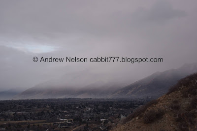
Love the look of this storm over the mountains.
One short section that had a different soil type and was kind of muddy.
The storm again.
Kennecott again.
The storm moving on already.
Looking down the gully.
Back to the worst of the steep and icy part.
Back down to the Aqueduct Trail.
50 feet later, you will reach the trail down to the trailhead.
The mountains to the north again. That storm moved through really quickly.
Deer trails.
Little bit of sunset peaking through the cloud cover.
Almost back down to the parking lot.
This is why you will see shortcuts covered in sticks.
There are signs that this hillside experienced a fire at some point. I am not sure if this post was a post when that occurred, or if they used a scorched stick to make a post.
Signs of the fire.
Antelope Island again.
Fun lighting.
Fun clouds.
More fun clouds on the way home (PSP).
I am super glad we came back to check this out again. It is a neat bridge! And a rarity around here. Now that I have gone up both ways, I think I prefer this way. I am not completely opposed to doing the loop again, so maybe next time. We passed a few more people than I would have liked, but it wasn’t too bad. Going with 9 out of 10 squirrels today.
As for difficulty, You gain almost all of the elevation in the first half mile but overall it isn’t too horrible. DR3.
Dogs are allowed, leashed. Just make sure you stay below the BST!
.jpg)


No comments:
Post a Comment