.jpg)
The Jordan River Parkway is a trail that follows the Jordan River for ~45 miles through Salt Lake County, and then connects to the Legacy Parkway in Davis County, and extends a little south into Utah County. I am slowly working my way along it on days that it is just me, or when avalanche danger is too high. I hope to eventually complete it. Today was another just me day. So I worked out the next section. Shields Lane to East River Front Park. I actually quite enjoyed this section. For the most part it was fairly removed from residencies and businesses.

Quick Details:
Length: 1.6 miles, 3.2 out and back.
Trail Type: Out and back, or connector.
Difficulty: DR2. Its flat, and paved.
Elevation Gain: NA. My pedometer didn’t register any elevation change.
Restroom: Not at Shields Lane, but there is one at East Waterfront Park.
Dogs? Yes, leashed. Please clean up after your furry friends.
Other Info: Cities: South Jordan. Mile Markers: 20
To Get Here:
From the north, Take i15 to 90th south head west. Turn left on Sandy Parkway. turn right on 10000 S (Shields Ln). Turn left into Shields Lane Park.
From the south. Take i15 to 106th south. Head west. Turn right on Jordan Gateway. Left on 10000 S (Shields Ln). Turn left into Shields Lane Park.
The Trail:

The tunnel under Shields Ln. where I left off last time.

Trailhead map.

Lots of helpful directional signs.

Fun old sign.
On the trail.

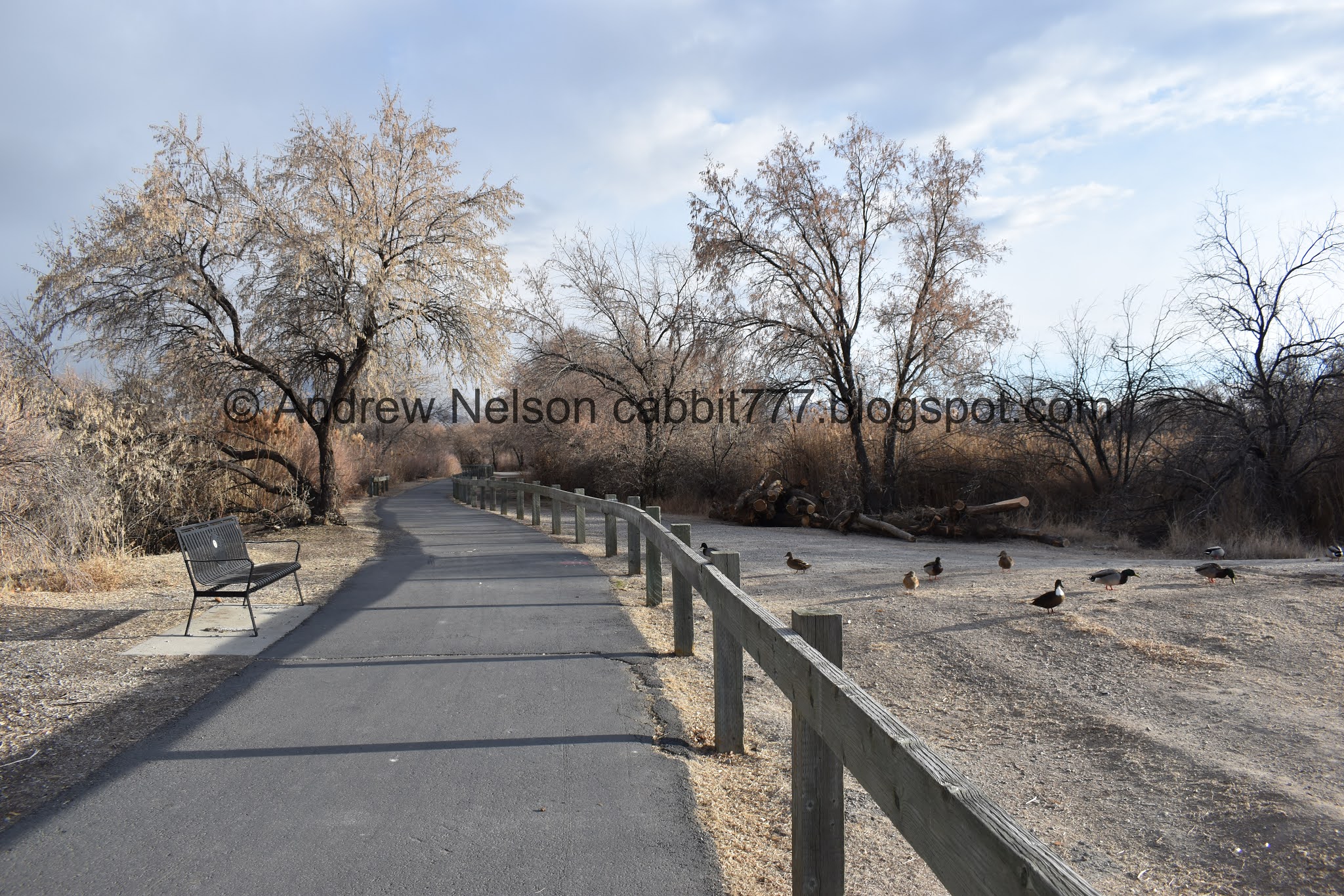
Duckies!

Like most of the entire trail system, the vegetation hides the river for a lot of the way, but there are spots that open up to see it.

You never know with ducks as you walk by them. Some are chill.

While others freak and and frantically fly away.

Some ducks and an American coot.

I imagine that normally there might be a nice view of the mountains. Today though they are a bit obscured by storm clouds.


More ducks.

More of the trail.

There are quite of few of these birdhouses along the way. The hole is a little bigger, so I wonder if this design is for ducks. Quick google search seems to confirm that.

South Jordan seems to have their own mile system. I noticed these start in the last segment I did. It starts at the city border.

The river again.

Hanging sock like nest. According to the Jordan River Parkway map, this is likely to be a Bullock’s Oriel nest. The birds themselves can be seen along the parkway in the summer time.

For most of the way, there is an equestrian trail right next to the paved trail. So, don’t be too surprised if you see a horse or 2.

More ducks.

This section of the trail is fairly far from most buildings, which is nice.

Golf course on the other side.

More ducks. Holy crap, this section of the trail is lousy with them!

I like how each city has put their own little spin on the benches, and various other things along the trail.

The little city mile posts. It appears they post every quarter mile.

Little rapid.

Master Jordan River Parkway mile marker 20. Not sure if this is 20 miles from Utah Lake, or 20 miles from the Utah County border.

The river again.

Another directional sign.

Holy cliff swallow nests, Batman!

Somebody appears to be home.

Heading under 106th S.

The river again.

More nests.

Another South Jordan mile marker.

Information sign. This talks about how trees planted deeper than normal seem to do better along the river.

This short segment follows next to a business district, but it still feels pretty wild.


Before long you enter a nice forested section.

South Jordan mile marker 2.

More ducks.


A murmuration of starlings.

Again, it is a shame the storm is blocking out the mountains today.

At the South Jordan 2.25 mile marker, I reached the East Waterfront Park, my intended destination of the day. So, it was time to turn back.
I am not sure what to do about the next 3 segments. I have a short one, followed by a long one, followed by an even shorter one. I am going to have to spend some time looking at maps and see if I can turn 3 segments into 2.

Helpful trail marker.

From the other side.
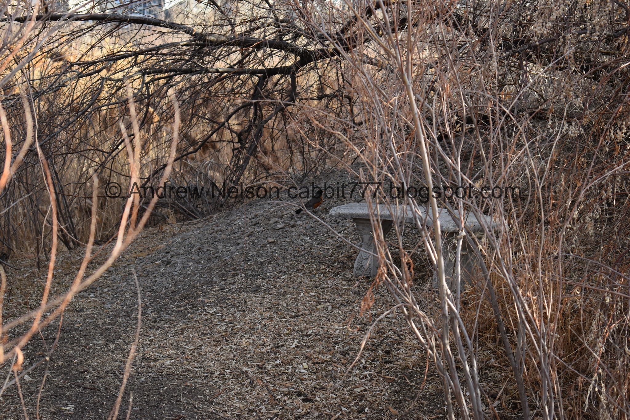
Nice little nook, with a robin friend.

Back to the last duck hangout.

With the river.

Forested section.

Ruh roh. Am I going to get snowed on again? Luckily I only experienced a couple of flakes towards the end. Not too bad.

The storm over point of the mountain.

.Heading back under 106th south.

More swallow nests.

Some of them build some elaborate and weird shapes.

The river again.

There are even more nests under the bridge.

The nests on the other side.

Information sign.

Park regulations.

The starlings worked their way down here.


They are fun to watch.

Back to mile marker 20.

A hawk way, way up there.

More ducks.

Panicky ducks. I always feel bad when I startle them off, but I mean… I don’t really have an option to go around them.

More of the trail.

Geese.

Also very panicky. Seriously guys? I am not going to hop in the water to get you.

More trail.


More ducks.

The river.

Almost back to the trail head.

I love this lighthouse looking house.

Fun clouds.
I actually really enjoyed this segment. For the most part is was away from houses and businesses. There were sooo may ducks today, and a couple of other birds to enjoy. There are also a couple of options to grab a snack or lunch if you feel so inclined. On this holiday Monday, it was not as busy as I was worried it might be. 8 out of 10 squirrels.

As for difficulty, it is paved, and generally flat. DR2.
Dogs are allowed, but must be leashed. Please clean up after your furry friend.

No comments:
Post a Comment