I liked this section of The Jordan River Parkway a lot better than I did the previous section. There is a short section through a neighborhood, but otherwise it’s all parks and open space. Plus there are quite a few interesting things to see along the way. My mileage came up a bit short today, which is odd, it usually goes over. But, looking back to the map I don’t think I quite made it to my intended destination. Whoops.
Quick Details:
Length: The map said 1.7, but I came up short and went 1.62 so 3.24 round trip. or. 3.4 if you go to the right spot.
Trail Type: Connector, out and back.
Difficulty: DR2. Paved and pretty easy going.
Elevation Gain: About 20 feet.
Restroom: At 17oo South Park.
Dogs? No. Big Cottonwood Canyon is watershed.
Other Info: Cities: Salt Lake City. JRP Mile Markers: 36 and 37
To Get Here:
Take 201 to exit 150, Redwood road. Head north. go about 6/10th of a mile and turn right on 17th south. Go About 7/10ths of a mile and you will see 17th South River Park on the left.
After parking, the trail picks up to the east, on the other side of the river.
The Trail:
The east end of 1700 South River Park.
Crossing over the river.
I love this little mural with a great blue heron.
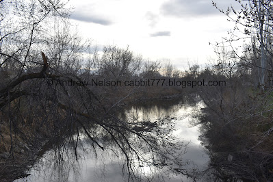
Bend in the river.
The Jordan River Peace Labyrinth. I tacked that on to the last section, because I knew this section had a couple neat features, so I didn’t explore again it today.
Panoramic. I tried to capture the whole oxbow it sits on.
Another mural.
Mountains above.
Mile Marker 36.
Geese.
The trail.
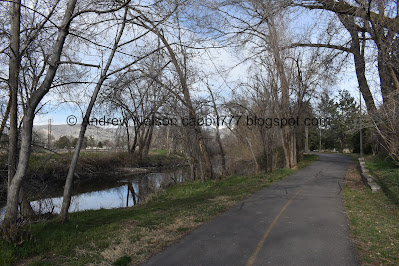
The river again.
Neat fence mural.
I like the frog.
Delicate Arch and smokestacks.
Hands reaching up under the mountains.
Salt Lake Cities benches are fancy. Although, I can’t help but notice the hostile architecture. I.e. intentionally designed to prevent someone from sleeping on it.
There are quite a few homeless camps scattered through the area, but not as bad as the previous section.
Crossing back over the river.
Not the best view of the river from it.
The trail is weird here at California Avenue, and goes to the west, but then you have to head back east to get to the crossing. Naturally this desire path/shortcut has worn quite wide. Anyway, you do have a dedicated light to safely cross.
Another nice part before we get the the icky part.
The river.
Informative sign. This answered some questions I had, and shows where the 4 creeks in Salt Lake City were diverted and buried.
Geese.
The 3 Creek Confluence. This was a fairly recent restoration. I decided to make that it's own post.
Another mural.
Neat bridge. It looks like a tied arch bridge, but I think it is just a fancy truss bridge.
Better view of the confluence.
Trail and river.
Random dock.
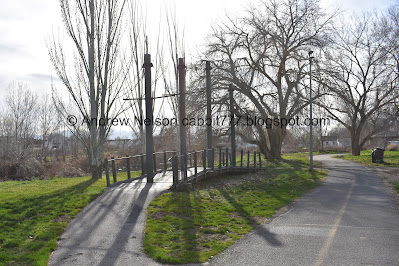
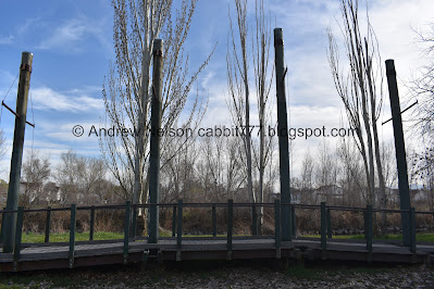
Crossing over the river again. Just an FYI some of the boards on this one shift o.O.
View downstream.
Upstream.
Bend In The River Park.
Neat pirate ship type play area.
Urban Treehouse.
This little path doesn’t make any sense to me. But, what do I know?
Little spring, or pond.
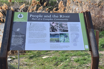
This sign really didn’t offer much more than talking about the river, the greenway that has been preserved along the river, and how the restoration projects are beneficial.
Front of the park.
More greenspace.
Mile Marker 37.
Wow, that was a quick mile.
The river again.
Passing the International Peace Gardens. Another fascinating area that I decided warranted it's own post.
Random little dock.
View from it.
Upstream.
Downstream.
The trail and river again.
Duckies!
I caught a glimpse of a pond or something on the other side of the river. Looking at google, it appears it is an oxbow lake, that has been preserved as the Fred and Ila Rose Fife Wetlands Preserve. Might have to check that out some time.
Holy giant granite slab, Batman.
Well, not granite. I learned it is concrete over a metal frame.
This is huge!
The river.
Neat bridge.
Again.
Well, I knew the next trailhead I was after was after the International Peace Gardens, and this looked good for me. I did push on to the 9-Line Trail crossing.
Trail sign.
9-Line trail and bridge. That also leads to the Fred and Ila Rose Fife Wetland Park.
Another mural.
This sign shows what the river looked like in 1937, and then after they channelized the river. They really destroyed a lot of wetlands. But then it talks about how now we have seen the damage our ancestors caused, and how we are working on restoring what we can.
This one mostly talks about how Salt Lake City is building a robust trail system for non motorized travel around the city like the Jordan River Parkway and the 9-Line Trail.
Alright time to start heading back.
When your sign is bent and delivers questionable content instead. hahaha Yes, I am 12.
Clearly this sign is working.
The neat bridge again.
After this I explored the International Peace Gardens. I decided to make that a separate post.
I popped out back on the Jordan River Parkway at this bridge to a connector trail.
The river again.
Mile Marker 37.
Crossing over Freemont Ave. It’s not a busy street, so looking both ways covered it for me, but there is a signal to indicate you are crossing if you feel the need.
It is really nice through here.
Back to Bend In The River Park.
The river.
I decided to explore the urban treehouse, now that it seems to have cleared out.
Squirrel!
Correction: Squirrels!
Hrm. Well, the urban treehouse is a little sad looking.
From the front.
The pirate ship again.
Squirrel!
Crossing over the river again.
Upstream.
Downstream.
Modesto Park
Entering the more urban area.
Muskrat.
Back to the neat bridge by the 3 creeks confluence.
After going back and forth a bit, I decided to make that a separate post.
3 Creeks Confluence.
Nice little wooded section before the urban area.
Squirrel!
The urban area. It’s not the worst, I didn’t feel like I am invading peoples back yards, but it’s a neighborhood walk for a minute.
This is like the definition of a micro park. A drinking fountain a a picnic table.
Squirrel!
Crossing back over the river.
Back to the mural fence. I just noticed the cocoon to butterfly bit. Amazing!
Bend in the river.
Trees growing out horizontally from the bank.
River.
Not sure if this is considered part of the 1700 South River Park, or if it’s just a greenspace.
Another river hazard.
Back to mile 36. So far, this seems to be the most vandalized mile marker I have seen.
Panoramic of the oxbow with the Jordan River Peace Labyrinth.
The river again.
The pretty 1700 South mural again.
Crossing over the river again heading back to the parking lot.
Wow! This section had a lot of fun things to explore! There are some homeless camps along the way, but they weren’t too bad. It also was not terribly busy. With 3 particularly interesting things to see along the way, plus some nice mountain views, the is a great section. 9 out of 10 squirrels.
As for difficulty, it is paved and pretty flat. DR2.
Dogs are allowed, but must be leashed. Please clean up after your furry friends.
.jpg)










No comments:
Post a Comment