.jpg)
Catherine Pass is a high mountain pass the connects Little Cottonwood Canyon to Big Cottonwood Canyon. We have only ever done it from the Little Cottonwood Canyon side though it can also be reached from Big. The pass offers some incredible views of both canyons, and in particular Lake Catherine below it. The amazing trail goes through boulder strewn fields, forests, and offers great wildflowers! It is a great trail that we have done a few times now, but it has been a while so I decided we would do it again today.

Quick Details:
Length: It is about 1.6 miles to the pass, so 3.2 out and back.
Trail Type: Out and back. You could do a longer connector to Brighton if you have a shuttle.
Difficulty: DR4. This is almost a nonstop climb!
Elevation Gain: About 920 feet.
Restroom: Yes, there are pit toilets at the TH and flush toilets down at Albion Base.
Dogs? No. Little Cottonwood Canyon is watershed.
Other Info: There is a $12.00 fee to use the Summer Road. You can skip that by hiking up from Albion Base. This will add about 1.5 miles each way.
To Get Here:
Drive to the top of Little Cottonwood Canyon. pay the fee, then continue approximately 1.9 miles up the Summer Road to the Catherine Pass Trailhead.

Heading up Little Cottonwood Canyon (Passenger Seat Photography (PSP)).

The “propped up boulder” (PSP). For as long as I can remember, there has always been a stick “propping up” this big boulder. The stick has changed a few times, but it’s always there. It makes me happy.

Waterfall (PSP).

Huge swath of downed trees from an avalanche the previous winter (PSP).

Fun clouds (PSP).

The fee booth (PSP).

Heading up the Summer Road (PSP).

The 2nd switchback (PSP).

The 3rd switchback (PSP).


View down from the Catherine Pass TH. There is a fire burning near Ensign Peak and the smoke is making its way up here. Yuck.

The Summer Road below.

The bluest dang bird I have ever seen! I believe it is a mountain bluebird. Sure is pretty.
The Trail:

This sign says it is a mile to Catherine Pass. The trail had to have been rerouted for that to be true.

Then across the road there is this old sign, which is closer to accurate.

The trail.

I think this is Sulphur flower.

Paintbrush.

I am terrible at identifying yellow, many petal flowers. However, I believe this is arnica.

More paintbrush.
There are about 200 different species of paintbrush. 15 in Utah. We’re going to see a couple different ones up here today.

More arnica.

Some penstemon.

Some white geraniums.

The trail again.

Lupine.

The pass we are heading towards.

More arnica.

A white skyrocket.

Lots of white skyrockets.

A particularly big one.

An old microwave reflector tower.

Another paintbrush.

I generally just call these wild daisies. I know they are all in the fleabane family, but I am not particularly good at differentiating them.

More paintbrush.

Western coneflower.

Paintbrush.

More daisies.

Geraniums.

Devils Castle and Sugarloaf Peak.

Devils Castle and the very busy looking Cecret Lake Trailhead.

Paintbrush.

The trail, starting to pick up on the climb.

Over a large boulder.

We are starting to get high enough to see Mount Baldy starting to peak up from behind Greeley Hill. You can see Mount Baldy better on the Collins Gulch Trail. But, we’re going to get a pretty decent view of it today too.


Lupine.


Daisies.

Lots of them.

Lupine, paintbrush, and daisies.

Columbine.

Paintbrush.

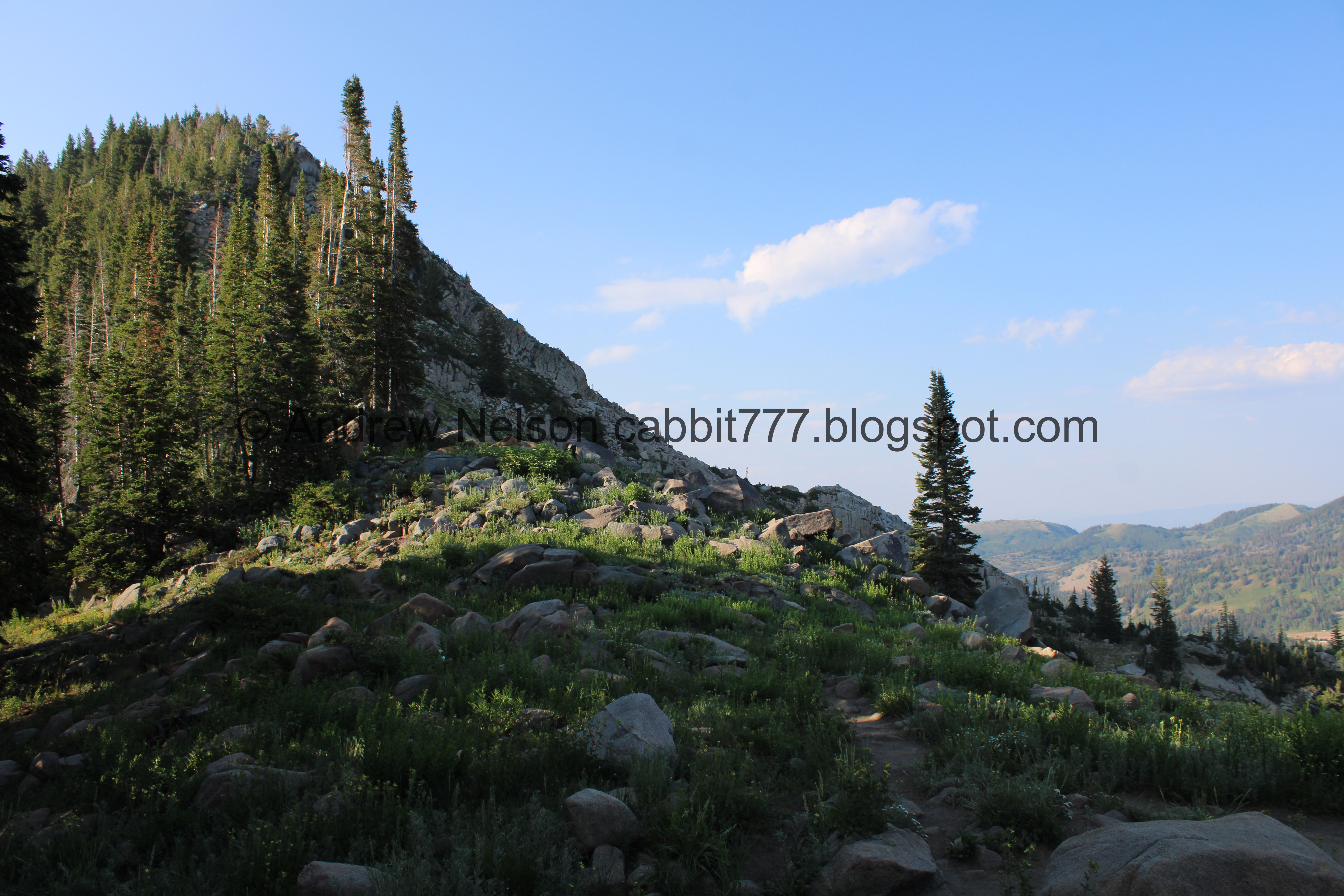
Finally, after being in the open sun for a bit we start hitting the forest and some shade.

Forest.

Yay! Elephant heads! I have been wanting to see these all season long!

Mixed in with some daisies.
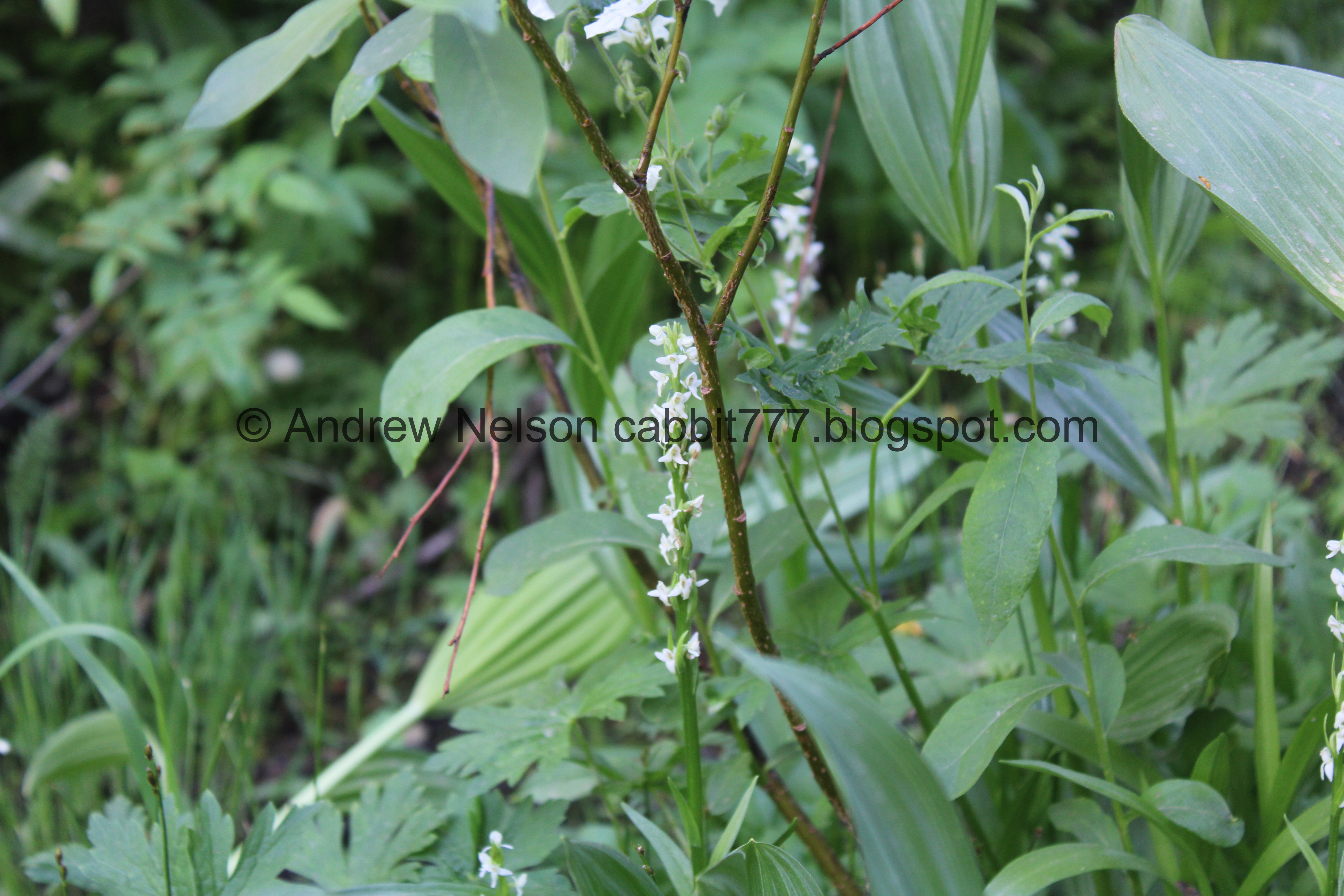
Another yay! White bog orchids! I mean, quite often if you find elephant heads, you are likely to find these nearby, but still, yay!

Another.


More elephant heads.

Elephant heads and white bog orchids.

Yellow columbines. These are pretty rare to find in my experience.

Fireweeds! Yay! Another favorite of mine.

The climb just gradually gets more and more steep.

The Albion Basin with Devils Castle and Sugarloaf Peak.

Sulphur flowers.

Continuing up.

Geranium.

Mint.

Little bridge.

More penstemon.

Lupine.

Little side stream over the trail. It was pretty easy to cross without getting wet.

Bluebells.

White geraniums.

Another side stream (probably overflow from the previous one). This was simple enough to just step over.

Another fireweed.

Landis noticed these plants and asked if I knew what they were. I wasn’t sure, but initially thought maybe hollyhock? But uhm…

They have berries. What in the world are these?

Fireweed.

Paintbrush.

Normally this part of the trail makes me nervous, however for some reason it didn’t bother me going up today.
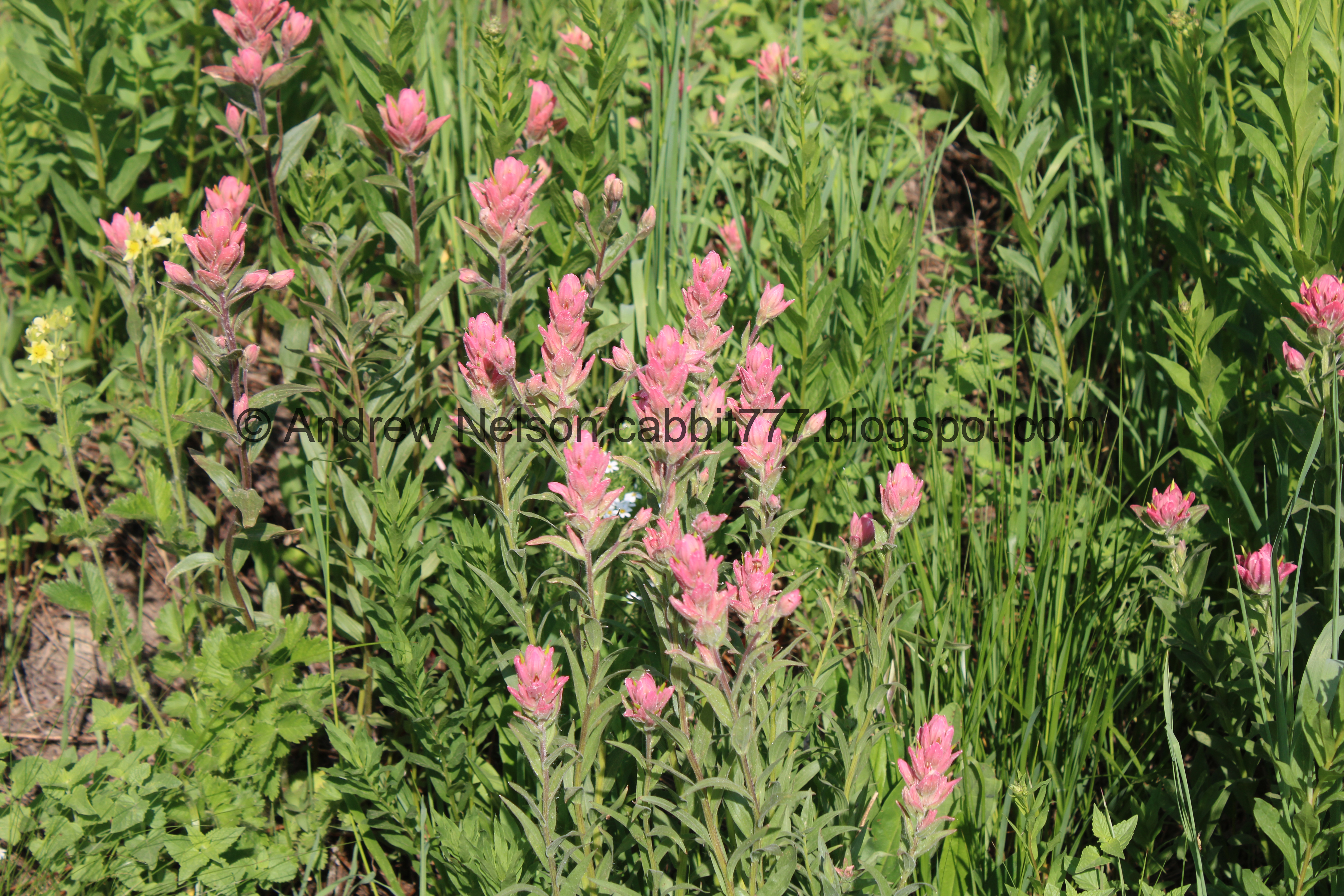
Maybe because I was distracted by the wildflowers LOL. Here is some paintbrush.

Jacobs Ladder. I like to check these for sleeping bees. I have only ever actually seen it once or twice, but it was neat and I’d love to see it again.

Paintbrush.

Nice mix of flowers.

I am not sure if I found another white lupine, or if it’s just young and hasn’t filled in the color yet. Leaning towards the former since I have seen it before. It’s not albino, they do come in white. It just seems a lot more rare to find in white.

Almost to the top, of this part.

Devils Castle and Sugarloaf peak above Albion Basin.

Paintbrush.

Arnica.

Sugarloaf Peak, Mount Baldy, and Greeley Hill above the Albion Basin.

Not sure what these little guys are.

Some faintly blue columbines. It is always a treat to see blue ones!

Fireweeds.

Closer.

Penstemon.

Short bit of down before we immediately climb back up. The down part still normally makes me nervous, but, an the trip up it wasn’t so bad. On the trip down though for some odd reason I struggled with it again. Seriously, sometimes I don’t understand my fear of heights. It seems inconsistent sometimes.

The Albion Basin, and Mount Baldy behind Greeley Hill.

Here is where the real climb starts. Oh boy.

Arnica.

Mint.

Continuing up.

A little side creek.

Mountainside.

Mine tailings.

Penstemon.

The stream bed, which is now dry. I guess there are a few springs in it.

The mine tailings again.

Devils Castle.

The dry stream crossing the trail.

Forget me nots.

A short break in the climb at the small, lower meadow.

Sugarloaf Peak.

Trail split with a cute little squirrel cut out. You want to hang left here. I think right heads down to the Albion Basin Campground.

More paintbrush.

The little meadow and some trees.

Back to the climb. Oi.

Forest.

Lots of lupine.

The dry stream bed again.

Paintbrush.

A chipmunk dashing across the trail.

Looking down.

Oof. More up. But this aint nothing yet.

Paintbrush.

Nice mix of color.

Devils Castle, Sugarloaf Peak, I am pretty sure that is Hidden Peak, and Mount Baldy.
.jpg)
Quick panoramic.

The start of the worst of the climb.

Columbine.

More up! I am not sure if this little side canyon is named.

Lupine and paintbrush.

More up.
Lupine.

The dry streambed again.


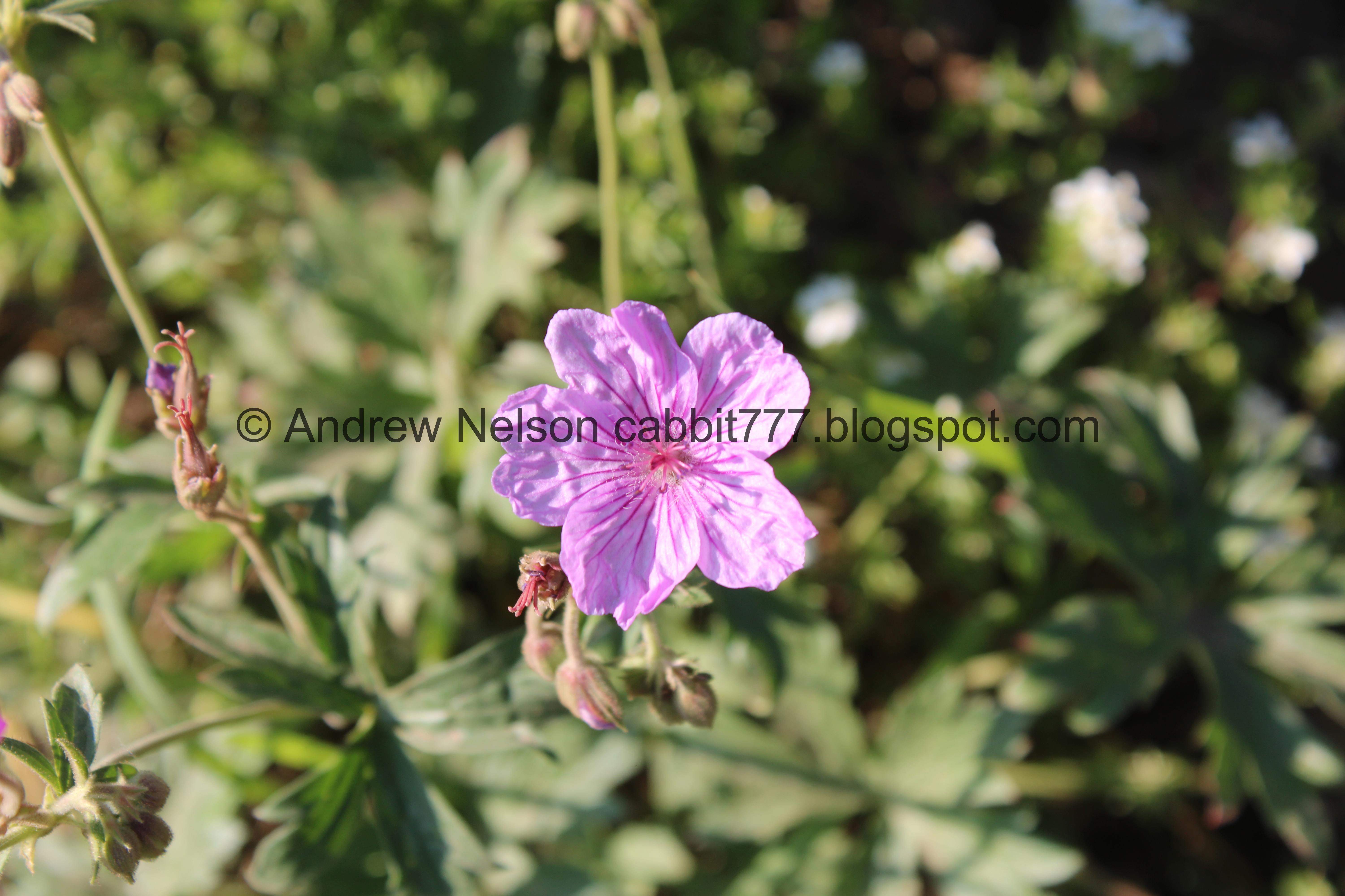
Various shades of geraniums.

The climb is starting to relax a little bit, but still up!

Penstemon.

Geraniums.

No idea what these are, but they are pretty.

Paintbrush.


Geraniums.

More white skyrockets.

I think this is Mount Wolverine. You can see the other side on the Twin Lakes Trail.

Pretty yellow flowers.

Paintbrush.

Water in the streambed again.

The big meadow. Here we get a nice brief reprieve from the constant climb. And it is quite welcome!

Mount Wolverine again.

Itty bitty little pond. We have not come up this way much earlier in the year, so I am not sure if it is ever much bigger, however it looks like it could be.

Just a chill stroll through the meadow.

Paintbrush.

Yay! Elkweed!!! Okay, well, now I saw just about every single one of my favorites on this one hike! The only one I didn’t see was a shooting star, but those are a little harder to find anyway.

Looking back towards the little pond.

Last little bit before the climb resumes. You can see the pass above, so not a whole lot more to go.

Another elkweed.

A little closer to the pretty flowers. I couldn’t get any closer because it was off trail.

But here is a digital crop.

The top.

Forget me nots.

The pass again.


Elephant heads.

Another little spring.

Back to the climb.

Looking back at the meadow.

Paintbrush.

Forget me nots.

Nice mix.

Pretty yellow flowers.

Back into the woods.

Huge split boulder.

Paintbrush.

Another kind of paintbrush.

Penstemon.

The first switchback (after the big meadow).

The meadow below.

Geranium with a beetle.

I get a little nervous about these switchbacks, but its more… anticipatory. Like, I just think they are going to be worse than they are. But for the most part they are fine. One short section I don’t like.
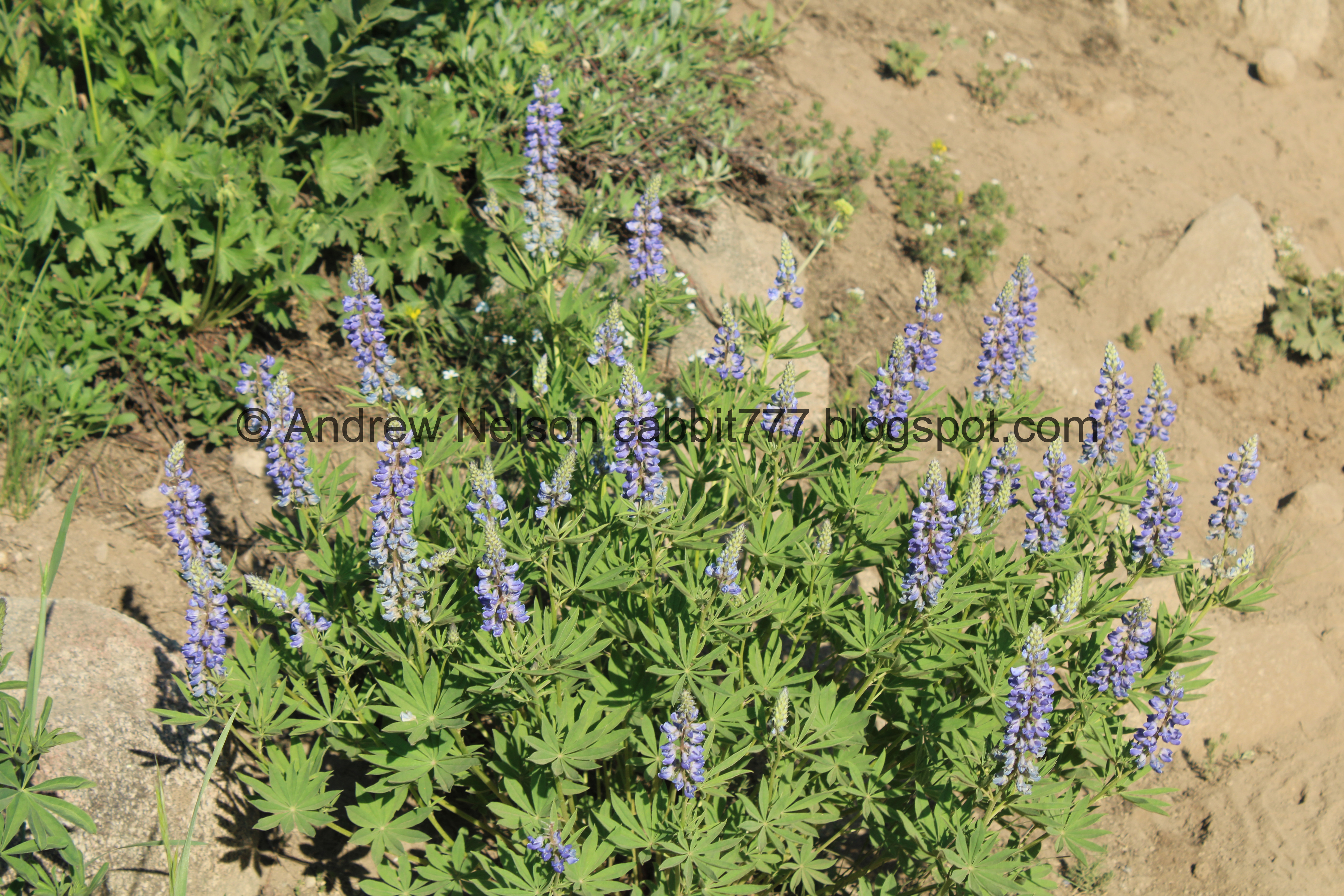
Lupine.

Little closer.

View down.

View across the canyon. I am like… 99.99% positive that is Hidden Peak peeking out between Sugarloaf Peak and Mount Baldy. I have only been up there a couple of times because the tram kind of freaks me out.

The 2nd switchback.

Again, not so bad.

Paintbrush.

View across the canyon again. Devils Castle, Sugar Loaf Peak, I’m not sure what this other peak peeking out it, Hidden Peak, and Mount Baldy. It is cool to see some of the peaks you can’t normally see.

A little closer to the little peaks between Sugarloaf Peak and Mount Baldy.

Digital crop. You can see the buildings, and what I am pretty sure is the top of the tram on Hidden Peak. I wish it wasn’t so smoky today.

Paintbrush.

Lupine and paintbrush.

It looks like this rock was quarried. We had a fun debate about whether they were harvesting granite, like at the Temple Quarry Trail, but ultimately decided that would be kind of silly all the way up here unless there was a granite building in the Albion Basin, which as far as I know, there isn’t. So we concluded they probably did it to make the trail easier.

The 3rd and final switchback.

Short little spot I don’t like, but am able to get through it.

Lupine.

Almost there!

Geranium with a beetle.

Closer.

Found a patch of snow still hanging on.

Wallflower. I successfully grew these in my garden last year, but sadly they did not come back this year.

Final push!

Paintbrush.

Starting to see Sunset Peak.

Huzzah! We made it!

Pioneer Peak on the left, and right is Sunset Peak. You can continue up to the top of Sunset if you are not as squeamish as I am.
Mount Tuscarora and the ridge between Little and Big Cottonwood Canyons.

Old sign. As I mentioned, you can continue down the other side to Brighton. Again, I feel like the mileage is under reporting a bit. Probably closer to 2.5 miles to Brighton.

Lake Catherine below.

View down into Big Cottonwood Canyon.
.jpg)
Panoramic.

Lake Catherine and Pioneer Peak again.

Little closer to the lake.

It looks like the Great Western Trail comes through here. The Great Western Trail is a trail that runs from Canada to Mexico, and traverses 4455 miles through 5 US states. It sounded kind of interesting to do, but if I have to go over Sunset Pass, I think I will pass.

Sunset Peak.
With Lake Catherine.

Mount Tuscarora and the ridge between canyons again.

The other direction.

Another patch of snow.

Lake Catherine again.
.jpg)
Another panoramic.

I did this last time we were up here, but it is still fun. One foot in Little Cottonwood Canyon, One foot in Big Cottonwood Canyon.
Alright, we had our fun, and even had the pass to ourselves for a little bit, but it was getting late, so we decided to head back down.

View down into the big meadow again, and we can see the little pond a little bit better from up here.

Heading back down.

More rock splitting signs.

Pretty yellow flowers.

Looking across the canyon with Sugarloaf Peak, an unknown peak, what I am 99.99% certain is Hidden Peak, and Mount Baldy.

Penstemon.

The upper switchback.

The meadow below, and the peaks across the way.
.jpg)
Panoramic.

Paintbrush.

Penstemon.

The middle switchback.

Looking down on the big meadow again.

Paintbrush.

These pretty white butterflies had been teasing me all day, and refusing to sit still for me. Until now. However this one was being more still than I was expecting and I started to wonder if it was alive…. Just when I thought about giving it a gentle poke it flew off. Phew. Landis says I disturbed it’s nap, but I hadn’t touched it yet.

The lower switchback.

The big meadow again.

Jacobs ladder.

Down to the big meadow.

Mount Wolverine. Twin Lakes should be on the other side of this ridge.

Elkweed.

Looking back towards the pass.

Continuing across the big meadow.

Well, I had planned on trying to focus on the trail a little bit more on the way down, but… flowers.

More paintbrush.

The big meadow again.

Down the steep side canyon.

Pretty yellow flowers.

White skyrockets.

Continuing down the steep canyon.

Devils Castle, Sugarloaf Peak, 99.99% sure that is Hidden Peak, and Mount Baldy.
.jpg)
Panoramic.

Closer view of Hidden Peak.

Continuing down.

Lupine.

Penstemon.

Lots of lupine.

Back down to the trail split. Left leads to the Albion Base Campground, right back to the trailhead. Now, normally when logs are placed like this in front of a trail, it is a sign they have closed the trail for restoration. So, I wonder if they are discontinuing the trail up from the campground. That would sure be a shame. Mostly because I have not had the chance to try it myself.

Paintbrush.

Mine tailings.

Penstemon.

Pretty forest.

The active part of the stream again.

Mount Baldy starting to slip behind the other peaks the lower we get.

More arnica.

Devils Castle and Sugarloaf Peak.
.jpg)
Another panoramic. Devils Castle, Sugarloaf Peak, Mount Baldy, and Greeley Hill.

Penstemon.

Arnica.

Short little bit of going back up to get over this large rock outcrop. I did fine on this section on the way up, but struggled a little on the way down with my fear of heights. I can’t explain why, I guess the view was different enough. But it is super short and I was able to power through it.

We kept hearing some weird crow like calls, but not quite. Then we spotted this guy. Crows aren’t this color, but maybe it is leucistic?

A little more clear shot. Well, the beak does not look very crow like… so I have no idea what we’re looking at here.
Oh yay, my little bird app was helpful today. It looks like it is a Clarks Nutcracker. It is in the corvid family, so that explains why it sounds kind of like a crow.

Fireweed.

Some light blue columbines.

Back down the other side of the rock outcrop.

Some kind of mint.

Neat cliffs.

Paintbrush.

Jacobs ladder.

Back to the little stream crossings.

Paintbrush.

Fireweed.

Geraniums.

The larger stream.

Lupine.

Back to the bridge.

Over a fairly deep little gorge.
Devils Castle and Sugarloaf Peak.

Huh, I have never noticed these cabins before.

Sulphur flower.

Fireweeds.

A corn lily starting to bloom.

Elephant heads.


Closer.

Elephant heads and white bog orchids.

Yellow columbine and lupine.

Lupine, elephant heads, and daisies.

Continuing down.

Daisies.

Columbines.

Columbines, lupine, and daisies.

Now we just have to make our way across the open boulder field.

Over a solid boulder.

This robin was being weird. It kept flying ahead of us and chilling, then when we got too close it would fly a little further down the trail, rinse and repeat. I didn’t mean to chase the poor fellow, but, we need to get down the trail.

Oh hey, a marmot friend. He decided to climb up onto this rock and sing us the song of his people. I didn’t know marmots had a similar call to a pika until now.

Then a quick rest.

Skyrocket.

Another angle of our marmot friend.

Oh, I did get a shot of him mid call.


Just chillin.

Little windswept.
Alright, bye friend! Thanks for serenading us!

Paintbrush.

The Sunnyside ski lift. Also, you want to take the thinner trail to the right. Left will get you down too, but it is a little out of the way, and will require walking back along the Summer Road to the parking lot.

Almost down to the parking lot.

Skyrockets.

Tons of them.

Closer again.

Arnica.

Closer.

Lupine.

I am pretty sure this short part was rerouted. We came up from the right, so we went down that way.

I think this is the other end of the reroute. It does prevent you from climbing over these boulders, so I guess it is nice.

The parking lot.

Paintbrush.

Back down to the parking lot. Phew!
We were really considering taking the short trail down into the Albion Meadows from here, but it was getting late and we were getting hungry. Plus, uh, we had a pretty good flower day as it was. Also, the meadows haven’t quite filled in yet anyway.

Heading down the Summer Road (PSP).

View down the canyon (PSP).
I spotted a moose on the way down! Luckily, not much lower than where it was is a small parking lot that pretty much nobody uses anymore. So we parked there and hiked back up the road and…

Hello cutey!


Just chilling.

We were a good distance away, (yay telephoto lens) but she still stopped to look at us. I didn’t want to disturb her bedding down for the night spot, so we decided we had seen her, and it was time to let her be.

Almost down to the fee station (PSP).

We stopped at the Albion Base for a quick break, where I got the view down the canyon.

Microwave reflector tower.

Continuing down the canyon (PSP).

One of my all time favorite views (PSP) Even with the smoke and haze.

Red sunset through all the smoke (PSP).
That hike was a little more tough than I remember it being, but it is absolutely beautiful! I love all the views. We only passed a couple other people, and even had the pass to ourselves for a bit! The wildflowers right now are absolutely breathtaking! I was just loving them all today, if all the pictures did not make that obvious haha. So, even with it being a little tougher, I am going with 10 out of 10 squirrels today! It was just a lovely hike.
As for difficulty, this is a long climb! Going with a DR4.
Dogs are not allowed in Little Cottonwood Canyon, so be sure to leave Fido home for this one.

No comments:
Post a Comment