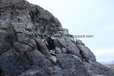
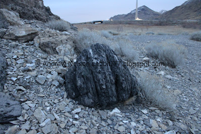
Black Rock is a large rock on the shores of the Great Salt Lake near the Great Salt Lake State Park in Magna. Black Rock itself is technically in Tooele County, but access to is is from SL County. It is a historic stop along the California National Historic Trail and there was actually once a resort here! Aside from some foundation there is little evidence of the resort, but Black Rock itself is actually pretty neat and worth the stop if passing through. You can reach this from the GSL State Park via the Sunset Beach trail (fee area), which we have done, but we decided to drive out to it for the 1st time today. We added this on after our adventure checking out the Mirabilite Springs on Silver Sands Beach.
Quick Details:
Length: It is about 3/10ths of a mile out to it so 6/10ths out and back. But with our bit of exploring and going around it we did about a mile balloon today.
Trail Type: Out and back, Balloon. Longer loop option.
Difficulty: DR3. Most of it is paved, the rest of it is like paved and is generally pretty flat.
Elevation Gain: NA
Restroom: No. But there are some in the Great Salt Lake State Park (fee area) otherwise, you will need to find a gas station.
Dogs? Unsure, but I believe they are allowed, leashed.
Other Info: While technically not part of the Great Salt Lake State Park, it is behind the gate that closes at 5:00 PM in winter. You can still exit after that but you cannot get in after that,
To Get Here:
Take i80 to exit 104 (west of Salt Lake City). Head north, then turn left at Saltair. Follow the frontage road for about 1.5 miles and there will be a split, head left. Go an additional 1.1 miles down the not so well maintained road to the gate. Park and continue on foot.
The last driven mile is pretty rough, but most cars should be fine on it.
Heading towards Black Rock (Passenger Seat Photography (PSP)).
Starting to get a bit of a sunset (PSP).Official sign (PSP)
Underpass (PSP).
Pretty sunset.
There is a memorial here.
The Trail:
Gate across the road. alrighty, it is on foot through here.
Information sign.
Tens of thousand of years ago a piece of the Oquirrh Mountains rolled off into Lake Bonneville. After the lake drained Black Rock became a a landmark for humans for the next 13,000 years. Early Indian tribes used it and it became a resort between the 1860’s and the 1960’s. Which made it one of the longest run resorts on the Great Salt Lake. Neat!
It was also a great inspiration and was joked that is you were a Utah Landscape Painter you had to have painted Black Rock at least once. While I am happy to have visited it twice now, and I think it is pretty neat, I don’t find it to be that scenic. Of course the lake levels are a whole lot more shallow now so meh. Maybe it was more scenic when the water was closer.
Black Rock and sunset.
The road you can no longer drive down is in much, much better shape than the road out to it.
Phragmites.
Continuing along. We are definitely pushing the good lighting at this point.
Black Rock.
The last little bit out to the rock is not paved, but is flat and hard packed.
Getting closer. As I mentioned above, this rock broke off of the mountains above and sunk to the bottom of Lake Bonneville.
Have you ever thrown a rock into a pond and watched it slowly slip back and forth on its way down? Yeah, I kind of wonder if giant behemoths do the same thing.
Looking back towards the Kennecott Smelter Stack. Tallest man made structure west of the Mississippi.
Black Rock.
California Trail Historic Route. Only 808 miles to Sacramento!
The rock again.
East side.
Looking across Sunset Beach to The Great Salt Lake State Park. This is how we got here last time. That was a bit longer at 2.4 miles out and back. You could also theoretically make a loop by going back that way, then back up the road. I think that would be quite a bit longer though. Playing around on the maps it looks like it might be about 3.2 ish miles.
Nearing the north side.
There is a little window.
Antelope Island.
Stansbury Island.
The north side of Black Rock.
Random slabs of cement. I don’t know for sure, but I assume these are probably what's left of the resort.
Random sign that whatever information it displayed has long since faded.
Marshes.
Looking back towards Black Rock.
Neat rock.
Which offers a nice view of Antelope Island.
Stansbury Island.
Panoramic. It is a little too dark to see the smaller islands in-between.
Old pieces of wood. I assume the remains of an old pier. It looks similar to the one you can see at the remains of Saltair I.
Black Rock again.
Another cement platform of some sort. Again, I assume this was probably part of the resort remains.
View of Antelope Island from it.
Stansbury Island.
Sunset Beach again.
The smelter stack again.
Well, we were having fun exploring, but we were running out of daylight. Time to head back.
But not before we finish going around the rock.
There is a lot more loose rock on the west side.
The west side.
Closer look at the little window.
The rock again.
We kind of joked that that little notch must be where the rock came from. LOL But honestly I have no idea.
The rock again.
Smaller piece of the rock.
Back to the south side of the rock.
The mountains as we start our short trek back to the car.
City Lights across the lake.
Looking back towards Black Rock.
Heading back along the old road.
More marshes.
Overpass and the smelter stack.
The smelter stack and surrounding facility (PSP). I caught the lights on the stack lit up. They blink so it’s kind of hard.
Well, I am glad we came back out to explore this, and did so from the main trail instead. We passed a few people on the way in, but otherwise had it entirely to ourselves. Its a super easy trail from either way, but this way is shorter, and probably just slightly easier since you aren’t walking on beach sand. I wish I had better lighting but that's entirely my fault. Going with 10 out of 10 squirrels today.
As for difficulty, it is mostly paved out to it, then it is hard packed earth to it. The west side is a little rocky, but otherwise its pretty easy going. DR3.
As for dogs, I am not entirely sure, it was not signed. However, considering it is next the the Great Salt Lake State Park, which does allow dogs, leashed, think the rule is the same here too.
.jpg)


.jpg)


No comments:
Post a Comment