The Mirabilite Mounds at the Great Salt Lake State Park are a fascinating, unique feature that has only been observed in a few places on earth, and one of them happens to be here in Utah at the Great Salt Lake. I think they are absolutely fascinating and tend to visit them at least once or twice a year since they were discovered in 1999. My close friend Elise mentioned she wanted to see them, so we dragged her out today too. Sadly, this was not my favorite trip out to them. But we had a fun day of exploring anyway.
Quick Details:
Length: Meh, about a quarter mile out to them, plus whatever you explore. We did about 6/10ths of a mile loop.
Trail Type: Out and back, loop.
Difficulty: DR3. It is super flat, but is also beach sand which changes texture often.
Elevation Gain: Maybe 10 feet to get down to the beach.
Restroom: There is one in the Visitor Center that closes at 5, or one near the Marina.
Dogs? Yes, leashed. But personally I wouldn’t trust my dogs not the damage the fragile formations, so I recommend leaving Fido home for this adventure.
Other Info: Fee area. $10.00 per car. Also waterproof boots are highly recommended as depending on the lake level, and the weather you may be wading.
To Get Here:
Take i80 to exit 104 (west of Salt Lake City). Head north, then turn left at Saltair. Follow the frontage road for about 1.8 miles and you will reach the fee station.
The mountains looking great after a fresh dusting (PSP (Passenger Seat Photography)).
The Airport (PSP).
Lots of antelope (PSP).
The Kennecott Smelter Stack (PSP). Tallest structure west of the Mississippi.
Saltair III (PSP).
The Kennecott Smelter Stack again (PSP).
The Trail:
The Kennecott Smelter Stack.
Visitor Center.
Lake shore.
The short, but steep hill down to Silver Sands Beach. Which by the way is located on the northeast corner, just to the left of the Visitor Center.
Green sand. I am not entirely sure what causes this, but I assume algae and/or moss?
With the smelter stack. There used to be a creek that flowed through here that we had to cross, but it seems to have meandered elsewhere. Beach streams are weird like that.
Antelope Island.
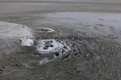
We made it! There is currently one central mound that is active. It would seem all of the others closed up.
Little mound on the main mound.
Main mound.
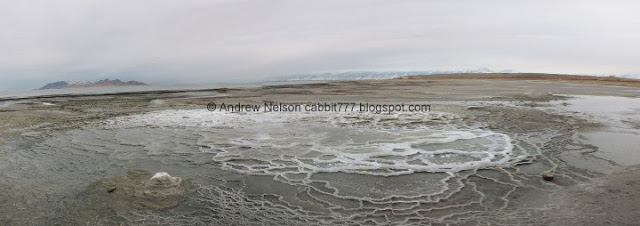
Again. You can learn a little more about what is happening here on my previous adventure here. But the gist of it is, there is a layer of salt underground. Some natural springs pass through that and bring the salt to the surface and when it is cold enough that salt crystalizes and starts to form terraces.
Random mound to the north. I love the random ring of... something around it.
Closer.
The main mound and the smelter stack.
Terraces.
Crystals.
Panoramic.
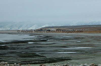
Stream. I think this is probably the outflow from the springs.
Terraces.
Main mound. Visitor Center in the background.
Terraces and crystals.
I think this is the main opening.
Another little mound on the main mound.
Main mound again.
I am just kind of slowly working my way around it.
2 itty bitty mounds to the east of the main one.
Well, that makes at least 3 smaller mounds on the main mound.
The random hill to the east developed 2 small mounds.
Little closer.
The other one.
The two itty bitty ones again.
Back to the main terrace with Stansbury Island in the background.
On the south side looking northish. Stansbury Island to the left and Antelope Island to the right.
I particularly like this one.
Pools and crystals.
Crystals.
Continuing around.
Panoramic.
Back to the little mound on the west side, pretty much where we started.
So lets see, not counting the 3 small mounds on the main one. 5 outer ones and one main one. So, 6 total today.
Main mound and pools.
The smelter stack reflecting in the pools.
Panoramic.
The mound to the north with the random ring around it.
Closer.
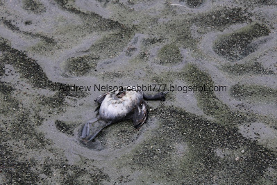
Dead bird.
The Great Salt Lake is critical habitat for millions of migratory shorebirds, some of them die, just a fact of life. The only weird thing is that the salty water tends to basically mummify them so they are kind of preserved when they eventually make their way to shore.
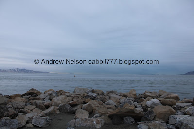
Speaking of shore, we decided to head out that way.
Stansbury Island.
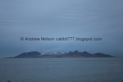
Antelope Island.
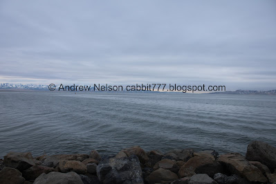
Another panoramic.
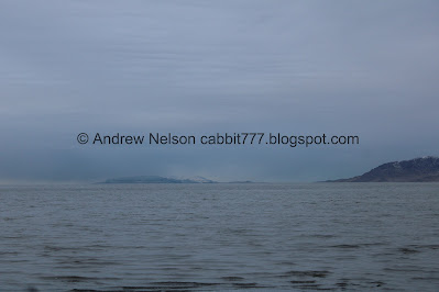
Promontory Point and Freemont Island.
From here I gave the option of continuing along Silver Sands Beach, or maybe exploring Black Rock. We decided to do the latter, so back west we go.
Sand texture.
Stansbury Island.
Another panoramic.
The little jetty next to the Visitor Center.
Boat cruising by, with Antelope Island in the background.
View from the jetty.
Panoramic.
Waves.
The smelter stack again.
Heading back towards the Visitor Center and parking lot.
Some frost hanging on.
The steep hill back up to the parking lot.
Since it was Elise’s first time we decided to do the Visitor Platform again. It really doesn’t add a whole lot of extra. Maybe a couple hundred extra feet depending on how much you explore.
Oh fun! I never noticed that they have a specific flag before now. I don’t pay a lot of attention to flags in general, but now I think I should start paying attention, at state parks at least.
The flag pole base has a dedication to the 2002 Olympics.
The view from the platform. You can see the jetty we were just on below.
Closer view of Antelope Island.
Panoramic view.
Stansbury Island, Carrington Island, Promontory Point, Freemont Island, and Antelope Island.
Antelope Island with the Lake Bonneville shore lines.
Stansbury Island.
Carrington Island.
I’m trying to figure out what the heck this white spot is. It looks like a white cap, but it hasn’t really moved at all. Probably just random debris.
Cause I didn’t do enough panoramic shots today.
Skyline map. I just posted all of the signs here last month, so I didn’t really bother with that today.
Antelope Island.
View east with Saltair, the wonky shores of the Great Salt Lake, and if you look closely you can see the mirabilite mounds.
Fun compass rose built right into the platform.
The marina. Taz Point is just to the right and skirts the north end of the marina. Its super short, so I recommend checking it out of you are passing through.
With the dwindling sunlight, we decided we would rather see Black Rock again instead. So, a little more driving. You can walk around the marina and across Sunset Beach to get to it too, but I thought we would take the road out to it instead.
Well, that was not my favorite trip to the mirabilite mounds, but it was still neat. And of course, I love love love bringing a friend to something that I think is absolutely amazing. I donno, it’s fun to share an experience I guess. As always it was pretty deserted. Most people stopping by do not seem to be aware they exist and instead mill around the 2 main viewpoints and then call it a day and keep going on their way. So yay, more for me to enjoy. 9 out of 10 squirrels today. I took one because the mounds were not as neat as I have seen them.
As for difficulty, Aside from the quick decent to the beach it is pretty flat, but it is beach sand which can and does change texture pretty often and can be a little tough. DR3.
Dogs are technically allowed, leashed, but as I mentioned I would be worried about them damaging the fragile formations, so I recommend leaving them at home if possible. Or maybe work out a good system with your partner that one holds the dogs, the other views the formations and switch off. Meh, just a suggestion. But do please try to avoid them damaging the formations.
.jpg)


.jpg)






.jpg)




.jpg)


.jpg)


.jpg)


.jpg)


.jpg)




No comments:
Post a Comment