There are 3 really quick to get to viewpoints at the Great Salt Lake State Park. The Visitor Platform is the quickest and easiest and is ADA compliant. Taz Point to the west of it and then there is a short little jetty just to the east of it at the beginning of Silver Sands Beach. This post will focus on the first 2 which can be completed in about a 1/4 mile out and back. Adding the 3rd one will only add about 2/10ths of a mile out and back, but we did that one to our Silver Sands Beach adventure.
Quick Details:
Length: About 1/4 mile out and back.
Trail Type: Out and back
Difficulty: DR2 for the Visitor Platform, DR3 for Taz Point.
Elevation Gain: Just a couple of feet up the Visitor Platform.
Restroom: Yes, in the Visitor Center, and over at the Marina.
Dogs? Yes, Leashed. Please clean up after your furry friends.
Other Info: Fee area: $10.00 per car.
To Get Here:
Take i80 to exit 104 (west of Salt Lake City). Head north, then turn left at Saltair. Follow the frontage road for about 1.8 miles and you will reach the fee station.
The visitor Platform is at the back, or far north point of the park, just beyond the Visitor Center. Taz Point is just to the west, next to the marina.
The Trail:
The Visitor Platform. It has a ramp so it is an ADA compliant place to view the Great Salt Lake.
The flag pole has a cement base dedicating it to the 2002 Olympics. Its weird, there are so many little dedications to the 2002 Olympics scattered around the valley. Quite a few can be found along the Jordan River Parkway.
Fun compass rose.
Nice view of Antelope Island and the little jetty on Silver Sands Beach.
Stansbury Island.
Panoramic.
Narrow point to get a better view.
Information about Saltair.
With a view of it’s current iteration.
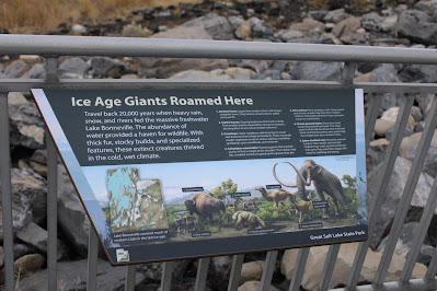
Ice Age Giants Roamed Here.
Skyline Map.
I can make everything out except for Freemont Island. But I think I just cant see the separation point between it and Promontory Point.
Panoramic.
Sailing on Great Salt Lake.
Great Salt Lake.
Lake Life.
After the Visitor Platform, we decided to check out Taz Point, which we haven’t done in a while. I think it was only recently named Taz Point as I don’t recall it being named before. It is super short at about only a 10th of a mile, 2/10ths out and back. Also pretty flat.
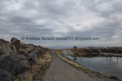
Super short trail along the marina.
The marina.
Continuing along.
The marina again.
The trail is leading us towards the opening in the marina, where it allows boats to access the lake.
The marina and the Kennecott Smelter Stack.
Before long we have reached Taz Point. Considering the sign has a dog silhouette on it, I am guessing it was named after someone's beloved dog. They have added a pair of benches too.
The light post also has been dedicated to the 2002 Olympics.
View from the point towards Stansbury Island. Not bad.
Panoramic.
Little bit of a sunset. With the benches here, it seems like a nice place to take in the sunset, but we weren’t patient enough for that today.
Fun fact: The header image of my blog was taken from here back in 2010. I guess I didn’t think that particular adventure was blog worthy though.
Heading back.
The marina again.
Random deep tube.
Warning for boaters using the marina.
Random boat cruising along.
On the south side of the Visitor Center there are some signs about the Kennecott Copper Mine here. 26 miles of operation.
Bingham Canyon Mine. Butterfield Canyon skirts that.
Concentrator.
Smelter.
Which you can see from here. At 1215 feet tall it is the tallest man made structure west of the Mississippi. And just shorter than the Empire State Building.
Refinery.
Silver Sands Beach with the mirabilite springs and Saltair in the background.
Antelope Island.
The smelter stack again.
Birds you might see here.
Sunset under moody skies.
Fun mural at the park entrance.
Saltair as we head back home (Passenger Seat Photography (PSP)).
The smelter stack again (PSP).
Moody skies on the way home (PSP).
Starting to see downtown Salt Lake City (PSP).
That was a fun day at the Great Salt Lake, mostly for the mirabilite mounds, but I am glad we decided to stop by these additional viewpoints again. It’s been a minute since we did the short Taz Point trail, long enough that it wasn’t called that at the time. The Visitor Platform had a few people, but we had Taz Point all to our selves. 8 out of 10 squirrels today.
As for difficulty, The Visitor Platform is paved, and ADA compliant, DR2. Taz point is super short and like paved, but is sandy. DR3.
Dogs are allowed, but should remain leashed at all times. Please clean up after your furry friends.
.jpg)


.jpg)


.jpg)


.jpg)


No comments:
Post a Comment