Devils Castle Loop is a lovely loop in the Albion Basin at the top of Little Cottonwood Canyon. The trail features lovely mixed forests, wildflowers, and majestic peaks above. This amazing trail is a great alternate to the nearby and much, much more popular Cecret Lake. However, there is a little bit of a mess of trails that makes it a little hard to follow at times. Despite that, it is one of our absolute favorite trails and we tend to do it fairly often.

Quick Details:
Length: It is about a 2 mile loop.
Trail Type: Loop.
Difficulty: DR3. It is a bit of a climb, but it’s not too bad.
Elevation Gain: About 500 feet.
Restroom: There are vault toilets at the trailhead, and in the campground.
Dogs? No. Little Cottonwood Canyon is watershed.
Other Info: Fee Area. $12.00 per car to use the Summer Road. You can avoid that by adding about 1.5 miles through the Albion Meadows (each way).
To Get Here:
Head to the top of Little Cottonwood Canyon. Pay the Summer Road fee And continue about 2.3 miles to the Cecret Lake Trailhead.
You can either go up the Cecret Lake Trail, or through the Albion Campground. I have not had luck with the former, and prefer the latter.
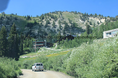
They currently have a construction project that is closing the road down to 1 lane (Passenger Seat Photography (PSP)). So there is a bit of a wait. Oi.
I can’t tell if there was avalanche damage, or if they are just enhancing it (PSP).
I noticed this sign last year, but have not caught a shot of it until now (PSP). Nice to see the town represented.
The fee station (PSP). I was kind of winging it today and ultimately decided what we did today would depend on the line. Since there was no line we decided to drive up the Summer Road.
FYI, the Forest Service Pass does not cover the fee here. I think technically it is a toll road, that is separate from the forest service. Yea, according to the website it is an amenities fee that help maintain the road, as well as the facilities along it.
Onto the Summer Road (PSP).
Continuing up (PSP).
Devils Castle and Sugarloaf Peak (PSP).
Continuing up (PSP).
A marmot friend (PSP). Hello cutey!
Super cute (PSP).
Just before he/she decided to go under the road (PSP).
Scurrying under the road (PSP). I didn't catch it with my camera, but I visually saw him go into a draining tunnel under the road, not under the car.
Down canyon (PSP).
The Trail:
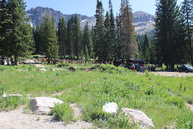
The Cecret Lake Trailhead with the Albion Store.
If you decide to go up the Cecret Lake side, there is a slight detour for construction.
As I mentioned, I prefer to go up the Albion Campground route to the left, so clockwise.
Little Cottonwood Creek.
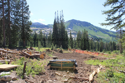
The construction area.
Lupine.
Climbing through the campground.
The first gate, this is for cabin access. Keep left here.
Quite a few piles of snow still hanging around.
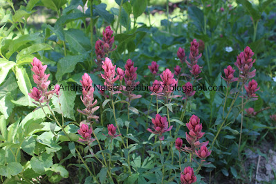
Paintbrush.
Western cone flowers.
Normally there is a gate her at the back end of the campground, but they appear to doing some construction up here as well. You do want to go through it though.
Devils Castle.
This is now a 4 way split. I believe left will get you to to the trail, but I have never done it. I tend to go forward, which is the original way. I don’t know if the new road going left is shorter/longer easier/harder, or about the same.
Couple steeper parts.
Lupine.
First columbine of the year! Well, wild one anyway haha. I have some at home.
Lots of forget me nots.
Sugarloaf Peak.
Paintbrush.
Bluebells.
Little stream. This is one of the first ones to dry up the later we get into summer.
Downstream with a bunch of bluebells.
Devils Castle again.
The little stream again.
Passing through some cabins.
Pretty forest.
Big patch of columbine.
A pair of them.
Snow cat. I wonder if this allows them to use their cabin all year, or if just a little bit more than just summer.
Devils Castle again.
More columbines.
Another short steep section.
Buttercup.
Columbines.
After the 2 dirt roads merge you want to look to the right for the smaller trail.
There is usually a small sign indicating it, but I guess we came too early this time haha.
Wallflower. I had these in my garden a few years ago, but they didn’t come back. I was and well still kind of am on a big grow flowers I see on our hikes kick.
Paintbrush and lupine.
Paintbrush.
Lovely forest.
Geraniums.
Forget me nots.
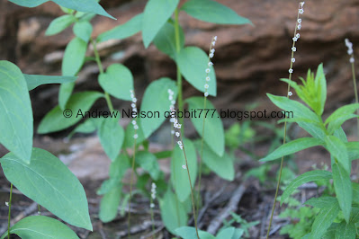
Well, what are these cute little things?
I think it is a smallflower miterwort.
They are super cute!
Elkweed.
Penstemon.
Pretty forest.
Some kind of mint.
Penstemon.
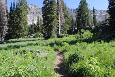
The trail mellows out quite a bit here.
Lupine.
A big patch of them.
Paintbrush.
The meadow below.
Continuing along.
Across towards Sugarloaf Peak.
Paintbrush.
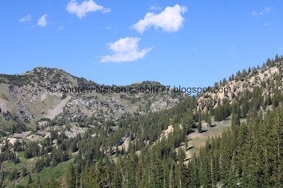
Devils Castle and Sugarloaf Peak.
Below.
Devils Castle.
This trail is like the opposite of most high elevation trails. The top part is more mild.
Boulders.
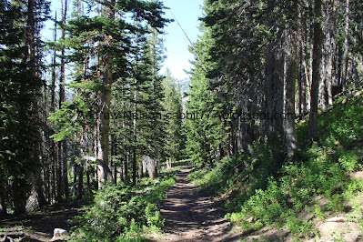
Just a lovely stroll through the woods.
Getting up close and personal with Devils Castle.
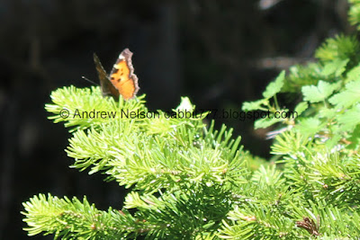
Not the best shots, but for whatever reason the butterflies REALLY liked the fir trees up here. There were tons of them that just kept landing in the trees. But of course they generally didn’t let me get very close.
Devils Castle.
Its just so pretty up here.
Another set of not great shots of the butterflies. They sure did not want their picture taken today!
There is a mine under this snowbank. This marks the highpoint of the trail.
I am guessing this depression in the snow is due to melting underneath into the mine?
The trail heading down the other side.
But first we’re gonna relax at the top for a bit.
Mine tailings below.
The valley below.
Panoramic.
Catherine Pass.
Devils Castle above.
The massive scree field below. Some of the larger boulders that came down from here are almost as far down as Alf's.
Alright, heading down the other side.
Through the scree.
This is generally a great spot to see pikas and marmots, but they did not want to play today.
There is a decent path through the scree. We have certainly scrambled through much worse.
Looking up.
And down. It’s crazy to think this has all come down off of Devils Castle, and continues to do so.
Elkweed. Not quite in full bloom yet.
I'm not sure what these are. I thought Perry's Primrose at first, the color is right. But the flower and leaves are not. I'm not sure, but I think it could be a prairie smoke?
Continuing along.
The scree field.
Catherine Pass again.
Parry’s primrose.
Closer.
The scree field below.
More mine tailings.
Utah’s own mini Half Dome, or well, that is what I am calling it now. It is a popular climbing crag.
From the front.
Wallflower.
Finally got a closer shot of one of the butterflies… but it’s wings are closed.
Alright, this one isn’t too bad.
Elkweed.
Pretty forest.
Some immature pink forget me nots.
Looking back towards Devils Castle.
Of course now that we have left the scree field we heard a pika start chirping. Haha, well, I do love them but no need to turn back. We see them pretty often.
Penstemon.
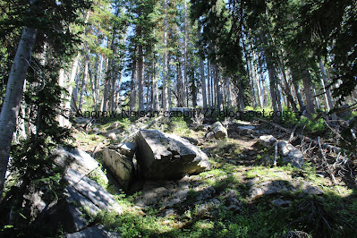
Forest and boulders.
Forest.
Plants growing out of a boulder.
A large pile of snow we have to traverse.
More forest.
More snow.
Broken trees.
Steep section.
Another butterfly. Google seems to think it is a hoary comma. I don't think that is correct however it informs me that they feed on tree sap, I didn't know any butterflies did that so I guess that must be why they like the trees. Huh. Learn something new everyday.
Continuing down.
Forest.
Bark peeling off.
Forest.
Another butterfly.
Bridge.
Downstream.
Upstream. It is a rather sizable spring.
After here is a small trail split. I am pretty sure you can go either way, but I always go forward (borrowed image from 2024 trip).
Forest.
Large boulders.
Another large spring.
Another butterfly. Google is suggesting it is a tortoiseshell, and that appears to match better.
Forest.
Another large patch of snow we had to traverse.
More forest.
Another trail split. I think this one is pretty clear to go left, downhill not back uphill.
More giant boulders.
Little alcove between them.
More boulders.
Paintbrush and forget me nots.
We used to take this fork to the right, but last time we did it looked like they had it closed on the other end of it, and its starting to look a little thinner.
So we took the left fork, which now looks a little stronger. So this short bit will be new to us.
This is/was a small web of forks that make it a little tough, but it looks like they are closing some of them off at least.
More giant boulders.
Continuing along.
Where 2 trails merge. I suspect the other fork goes back to the fork by the springs. But, we want to go right to keep doing the loop.
More boulders.
Where the trail crosses the much more popular Cecret Lake Trail.
The main Devils Castle Loop continues across the trail, down through the woods and connects to the Cecret Lake TH Overflow Lot. Or you can just go down the Cecret Lake Trail. Looking at the map I don’t think it makes much of a difference (although continuing along the loop is much, much less busy). In the moment, I didn’t have a map on me, and I had decided I wanted to add the meadows so I thought we would do the shorter (now I know not by much) route going down the Cecret Lake Trail to the right here.
Looking back towards Devils Castle. After a few years of doing this trail I think I am finally confidant enough to try doing it from the other direction again. The one time I tried it before we absolutely did not go the right way at all and missed half of the trail.
Heading down the Cecret Lake Trail when we noticed something…
Well hello friend.
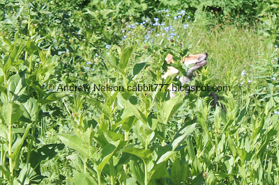
Little hard to see him through the foliage but give it a minute.
Cute little fox friend. I am pretty sure this is the first one we have seen in this canyon.
This totally made the decision to go this way worth it!
Hello there!
I am a little surprised he doesn’t avoid the popular trail.
But hey, it was great seeing him.
With his big fluffy tail.
Back into the foliage.
Back out.
Then it ran into some people which naturally sent him back into the foliage.
Continuing down.
One of the streams.
With Devils Castle above.
Geologic forces.
This sign explains that the glacier receding from here all the way down the canyon is responsible for the perfect U shape of the canyon, and also brought all the boulders you can see around you down.
Downstream.
Columbines.
Another little stream, accompanied by some bluebells.
Huh. The bottom of the Supreme Lift is gone.
Correction, the whole dang thing is gone! We later learned that they are replacing it. The old lift apparently had a bend in it that wasn’t good for mechanics, so they are replacing it with a strait line.
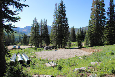
Crossing through the construction area. I am not sure if it is part of the lift replacement, or something else, but I assume it is related.
Columbines and paintbrush.
Bridge over the creek.
Columbines.
Upstream.
Downstream.
We heard some particularly loud birds and eventually started seeing them flitting around. I finally caught one on a bird feeder the camp host has setup. I believe it is a Clark’s nutcracker.
Flowers on the hillside as we make our way down to the Catherine Pass Trailhead (PSP).
Well, as always that was an amazing hike. Still one of my favorites. I love the perfect amount of work vs payout. The views are great, the wildflowers are amazing, and it is not busy at all. Plus we had some good wildlife sightings today. Even with the Summer Road fee I am going with a perfect 10 squirrels.
As for difficulty, it is a bit of a climb, but not too bad. DR3.
Dogs are not allowed in Little Cottonwood Canyon so be sure to leave Fido home for this one.
.jpg)











.jpg)















No comments:
Post a Comment