.jpg)
Lake Mary is an absolutely beautiful reservoir located above Brighton in Big Cottonwood Canyon. The trail features a creek, some nice wildflower filled meadows, some pretty forest, and well, Lake Mary. You also have a pretty good chance of seeing wildlife along this trail. If you have a little bit more energy you can keep going to Lake Martha, Lake Catherine, and even up over Catherine Pass.
My original plan for the day was to do Twin Lakes, however the boardwalk restoration project around Silver Lake currently has that closed. The ranger did say hopefully next week it will be open, so we will try again.

Quick Details:
Length: It is about 1.2 miles to Lake Mary, with a little bit of exploring we did 2.9 out and back.
Trail Type: Out and back, loop options.
Difficulty: There are some serious climbs on this trail, with a few breaks in between. DR4.
Elevation Gain: About 800 ft.
Restroom: There are flush toilettes in the Brighton Lot located at the Millicent Chalet. I understand there are also some in the main Brighton Center, but it has limited hours.
Dogs? No. Big Cottonwood Canyon is watershed.
Other Info:
To Get Here:
Head to the top of Big Cottonwood Canyon. You will eventually hit the one way loop road at Brighton. Take that to the back end where the large Brighton Parking lot it. Park. The trail is between the Brighton Center and the big Brighton ski map/sign.

The mouth of Big Cottonwood Canyon (Passenger Seat Photography (PSP)).

The roadside sunflowers are going nuts (PSP).

They suspended the horrible one lane traffic signal for the weekend again (PSP). I really hope this continues through fall.

Continuing up the canyon (PSP).

OOOH!!! Some patches of color getting started (PSP).

Then we got stuck in some traffic jam that didn’t really make any sense (PSP).

Then we saw life flight come up from the road (PSP). Oh boy, somebody is not having a good day. I hope everything turns out okay. We didn’t see anything on the news, so hopefully it wasn’t too bad.

Some gloomy clouds that made us a bit nervous (PSP). Luckily we did not get rained on.

The upper construction project was also suspended for the weekend (PSP). Phew!

Nearing Brighton with a nice view of Mount Millicent (PSP).
We stopped at our original planned destination.

Clouds above Scott Hill.

Terrible shot, but the boardwalk around Silver Lake appears to be coming along nicely.

Chipmunk!
We looked at the project signs and it did look like the current status did affect the back end trails, including the one we wanted to use. I thought they had specifically planned this project to prevent that, but it appears I was wrong in that thinking. After confirming with the ranger at the visitor center, we decided to do Lake Mary instead.
The Trail:

Heading up the Lake Mary Trail.

Trailhead kiosk.

I think this sign is new.

The steep climb up the initial hill.

The wildflowers are severely diminished after our Labor Day snow in the mountains event (yes already). But there are a couple left to be found. Mostly a lot of these daisy-like flowers.

Mount Millicent.

Oof. It is quite the climb.

We found a paintbrush still hanging on.

Some daisy-like flowers and mint.

A spent elk weed.

What I have dubbed: Dinosaur rock.

After the first 2 switchbacks and dinosaur rock, the trail mellows out for a bit.

Peaks.

More daisy-like flowers.

Looking back down and across the canyon.

This little water tank and utility building has kind of become our go to spot to take a break before the next climb. There is plenty of shade, and a few spots to sit down if needed.

Switchbacks 3 through 6 up and around the big boulder.

Some lupine.

Back to the climb.

Another paintbrush.

Up to the big boulder.

Bee in a daisy-like flower.

Sulphur flowers.

Back side of the big boulder.

After the big boulder you get another break from the climb as you enter the woods.

Lots of flowers.

Little stream going across the road.

Back to the climb, with another stream going across the trail.

Forest.

The new disc golf course goes up the ski run to the left. You want to stay right.

Lots of tree roots underfoot.

More forest.

More daisy-like flowers.

Lots of them!

Rocky climb.

More up.

Looking across the canyon toward Scott Hill. I’ve said it before, but Scott Hill is easily identified by the Mickey Mouse shaped mine tailings on the side.

More fun forest.

There was a large patch of snow here last time we came through.

The Dog Lake junction. I would say this is about 3/4 of the way to Lake Mary. And, you get another short break from the climb here.

Little bridge over the combined outlets of Lake Mary and Dog Lake, 2 of several headwaters of Big Cottonwood Creek.

More forest.

I love this gnarly old tree.

Well, hello! We found a moose friend, that is a liiiitle bit closer to the trail than I would like.

Put on the telephoto lens, and hello pretty girl.

She is much more interested in getting her munch on than us simple hikers.


Tasty tasty leaves.

So majestic.

More yummy leaves.

The higher up ones taste better.

She was really completely unbothered by us today.
Alright, time to move on.

Lupine.
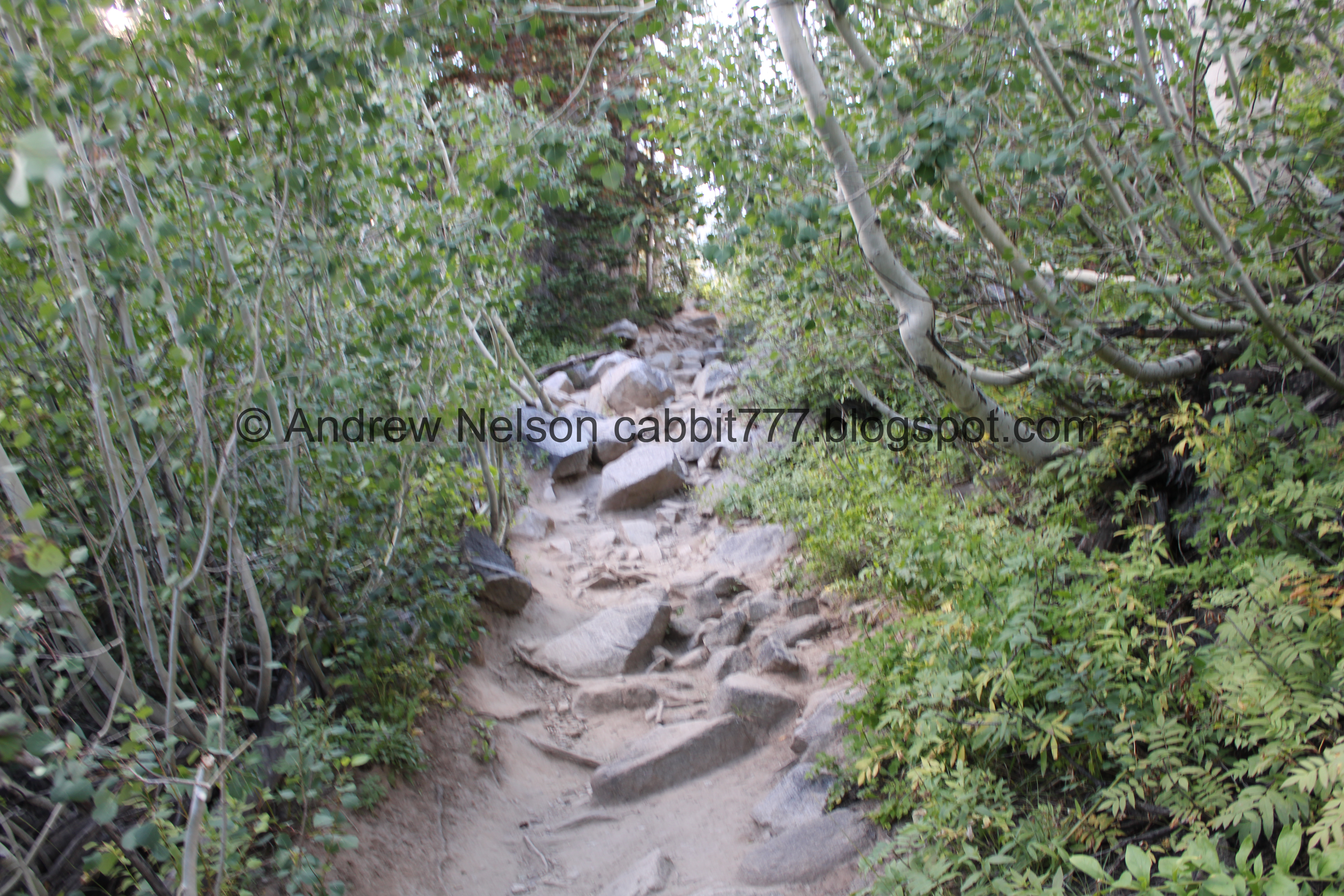
Another short, steep, rocky climb.

The creek.

I still don’t know what exactly this is. Possibly the remnants of an older dam?

First view of the dam.

Some arnica.

A nice mix with some lupine, arnica, and daisy-like flowers.

Sulphur flower.

Another nice mix.

The little overflow waterfall we saw last time is no longer flowing.

Big patch of arnica.

We have seen some pika and even some marmots in the scree below the dam before. No pika, but I am pretty sure that is one of their haystacks.

Then we enter the section I have dubbed the narrows, which is the section below the dam. I call it that because it is a narrow path between the foliage and the dam itself.

Big ol hole.

The dam.

For most of the section below the dam you will be walking through flowing water. There are plenty of boulders and rocks to keep your feet mostly dry if you pay attention.

The main outflow.

The upper water appears to be coming from water seeping out of the dam which kind of freaks me out a little bit. However, considering there is a town directly below it, I am sure they monitor it closely.

Miniature waterfall.

More flowers.

Little bird getting a drink.

The last section of the narrows.

Miniature twin waterfall.

Then we have the final steep, rocky climb.

Mount Tuscarora and Mount Millicent.

Then at about 1.2 miles, we made it to the lake! Whew!

The front section.

The middle section, with Mount Tuscarora and Mount Millicent.

Little islands.

Nice clear water.
.jpg)
Panoramic.

Mount Millicent and the lake.

Whoa! I found a fireweed still hanging on. I don’t think I have ever seen one this late into the season. Yay!

Almost every single time we have come up here, some group was hanging out on these rocks near the back end of the lake, but today it was clear! So I decided it was my turn to be the group on those rocks, for just a minute or two.
The back of the lake with Sundial Peak, Catherine Pass, I think I can see the tip of Mount Wolverine, and mount Tuscarora.
Fun fact, before they put in the dam, creating Lake Mary, this back section was a lake called Lake Phoebe. We had the cool experience of seeing as close to what that might have looked like quite a few years ago when they drained the lake for dam repairs.

Little fishies.

Super Clear.
.jpg)
Panoramic of the back end of the lake.

Granite boulders in the lake.

More little fishies.

Mount Millicent.
.jpg)
Another panoramic of the back end.

More fish.
I noticed the big boulder had been vacated so we decided to head that way.

Some fall color coming in.

Sulphur flower and some daisy-like flowers.

The back end of the lake again.
.jpg)
The entire lake from the big boulder. It distorted it a bit though.

Mount Millicent again.

Back end of the lake again.

The big boulder is about midway along the lakeshore and is pretty easy to climb up onto.
We decided to head on back down. As I mentioned earlier it’s not much further to Lake Martha, and not too much further to Lake Catherine. It’s been a few years since we have done that, I should plan on doing that again soon.

Another fireweed.

The front end of the lake.

Weird cement structure.

One last look at the front of the lake.

More sulphur flowers.

Back down the rocky hillside.

Spent elkweeds.

Back through the narrows.

Lots of flowers.

Thistle.


The main outflow.

Patch of geraniums that are changing color.

The dam.

The pika haystack again.

Pretty purple flowers.

We did end up briefly seeing a pika. Hello cutey!

Some lupine.

Back to the little pond.

The creek again.

Our moose friend moved to the other side of the trail.

With a view.

Telephoto.

She just seems to be staring off into space. Weird.

Another hiker came down and informed me she had a calf with her earlier. So maybe she is watching her calf? I don’t know. I took a couple shots of her but they are all pretty much the same.

Another hiker asked if we say the other 2 moose at Lake Mary, I clarified Lake Mary? And he confirmed. I am pretty sure he meant Catherine, but maybe we missed them.
Alright pretty lady, have a good night!

View across the canyon.

Forest.

Back down to the bridge.

We took this thinner trail out towards Dog Lake.

The creek.

We found our moose friend again. It looks like she might have bedded down for the night.

Hello again! We decided not to dawdle too long so she could relax and get some sleep.

Lupine.

Eventually we connected to the main trail towards the lake.

Some more paintbrush.

Dog Lake, not to be confused with the nearby Dog Lake. We decided we didn’t need to walk all the way out to it today, as we recently saw it and it’s not terribly exciting.

I think this is Clayton Peak.

Lots of arnica.

Growing out of solid granite.

Mixed flowers.

Another paintbrush.

Paintbrush and lupine.

Another neat paintbrush.

View across the canyon as we approach the main trail again. That was a short 3/10ths of a mile detour.

Better view with Scott Hill.

Lots of flowers.

Couple of springs below.

Continuing down through the forest.

Daisy-like flowers.

Back to the big boulder.
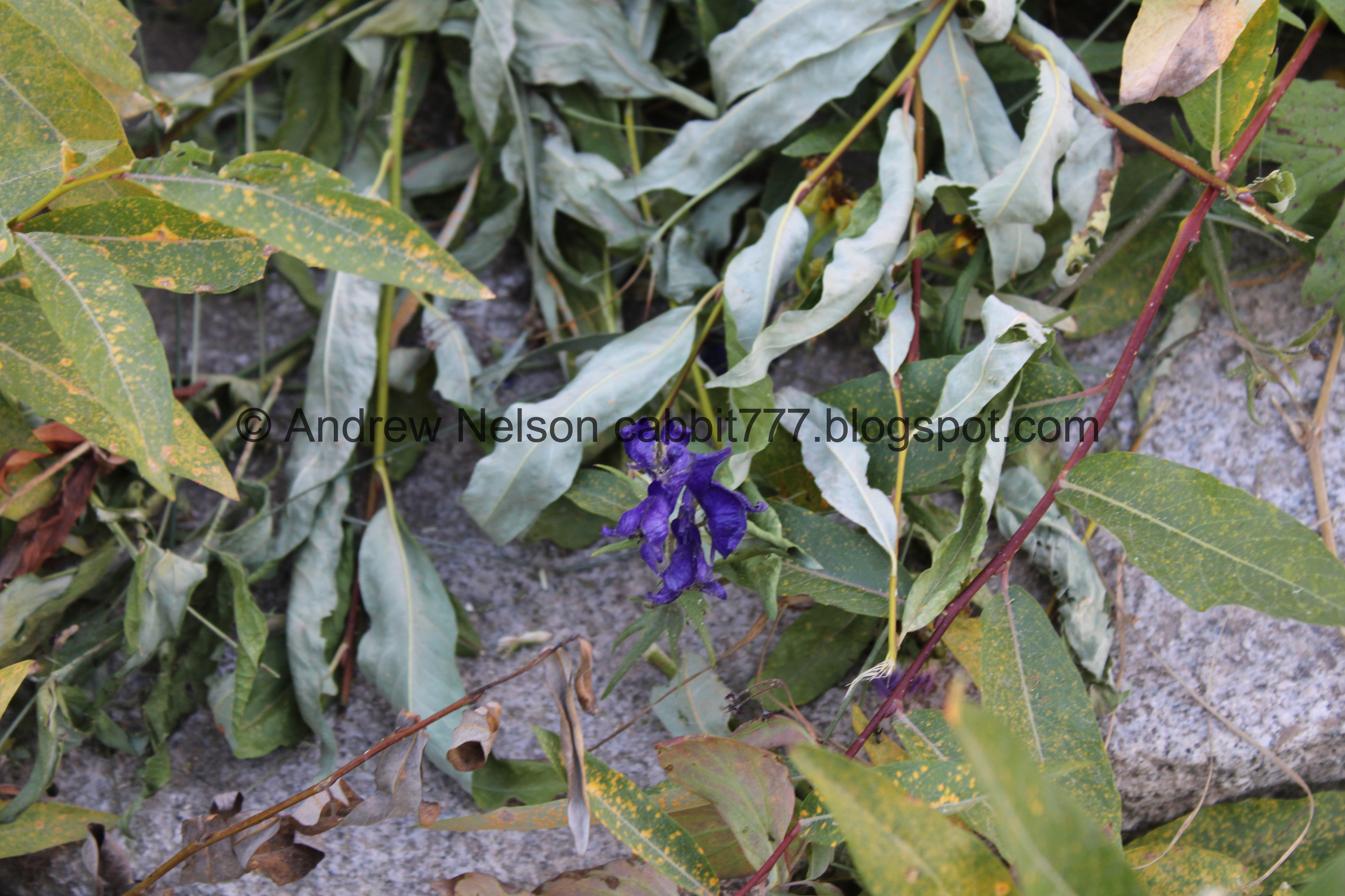
A larkspur still hanging on.


Some paintbrush.

View across the canyon.

Peaks.

It looks like they have their disc golf course up and going now.

Back to my so dubbed “Dinosaur rock”.
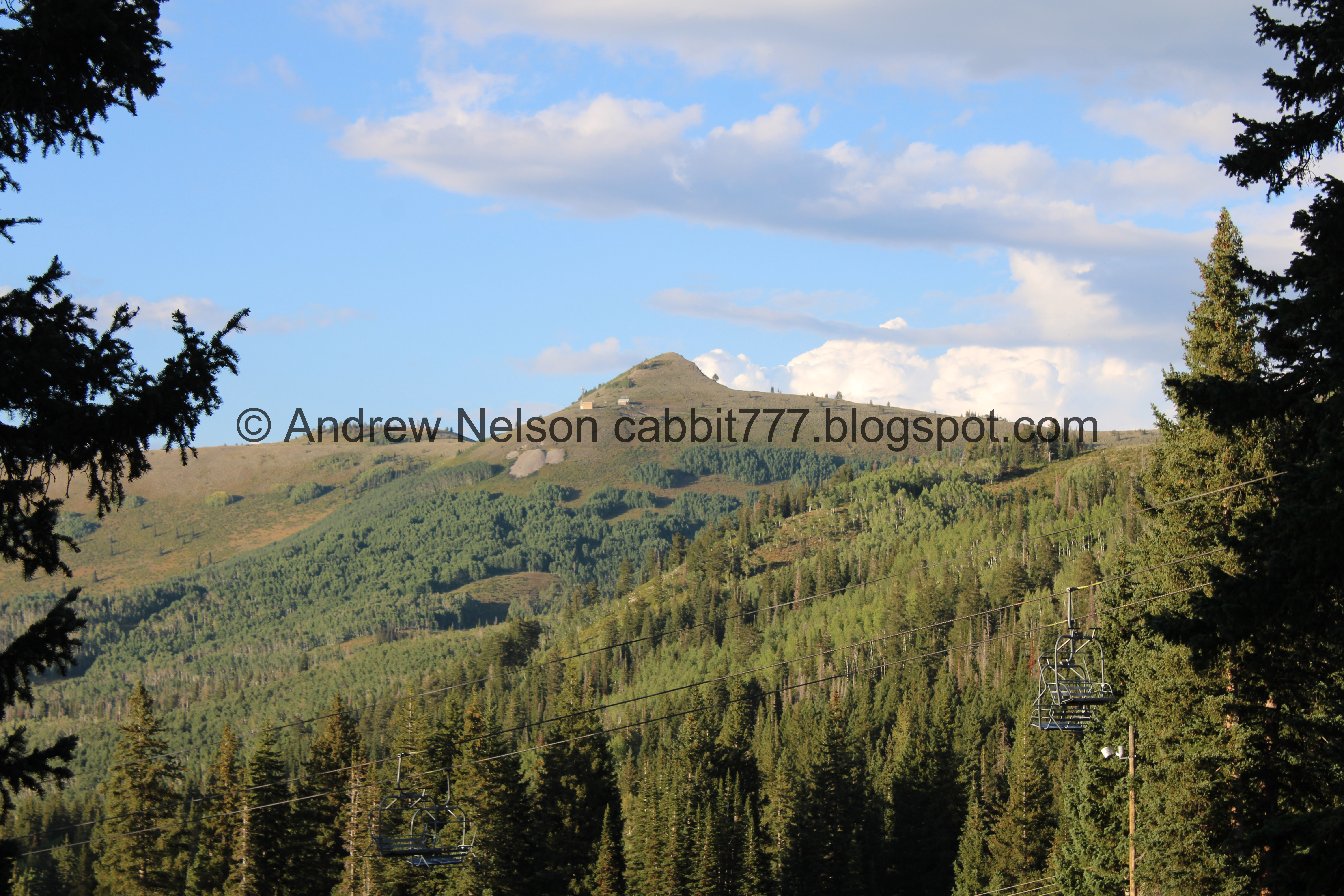
Scott Hill.

More daisy-like flowers.

Lots of them.

Western cone flower.

More daisy-like flowers.

These ones have a fun spiral shape to their petals.

Almost back down to the trailhead.

Some more spent elkweeds.

I swear every time we come here the picture on the back of the big sign is different. I particularly like this one.

Mount Millicent from the parking lot.

Well, the main Brighton Center is closed for the evening so we drove across the parking lot the the Millicent Chalet to use the restrooms there.

The stream coming out of Twin Lakes. This is an alternate route up to it, but it doesn’t look very fun.

I found a cute little purple penstemon down here.

Looking back towards Brighton.

Heading back down the canyon and under Scott Hill (PSP).

Huzzah! They did not turn on the construction lights (PSP).


Continuing down (PSP).

Lots of roadside sunflowers (PSP).


With a nice sunset to end the day (PSP).
That was not the adventure I had planned for the day, but it was probably close to the amount of effort I had planned on putting in. Plus, we had a bonus moose sighting so all in all, not a bad plan B. This trail is usually pretty busy, but it was not terrible today. All and all a nice fun day on the mountain. 9 out of 10 squirrels today.

As for difficulty, It is quite a climb! And quite a bit of it with no shade. But there are some breaks along the way. DR4.
Dogs are not allowed in Big Cottonwood Canyon due to watershed restrictions, so be sure to leave Fido at home for this one.


.jpg)


.jpg)


.jpg)


.jpg)




.jpg)


