.jpg)

Quick Details:
Length: Approximate 3.5 miles out and back. You can add a quick half mile out and back to Bountiful Lake if desired. No loop option that I am aware of.
Difficulty: DR2. Flat, paved.
Elevation Gain: NA. Just a smidge up the overpass to the TH parking lot.
Restroom: No, but there is one at Bountiful Lake.
Dogs? Yes, Leashed.
To Get Here:
From The Legacy Parkway. Take the 5th S. exit. Just west of the bridge over 5th S and before the road curves to the north is a parking lot.
From i15. Take the 5th S exit and head west. Go over the Legacy Parkway and turn Left into the 5th S. TH parking lot.

The Trail:
From this trailhead you can immediately go south down the Legacy Parkway Nature Trail, or you must cross the Legacy Parkway to get to the Legacy Parkway Trail, from there you can head north or south. We did south last time so today we are going north.

I love the way the mountains look with fresh snow on them. That is Mueller Park where Mill Creek originates.

You’ll have to cross the SB on ramp, and the NB off ramps but its fine.

Just on the other side of the parkway is a staircase down. If you need to, the stairs can be avoided by going down just a little further.

We have reached the Legacy Parkway Trail. As I mentioned, left will take you down to the 2425 S TH. Right will take you to Mill Creek.

Tunnel under 5th South.

Surprisingly pretty clean. A couple spots I noticed had to be painted over but otherwise not too vandalized.

Like the previous segments, this one follows the Parkway fairly closely for the entire way.

We caught the attention of a couple Llamas on this farm. Hi guys!

Oh my goodness they are way too cute.
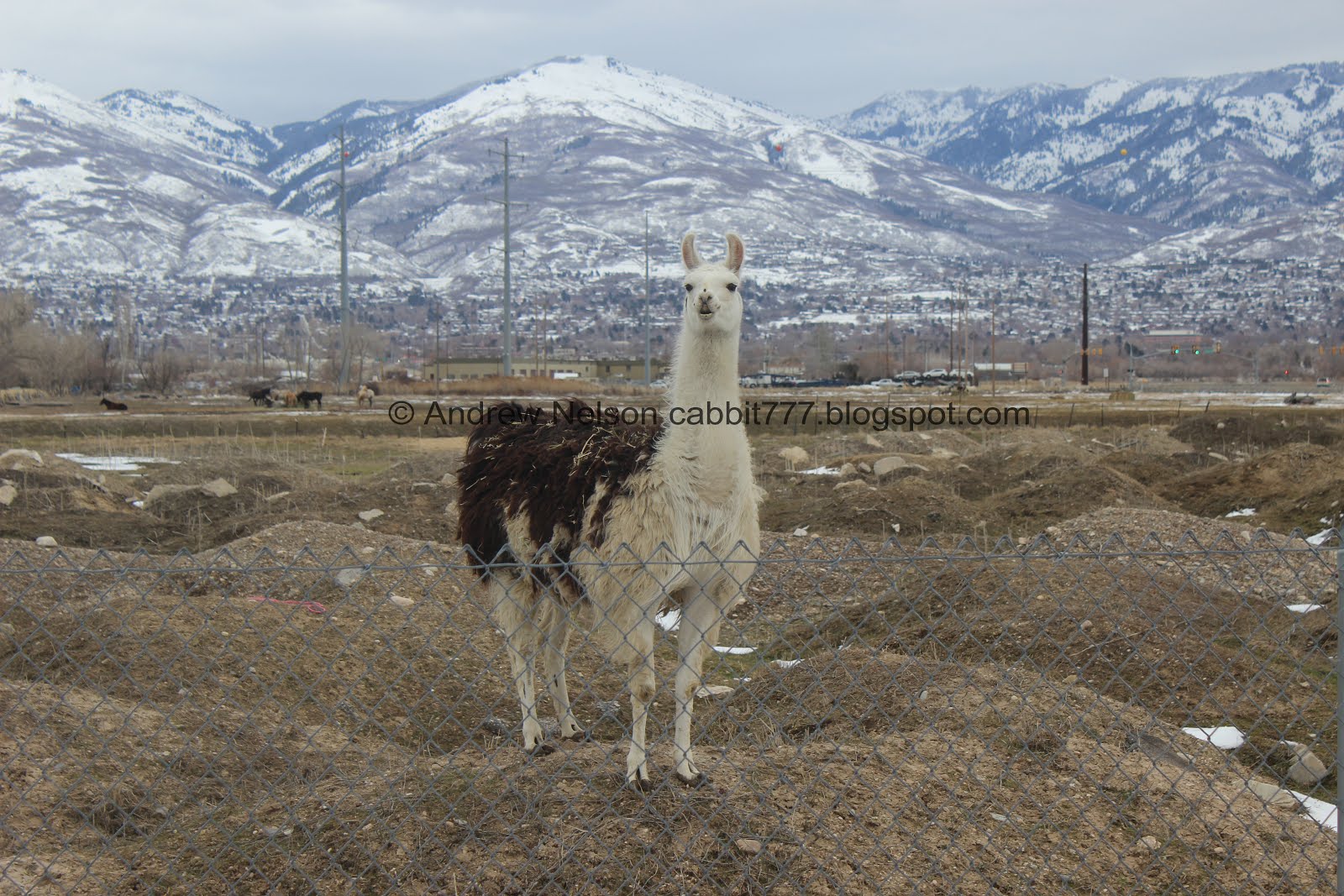
He climbed up to see us better.

The rest of their buddies.

We heard a very loud boom followed by this truck loosing debris. He got a really nasty flat that must have caused some gnarly damage. Luckily it doesn’t look like anybody got hurt, but that was a little scary.

We are keeping a close eye on the clouds. We know it’s supposed to snow eventually but so far all seems well.

Pretty mountains.

Closer canyons. I think we have done them all lets see….
Ricks Creek (Ford Canyon), Barnard Creek, Parrish Creek, Deuel Creek

One of the things I like about the Legacy Parkway Trail is there are mile markers every half mile.The 5th South Trailhead is just north of mile marker 4.

Mueller Park again.

All of the other canals along this section were labeled, but this one is not.

Gnarly looking clouds.


A-1-2 Drain. I just missed something on the surface…

Oh there it is again. Most likely a muskrat. I’ve seen them in this area before.

There are 2 of them fun.

I switched to the telephoto lens and caught this quick shot but then they decided to stay underwater. Darn. It was still neat to see them.

Mountains again.

You can see the Francis Peak Radar Tower above Bair Canyon.

Clouds again.

Mile marker 5.

Oh this canal isn’t labeled either.

A large hawk landed on a tree on the other side of the parkway. Too far away to get a good picture, but meh.

More gnarly clouds. In hind site, this probably would have been a good sign to turn around.

Geese.

Oh yay, an American Kestrel. Utah's tiniest little bird of prey (a falcon). Probably the 2nd best picture I’ve caught of one now. Oh, and if you look closely, it appears to have just snagged dinner!

Not the best shot, but in flight.

Hard to identify a silhouette but if I had to I would say likely a red tailed hawk.


Mill Creek. huh. Google Maps made me think it was a little further south. Maybe they split it at some point.

5.5 mile marker. Whew! Only 9.5 miles left to explore.

Just before the Mill Creek Trailhead.
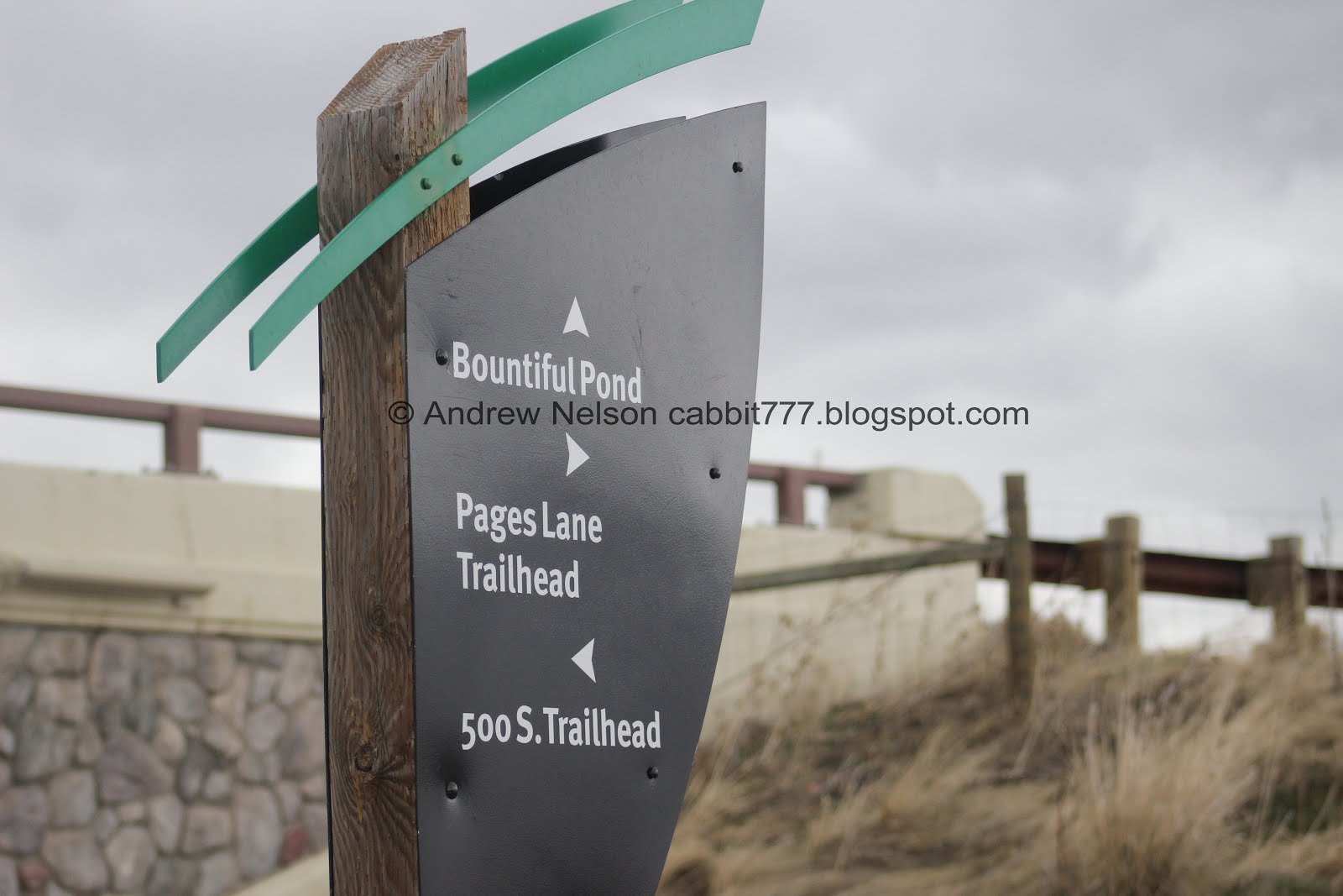
This is about 1.75 miles from the 5th S trail head, and about .6 miles from the Pages Lane TH. I originally planned to turn around here, and that would have been the better option today, but I wanted to explore some more so we went to Bountiful Lake. The signage along the trail is great, but I would like to see mileage added.

To get to Bountiful Lake you will go under Legacy Parkway.

Bountiful Lake. It has a thin layer of ice on it now. Not sure I would walk on it just yet.

Low clouds.
Well, I was hoping the coming storm would’ve held out a little longer, or at least start a little slower but it pretty much went from cloudy to full on blizzard in the blink of an eye. So, we decided it was time to head on back.

The wind whipping the fresh snow around the ice. That was pretty neat looking.

A bunch of robins looking for food.

Caught some of the blizzard as we went into the tunnel.

The Mill Creek TH.

5.5 mile marker.

Some geese.

Oh boy it’s really coming down. We’re dressed well, but it’s not terribly fun hiking in a blizzard.

We’re making excellent timing though!

Can’t see the mountains anymore.

Back to the A-1-2 drain. The muskrats must have better sense than us and have gone in for the day.

Or they are hiding from this hawk that is patrolling the area.

More geese.

4.5 miles. Almost back.

The 5th S Bridge looks like a ghost in all this snow.


Horses and llamas huddle together for warmth.

The tunnel under 5th S.
The wind was blowing the snow eastwards, so no pictures while we made the short trek west to the trailhead. That part was the worst oi.
You know, even though we had to walk back in a blizzard (our fault, we knew it was coming but pushed it anyway) I think this was my favorite segment so far. It’s probably because we saw some great birds, and some other wildlife, and the snow looming Sunday made it a quieter day along the Legacy Parkway. going with 6 out of 10 squirrels.
As for difficulty, It’s paved, and fairly flat. going with a DR2.
Dogs are allowed. Please clean up after your furry friend.

No comments:
Post a Comment