.jpg)
The Spring Hollow Trail is a nice trail located in Draper that features excellent views of the Salt Lake Valley. The trail cuts through several hollows next to a golf course and then working into a channel between neighborhoods. I think Draper wins as far as building an extensive trail system throughout the city. You can see a full trail map here (external link).

Quick Details:
Length: About 2.5 Miles out and back.
Trail Type: Out and Back, Point To Point, or Connector.
Difficulty: DR3.
Elevation Gain: About 500 ft.
Restroom: No. There is one at the nearby Potato Hill Trailhead.
Dogs? Yes, leashed.
Other Info: This trail starts at the top, and returns uphill.
To Get Here:
From I15 Take exit 288, or 14600 S in Draper. Go left. Go almost a mile and turn right on Traverse Ridge Dr. After about 1.4 miles turn left on Mike Weir Dr. Another .4 miles you will see a dirt parking lot on the right.
Walk towards the north end of the parking lot. Cross the creek, then cross the street and hike down.
The Trail:

Looking up towards Red Rock Climbing Crag. I thought about adding this on to our adventure today, and am kind of kicking myself that I didn’t since I learned it is super short. But, meh. Maybe next time.

I was just going to walk along the shoulder of the road until I noticed the trail to the right.

Little bridge.

The little stream it crosses.
After this you will take the crosswalk across the road.

On the other side of the crosswalk you will find the Spring Hollow Trail sign.

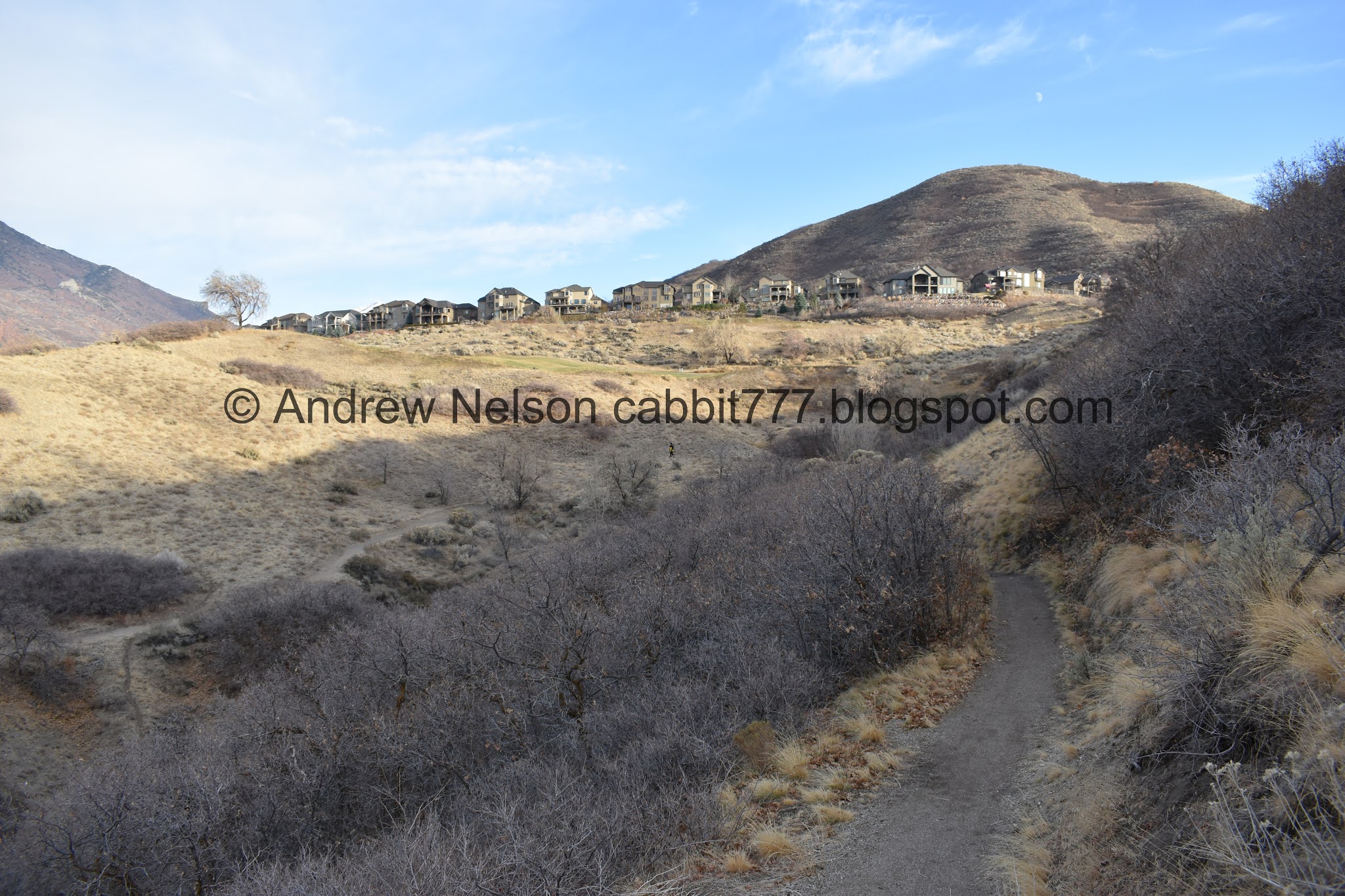
Already getting a great view.

You can see the Aquariums Claw from up here.

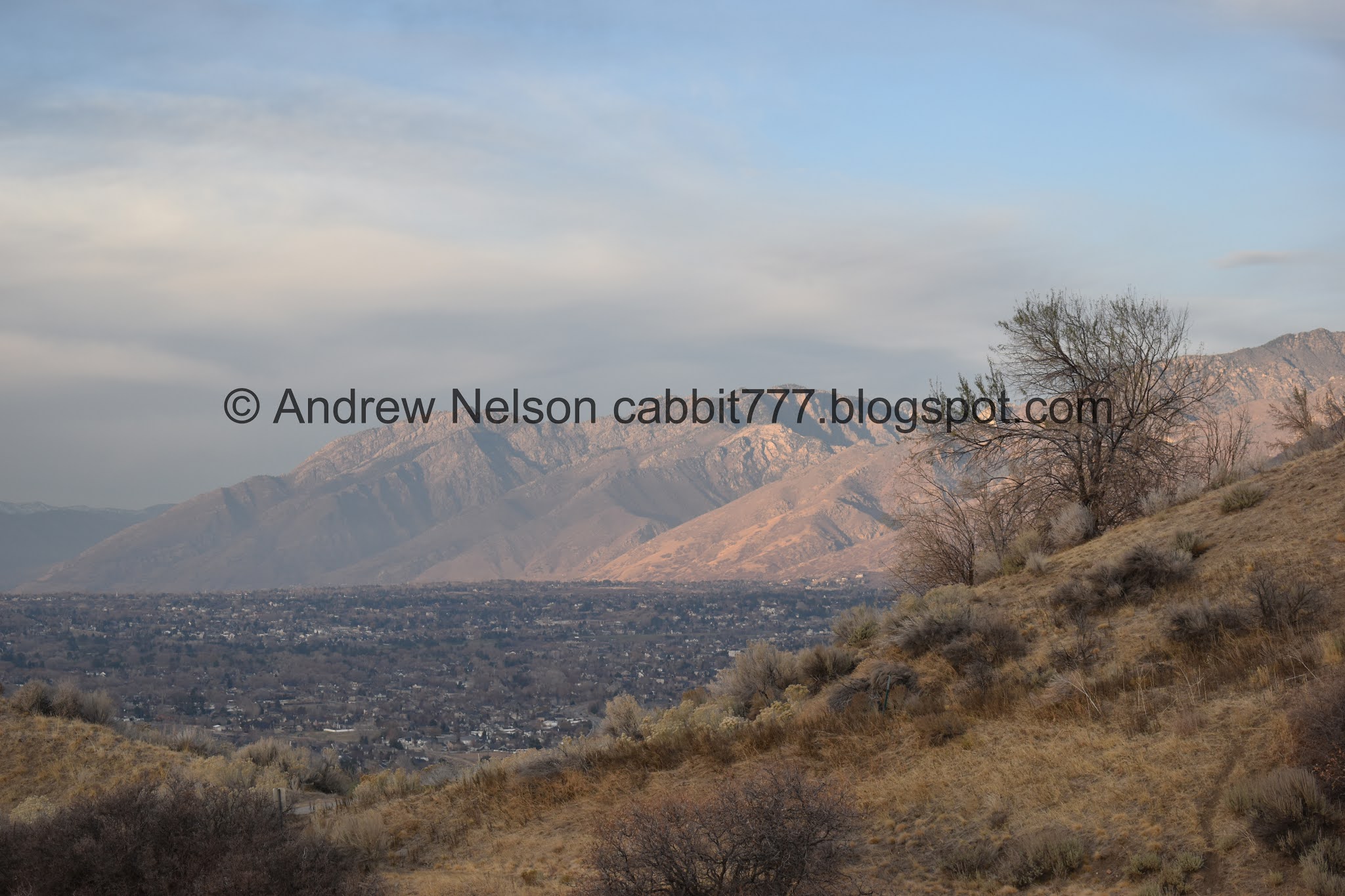
Looks like we have a little bit of an inversion.

The trail crosses some golf cart paths a few times, but it is always easy to pick up n the other side.

Looking back towards Red Rock. At the time I wasn’t sure if it was the one on the left, or the right. But after looking at some pictures I now know it is the one on the right. Also, if you zoom in you can see some people climbing on it.

Above the golf course.
Panoramic view of the Salt Lake Valley.


Hitting the scrub oak.

Across an open area.

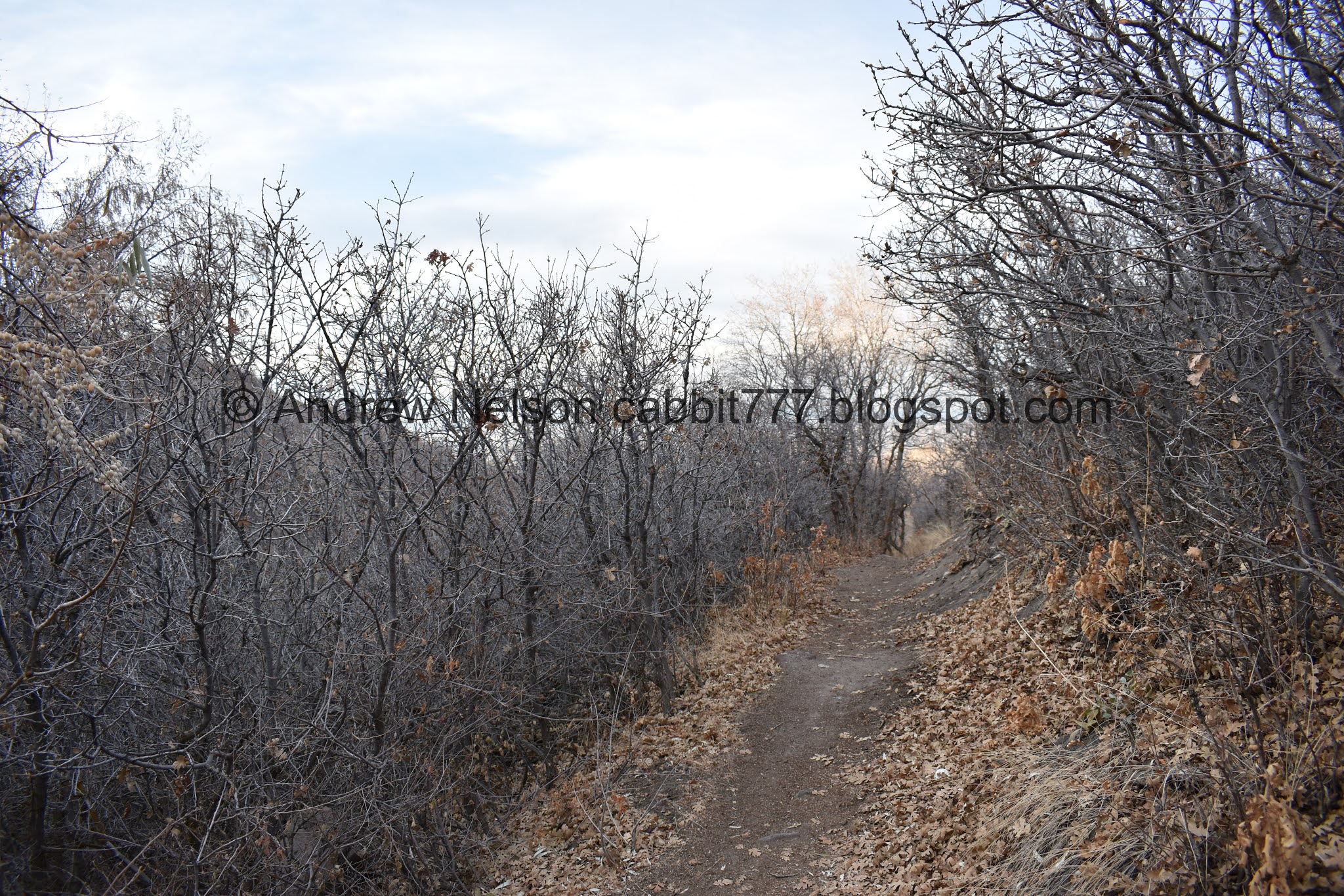
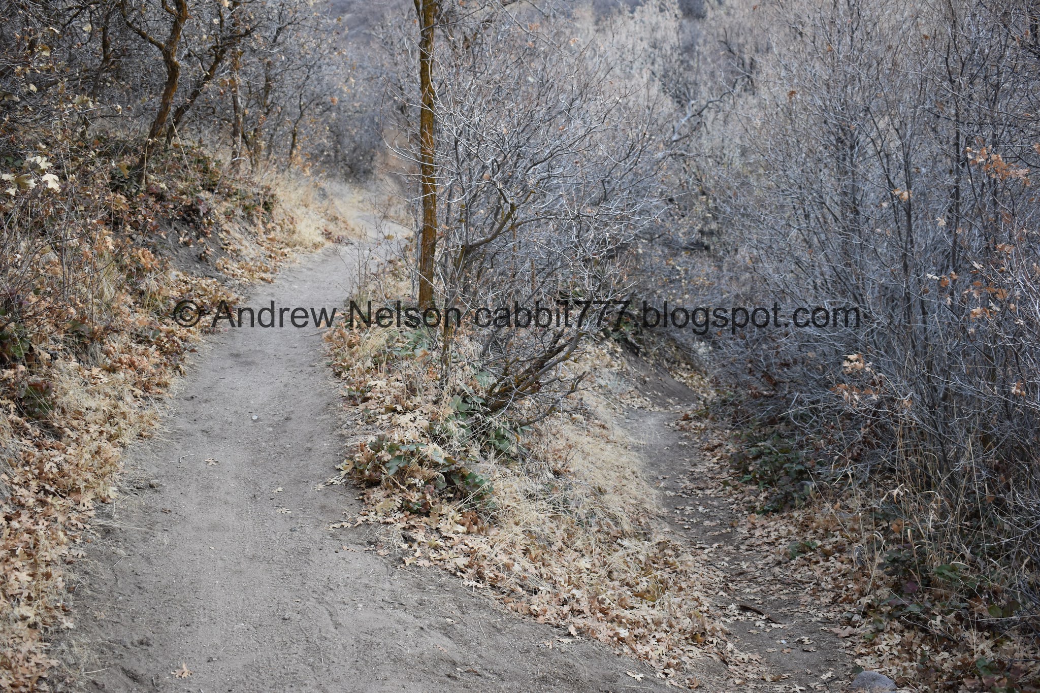
Tree tunnel.

Leaf littered hillside.

The golf course again.

Crossing another golf cart trail.

Another panoramic.

Potato Hill. An easy to reach sub peak, or there is a nice little trail system around it.

It was far away, so it is hard to tell for sure, but I believe this is a red tailed hawk.

Entering another hollow. Both had springs so its hard to say which one is Spring Hollow. Or maybe both of them are?

Heading down into it.

The hawk decided to hang out in this tree. I don’t know why I didn’t think to pull out the telephoto lens, but I didn’t.

Through the sage.

The view below.

Mount Jordan. I feel like we have spent a lot of time around it the last year or so.

Random manhole. I wonder if they planned to develop the area, and changed their minds, or if it is just an access point to the sewer infrastructure between the communities above and below.

Still kicking myself for not pulling out the telephoto lens. Hawks don’t often just sit still for long.
Heading down.

Potato Hill again.

Reaching the bottom of the hollow.

Potato Hill again.

Looking down the hollow.

Deer trail across the hollow.


Back into the scrub oak.

Looking into the gully below.

The leaves are super thick! But luckily it didn’t make it too difficult to follow the trail.

The trail now starts going between yards.

It took my brain a good couple seconds to figure out what I was seeing here. At first it seemed like I was seeing part of the mountain peaking through the white clouds. Eventually I realized its just some smaller wisps of dark clouds.

Another crosswalk. I would say, unless you want the extra mileage, go ahead and just turn around here. The rest of the trail is kind of meh. It goes between peoples back yards and there are a couple very defensive dogs along the route too. Not terribly enjoyable. This will shave off approximately 6/10ths of a mile out and back.
But, I didn’t know that. So here is what is in store should you continue.

Narrow corridor between private backyards. I know we are allowed to be here, but it still feels so intrusive. Which is weird, because I now live in a house with a corridor like this. The only difference is, only local neighborhood kids use it, and the city isn't recommending it as a trail. But I totally don't mind the people walking by. Even if it makes my dogs crazy haha. So I don't know why I feel intrusive coming though here now.

Not pictured, the 3 dogs very loudly defending their respective properties. One of which that seemed like if it just put in a smidge more effort could totally hop the fence and get to us. o.O

Eventually you pop out into a field.


I guess this is technically the end of the Spring Hollow Trail. We took the right fork and followed the Highland Trail for just a smidge longer.

Bottom of the hollow.

Getting a view again.

We followed the left split the 5 feet to the sidewalk and called it good. The Highland Trail follows Highland Dr. which doesn’t sound terribly appealing. We only were on it for maybe 1/10th of a mile.

Heading back.

The inversion is hanging onto to the mountains across the way like fog.

Sagebrush.

Nearing the neighborhoods again.

I see these structures on a lot of trails. This is the smallest one I have seen.

Back into the neighborhood corridor.

This is weird. Its a fenced off area, completely separated from any property line. I wonder why? Landis ventured possible community garden? I wonder if maybe property line issue and deal with the city to allow the trail through here? I don't know, but it is weird.

Quail.

Back to the road crossing.

I have never seen an 'Owners must clean up after their dogs' sign with this imagery before…

More scrub oak.

Back into the hollow.

Potato Hill again.
There is a smaller trail down to the bottom but we didn’t check that out today.

More scrub oak.

View of the valley below.

Again.

Mount Jordan and other mountains beyond.

Nearing the top of this hollow.

Looking into the hollow. That looks like a possible spring to me.

Potato Hill again.

Looking towards Red Rock Climbing Crag again.

View of the valley below.

Panoramic.

Heading across towards the next hollow. You know, coming down, I was a little worried about what we were getting ourselves into. But coming back up hasn’t been too bad. There is a nice mix of climb, flat, climb, flat.

More scrub oak.

Leaf litter. I love coming across thick carpets of it.

View above the golf course.
Fun lighting on the mountains.

Panoramic.

Landis noticed a bunch of white dots on the course below, which we quickly deduced to be golf balls. But uh, don’t they have special carts to gather them back up? I guess they don’t run it on Sundays?

Another view of Red Rock.

Some more color. Likely dead, but it’s still pretty.

More scrub oak.

Inversion.

One last panoramic.

Closer look at the south end of the valley. Can you spot the aquariums claw?

Potato Hill again.

Red Rock again.

Final jaunt through the sage.

Red Rock again.

Back to the bridge.

The little stream.

Cattails.

Red Rock again. Still kicking myself for not wandering up to see it closer.

Last light on the mountains.
Not a bad trail system. I mean, I did not like the tight neighborhood corridor, but the upper section was pretty nice and had some great views. There weren’t many people on the trail today either which is always a plus. There were a few spots that would have made passing someone a little worrisome as they were thin, but luckily we didn’t pass anybody in those areas. Going with 7 out of 10 squirrels today.

As for difficulty, it starts at the top, and returns uphill, but it wasn’t too bad. DR3.
Dogs are allowed, but must be leashed. Please clean up after your furry friends.

No comments:
Post a Comment