I have been slowly making my way along the Jordan River Parkway. It’s about 45 miles long so I have been doing it in segments. I’ve reached a part of the trail that has a short segment between trailheads, followed by a long one, a short one and another long one. I wasn’t quite sure how to break these up into more even segments so I decided I would take the dogs out and do this quick shorter section today.
Quick Details:
Length: 1.2 miles out and back.
Trail Type: Out and back or connector.
Difficulty: DR2. It is paved and practically flat.
Elevation Gain: About 36 feet.
Restroom: At both ends. Not sure if either are open in winter though.
Dogs? Yes, leashed. please clean up after your furry friends.
Other Info: Cities: South Jordan. Mile Markers: 19
To Get Here:
Take i15 to 106th South and head east. Go about a half mile and turn left on S. River Front Pkwy. Go almost another half mile, through the round about and take the first left onto 10901 S. It doesn't look like a road, rather it looks like you are going into the parking lot of the businesses, but keep going strait for about 500 ft and you will see the park and parking lot. If you hit a second round a bout you went too far.
The Trail:
Trailhead sign. You can go forward here, or shave a tiny bit off and go left here. I wanted to get to where I had left off last time, so I went forward.
This looks like a great park for the kids! I had to wait to take a picture to when I was leaving as it was full of kids when I got here. I generally make it a rule to not take a picture with random kids present.
Here is where I left of from last time.
First view of the river.
It’s such a beautiful day today!
Great view of Mount Jordan.
Big Cottonwood and Little Cottonwood Canyons.
Panoramic.
Mile 2.25 on the South Jordan quarter mile trail markers.
Which is just before mile marker 19 on the Jordan River Parkway system.
Open space along the River Front Park. There are a couple lovely gazebos with picnic tables through here.
Another view of the mountains.
Oh fun, I found where Midas Creek joins the Jordan River.
Lots of ducks hanging out here.
The trail again.
Mile 2.75 on the South Jordan quarter mile markers.
Whelp I reached my intended destination today. I decided to round it out by going around the fishing ponds.
Well, it’s tiny but lovely.
I didn’t realize it at the time but there are actually 3 ponds right here, this is just the furthest north one. Guess the name of Fishing Ponds makes more sense now. Eh, I will check the other 2 out when I pick up the next segment.
This pond is called Midas Pond. makes sense with it being near Midas Creek, and is likely filled from it.
From the other side.
Panoramic.
More mountains.
View to the south.
More mountains.
Rejoining the Jordan River Parkway and some ducks!
More ducks.
Trees and clouds.
Midas Creek again.
From the other side.
Tree full of robins.
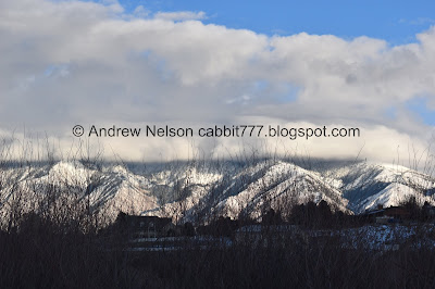
.Mountain views.
Nice sun ray.
Clouds obscuring the top of Mount Jordan.
Mile marker 19 again. I wonder when they switched form Jordan River Trail to Jordan River Parkway, or maybe they are interchangeable.
The South Jordan quarter mile markers, .5 miles from this direction, 2.25 from the other side.
More mountains.
More.
Another panoramic.
Oh wow, you can see Mount Timpanogos from here!
Another panoramic.
Quite the unique view of Mount Timpanogos.
Another panoramic.
Little Cottonwood Canyon.
Mount Jordan.
I really enjoyed this short segment of the trail. It followed along a long park so it was open space. Not a whole lot of views of the river though, which is the only detractor. However, the mountain views really make it here! There were a few people along the trail, most wearing masks, which makes me feel more comfortable. This is a great segment to do when you don’t have a lot of time, or just want a quick adventure. 8 out of 10 squirrels.
As for difficulty, it’s paved, and practically flat. DR2.
Dogs are allowed, but must be leashed. Please clean up after your furry friend.
.jpg)


No comments:
Post a Comment