Bell Canyon AKA Bells Canyon is a beautiful canyon in Sandy. The trail features 2 waterfalls, and 2 reservoirs (both referred to as upper and lower, respectively). The trail also features lovely forests, a creek, wildflowers, and possibly even some wildlife. There are currently 2 trailheads, Granite, and Boulders. They are both quite the climb! But I think this one is slightly easier. We tend to do some version of this trail at least once a year.
Quick Details:
Length: About a 3 mile balloon.
Trail Type: Balloon, or out and back.
Difficulty: DR4. It is a bit of a climb!
Elevation Gain: About 660 feet.
Restroom: Yes.
Dogs? No. Bell Canyon is watershed.
Other Info:
To Get Here:
Take i15 to 90th south in Sandy, head east. 90th will become 94th, keep heading up. After you pass Wasatch BLVD. the trailhead will be about 500 feet beyond, on the right. If the small parking lot is full, there is overflow parking about 800 feet east.
And likely very soon, there will be the new parking about 600 feet to the south on Wasatch. More on that momentarily.
The Trail:
Trail rules.
Again, how many signs do they need to put up to get through to people?
I think these are mules ears.
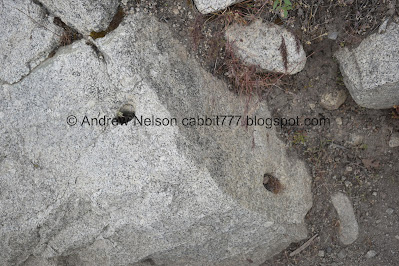
There is quite a bit of evidence of quarrying along this trail. You can learn more about that at the nearby Temple Quarry Trail.
Some phlox.
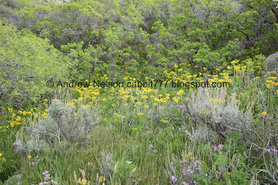
Not sure, I struggle with yellow, many petaled flowers. There are just so many of them. I am leaning towards some kind of groundsel, but still not sure.
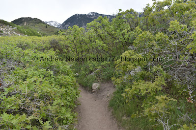
The trail is very lush and green right now. I love May! It is definitely the best month for hiking.
More of what I think are mules ears. I originally thought arrow leaf balsamroot, but the leaves are not right.
New trail connector. We didn’t realize it at the time, but that appears to connect to a new parking lot they are building. Again, more in a moment.
More phlox.
Rocky trail.
Another new connector trail, again, we did not realize it at the time, but it also appears to connect to the new parking area, again, more on that soon.
I think this is a camas.
More mules ears.
Pretty purple flowers.
More phlox.
Mix of flowers.
More phlox.
Some young lupine.
Hrm. Not 100% sure what this is, but my best guess is some immature geraniums.
Whoa! They have built in some new parking for the area! It looks pretty complete to me, and should be ready to open soon I imagine. I did some digging and found this: outside article. I think that is a wonderful gift those families provided for the community!
Quick version: The 2 oldest Sandy City families agreed to sell the land to the city at a discounted rate, with the promise that it would be turned into a community resource.
When completed, the project will include a nature trail, restrooms, a picnic area, and about 130 parking spots. While I think it will be awesome to not have to fight for parking, I do worry that a good portion of people who would have decided to go elsewhere, due to not finding parking, will make this already busy trail even more busy. But, I guess it is a trade off.
The new area will also include a helipad and staging area to serve as a base of operations for forest fires and search and rescue operations. Not just for Bell Canyon (which requires those services 4-5 times a year) but other nearby areas.
The article is from April 2021, and said it was expected to open sometime in July. I guess there must have been some kind of delay, but it looks pretty much done to me.
Update: So I was right about it looking like it is almost done. The new trailhead opened the following Thursday 5/26/22. Part of me wants to go back and check it out but maybe I will wait a minute.
I also predict that this might replace the original Granite Trailhead. But, that is just speculation.
Panoramic.
It really is an amazing improvement. One (or both) of the families pretty much had a junkyard there, which was a bit of an eyesore. A parking lot is better lol. Also, I am glad it did not go to a developer. Houses there would only exacerbate the parking problem, but would also ruin the view, and then of course there would be rich people complaining of hikers in their back yard. Oi. I am very happy it went the way it did.
You can just make out the 3 parking areas they added.
They also added mile markers. Although, I think they did this a couple years ago.
Steep and rocky.
Another view of the new parking area.
Steep switch back.
Looking at some of the plans, I think that area to the left will be the new nature trail.
The mountain we are climbing.
We made it to the ridge! So we get a little break from the climb now.
The service road is very prominent, the trail we will be following up to the next ridge is just above it.
Brief downhill section, keep in mind you have to climb back up this on the way out.
The hills are so green and pretty right now.
We will explore this particular formation on the way down.
Hills above.
At the bottom of the descent you will find these two boulders. Then the climb resumes.
Gloomy clouds.
More pretty yellow flowers.
Back to the climb. It’s a little more mild than the initial switchbacks.
More flowers.
The previous ridge we climbed over.
More phlox.
Miners lettuce.
Ladybug.
I think this is some kind of pea.
View of the valley again.
The trail above the access road.
More signs of quarrying.
More trail.
We made it!
We decided to do the loop trail around the lower reservoir. Counter-clockwise is a bit easier. If you want to head to the waterfall, then go left instead, as it is the shorter route.
Whoa! The lower reservoir is full again! It’s been a good couple years since I have seen that!
Upper Bell Canyon.
The reservoir again. It is definitely a lot prettier when full.
Panoramic.
The valley again.
The trail up to north peak of what I call The Bell Bottom Twins. I considered doing it again today, it’s super short and easy but meh.
Upper Bell Canyon.
Cropped in a bit closer. You can see the people exploring up there, including one that is engaging in dangerous activity. Seriously, don’t cross a creek at the top of a waterfall. Quite a few people have died here doing that.
The upper canyon again.
With the lower reservoir.
The creek leaving the reservoir.
The reservoir again.
The little canyon between the twin peaks. This is where the Boulders Trail will pop you up.
Upper canyon again.
Nice little tree tunnel.
Hard to see the reservoir through the trees back here.
I decided to run out and see how the Bonneville Shoreline Trail was coming along through here.
The south twin.
It looks like the trail might come through here, but we weren’t up for climbing down then back up that to confirm. The official Bonneville Shoreline Trail page says it is still in future state so, I donno. Hopefully soon though!
Dry Canyon.
The south end of the valley.
Dry Canyon, Rocky Mouth Canyon, Big Willow Canyon and Little willow Canyon.
Back to the main loop.
The reservoir again, with the north twin.
Another view of the upper canyon.
It is pretty up here.
The creek.
The water coming out of the spillway.
Where it enters the spillway.
A little bit beyond the main loop, we find ourselves in a thick forest.
The creek again.
More forest.
Fun pile of giant boulders.
Seriously, these things are huge.
We went a little further up this side trail, but weren’t sure where it lead. I think it ultimately joins the main upper trail again, but I am not 100% sure.
Back to the boulders.
That top one looks a bit precarious.
Back into the forest.
Down to the spillway, which offers a convenient crossing.
The creek.
I wonder what animal tracks these might be, definitely not duck. I am leaning towards maybe a racoon?
And these 3 toed ones. Leaning towards goose.
Oof, I hope we don’t get rained on.
Milk vetch.
Nice and flat for a minute.
I think this is woodland star.
We passed by the split off for the Lower Falls (and upper falls and upper reservoir), but there was a group in front of the signs so I didn’t take a picture today.
Just past that the trail starts heading downhill again.
The reservoir again.
Panoramic.
Ew, is that dust?
With some light rays.
Another panoramic.
Heading back down.
More signs of quarrying.
More flowers.
Sage with some insect galls.
Phlox.
More down.
We took a short side trail out to some boulders and found this along the way.
Big boulders.
These also show signs of quarrying.
Split rock.
More quarrying.
Again.
Looking up.
Looking towards the short uphill section we need to do to get up over the next ridge.
Fun moody clouds.
Boulder at the bottom, just before the climb back up.
Dusty skies.
Looking back towards the previous ridge.
The boulders we explored.
Last little push. The short climb up to the ridge isn't much.
More quarrying.
Turkey vulture.
Over the ridge.
It’s like a kind of mild haboob.
The new parking lot again.
Update: The new trailhead opened the following Thursday 5/26/22.
Lupine.
The storm again.
More pretty yellow flowers.
More quarrying, and one of the 2 trails to the new parking lot.
More quarrying.
Back down to the parking lot.
Holy turkey vultures, Batman.
And a red-tailed hawk. This is not the first time I have seen these 2 species hanging out together. Makes me wonder if they normally hang out together.
Crazy clouds.
Random bench at the trailhead.
I really do enjoy this trail. Even with part of it that makes me struggle a bit with my fear of heights. I think the lower reservoir is one of our prettiest reservoirs around. I enjoyed the wildflowers, and rock out cropping's as well. It was busy, but not crazy busy. I guess we will see how the new parking lot will effect the area eventually but ultimately, I think it will be a good thing. 9 out of 10 squirrels today.
As for difficulty, it is seriously a climb! DR4.
Dogs are not allowed due to watershed restrictions. Please leave Fido home for this one.
.jpg)


.jpg)


.jpg)


.jpg)


.jpg)


.jpg)


No comments:
Post a Comment