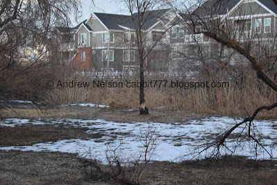
This section of The Jordan River Parkway is a little wild, but near some residential homes. It does offer some nice views of the mountains though. We’ve done this section before, but we did Bateman Pond and it was shorter than expected so we added this as a quick extra.
Quick Details:
Length: 1.43 miles out and back.
Trail Type: Connector, Out and Back.
Difficulty: It’s paved and fairly flat, DR2
Elevation Gain: NA
Restroom: Not at 70th South but there is one in Winchester Park. Now sure if it is open during winter though.
Dogs? Yes, Leashed.
Other Info: Cities: West Jordan, Murray. JRP Mile Markers: 26
To Get Here:
Take i15 to the 7200 South exit, head west. At about 9/10ths of a mile the trailhead will be on the left.
The Trail:
View from the trailhead.
TH kiosk.
Pacificorp GreenCorps planted native trees, brush, and grasses.
Heading under 70th south.
There are surprisingly few cliff swallow nests under hear. Most bridges have a ton.
The river.
Muskrat.
Stormwater outfall.
Signs of beaver activity.
Another stormwater outfall.
There is a bridge across it.
I am like 99% sure this is the water that comes out of Bateman Pond that we were just at. You can kind of see the little gully for it above.
Ducks.
Tree full of robins. Fun fact, they don’t necessarily fly south for the winter.
This section of trail is near peoples back yards, but at least there is a bit os space between them and the trail.
The mountains all lit up.
Panoramic.
Big Cottonwood Canyon.
There appears to be a confluence on the other side of the river, I couldn’t locate any named creek or stream, it’s probably a canal of some sort.
Mountains and river.
As we near Winchester St. the area opens up a bit.
The mountains again.
Another panoramic.
Love the lighting.
Mile Marker 26.
Warning signs for canoers to exit the river due to a hazard ahead.
The exit ramp.
Entering Murray.
Last light.
Heading under Winchester St.
Tunnel.
The aforementioned river hazard. There are 3 of these right here.
River and mountains.
The sign is a little too dirty and weathered to read but as I understand it the street, and this park were named for the Winchester Homestead that was around here somewhere at some point.
Not to be confused with the much more famous Winchester Mystery Mansion.
Oh! I found the beginning of the Gold Medal Mile that ends on the next section. This is not on the Jordan River Parkway, instead another connecting trail from the parking lot.
Ducks, and a random American Coot.
I decided we would push on to the pond in Winchester Park and that would be our destination for the day.
The pond.
And here come the ducks! Sorry guys, we didn’t bring any oats for you.
A friendly reminder that bread does not provide appropriate nutrition, and pollutes their water. Consider instead: Cut seedless grapes, cooked rice, birdseed, peas, corn, oats and chopped lettuce.
I like that these signs are popping up at more places where there are ducks.
The pond. I don’t have anything to back this up, but I suspect this may have been an oxbow lake.
Panoramic, which kind of distorts the kidney shape of the pond.
Ducks again.
Well, we decided to head on back.
River and mountains.
Fun pink clouds.
Back to the tunnel under Winchester, now heading into West Jordan.
Nice little sunset.
Which provided some nice pink above the mountains.
There is a gravel alternate path that is closer to the river. so I decided to use it.
Mile Marker 26 again.
Big fluffy pink cloud.
More pink clouds as we near the end of the gravel trail where it reconnects to the main one.
Sunset.
Mountains.
Back to the stormwater outfall.
The other side.
Heading back under 70th.
Last bit of sunset.
A last look at the mountains.
Not a bad section along the parkway. Somewhat wild and had some nice mountain views. Not too busy either. 6 out of 10 squirrels.
As for difficulty, it is paved all the way out and back, but even the gravely side trail we did was kind of like paved, and it is fairly flat. DR2.
Dogs are allowed but should remain leashed at all times.
.jpg)


.jpg)


.jpg)


.jpg)


No comments:
Post a Comment