The mirabilite spring mounds are still going strong out at the Great Salt Lake so I decided we should go see them again. They are such a rare and unusual thing that as long as they keep coming back, I will too. I tend to go at least once each winter since they were discovered in 2019. Because I find them to be just absolutely fascinating. Particularly because this phenomena has only been observed here at the Great Salt Lake, the Arctic and Antarctica. We were just here last month, but again, it’s cool so we came back.
Quick Details:
Length: They are only about a quarter mile out, with a little exploring we did a 3/4 mile loop.
Trail Type: Out and back, loop options.
Difficulty: DR3. There is a short hill at the beginning but the rest is generally flat. However it is beach sand and mud.
Elevation Gain: About 20 feet.
Restroom: Yes. In the Visitor Center or next to the marina.
Dogs? Yes, leashed.
Other Info: Fee Area. $5.00 per car. Also, boots or galoshes are highly recommended.
To Get Here:
Head east on i80 to exit 104. Turn right off the exit towards Saltair, and then immediately left (following the signs for the Great Salt Lake State Park and Marina). Follow that to the end. Pay your park fee’s and head in. Silver Sands Beach is accessed to the left (north) of the Visitor Center.
I love the way the mountains look after a fresh snow (Passenger Seat Photography (PSP)).
Decker Lake (PSP).
Downtown (PSP).
The airport with the new art piece (PSP). I still need to check that out.
I love that you can see see antelope out here (PSP). I hope they don’t develop much more out here so that they still have room to be wild.
Oh, there is a bunch of them out there! (PSP).
Antelope Island (PSP).
Saltair (PSP).
The Visitor Center.
The Trail:
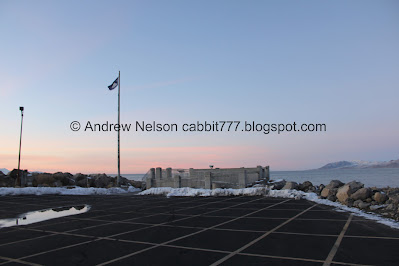
The viewing platform.
The quick hill down to Silver Sands Beach. It looked a lot more slippery than it was.
The Kennecott smelter stack. We are both pretty sure the big K painted on the top is new ish. I had never noticed it before the last time we were here.
Dead bird.
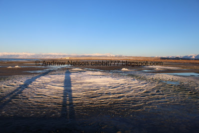
Approaching the mounds. They kind of just look like snow drifts from back here.
Streams and mud.
BTW, if you want to avoid mucking in the mud, there is a sandbar to the south. It doesn’t add much mileage either.
Fun texture.
We have arrived!
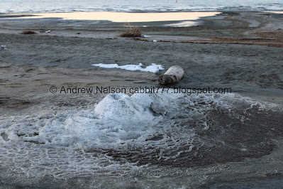
The 2 largest mounds (and furthest west) have about merged. Each mound can have multiple springs on it.
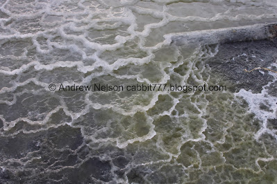
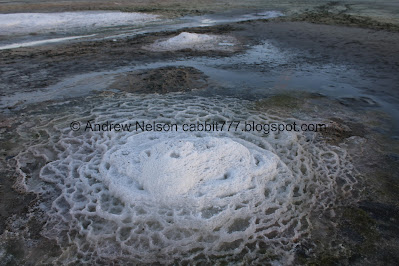
I just love the natural terraces the mirabilite crystals make. I say it every time, but it is a lot like the terraces you see at Mammoth Hot Springs in Yellowstone. However instead of hot water, cold water causes this.
The mound again.
A small mound.
This one looks like 3 volcanos.
Fun terraces.
From the other side.
Another mound.
From the side.
Itty bitty mound. Footprint for size.
Closer.
The smelter stack again. Fun fact, this is the tallest man made structure west of the Mississippi.
More dead birds. Nothing to be alarmed about, when birds die in the Great Salt Lake the salt basically pickles them so they don’t decompose as quickly. Also, thousands of birds come to the Great Salt Lake every year, and well, some of them die.
Another large mound.
Terraces.
Another angle.
A smaller one.
From the top.
Closer.
The itty bitty mound with a little reflection.
Another mound.
From the side.
Back to the 2 largest mounds.
Terraces and crystals.
Some submerged ones.
As I said, these 2 large mounds are merging into each other.
More crystals.
Another mound. I counted 10 mounds today.
Back to the biggest one.
So what exactly is going on here? Well, the quick version is there is a layer of mirabilite (a type of salt) a couple feet below the ground here and there are natural springs that are bringing that up to the surface. With the cold air, that salt crystalizes and starts building these terraces. More info from our first trip here. When the crystals get too warm they break down into an ugly powder called thenardite. So, don’t bother trying to take home a crystal, aside from being illegal, it won’t last.
Panoramic of the 2 largest mounds.
From the side.
5 of the mounds and the smelter stack.
Panoramic.
A mound and the smelter stack.
Colorful terraces.
I decided to make another round around.
Oh, it looks like another itty bitty mound is starting to grow here.
6 of the mounds. These are the southern ones.
Another panoramic.
The big mound again.
The 2 big, merging ones.
Terraces.
Looking out towards the lake.
The big mound and the smelter stack again.
A smaller mound.
The triple mound again.
A double mound.
Inside one of the craters.
This is a cool mound.
Back to to the itty bitty mound.
The other side.
The smelter stack again.
Antelope Island.
Saltair.
Back to the southern group and one of the larger mounds.
From the side.
This unnatural straight line caught my attention, and I realized the terraces are growing over a a piece of lumber.
More fun terraces.
The other side. I think this is the furthest east one.
More terraces.
The mound again.
Crystal formations.
Multiple mounds.
Another mound.
Panoramic from the south side. All of the mounds plus Stansbury and Antelope Islands.
Another mound. I am starting to have a little difficulty telling some of them apart.
Another one.
Multiple mounds.
The 2 biggest ones.
Another panoramic.
The 2 big mounds again, with Stansbury Island.
Antelope Island.
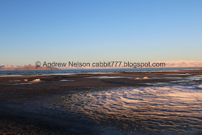
The mountains turning pink with the setting sun.
Another mound.
Back to the big one.
Crystals.
The colorful band separating the 2 large mounds.
Closer.
Panoramic of the 2 large mounds.
Closer to the main craters.
Another mound.
Pink mountains again.
Another mound.
And another.
Heading around the side with the Visitor Center in the background.
More dead birds.
The other side of the previous mound.
The double mound as we head towards the lake.
Silver Sands beach does keep going, you can go all the way out to Saltair and beyond, or there is a kind of neat little shipwreck just a little further east.
Mounds and the smelter stack.
The triple mound again.
Stansbury Island.
Antelope Island.
Panoramic. You can even see Promontory Point just to the left of Antelope Island, and the little blip between is Freemont Island.
Looking back towards the mounds.
Panoramic.
The icy wind was creating some pretty good waves on the lake. It almost sounded like the ocean today. It was actually kind of relaxing.
We decided to head back along the shoreline.
Promontory Point and Antelope Island.
Stansbury Island and Carrington Island (the tiny bump to the right of it).
Another panoramic.
I wish I had thought to take a video. The waves were just great today.
Bird tracks.
Stansbury Island.
Antelope Island.
The smelter stack with a nice reflection.
Waves.
There were a couple sinking into the sand moments, but not too bad.
Little bit of a sunset.
Continuing along this thin sandbar.
The smelter stack again.
More waves.
Long wet crossing. I sunk down a little further than expected and got a little water in my boot. But it wasn't too bad otherwise.
We made it to the small jetty that has these cairns. Normally random cairns kind of piss me off, as generally they are used as way markers but unfortunately Instagrammers have lately been just creating them for no reason. However, here they serve as nesting sites for orbweaver spiders. One of these days I might check out spiderfest, even though I am pretty arachnophobic.
More cairns.
More sunset.
To the east.
More cairns.
The tip of the jetty with Promontory Point and Antelope Island.
Another panoramic with Stansbury Island, Carrington Island, Promontory Point, Freemont Island, and Antelope Island.
More waves.
Crashing into the jetty.
A lot of cairns.
The jetty again.
Some weak lenticular clouds over the mountains to the south.
The hill back up to the parking lot. Again, it looks more slick than it actually was.
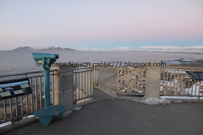
The lake overlook.
There is a little alcove to get a good view of the lake.
The jetty we were previously on, and Antelope Island.
Little bit of sunset with Stansbury Island.
The mountains to the east are back to white with blue and pink skies.
The mirabilite mounds.
Fun giant compass.
Kennecott Inland Sea Shorebird Reserve.
Historic Saltair.
Lake Life.
Skyline Map.
I can make out most of what the map shows here. Stansbury Island, Carrington Island, Promontory Point, Freemont Island, and Antelope Island.
Panoramic.
Sailing on Great Salt Lake.
Great Salt Lake and it’s saltyness.
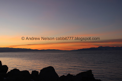
Ooh, we are getting a bit of a sunset.
There are a lot of random little tributes to the 2002 Utah Olympics found along the valley. Including here, and sections along the Jordan River Parkway.
The marina.
The Visitor Center.
The smelter stack again.
Oh we actually got a bit of a sunset.
You can see the Lake Bonneville shorelines on this peak.
Sunset again.
One last sunset shot.
I followed an animal around for a minute, that I ultimately decided was just a cat. What a cat is doing out here, I don’t know.
Sailtair (PSP).
The exit gate (PSP). If you find yourself out in the park after closing, you will have to deal with this. It is a little finicky and you will have to practically nose up to the the gate, and it takes a minute to open, but it will open. We had to back up and try again this time, but it isn’t normally that finicky.
Afterwards we decided to give Burgertory another shot. The burgers were good, the fries were great, but it was not as phenomenal as my friends had made it out to be. I absolutely loved the horror theme though. I would come back if it is on our way, but I wouldn’t make a trip out of my way to go back.
Well, that was a fun adventure. I really love seeing the mirabilite springs and how much they can change in such a short period of time. I seem to be the only nerd that is fascinated by them as we were the only people out exploring them today. which, is well, a win. It’s nice to explore them at our leisure. 10 out of 10 squirrels today. even with the mucky mud.
As for difficulty, its mostly flat with a short hill at the beginning, but it is beach sand and some mud. DR3.
Dogs are allowed, but should remain leashed at all times. Also, be sure to watch your pups to ensure they are not damaging the fragile formations.
.jpg)






.jpg)


.jpg)


.jpg)






.jpg)


.jpg)


.jpg)






.jpg)

.jpg)


.jpg)


.jpg)




.jpg)




No comments:
Post a Comment