Parleys Trail is an 8 miles trail that goes from the mouth of Parleys Canyon all the way down to the Jordan River Parkway. This far west section connecting to the JRP was just completed with 2 new bridges in September last year so I thought we would come check it out. This section of the trail features the river, and a lot of industrial area. This was definitely not my favorite trail, but I do want to complete the entire thing eventually. We have previously done a little bit of the east end of the trail.
Quick Details:
Length: About 3.4 miles out and back.
Trail Type: Out and back, connector.
Difficulty: It is paved and the bridges have a casual grade DR2.
Elevation Gain: About 50 feet.
Restroom: No. There might be one in Jordan River TH Park, but the park is closed so I imagine the restroom is as well.
Dogs? Yes, Leashed.
Other Info: You can access this trail via Trax. Use the River Trail Station and head east on 2320 S. to Jordan River TH Park.
Cities: West Valley and South Salt Lake.
To Get Here:
Take the 201 to exit 150, Redwood Road. Go about 2/10th of a mile and turn left onto 2320 S. Follow that about 9/10 of a mile to the end. Jordan River Trailhead Park is on the right.
Note if coming from the west, when getting off of the freeway, go forward through the light and follow 2200 South until it curves around and crosses 2320 S. Turn left there.
Decker Lake from i215 (Passenger Seat Photography (PSP)).
The Trail:
This part of the trail is so new it is not on any of the maps so I was just kind of winging it today. My original plan was to park on 9th west… but there was not any parking there so our alternate was the Jordan River Trailhead Park.
Trailhead sign. To get to Parleys Trail you will want to go left, north. For them making a big hurrah (outside link) over this section being opened they sure didn’t put any signs in. So I stupidly went the wrong way first. I might add a “blooper reel” to the bottom of this post.
Bridge over the Jordan River. This is not the bridge you want. Keep going north. Going across will put you on the Mill Creek Loop.
Across the river is the Jordan River Rail Service Center.
Some American coots.
Tunnel under the Trax line with a nice mural painted on it.
Inside.
About 3/10’s of a mile later we have reached to turn off for Parleys Trail. This newly completed section resolved a not so convenient detour along 21st South.
With the new bridge. I am not sure why building a new bridge just 3/10ths of a mile north was easier then going under the Trax bridge and connecting to the already existing bridge to the south, considering there is already pretty much a trail out to it too but whatev’s. The new bridge is nice though.
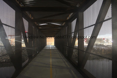
Inside.
Downstream to the north.
For some reason they decided it needed to be fenced in. I mean, I guess it is to prevent people from going on the Trax lines, or wandering over onto the 201 but, it still seems excessive.
Now we are on the north side of the Jordan River Rail Service Center.
Approaching 9th West.
With the new bridge over it.
It is a nice bridge too.
9th West.
I wasn’t 100% sure were to go after the bridge. Luckily this temporary sign is still in place. So you want to go left (south) along 9th under and to the other side of the Trax bridge.
Under the Trax bridge and pedestrian bridge we just crossed.
Then there is a permanent sign indicating where to turn left to keep going east.
Continuing east. We noticed a lot of random articles of clothing on the trail today including these random shoes. Weird.
More industrial area.
A stream of some sort.
Now we start the climb for the bridge over the railroad tracks.
Union Pacific Railroad.
Holy crap, Longest. Bridge. Ever! It is definitely longer than the new tied arch bridge north of here along the Jordan River Trail, but not as neat.
I thought I would struggle with this bridge and my fear of heights, but I guess because it is enclosed, and connected to the Trax bridge I did just fine on it. Still going to tag my Fear of Heights Trigger for those that might struggle with it too.
Union Pacific Railroad again.
Railroads.
Random forks hanging on the fence through here. Super random.
Railroad tracks again.
Little pond.
Denver and Rio Grande Western Railyard Freight Office Wages, C 1915-1916.
Denver and Rio Grande Western Railyard Baggage Office Wages C. 1907 - 1910.
Denver and Rio Grande Western Railyard Warehouse Wages C. 1912 - 1913.
Denver and Rio Grande Western Railyard Yard Office Wages C. 1914 - 1915.
Welcome to the historic Roper Railyard.
Well that was a fun little bit of history.
South Salt Lake water tower. South Salt Lake: Center of Industry. Unlike the Jordan River Trail, this trail does not seem to have any mile markers, or city markers. So I am not quite sure where we crossed the city boundary. Oh, it' was the river. Of course it was. I should have known that considering I learned that the river acts as the border to a lot of cities while doing the Jordan River Parkway.
The last part of the bridge.
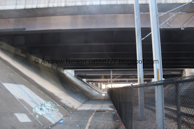
Heading under the freeways. I knew this trail would have to go under the freeway, but I didn’t realize it would take us under the giant mess of freeways that Utah affectionately calls the “Spaghetti Bowl”. In other words a confusing mess of freeway interchanges worming around each other. It’s uh… quite noisy through here.
Pond that one of the freeways passes over.
Trax passing by. I was starting to wonder if the service was done for the day considering how far we got before seeing one pass by.
Old abandoned parking lot. I was wondering what the heck this was and used the Google history feature and saw there were a few businesses here back in 2019. They seem to have been torn down since. I wonder what for? Possibly a new Trax station?
3rd West. This next segment of the trail is still surface streets right now. As far as I can tell you will need to go south a little bit and then back east along West Haven Ave. Then north on West Temple before continuing east on the trail. We decided this was probably a good spot to turn back. So we'll do that next time.
Fish mural.
Heading back under the Spaghetti Bowl and a narrow part of the trail. I get they could not move to the right here with the Trax lines, but seriously, this little shack couldn’t be moved?
Under the Spaghetti Bowl.
The South Salt Lake water tower again.
Starting the long bridge over the railyard again.
Hoo boy, here we go. I did mention I was fine on this long bridge, but as you can see, I did stay well away from the edge. Man, the fear of heights thing is sure a beast. I know it is totally irrational, but that does not change how I respond to it.
The railyard again.
The forks again.
Down the other side.
Low clouds. I love that there are little pockets of light between the peaks under it.
Back to the bridge over 9th west. I got tired of wiping the rain off on the lens so sorry about the artifacts.
Snowy trail.
The Jordan River Rail Service Center again.
Trax train coming out of it. It seems a lot bigger than the building it was in.
The final bridge over the Jordan River.
Back to the tunnel under the Trax line.
Inside.
Bluebird.
Fox.
The Jordan River Trail.
The Jordan River Rail Service Center again.
Back to the Jordan River Trailhead Park. If you want to continue west, you can keep going south about 7/10th of a mile to the Redwood Nature Park and pick up the Crosstown Trail heading west out towards Decker Lake and beyond.
Park sign, and the barricade because the park is closed.
Landis did some digging and found that the park is closed due to unsavory activity including drug use. Oy. This is why we cant have nice things.
Well, I liked this trail a bit, I liked the historical stuff, and I really appreciate the efforts that Salt Lake County is putting in to make alternative routes to use without a car. I also loved that we really did not see any people along the way. However, I did not love the fact that it was in a bad area, and there was not a real safe place to park. Plus, well, the industrial area is well, industrial. I think I am going with 3 out of 10 squirrels today. I might have liked it better if it wasn't rainy and if I could see the mountains. And maybe if there was better signage as I got a little lost, see my Blooper Reel below.
As for difficulty, it is mostly flat, and paved, with mild climbs for all of the bridges. DR2.
Dogs are allowed, but should remain on leash at all times. Please clean up after your furry friends.
BONUS Blooper Reel:
With this section of the trail being so new, it not on any maps, including google. So I was kind of blindly just blundering through to find it. and well, I made a few blunders. So, here is my blooper reel.
Heading across the Jordan River on the old bridge. At the time I thought the trail on the other side was what we needed.
Upstream, to the south.
I know right is the Mill Creek Loop so I thought we needed to go left.
The river again. As you can see the pavement has ended. I was starting to think I might have screwed up right about here.
American coots. Look at the crazy feet! I love these guys.
I can see the bridge we were supposed to use on the other side of the Trax bridge. However it looked like there was room to go under the Trax bridge, so I thought all was not lost.
We just need to scramble across these rocks. Which was not at all easy.
Annnnd, we’re fenced in. Well poop. To further make it a problem the type of fence they used is not really climbable, not that we are of fence climbing age anymore anyway LOL. Guess we need to turn back and start over.
The new bridge we were supposed to use.
Back across the rocks and under the Trax bridge.
The river again.
The Jordan River Rail Service Center.
With a Trax train. I wondered why it was powered up since it didn’t appear to be in use at the moment but Landis mentioned that it’s likely powered by the lines by default which makes sense.
The river again.
Back to the other bridge.
Muskrat!
The bridge again.
In all my little blunder added an extra .91 miles, which I did not factor in above. Plus we saw a muskrat! So not a complete waste haha and as you can see I did eventually find where we needed to go.
.jpg)


No comments:
Post a Comment