Antelope Island State Park is an amazing island oasis that is only about an hour north of Salt Lake City. The park features incredible views, loads of wildlife, some history, and lots of hiking options from short half mile trails to much longer trails. We absolutely love it out there and try to make at least 1 trip out each year. The trouble is finding that little window between where it warms up, and before the biting gnats come out.
Scenic Drive Details
Length: The causeway is approximately 7 miles. Then the island can be split into two sections for driving. The north end has a 4 mile loop with about 2 miles of spurs up to Buffalo Point and down to White Rock Bay. Then the East side down south is about 10 miles down to Fielding Garr Ranch with an additional 4.5 miles further south on dirt roads, if the gate is open, as well as a few spurs out to a few items of interest.
Time Needed: At least 2 hours, depending on how much exploring your do.
Road Conditions: Mostly paved, standard 2 way roads. 4.5 miles of dirt roads.
Summit: NA
Restrooms: There are a mix of flush and pit toilets scattered throughout.
Interesting Things: Wildlife, history, and loads of trails to explore.
Other Info: fee area. $15.00 per car. Bring bug spray however, if the biting gnats are out - nothing really helps prevent bites.
To Get Here:
Take i15 to Antelope Drive (exit 332) in Layton, head west. Pay the fee just before the causeway, then cross that onto the island.
Or if coming from the south, you can take the new West Davis Corridor, and get off on Antelope Drive.
Heading towards the island.
My camera battery was charging on the way out, so a couple photos from my phone on the way out.
Well, this finally gave us an opportunity to check out the new West Davis Corridor (Passenger Seat Photography (PSP).
The West Davis Corridor goes through a bunch of nothing (PSP). Well, not nothing, super important wetlands. It did end up saving us about 10 - 15 minutes, and skipped much of the lights and traffic on Antelope Dr. However, I really don’t think it was worth destroying our wetlands for that. I didn’t get a picture of it but we watch a ring necked pheasant almost get hit. :(
Old barns (PSP).
We passed by The Great Salt Lake Shorelands Preserve (PSP).
The Adventure:
Before long we made it to the fee station at the beginning of the causeway (PSP). They are actually operating both of them today like normal.
The causeway (PSP). Also, switched over to my camera now.
Frary Peak (PSP).
Some American avocets in a little pond (PSP).
The causeway again.
I think that is Freemont Island out there (PSP).
The bizarre shallow beast that is the Great Salt Lake (PSP).
One of the openings in the causeway (PSP).
The lake again (PSP).
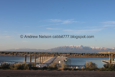
The marina (PSP).
Before long we reached the island (PSP).
Our first stop was the Visitor Center today since it had been a little while since we’ve been in there. The most direct route is to the right.
The marina again (PSP).
Ladyfinger Point (PSP). We’ll come back to this.
Bridger Bay (PSP). One of these days I will walk out there.
The Visitor Center.
Some bison off in the distance.
I love these painted bison statues, and this one in particular. A bunch of these showed up around downtown during the 2002 Olympics, and now exist at various places. There are at least 3 of them on this island. I got the one next to the park sign, but didn't get a picture of the 3rd one today which is also near the causeway.
The causeway below.
Panoramic.
Fun deer statue.
Window view.
The view from the window.
I was surprised to learn the visitor center closes at 4, rather than 5. We managed to squeeze in just in time and made things snappy.
Our next stop brought us to a spot that we have had pretty good luck seeing burrowing owls. Well, today was not a disappointment. Although, he was a little further away than normal.
Soo cute! I love these little guys, even if they are so small they are hard to spot.
Some bison.
We spotted some antelope and pulled off at the RV change station to see them better.
Just doing antelope things.
Long billed curlew.
With the antelope.
Digital crop.
Another one on the ground. They were both together, but I missed that.Doing long billed curlew things.
Antelope again.
Long billed curlew again.
More antelope.
Male.
Long billed curlew again.
Ruffling it’s feathers.
Again.
They are certainly weird looking birds!
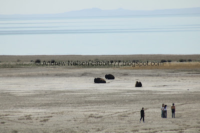
Moving along, we found some bison on the beach (PSP).
Buffalo Point (PSP).
Bridger Bay again (PSP).
We made our way up to Buffalo Point. The drive is a little eep, but not too horrible.
White Rock Bay (PSP).
Bison below.
White Rock Bay again.
Traces of Lake Bonneville.
Which you can see here.
Little closer.
Perhaps I am misremembering, but I swear the Island Buffalo Grill used to be here.
Viewing platform.
Great Salt Lake The Wanderer. This talks about the different levels of the lake.
White Rock Bay again. You can see the Lakeside Trail below.
Panoramic.
The White Rock Bay Campground.
Another panoramic.
Then we did the Buffalo Point Trail for the first time in years, and it was amazing! I made that a separate post you can see here.
Bridger Bay again.
Heading down Buffalo Point Rd. (PSP). It is a little scary, but not awful.
White Rock Bay Campground (PSP).
White Rock Bay (PSP).
From here we decided to drive on down to the south side of the island (PSP).
Onto the East Side Road (PSP). With some bison on the beach.
Down the east side road (PSP).
Mountains (PSP).
Downtown SLC (PSP).
Cropped in a little closer.
Beacon Knob (PSP).
More mountains (PSP).
Frary Peak and Dooley Knob (PSP)
The other side of Beacon Knob (PSP).
Frary Peak and Dooley Knob again (PSP). Plus the neat unnamed formation in front of them.
Closer look at Dooley Knob (PSP).
Closer look at the unnamed formation (PSP).
A bunch of bison (PSP).
Downtown again.
We took a quick detour on this dirt road out to Mulberry Grove Picnic Area because we had never been there before (PSP).
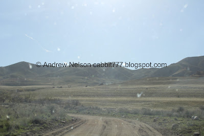
The dirt road is a little rough but not horrible (PSP).
The picnic area.
I guess these would be mulberry trees then.
It’s a pretty little grove.
Pretty yellow bird. I think it might be a bullocks oriole.
Alright, that was neat, but nothing terribly exciting.
Heading back down the dirt road.
Fun peaks.
Before long we reached Fielding Garr Ranch (PSP). As far south as you can go on paved roads. You can go further south, its just on a dirt road that closes in winter. It takes you to the south end of the island and then you can continue on foot on the South Island Trail almost to the southern tip.
Neat old car, According to the license plate it is a 1946 Ford. Landis looked it up and found it is a 1946 Ford Super DELuxe
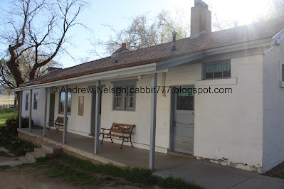
Some of the ranch buildings.
The Sentry.
More old buildings.
More.
The main house.
I assume this is showcasing the original brick. It was under reconstruction last year.
Oh yes, here is an image of it from our 2020 trip.
The spring house. A really old method of refrigeration before refrigerators.
The little grove of trees. I like walking through here, I often see some kind of neat animal. Not today though.
Looking up.
A little pond.
Fun little tree arch.
Bigger pond.
The spring house again.
The main residence again.
Old silo.
Inside.
The sheering barn.
That fun pointy ridge is apparently called Daddy Stump Ridge.
All the dirt we kicked up on that short dirt road.
Well, we decided not to go down to the south end of the island and pick up more dirt today and just headed back north.
More bison (PSP).
We spotted a northern harrier hunting along the fields (PSP).
Mountains (PSP).
Beacon Knob again (PSP).
More bison (PSP). This is probably the first time we have been out here that we didn’t have a closer bison encounter. We of course keep our distance from them, but usually there are a few a little closer to the road.
More bison (PSP).
The Great Salt Lake (PSP). It’s pretty much just the Jordan River fanned out a bit on this side.
One of the openings in the causeway to let the water through (PSP).
Bison on the beach (PSP).
Today was birds on the signs day (PSP). We found quite a few birds perching on various signs throughout the park today.
Buffalo Point again (PSP).
I got a hot tip on a good spot to possibly see owls and well, it did not disappoint.
Such a handsome fella.
Oops, didn’t mean to wake him up.
Oh good, back to sleep.
I can’t remember if there was a breeze of if he was just twitching his ear.
From the side.
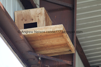
They have put in a couple of bird boxes in here too.
This one is occupied. Hello cutey!
So fun!
Well, eventually I managed to peel myself away and we continued our adventure.
Bison wallows (PSP). Bison like to wallow around in the dirt creating these little shallow depressions.
Well, I will be damned. I did not see them when I took this picture, but I caught 2 cute little burrowing owls!
Bison on the beach (PSP).
More.
Again, I captured a burrowing owl without seeing it haha. These guys are so small, and so far away. It really is just about knowing where to see them. And well, I need to invest in a better lens now that I know where to look for them. I discovered this spot by a random sequence of events a few years ago. I stopped to take pictures of some antelope, Landis noticed a pretty bird and while I was trying to locate that in the telephoto lens I noticed a group of boulders, and well, 2 seemed a little off, turned out they were owls! A friendly fellow owl loving photo nerd tipped me off to the other location. I am sure there are more on the island, but knowing these two has proven to be pretty successful.
I am not sure what I caught here. Maybe a bunny, or a porcupine?
We took a short break at one of the picnic areas where we saw some more bison.
Some more on the beach.
Bridger Bay.
Buffalo Point.
Ladyfinger Point. It looks like Egg Island is an island again.
Panoramic of Bridger Bay. Buffalo Point to the west and Ladyfinger Point to the east.
Some antelope on a ridge.
Again.
Again.
They appear to be bedding down for the night.
We did a quick hike out along Ladyfinger Point. Again, I made it a separate post.
The Visitor Center (PSP).
Again (PSP).
The main sign again and at the end of the causeway (PSP).
We stopped by the Marina to get one last break before we made the long drive home.
The opening to the lake.
Old boats.
The Visitor Center again.
Flag. It looks like there is a US Army Ranger and Air Force Memorial there. We didn't stop, but maybe next time.
Oh, we got another glimpse of the old car again.
And, back onto the causeway (PSP).
The flag again.
The lake (PSP).
Looking back towards the island (PSP).
Where there is an opening in the causeway (PSP).
You can see the fresh water mixing in to the salt water (PSP).
The lake and some shorebirds (PSP).
The causeway again (PSP).
Starting to reach the shallows (PSP).
I tried really hard to catch the columns of bugs that make the causeway look like it is on fire, and this is the best I caught (PSP). They are midges, which are non biting flies.
Back to the fee stations (PSP).
What the car looked like when we got home. Yuck.
Anyway, it was a fun day on the island as usual. We had a great wildlife day, and incredible spring weather. It was the perfect idea to do today. I just wish I had thought to ensure we had bug spray. Antelope Island really is the best little daytrip from Salt Lake City. It feel like you have been transported somewhere else entirely. 10 squirrels!
As for difficulty, most of what we saw was pretty much get out and look, DR1. With a couple trails we explored which would be closer to DR3.
Dogs are allowed, but must remain leashed at all times. Please clean up after your furry friends.
.jpg)


.jpg)




.jpg)

.jpg)








.jpg)




No comments:
Post a Comment