.jpg)
Ladyfinger Point is probably the shortest trail on Antelope Island. It features some great views of the Great Salt Lake, some fun rock formations, and some wildlife. I am not really sure I would consider it a peak, but it is the easiest peak to get to on the island, and well, every where we have been. This is a fun little trail system to explore, and we have done it a few times now. However decided it was worth a revisit on our 2024 Antelope Island trip.

Quick Details:
Length: The sign says it is a quarter miles one way, we ended up doing about a mile loop.
Trail Type: Out and back, unofficial loop option.
Difficulty: DR3. It is pretty easy going, but there can be some boulder scrambling.
Elevation Gain: 8 feet for the main trail, we did about 36 feet.
Restroom: Yes, pit toilets at the TH. Note: the right restrooms lock does not engage. I used it anyway and gave someone an unexpected surprise. Luckily I just had to pee so they only saw my clothed backside but I still felt bad and then warned them that the lock does not engage. She ended up using it, but had her husband stand guard LOL. I would have done the same if Landis had come with.
Dogs? Yes, but must remain leashed at all times.
Other Info: Fee area. $15.00 per car.
To Get Here:
This is at the northeast tip of the island. After crossing the causeway, turn right at the sign, then it will be on the right.
The Trail:

Trailhead sign. We ended up seeing all the wildlife mentioned here except for the rodents.
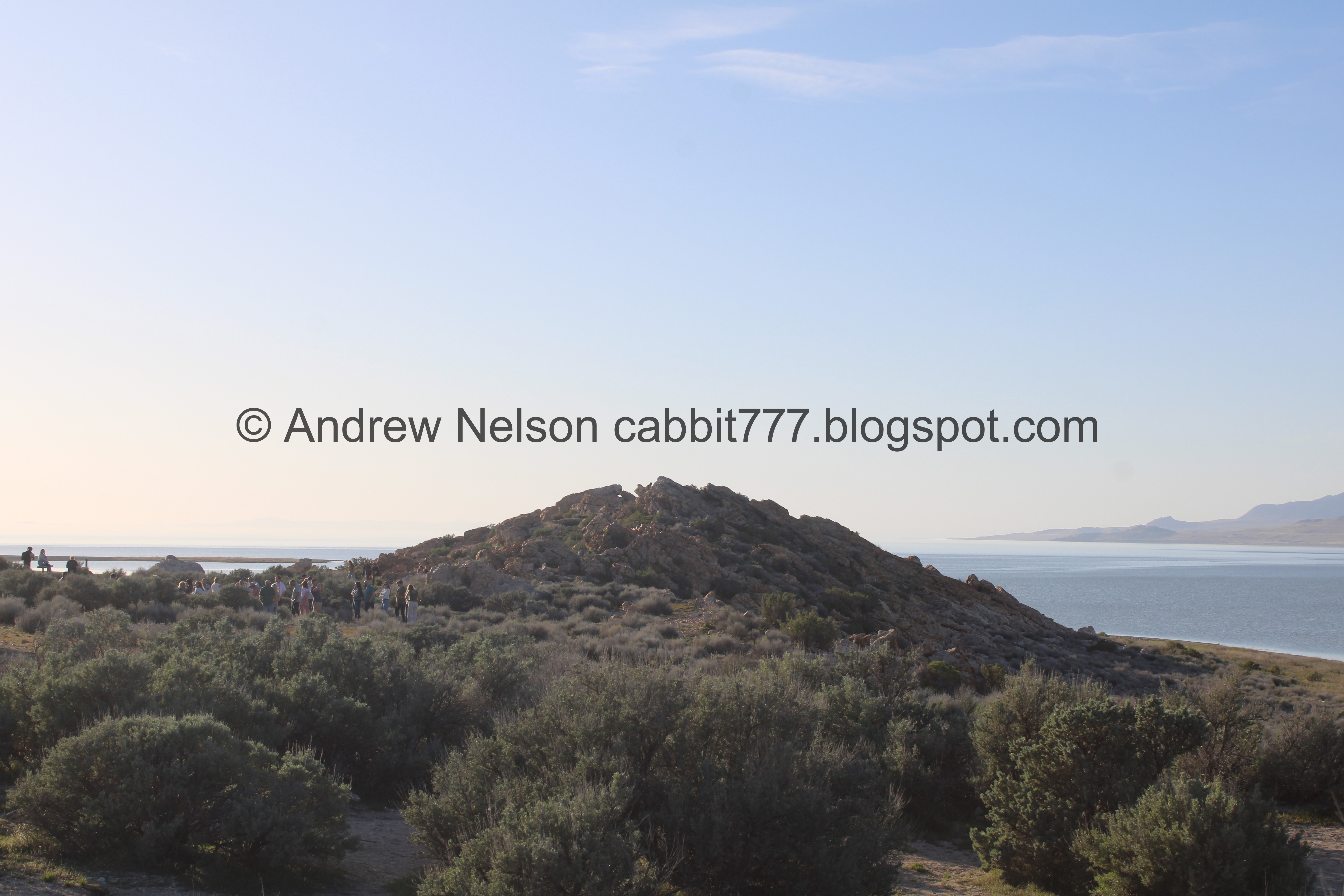
The tiny peak.

Ecology of The Great Salt Lake.

The peak again. It was quite busy here today!

Super easy trail.

Bridger Bay and Buffalo Point.

Some more parsley.

Lots of it around here.

Approaching the rocky part.

Random little staircase.

Heading up to the little peak.

The Great Salt Lake.


The final scramble to the peak.

The Great Salt Lake again.

We found a cute lizard friend.

There is a messy web of trails, so I think I made it to the intended destination, but I am not 100% sure. Last time we did this, we found a marker. But, I think we were pretty close.
Anyway, I was hoping to explore the point and beach a little more so we found a trail that brought us back around.

Fun rock formation.

Old bench.

Well hello there bunny friend!

He actually sat still for a minute. Usually they immediately take off.

Ope, there he goes.

I do love these guys. So cute.


The rocks here are so bizarre.

Looking towards the point and Egg Island.

Back towards the peak.

The trail winding its way around boulders.

The point and Egg Island again.


More fun boulders.

The trail took us here, and we had to pick our way across the boulders to get down to the beach.

Giant spiral. I first noticed this last year. The water has come up quite a bit since then.

Still scrambling.

Back to solid ground.

Another bunny friend.

Super cute.

The big spiral again. Someone had way too much free time.

It looks like the lake has come up high enough to start damaging it.

To the north.
.jpg)
Panoramic.

An American coot.

We decided to head up towards the point. I know we can’t get to Egg Island (physically, or legally) but the point should be alright.

The lake again.

The point and Egg Island.

Lake and mountains.

Egg Island again.

Looking back towards the peak.

Buffalo Point again.

Continuing along.

The point and Egg Island. We decided this was far enough because it looks a little sketchy for the last 20 feet or so. So we decided to head back.

Buffalo Point again.
.jpg)
Panoramic of the point.

The point again.

The peak again.

Random red spot.

The lake again.

The big spiral again.

Where we came down. Landis didn’t want to boulder scramble again, so we decided to see if there was another way up.

The spiral again. It’s no Spiral Jetty, but it is kind of neat.

The peak again.

The lake again.
.jpg)
Another panoramic.

More fun rocks.

The Visitor Center off in the distance.

Well, we had to pick our way around the boulders, but it was less of a scramble. We realized after the fact that if we had keep going south ish there would have been a better trail up but meh. This wasn’t too bad.

Another bunny friend getting it’s nom on.

Better look.

More rocks.

More parsley.

Bridger Bay and Buffalo Point again.

Back on the main trail.

Looking back towards the peak.

Fun rocks.
Well that was fun! I am glad we decided to do it again, and got to explore a bit more of the beach then we have done before. For some reason this trail seems to be super busy at the beginning, but when you hit the rocks it thins out significantly. After we hit the peak and started towards the beach we didn’t see anybody until we were near the trailhead again. 9 out of 10 squirrels today.
As for difficulty, to the peak is a pretty easy scramble, and to the beach is a bit more of a scramble but both are pretty okay if you take your time. DR3.
Dogs are allowed, but should remain leashed at all times.

No comments:
Post a Comment