.jpg)
Donut Falls AKA Doughnut Falls is a great little trail at Mill D in Big Cottonwood Canyon. We have done it quite a few times in the warmer months, and even tried once in early spring but the snow was way too deep that year. This yea our winter has been really mild. There is no snow down in the valley so, after seeing avalanche danger was low today I thought we would go a little higher up than we normally do this time of year. In the wintertime the road below the trailhead is closed to non residents so you will need to park at Mill D South and add the road to the short hike.

Quick Details:
Length: The map at the trailhead said .5 miles but I think it is actually closer to .75. Add the .75 section of road and it is a solid 3 mile round trip in winter.
Difficulty: DR3
Elevation Gain: With the road about 645 ft.
Restroom: There is a pit toilette at the trailhead, but it is closed during winter. The flush toilettes at the Mill D parking lot are open (and heated even!)
Dogs? No. Big Cottonwood Canyon is watershed.
Other info: Be aware of avalanche conditions before heading into the mountains in winter. The Utah Avalanche Center is a great resource to help you be informed.
I also recommend having at least micro-spikes and a hiking pole.
To Get Here:
Drive approximately 9 miles up Big Cottonwood Canyon to Mill D South, which will be on the right side of the road. Hike up Mill D South Road. It is open to the public, however it goes through private property so stay on the road. If it is not winter and the gate is open you can try your luck at the trailhead. But it is a popular trail and parking is limited.

The Mill D South Parking lot. The road is on the east end towards the restrooms.
The Trail:

The pretty meadow below Reed And Benson Ridge.

Big Cottonwood Creek.
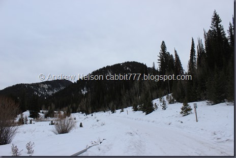
The road is plowed but not all the way down to the cement. We noticed that and put the micro spikes on before starting and it made trekking up this not an issue at all.

Reed And Benson Ridge to the left, Kessler Peak to the right.

Private land notice.

Super pretty up here today.
I mentioned we were having a light winter right?

Just for comparison, here is what the road looked in in April of 2008. APRIL!

Kessler Peak.

I think this is where we gave up last time we hiked through the snow up here.
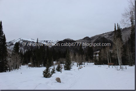
I would LOVE to have a cabin up here. Life goals.


Pretty forest.

3 quarters of a mile later we made it to the actual trailhead! From here you have the option to take the trail to the left, or the road to the right. We’ve actually never taken the road but the trail is nice so we decided to do that again.

Kessler Peak again.

It’s hard to see, but the trail is fairly well packed down.

This first section of the trail is the steepest part. If you can make it up this you’ll be just fine.

Nice snowy trees.

Kessler Peak is really pretty in the winter.


I love the woods in winter.

With Kessler Peak.

The bridge over Mill D South.

This layer of ice on top of the water.

Looking upstream.

The trail joins the road again for a little while.

Trail split. Follow the signage and go to the left.

Loving the winter scenery.

Approaching the narrow canyon that holds the falls.

Reed And Benson Ridge.

And the worst part. A very icy rock. I tried going down slowly and well, ended up basically sliding down on my butt, not ideal but I made it, and it didn’t hurt.
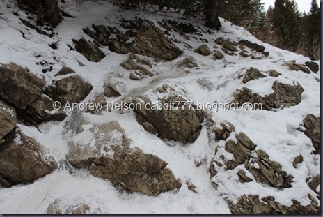
Looking back at it. Of course on the way back we found a way around it.
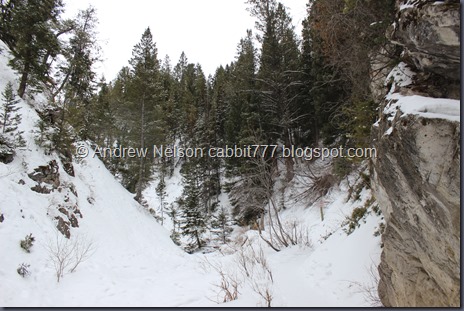
The narrow canyon.

Here you can see the falls above and a bridge over the stream. It’s been a few years since we have been here but at least time from the last time we were here there is no actual bridge. I’m not sure if one was added, or if it was an ice bridge, but it held us so that's all that mattered.

The frozen waterfalls.
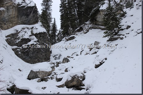
You can just make out the little hole that makes the waterfall a doughnut.

The tree’s above.

The whole thing.


Some ice formations.
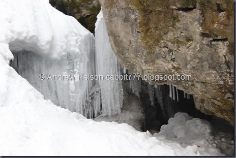
A little closer.
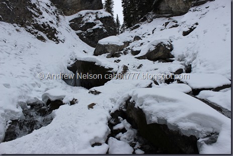
The waterfall.
I really, REALLY wanted to get up to the cave and see what the ice looked like inside but it was just too slick and the micro spikes weren’t helping with that at all. Maybe if I had some serious spikes I might try it but I decided to be safe today and not risk getting hurt just to see something neat.

Cool little ice patch.
I loved the way the water looked coming down here so I took a quick video.

Another shot of the waterfall.
We actually got Donut Falls to ourselves for the first time ever and for quite some time even! One of the other benefits to hiking in winter. But we were losing daylight so we decided to head on back.

Looking down canyon.

Snowy log.

Back down to the bridge? Ice patch? we crossed.

A last parting look.

Back to the icy boulder. It did not look fun trying to get back up this. However we noticed a path through the snow continued down so we followed it.

The creek.

Very quickly we came to a make shift bridge across the creek heading back to the main trail. Nice short detour that got us back a lot more safely.

Reed And Benson Ridge.

I love the way willow shrubs look in winter. You can see quite a bit more of this around the not far from here Willow Lake.

Back on the main trail with a nice line of aspens.

The thin line of snow on this fallen tree makes it look fake.

A winter wonderland.

Back down to the lower bridge.

With the micro-spikes these random ice patches didn’t slow us down at all. Even the quicker downhill pace I just kept on a trekkin and barely noticed them. So glad we have added them to our winter gear.

Pretty sure those are bunny tracks.

Frosty trees.

Kessler Peak again.

Back down to the trailhead.

And the road. Just 3/4 of a mile to go.

Looking across Big Cottonwood Canyon towards Mill D North. We did that recently to Dog Lake. I still want to take it to Desolation Lake one day.

Caught the end of a snow devil. A dust devil but with snow.


Pretty peaks above.


Heading down the road.

Another pretty peak.

Almost back to the bottom. Notice the other side doesn’t have much snow.

Big Cottonwood Creek.

Looking up Big Cottonwood Canyon.

The parking lot has cleared out quite a bit.

And a quick view heading down canyon (DBP).
I am a little bummed I didn’t make it to the cave, but am happy that I made the safe choice. We still had a great time and enjoyed our winter adventure. Considering we haven’t really seen much snow this winter, it was really nice to play in it for a while. Normally this trail is very busy but we only ran into a few people, and even got quite a bit of time alone with the waterfall so that was really nice. With the gear we had it was also still pretty easy. Going with a 9 out of 10.

As for difficulty, very mellow elevation gain. With a mild winter and the right gear I found it to be fairly easy. DR3.
Dogs are not allowed as Big Cottonwood Canyon is watershed. Please leave your little buddy at home for this one.