.jpg)
We have now explored the entire canyon, but there are multiple trails. So far we have done the east section via The Sego Lily Trail (AKA Sleepy Hollow) and the Dry Creek Trail. The middle section via the Dry Creek Trail and the Mountain View Trail, and the west section via the Dimple Dell Trail and Dimple Dell Loop Trail. Today I decided to check out the North Rim Trail. The official city map lists this as the Dimple Dell Trail, but the multiple trail markers all say this is the North Rim Trail so that is what I am going with.

Quick Details:
Length: 2.8 mile point to point, 5.6 out and back or longer with other trails.
Trail Type: Point to point (with shuttle), out and back, or you have loop options.
Difficulty: DR3. Super super easy. miner ups and downs.
Elevation Gain: About 500 ft.
Restroom: The Wrangler TH has some, but they are locked in winter. The Mount Jordan TH does not, but nearby Granite Park does. Not sure about the winter situation there though.
Dogs? Yes but they must be leashed. Please clean up after your furry friend, and respect leash laws.
To Get Here:
We used the Wrangler TH today. Take 106th South to 13th east turn left, Go north for about 1200 feet then turn right*. Go another 300 feet and you will see the Wrangler TH on the right.
*if you pass Smiths on 13th east, you went to far, but go ahead and turn into their parking lot and head south it’ll get there too.
To get to the Mount Jordan TH: make your way to Little Cottonwood Road and Wasatch BLVD. Head west down Little Cottonwood Rd. Turn left on 3100 East. Follow that through the stop sign. 3100 E will eventually curve to the right., immediately afterwards you will see Dimple Dell Rd to the left, and then the parking lot will be just beyond that.
Note: If doing out and back this TH will be starting at the top and returning mostly uphill.
The Trail:

There are 2 trails leading from the Wrangler Trailhead. You want the far east one. The west one next to the kiosk will take you down towards the Dry Creek Trail.
Also note the large mound of wood chips. It appears they are in the process of relining the trail.

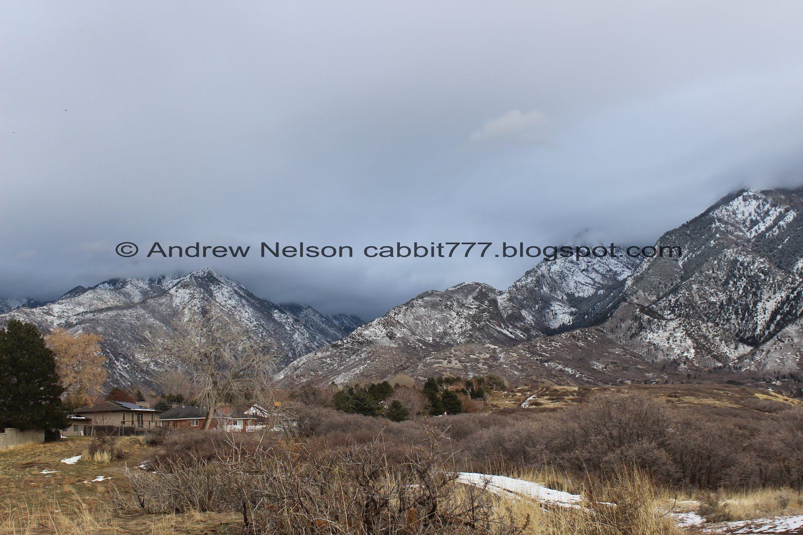
Almost immediately rewarded with a great view of the mountains.

One of the many trail markers referring to this as the North Rim Trail.

Another lovely view of the mountains. This post is going to have a lot of those.

That line of snow in that canyon caught my eye. I am not 100% sure, but I am pretty sure that is Big Willow Canyon. You can’t get very far up it, but there is a dirt road there and I think that might be what this is. Little Willow Canyon to the right.

The wood chip lined trail.

Don’t forget to turn around and take in the view behind you. You can see the Kennecott Mine from here.

The mountains to the south.

About a half mile in you will come to the Flanders Loop Trail. I thought we might do this on the way back, but didn’t realize at the time how long this trail was! So, we will hang onto that for a time we want something short and easy, or maybe as an add on trail some day.

The mountains again.

Panoramic.

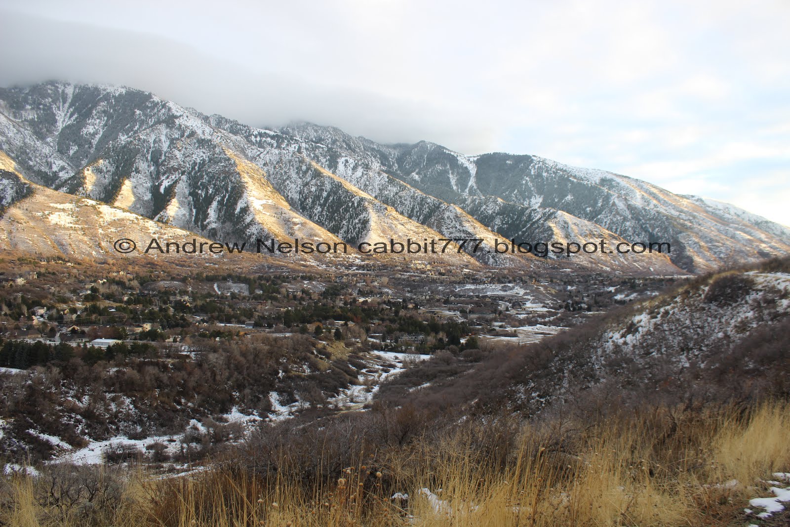
Little Cottonwood Canyon.

Looking down into the canyon.

Connection onto the Mountain View Trail.

The trail again. As you can see you are hiking behind some houses for a while here. It’s not too bad in the winter time.

Some sun rays.

Looking down into the canyon again.

Bell Canyon.

Another panoramic. Lets see. Little Cottonwood Canyon, Bell Canyon, Dry Gulch, Rocky Mouth Canyon, Big Willow Canyon, Little Willow Canyon, and Bear Canyon. All of the little canyons on Mount Jordan.

I think this is where the ‘Highland Drive scar’ is. Apparently the original plan was to continue Highland Drive through here, and it got as far as being bulldozed, but somehow, miraculously, it was stopped. I wonder if there are any news stories about that.... Oh, oh dear. Looks like it is still a possibility. I really hope that doesn’t happen.

Across the canyon again.

Little spot of sunshine on the mountain.

Mount Jordan again.
With the trail.

Another panoramic.

I love all of the neighborhood connections along the trail.

Some of the ups and downs along the trail.
Little Cottonwood Canyon.

Big Cottonwood Canyon.

Looking down into the canyon again.

A beautiful scrub-jay.

I think this might be the trail we previously used to connect to different trails as a turn around point.

Little bit of a climb here. Not too bad.

Another spot of sunshine on the mountain.

Little Cottonwood Canyon and Bell Canyon.

More of Mount Jordan.

Another neighborhood connector with more wood chips ready to go down on the trail.

Lone Peak obscured by the low clouds.

A couple of horses on the trail. This park is popular with equestrians.

The Fox Point Loop Trail. Maybe another shorter option we’ll check out some other time. Stay left to remain on the North Rim Trail.

This was the only main trail split that was not signed. This is either the random connector trail, or the other end of the Fox Point Loop. Anyway, it seemed pretty intuitive to veer left here so that is what we did, and it was the correct choice to remain on the North Rim Trail.

Now the trail head generally north, as does the canyon. And we have a bit more snow to tread through.

Bell Canyon and Dry Gulches.

Fox Hollow Trail. This one isn’t on the map, but from what I can see on Google maps it is just another short loop off the main trail.

Big and Little Cottonwood Canyons.


I was starting to feel like we had gone far enough, as we still had to come back. But then I noticed the Sleepy Hollow Trail below, so I knew we were getting close to the end, so we pushed on. Might regret that in a day or two haha.
Looking back down the canyon.

Another panoramic. This one including Little Cottonwood Canyon.

Nice lighting on Little Cottonwood.

I found where they have left off on the new wood chips. Honestly was not expecting such a clean line.

More fun lighting.

I grew up not far from here and I always referred to those twin peaks in front of Bell Canyon as the butt. Yes I was 12. Yes, my mind still is.

Granite Park across the field. I spent a lot of time in that park years and years ago.

We reached the Sleepy Hollow split off. This is where we went down into the canyon the first time we explored the area together.

Neat tree.

Another giant pile of wood chips.

We made it to the Mount Jordan Trailhead. 2.8 miles out to here, and just another 2.8 back.

Little Cottonwood Canyon.

Well, there isn’t really anything to do here but head on back, so that is what we did. Although, if you still have a little extra energy, there is a really short path out to Sunrise Point, just a couple steps to the left here. It also connects back a little further down by the Sleepy Hollow trail.
You can also head back to the trailhead using any number of trails down in the canyon. Just keep heading south/east until you reach the TH or, hit a tunnel. Then climb up the hill to the TH. It was starting to get dark so we opted to go the shortest route back, the way we came.

Last light on the ridge.

Bell Canyon and The Butt! You know, I should climb those one day. And maybe grow up and start calling them something else, like maybe the Bell Canyon Twins or something.
OMG. I just realized that the Bell Canyon Boulders Trailhead goes up right between them. How have I not noticed this before? I guess they look less like a butt when you are closer.

Fun clouds.

Looking down into the canyon.

Little spot of light in Little Cottonwood.

Little and Big Cottonwood canyons.

Another panoramic including Big Cottonwood Canyon.

Big Cottonwood.

Little Cottonwood.

Heading back down the snowy trail.

Another patch of light on the mountain. Loving the lighting we are getting this evening.

Lenticular clouds forming over the peaks.

I have seen this phenomenon before and am thrilled to capture it myself! The peaks shadow on the clouds.

With a great sunset as well.

Looking into the canyon again.

Neat. You can see where i15 crosses into Utah County via Point Of The Mountain.

Panoramic of the Salt Lake Valley below.

The fun mountain shadow again.

The clouds again.

Looking back at the mountains.

Another panoramic.

Temple 1.

Temple 2 and 3. Seriously, so many temples.

The valley lights below.

Here is the Highland Dr. Scar.

From the other direction. Glad we got to do this trail before this becomes a road.

The mountains again.

Valley lights again. I really try to not push us into hiking in the dark, this time of the year it sometimes tends to happen. As far as ending up hiking in the dark, this is certainly not the worst trail for it to happen on.

Back to the trailhead. yep, last folks on the trail today haha.
I am glad to finally experience the canyon from 13th east to the top in one trip. It was a little longer than I was anticipating, but I think this is the absolute shortest route to do it. The North Rim Trail does not stay near the rim for the entire way, but enough that you can still enjoy the canyon below. However, I enjoyed the views of the mountains with a fresh coat of snow, and the view of the valley below. It is also not a very crowded trail this time of year either. We only ran into a couple of other groups. It's also nice to say we have now done the entire Dimple Dell Trail as the city refers to it as. Going with 9 out of 10 squirrels, losing one for the confusing web of trails, multi-named trails, and for the lack of mile information on the signs.
As for difficulty, it’s super comfortable wide trail with wood chips for the entire way. There are some mild ups and downs though so DR3.
Dogs are allowed, but must be leashed. Please clean up after your furry friends.

No comments:
Post a Comment