.jpg)
I thought I would like this section of the Jordan River Parkway, but it was a bit meh for me. There were some wild open parts, but there a lot of development happening though there, and the trail doesn’t really follow the river.

Quick Details:
Length: Normally, 3.2 miles out and back. With the detour it ended up being 4.2
Trail Type: Out and back or connecter.
Difficulty: DR2
Elevation Gain: 230 feet
Restroom: At both ends.
Dogs? Yes, leashed. Please clean up after your furry friends.
Other Info: Jordan River Trail Mile Markers 10 (and assumed 11). Cities: Bluffdale
To Get Here:
Take i15 to 14600 S, head west to Redwood. Road.Take Redwood Rd. south for about a mile to Iron Horse Blvd, head east for about 8/10 of a mile, Parry Farms Park will be on the right.
The Trail:

Where I left off from last weekend. The Utah and Salt Lake Canal Trail converges with the Jordan River trail here. I can’t tell for sure, but you MIGHT be able to make it a loop with that.

Mountains to the north.

Steep Mountain.

What the… dang it. Well, at least there is a detour.

Oh, I guess they are building a bridge, and the trail is expected to be closed until next spring.

Little bridge over the Utah And Salt Lake Canal.

Looking south. There is a gate across the road, but the signage just said it is monitored via CCTV, and no swimming, floating etc. So, I THINK you can still walk down it.
I thought for a moment that this would be the detour route, but there was not a detour sign, and I remembered it said the detour route was paved, so I kept going.

Looking north.

Little bit of a climb here.

Lots of sage and rabbit brush.

Looking towards the Jordan Narrows.

First view of Mount Timpanogos looming over the Point of the Mountain.

Lone Peak, Steep Mountain and Mount Timpanogos. Steep mountain looks weird from this angle.

Once I hit, what I later learned is Porter Rockwell Blvd. I wasn’t sure where to go. Eventually I spotted the orange detour sign ahead.

Closer. I imagine once they complete the road they will probably put in a good cross walk.

Cows.

Looks like the paved detour is the Utah Lake Distribution Canal Trail. I also think they paved this segment just for the detour. But, I can't prove that haha.

The canal is quite dry at the moment.

I think this is Wood Hollow.

Donkeys. If the smell bothers you, pull your mask back up. It helps haha.

Twin Peaks, Lone Peak, Steep Mountain and Mount Timpanogos.

Mountains to the north.

Mountains to the north.

Panoramic.

Oh! I found the bridge they are building. And the cartoon like roads that just end abruptly before the chasm. I am pretty sure they have road signs closing it before that point but, yeah.

The Jordan River Below, again being split up. I wonder how many people still depend on all these canals, and if we can close any of them and maybe return the river to it’s natural state.

New houses coming in.

I kept looking to see if I could see Alien Tower from here, but so far, no luck. It’s up there somewhere though.

Ah. The next detour sign. It fell over, but hey, I can see it.
You can stay on the Utah Lake Distribution Canal Trail, and have a lot less up and downs, or you can make a loop with it if you want.

I wasn’t 100% sure of it at the moment, but I am back on the Jordan River Trail. With a view into the Jordan Narrows.

Starting to get a glimpse of Box Elder Peak peeking up behind Steep Mountain.

Little locomotive coming along the tracks. There is a lot stuffed into this narrow section of the valley. The river, several canals, the train tracks, some industrial stuff, and i15. Oh, and somewhere along the way is the soon to be moved prison.

Mount Timpanogos.
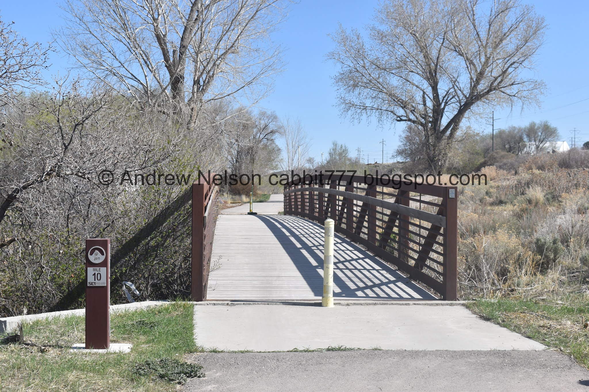
Mile Marker 10 and a bridge. I am guessing mile marker 11 was somewhere along the part we were diverted from.

Neat rock stack.

Point of the Mountain.

Looks like an old dried up spring.

Horses!

Spring.

Which appears to be what feeds this pond.

Cute pond.

The trail. You can see the Utah Lake Distribution Canal to the right here. You can also see a dirt road at the bottom right. Apparently the farm(s) around here are able to use the trail to access their farms. So, I guess, don’t be surprised if you stumble upon a random car or tractor.

Mount Timpanogos. And some weird chute thing built into the side of the mountain. I know Geneva has some mining operations over there, so probably related to that.

Said mine.

Minor road crossing. This is also where the Canal Trail connects again.

Starting to get a good full view of Mount Timpanogos.

I think this is the point to point marker on the trail that without the detour would make it 1.6 miles. We added .26 miles going to the actual trailhead and back.

One final little climb.

Windmills and power lines.

Made it to the next trailhead. woo. Okay, time to head on back.

Huh. I can’t recall noticing the simple map on the side of these signs. Neat.

Mountains to the south.

Point of the Mountain looks super, super weird from this vantage.

While we’re at it, the Salt Lake Valley looks weird from here too.

I am not 100% sure, but I believe that fait little bump on the horizon, is Antelope Island. Again, super weird to see it from the vantage.

The Salt Lake Valley again. You can also see the Canal Trail just above the Jordan River Parkway Trail.
There are not a lot of places around here where you get an actual horizon. It kind of freaks me out. I am very much accustomed to having mountains in the way, thank you very much.

Back to the little pond.

Back to the horses.

The bridge over the side gulch.

Mile Marker 10 again.

Twin Peaks and Lone Peak.

Panoramic view.

Back to the detour. oi.

New asphalt.

Why hello there! Red-tailed hawk.


Such a beautiful bird.
Red-tailed hawks: note the red tail, obvious, but not always present, but the wedge shape, and the wide wings, are. You can also look for the belly band, but again that is not always present. The black marks on the wings near the head, that is consistent.

Good lighting today.

The Jordan River below, again being split. I can think of at least 3 locations that the river is split off into various canals.

The future bridge for Porter Rockwell Blvd.

A little closer.

Closer still.

Okay. Bluffdale can anticipate growth and build major arteries. Why the heck cant Saratoga Springs? I don’t know if you have been out that way but they are developing like nobodies' business, and yet, they are not building major artery roads and are just relying on Redwood rd. It is an absolute mess out there. So, why can Bluffdale do it, and Saratoga Springs can’t?
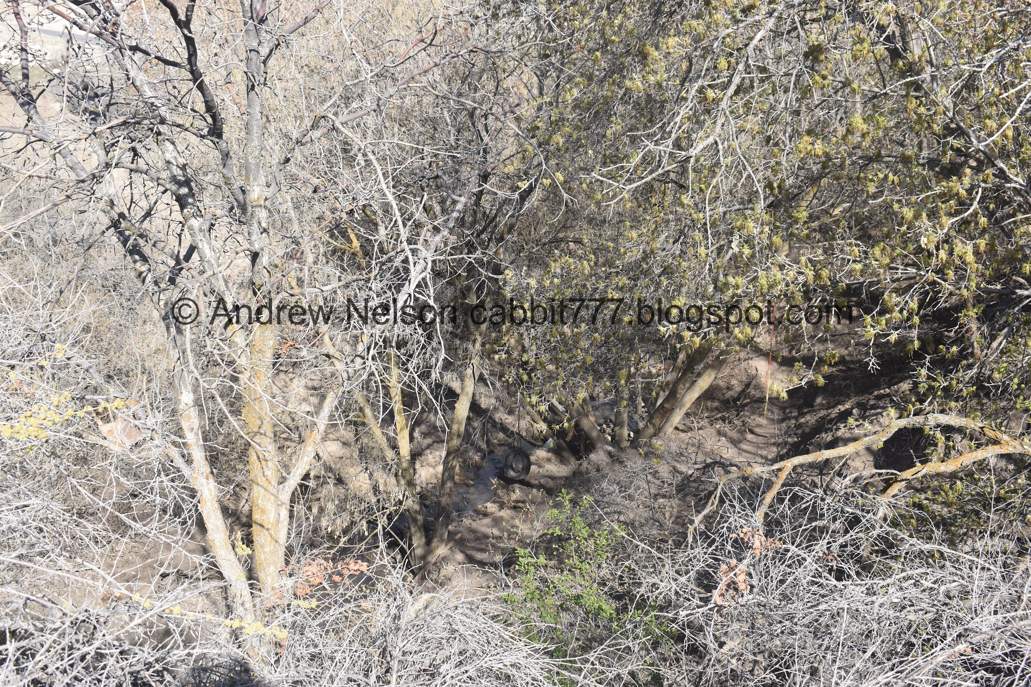
Oh fun. I found another tire swing in Wood Hollow.

And a tree house.

Cows.

Getting ready to cross Porter Rockwell Blvd.

The Utah Lake Distribution Canal Trail does continue. But I didn’t know where it lets out so I took the detour back to the Jordan River Trail.
Note: It lets out in the neighborhood above Parry Farms Park. You have a couple options to get back to the park via neighborhood sidewalks if you want to go back that way. The simplest being using Iron Horse Blvd. A shorter but more convoluted route would be to use Riverview Dr, to Packsaddle Dr. to Iron Horse Blvd.

The narrow valley.

The little JRP connection trail.

I mindlessly wondered that these hill couldn’t be natural could they?

Then I got back down to the Utah and Salt Lake Canal haha nope, not natural. It's the dirt they dug up out of the canal.

Back down the Jordan River Trail.

The little valley below.

Back down to Parry Farms Park.

Where I was treated to a pair of red-tailed hawks.

Cool!

Forward will continue along the Utah and Salt Lake Canal Trail. The Jordan River Trail will be to the left about 150 feet.
I think I would have enjoyed this trail a lot more had it not been for the detour. However with the detour it was really kind of just meh. Lots of development happening, construction. And some industrial stuff. I did enjoy the red-tailed hawk sightings though. Going with 5 out of 10 squirrels.

As for difficulty, it’s paved, and while a bit on the hilly side, its fairly easy DR2.5
Dogs are allowed, however must be leashed. Please clean up after your furry friends.

No comments:
Post a Comment