Monday, January 20, 2025

Porter Rockwell Trail: Sandy Dog Park to 110th South

 The Porter Rockwell Trail is an ~11 mile trail between Pioneer Avenue in Sandy and Minute Man Drive in Draper. It is a paved alternate commuter trail that, among other trails, the county has been pushing. They are meant to be non-automobile commuter trails, and some also offer safer alternate routes for school children to get to and from school that are not next to major roads (see the White City Trail). Some of these trails are pretty cool, some of them are duds. Some, Like The Jordan River Parkway are a mix of both haha. Anyway, for our bonus day off we got a super, super late start for the day, like later than yesterday. So I figured it would be a safe option to do with being more than likely to get caught after dark on. I am going to throw out that, aside form the beginning section, I did not particularly care for this section. I liked the previous random section we did a bit to the south a little better.

Note: Introducing my new label: City Path.

Quick Details:

Length: We did about 3 miles out and back. Of course you have longer or shorter options.
Trail Type: Out and back, connector.
Difficulty: DR2. It is paved, and almost flat.
Elevation Gain: About 36 feet.
Restroom: No.
Dogs? Yes, leashed. Please clean up after your furry friend.
Other Info: This section can be reached via Trax using the Sandy Civic Center Station. I would imagine a lot of this trail can be accessed via Trax as it follows the line for the most part.

To Get Here:

Take 90th south or 106th south to State Street. Turn east on Sego Lily Dr. Head east to 300 East. Go right and follow it to the end of the road. which will be next to Sandy Dog Park. There is a trail to the north that will connect to the Porter Rockwell Trail.

Alternately, you can park at the Sandy Civic Center Trax Station, or take Trax to it.


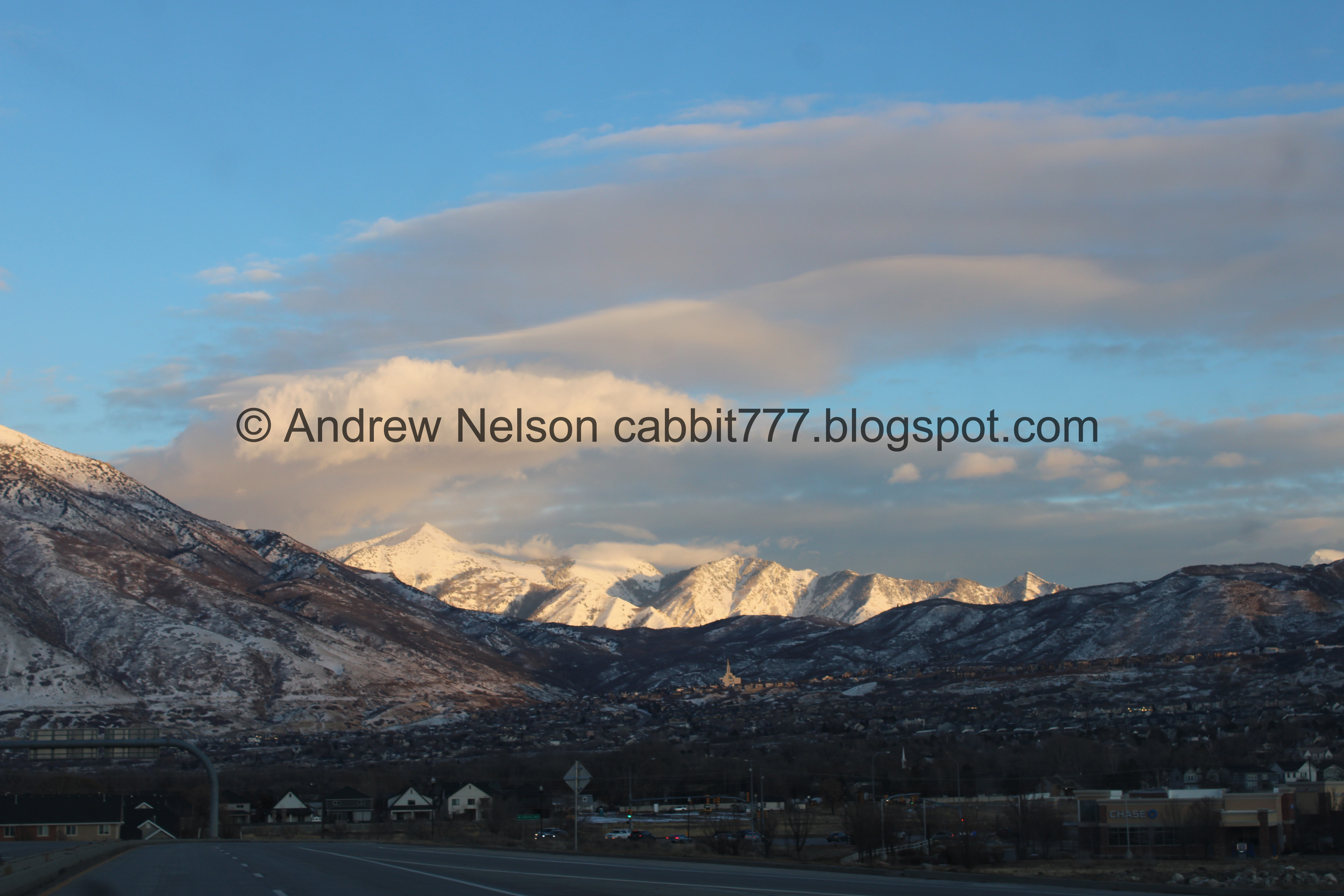
The air is looking a little chewy today (Passenger Seat Photography (PSP)).

The Trail:


The trail is to the north of the Sandy City Dog Park.


Approaching the Sandy Civic Center Trax Station which is about 630 feet west from the parking lot. You can go either way here, we went left or south. It looks like the trail currently goes about 2 miles to the north to Pioneer Avenue, and about 9 miles to the south to Minuteman Drive from here. 


Heading south.


The west section of Sandy City Dog Park. I… I don’t understand why it is split into two sections. My theory was this west section has a water feature so its closed in winters.

Okay, from what I have found through various news articles, is the west side has grass while the east side is gravel. They rotate back and forth to allow the grass to recover.


Heading south across a little bluff of sorts.


Little Cottonwood Canyon. It looks a little weird from this vantage.


Panoramic of the mountains. Mount Olympus, Twin Peaks, Mount Jordan. 


Steep Mountain to the south.


I think this is where Dry Creek comes out. I don’t know why they covered it up from the Bottom of Dimple Dell to here. Aside from our ancestors obsession with burying creeks. I am also curious as to why they covered it up, and then didn't develop it. I wonder if maybe the sandy soil wasn't stable enough here? Total shot in the dark though.


There are a couple random neighborhood connectors. Stay on the path with the painted line.


Another panoramic showing the mountains, and the undeveloped bluff.


There is another neighborhood connector that goes down beneath the trail, and the train line, connecting to Beetdigger Blvd.


Well, this is pretty much the view for the next half mile or so. Sound wall to the right, fencing to the left.


Another neighborhood connector. This one connects to Sandy Willow Cove.


This looks like a trail counter.


Continuing along.


Venus is particular bright this evening.


At just under a mile we reached 106th south. There is a signal to make it a safer crossing, but our timing today, the Trax train set it off before we got there so we had to double time it through. But it made me feel a little less bad since it wasn’t triggered just for us. No such luck on the way back though.


No sound walls though this section, which appears to be more farms. I guess the animals aren’t bothered by train noise? Or nobody cares if it does.


Continuing along.


Mount Jordan.


Neither of us quite understand what the various color lights for the train operators mean. Might have to look that up.

Green means that at least TWO blocks beyond this signal are clear. Yellow means that only ONE block beyond this signal is clear and this route is impassable at the next signal. Red means that this route is impassable. Okay, it's pretty much the same with traffic lights for us. It threw us off that it went from yellow to green, but it works slightly differently on train lines But generally the same. Green = go, yellow = exercise caution/prepare to stop, red = stop.


Mount Jordan again.


This bee farm has these warning signs. I wondered out loud if that was to try to keep people out, or for liability purposes. Landis mentioned probably both.


Another neighborhood connector.


Continuing along.


Just short of another half mile we reached 110th South. There is no light or any other protection for this crossing. You just need to watch and hope traffic sees you and stops. Luckily it is not nearly as busy as 106th.


Shortly after the crossing we reached 1.5 miles. I considered pushing on to 2 miles, but it was getting dark, and we were getting cold so we turned around here. 

I was hoping we might reach Draper City Park where we left off last time, but hahaha that’s a little bit further. Looks like about 4 miles or so further (I didn't thoroughly vet the trail today). If I do decide to complete this trail, that will probably be 2 more sections to the park.


Back to 110th South.


We noticed these mcmansions did not get a sound wall. We figured this development was probably built after Trax started here, and UTA went you knew this was here, build your own sound wall.


Back to 106th South.


Back to the sound wall section.


Back to the little bluff.


Back to the Trax station.


And the last little section heading back east to the parking lot.

Well, this was not at all my favorite paved commuter path. It was pretty boring with the sound wall blocking most of the view. I did like the short part at the beginning with the little bluff, but otherwise it was pretty meh. I do like to complete these trails, because sometimes I find unexpected little gems and I like to have a good easy paved option in the winter, but this was just so meh. Eh we shall see. 3 squirrels. Only getting a slight bump up for the bluff section.

As for difficulty, it is paved with a very mild elevation change. DR2.

Dogs are allowed, leashed. Please clean up after your furry friends.

Sunday, January 19, 2025

Sweet Caroline Loop

The Sweet Caroline (BUH BUH BUH!) Trail in Corner Canyon, Draper (sorry couldn't resist myself, and yes the song was stuck in my head most of the way) is a great short trail. This trail features some nice scrub oak, mountain views, and valley views. This shorter trail is a great option if you don’t have a lot of time, or maybe an after work adventure. It can also be combined with the Lower Corner Canyon Trail to make a nice little loop. We were off to a super, super late start today so I thought this would be the perfect trail. You can access this trail from the Andy Ballard Arena Trailhead, or the Carolina Hills Trailhead (which would be slightly shorter), We chose the former today.

Quick Details:

Length: We did a 1.68 mile loop. There are shorter, or longer options though.
Trail Type: Loop. Out and back option, longer options.
Difficulty: DR3. It is a very gentle and easy climb.
Elevation Gain: About 250 feet.
Restroom: Yes at the Andy Ballard Arena. I am not sure if it is open in winter though.
Dogs? Yes leashed. As long as you stay below the Bonneville Shoreline Trail (BST). Which this trail does, but just in case you decide to explore further.
Other Info:

To Get Here:

To get to the Andy Ballard Arena Trail head:

Take i15 to the Bangerter Hwy exit and head east. Go about a half mile and turn left onto 13800 S. Take that 1.7 miles it will curve to the north. Turn right on 1300 E. Immediately turn left on Highland Dr. Go about .4 miles and turn into the parking lot. You want to park near the northern end.

Look for the tunnel under Highland Drive. The trails on either side will get you down to it.


The mountains are looking like a snowy wonderland (Passenger Seat Photography (PSP)).


Little Cottonwood Canyon (PSP).


Corner Canyon in shadow, with Box Elder Peak lit up (PSP).

The Trail:


Trailhead sign.


Fun clouds.


We generally go down to the north side of the tunnel using the Bunny Bradley Trail. But you can also go down on the south side, which now that I am looking at the map looks like it might be shorter, but it really depends on where you park I guess.


Not very for down there is a signed split directing you to the tunnel.


You know you are getting a late start to your hike if you see a sunset at the beginning. Oops.


The tunnel under Highland Drive. Technically you can try to scramble across Highland Drive, but they built this tunnel for your safety so might as well use it. Not to mention since it was built, there is no trace of a crosswalk anymore either.


Inside.


Someone made perfect little circles in the snow.


Corner Canyon Creek is quite frozen, but we can still hear it bubbling a bit.


The random corral you have to wiggle through. I think this was intended to slow down fast downhill cyclists before the tunnel.


Trail counter. This just counts how many people pass by so they can determine what kind of usage a trail gets. This helps determine where to focus trail improvements. The absolute best example I can think of is the recent and absolutely incredible improvements they made to the Alien Tower Trailhead.


Right after the corral thingy there is a trail split. Right heads up the Lower Corner Canyon Trail, left leads to the Sweet Caroline Trail, so we want to go left. Or if you want to go around counterclockwise, go right. Your choice really.


More sunset.


Looking back across Highland Drive towards the trailhead. We seem to be the only people here this late today.


The trail is next to Highland for just a minute.


Another trail sign. Yes, I had the song stuck in my head almost all the way LOL.


Super mild trail.


More sunset.


Some long faded signs, and the “If you see a horse say Hay!” sign. "Horses need to hear a voice when approached".


Bikes uphill only, dogs must be leashed, and some information about wildlife that can be found here, including a warning about cougars.


The trail and the canyon below.


This trail follows along rich peoples back yards, which feels a little intrusive, but meh. They bought a house next to a popular hiking area so their bad if it bothers them. Personally, I would love to have my backyard connect to a pretty hiking area. I would use it almost every day!


It does wind away from the back yards quite a bit so it’s not too bad.


Remnants of sunset.


Scrub oak.


Parts of this trail are seriously right next to the Lower Corner Canyon Trail. I didn’t realize they were so close until now.


The valley below. You can see The Claw from here.


Scrub oak.


I did a lot better with my fear of heights issue on this trail than I did on the Creekview Trail on the other side. This was honestly the absolute worst spot and it didn’t really trigger my fear of heights, but it did trigger the ‘oh boy, is it gonna get worse’ trigger, and then it never did so its fine and not really an issue at all for me.


Deer tracks. We almost always see deer in this canyon, but not today.


Poison Ivy warning. I have only seen these warnings here and Hidden Hollow. However I have yet to see it in the wild. Then again, I tend to spend the warmer months generally a bit higher up.


Continuing along. I thought I might need my micro spikes today, but so far, no issues.


The canyon below.


Close to backyards again.


Across the canyon.


WOW!!!! Look at that perfectly lit up lenticular cloud above that peak to the west. Just amazing!


Again. Amazing.


I thought this might be the Carolina Hills Trailhead, but it certainly was not. This appears to be a neighborhood connector off of Royal Chase Circle.


This seems be a shorter option to do the Creekview Trail. I wish I had noticed this before doing that trail. Then again, it could be new. They are constantly adding trails through this canyon.


Trailhead kiosk.


Hills above.


Oh boy. I hope we don’t get snowed on.


Continuing along.


Across the canyon looking at the Creekview Trail (upper) and the Lower Corner Canyon Trail.


Bridge that leads to the Jungle Trail. We will come to that shortly.


This is the quickest access to the Jungle Trail, and is just below the Carolina Hills Trailhead.


The trail switch backed up here and made me a little confused for a minute because I was expecting to hit an old dirt road…


The Jungle Trail below.


At about 7/10ths of a mile we reached the Carolina Hills Trailhead. You can turn back here for a shorter out and back, but we decided to continue to the end of the trail, which is just a bit further. 

Again, this is also another option to start this trail if you want something a little bit shorter.


Trailhead kiosk.

There are three trails from here. We came up from the lower, southern one. You can take either of the upper trails. We opted for the middle one.


I don’t know why they say Jungle Trail is this way, I mean, I guess the top of it is, but the bottom of it is a little closer from the trail we came up, as I mentioned earlier.


This is not quite what I was expecting for this part of the trail. But, I was just a little confused for a minute
.

Hills above.


Above the Lower Corner Canyon Trail.


Nearing the top. 

For our intended loop today, we are going to go right/forwardish.

If you want a little bit of a longer loop you have a couple options to the left towards the Hoof N Boot Path. One jumped out to me, take the Gas Line Trail to the BST down to The Crossroads, then down the Lower Corner Canyon Trail. It looks like that will add just under a mile. Of course there are quite a few additional options for longer trails. Corner Canyon has a huge web of trails.


Okay, now this is what I was expecting for this part. A wide old dirt road. I guess if I had used the upper, upper trail I would have seen it sooner. But, whatevs, I know precisely where I am now.


Where the trail joins the Lower Corner Canyon Trail.


From the other side. Again, you can turn around here for an out and back, or continue down the Lower Corner Canyon Trail. We opted for the latter.


Continuing down. Just a quick reminder, since oddly there isn’t a sign for a minute. Even though it is completely against regular hiking courtesy rules, you want to stay to the left on this trail. Fast downhill bikers will come down on the right.


The gully.


I guess it wasn’t too far before we came across one of the signs advising to stay to the left.


The upper creek crossing (for this section).


Bridge.


Which provides a more direct route from the Carolina Hills Trailhead to the bottom of the Jungle Trail.


View down.


Closer look at the valley lights.


View down again.


The bottom of the Creekview Trail.


The other side that leads up to the Sweet Caroline Trail and closer to the Carolina Hills Trailhead, or the neighborhood connector.


What’s left of the sunset.


The valley again.


Continuing down.


The lower creek crossing.


Looks like they finished repairing the damage to the Rush Trail (downhill bikes only).


Lower Canyon Road with the Sweet Carolina Trail above it.


The valley again. If you look closely you can see The Claw from here.


A frozen Corner Canyon Creek.


Again.


Back down to the tunnel under Highland Drive.


Inside. I don’t know what it is, but both this time, and last time we were here the echo’s sounded a lot stronger on the way down. Not sure if it’s just what is or isn’t in front of either end, or the colder night air or what, but it is weird.


Some fun spirals. Someone had some fun with their bike today.


The valley. The Claw lit up in blue right now.

Well that was a fun little trail. We only saw 1 other person by the trailhead, but nobody else. So it was nice and quiet. It was a good short option to do on a day we got a later start than we wanted. It wasn’t too steep or slick at all. It was a fun trail with the option to make it longer if desired. 9 out of 10 squirrels today. Losing 1 due to there not being any particular neat end prize.

As for difficulty, it was a super, super mild climb. DR3.

Dogs are allowed, leashed. If you decide to explore further be sure to stay on or below the BST, as they are not allowed above it. Please clean up after your furry friends.