.jpg)
The former site of the long gone Cottonwood Mall is on the banks of Big Cottonwood Creek. Since I am on a crackhead mission of following our creeks as much as I can, I decided to come check this out, I knew it would probably not be a terribly great trail, along the very busy Highland Drive. But, hey, we got to see another small section of Big Cottonwood Creek so I will call it a win. Currently, the very slow moving development has made this part of the trail a bit of a pain, but I suspect when it is eventually done, it might be a little more enjoyable. This is an exception trail. Normally I only do official city trails, or trails off of parks, but this is a random city trail that happens to be next to the creek.
Quick Details:
Length: We did about .65 of a mile out and back.
Trail Type: Out and back, connector.
Difficulty: It’s mostly sidewalk, and flat so DR2. Right now with the ongoing development, there was about 1/10th of a mile section that is on the shoulder of the road, so maybe not so much.
Elevation Gain: NA
Restroom: No
Dogs? Dogs are allowed on leash on city sidewalks. Please clean up after your firry friends.
Other Info: There is currently some ongoing development here, so sidewalks may not be available.
To Get Here:
This part of town is a little.. messy. But, from i15 take 45th South east to 7th East, turn right. Follow 7th south as it curves to the east and becomes Van Winkle. just after 9th East, take a left on Murray Holladay BLVD. Turn right on Highland Drive, find somewhere to park on the east side between 4830 South and Arbor Lane.
The Trail:
After a failed attempt to park where I had originally planned, we found a wide shoulder on Highland Drive with no signs barring the activity.

Big Cottonwood Creek.

I am a little surprised to see beaver activity in this crowded part of town.

There is no sidewalk through here right now, but the shoulder is pretty wide. So we decided we were okay here.

The creek.

Continuing along Highland Drive.

The sad, sad site of the former Cottonwood Mall. From what I remember, there was a big controversy about it being demolished, with the promise of it being rebuilt to something better. Then, the recession hit and it sat vacant for years. Now they appear to be slowly developing it, but what was lost will never return. Stupid greedy developers, stupid city managers that let this happen. Sigh. Utah is pretty, but the corrupt politics piss me off sometimes.

Back in 2007, courtesy google maps. You can just make out the old mall. Man, this opens old wounds. This was one of my old haunts as a teenager.


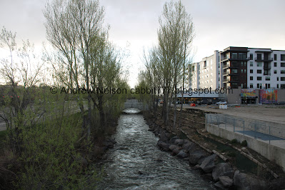
The old car bridge did allow us to get a better view of Big Cottonwood Creek.

Low head dam, or a drowning machine. You do not want to find yourself in the water anywhere near one of these. If you get caught in it you will just keep churning and churning with no sense of which direction is up until you drown.

Some neat murals on the south side of this apartment building. We both had snarky things to say. Like: "Here is a picture of trees, instead of… actual trees". And "Here is a picture of the mountains… that this development is going to block the view of". hahaha.

But really, the mountains do look nice from here, for now.

Mount Olympus.
.jpg)
Panoramic.

Still on the shoulder of Highland Drive.

The side of the low head dam.

More creek.

Restoration efforts.

June 2007, courtesy of google maps. Man, I miss this mall.

Downstream.

We have reached a section that the development is mostly complete, and are finally able to get off of the shoulder. The creek is still nice through here too.

There are a few nice benches to sit on and enjoy the creek.

One of several auto bridges that cross the creek and enter the old mall property.

Grandeur Peak.

The creek and some construction barriers.

More murals on the north side of the building.

Grandeur Peak again.

The creek again.

Little rapid.

Here the creek flows under Highland Drive.

Raven with a bill full of sticks.

Our raven friend in front of what has become of the old Macy’s building.
Back to our friend google maps.

Here is Macy's in July of 2007, still connected to the mall.

April, 2009. Apparently it managed to hold out as a standalone store for a few years.

May 2017, it looks like they gave up (or were bought out), and the building is left alone.

October 2024, it appears to be refurbished into office spaces.

Today, with our raven friend.

With his sticks.

Off he goes.

Big Cottonwood Creek heading under Highland Drive again. From here it flows through some private neighborhoods, before being accessible again in Big Cottonwood Regional Park - Creekside Park.

Upstream.

We pushed on down to 4830 South, then decided to call it. There does not seem to be any trail along the creek below here. So back the way we came.
Downstream it appears there is a lot of private neighborhoods before another accessible spot along Big Cottonwood Creek Regional Park - Creekside Park.

Mount Olympus.

The creek again.

Again.

More murals.

One of the many crossings.

Grandeur Peak again.

The developed section.

Again.

Another bridge.

Mount Olympus.
.jpg)
Panoramic.

Crossing the creek again.

The low head dam again.

Back on the shoulder of the road.

Low head dam.

Highland Drive and mountains.

Trees and creek.

Heading up Murray Holladay Road on our way to our next adventure (PSP).
I did a little digging with google maps history, and didn’t find anything more compelling than I already shared.
I am still really sad they tore down the mall, forever ago, and are just now, slowly building more BS condos. Right now with the ongoing development this part of the creek kind of sucks. However, with the short section that appears to be almost complete, I have hope that this might be a nice creek side walk someday in the next couple of years. Right now, I really did not like having to walk along the shoulder of the busy road. I think I am going to go with 3 squirrels today
As for difficulty, it is paved, and generally flat. DR2.

Dogs are allowed on city sidewalks, leashed. Please clean up after your furry friends.

No comments:
Post a Comment