.jpg)
The Avenues Terrace Hills area is a huge mess of trails located in well, The Avenues, downtown Salt Lake City. The trail features pretty rolling hills, some scrub oak forest, wildflowers, and amazing valley views! Last time were were here we did a shorter loop and random spur. Today I thought we would do a longer loop, and well, we did, but not quite the longer loop I had planned on. Right now there is some construction in the area, so pay attention to trail closures.

Quick Details:
Length: We did a 1.4 mile loop.
Trail Type: Loop, out and back or longer loop options.
Difficulty: DR3. It was a pretty mild climb.
Elevation Gain: About 370 feet.
Restroom: No.
Dogs? Yes, leashed.
Other Info: There is almost no shade on this trail, so not recommended on a hot day. Also right now, as of April 2025 there is construction going on, which may close trails. You can see more about that here (outside link).
To Get Here:
Take South Temple east, after State St it will turn into 2nd Ave. Take 2nd Ave 9 blocks to I St and turn left. Take I St. 12 blocks to 13th Ave. and turn right. Immediately take the left fork to Northcrest Dr. after a half mile turn left on Terrace Hills Dr. Follow that for .4 miles to the Cul Du Sac located at 1036 Terrace Hills Dr. Find street parking.

Climbing up I Street (Passenger Seat Photography).

Every time we do it, I get re-surprised at how long and steep it is (PSP).
The Trail:

You can go up either the east or west side. We did the East Terrace route last time, so I thought we would do the West Terrace route today.

Uh Oh! Well, hopefully we don’t run into any problems.

Before long the sidewalk ends, and it is just an old dirt road.


Trail sign.

Climbing up.

Those switchbacks look worse than they are.

View to the south.

Random pillars. I suspect these might have been an old gate?


Hillside flowers. I suspect some sort of balsamroot.

Continuing the climb.

Amazing green foothills.

The Avenues Twin Peaks.

Closer.

The first switchback.

It offers a pretty nice view.
.jpg)
Panoramic.

Back to the climb.

Water tower above.

The trail is nice and wide through here, so it’s not bothering me.

Closer to the water tower.
There is a 4 way trail split. Right is a shorter route that we did last time. Left is the Bonneville Shoreline Trail (BST) continuing west (and will connect to the 18th Avenue Trailhead, as well as a few other random neighborhood connectors). Forward, is the BST heading east and is under some restoration area, but still accessible. We went forward. This is the first of several multidirectional trail splits.
So, this short section will be new to us.

"Restoration area. Keep dogs on leash, follow signs, and hike through mud, not around it."

Looking back down.
.jpg)
Panoramic.

The logs were not really consistent, so it was not always super clear where they want you to walk, but I think we managed.

Not to mention some of them appear to have shifted. I think through here they want you to keep right.

Pretty green hills.

The Avenues Twin Peaks.

The view below.
.jpg)
Panoramic.

The water tower again.

The East Terrace trail on the other side that we will be going down near the end.

Hilltop.

A view across towards City Creek Canyon.

You can go forward, up and over the little peak, or use the bypass on the right. I opted for the bypass, even though it was a little more thin. Why add extra climbing when it can be avoided.

Some closer flowers. Pretty sure this is arrowleaf balsamroot.

Little closer.

Cute but tiny little pink flowers.

This spot made me a little nervous, but it was just I don’t know what’s coming nervous. Hindsight, I was fine.

Avenues Twin Peaks and the pretty foothills.

More balsamroot.

The peak we are bypassing.

More balsamroot.

Looking back at the peak.

The University of Utah complex, and the mountains above.

Some of the major arteries heading south. I love living on the grid system. I thiiiiink the middle one is 7th East.

Here the guide logs are a little more clear.

City Creek Canyon again.

Continuing the climb.

The logs led us towards another thinner peak bypass. So, I think they are trying to revegetate the smaller peak to the right.

A massive 7 way split. Oh boy. So, forward stays on the BST. The 2 left head towards City Creek Canyon I think. One down, one up. Top right is a downhill bike area only that comes down from another 7 way split labeled as BST to Bobsled Alternative, which was what I had planned on doing today, until I learned it was downhill bike only. The lower right trail is an upper section of the Valleyview trail which is what we ended up doing. Lastly the 2 trails at the bottom are what we came up, and the alternate. Oof.

As stated, I had planned on doing the upper right trail, but I did not realize it is a downhill bike trail only. Well, that is what I get for making plans on google maps. Sigh.

If I had taken more time to consult the maps, I would have realized we could have stayed going forward on the BST and ended up where I had planned, just in a slightly longer way. But it would not have been super long either. Meh, I guess we will do that next time.

The lower left trail leads to the 18th Avenue Trailhead. or City Creek. It is currently closed due to the power line project.

Also down there is the Meadows Trail, which I need to check out sometime soon. It sounds nice. You can also see City Creek Canyon.

So that leaves us with this little connector that will take us to the BST Valleyview Trail. Sigh, not what I planned on doing, but at least I know where it will take us. This leads across to the East Terrace Trail.


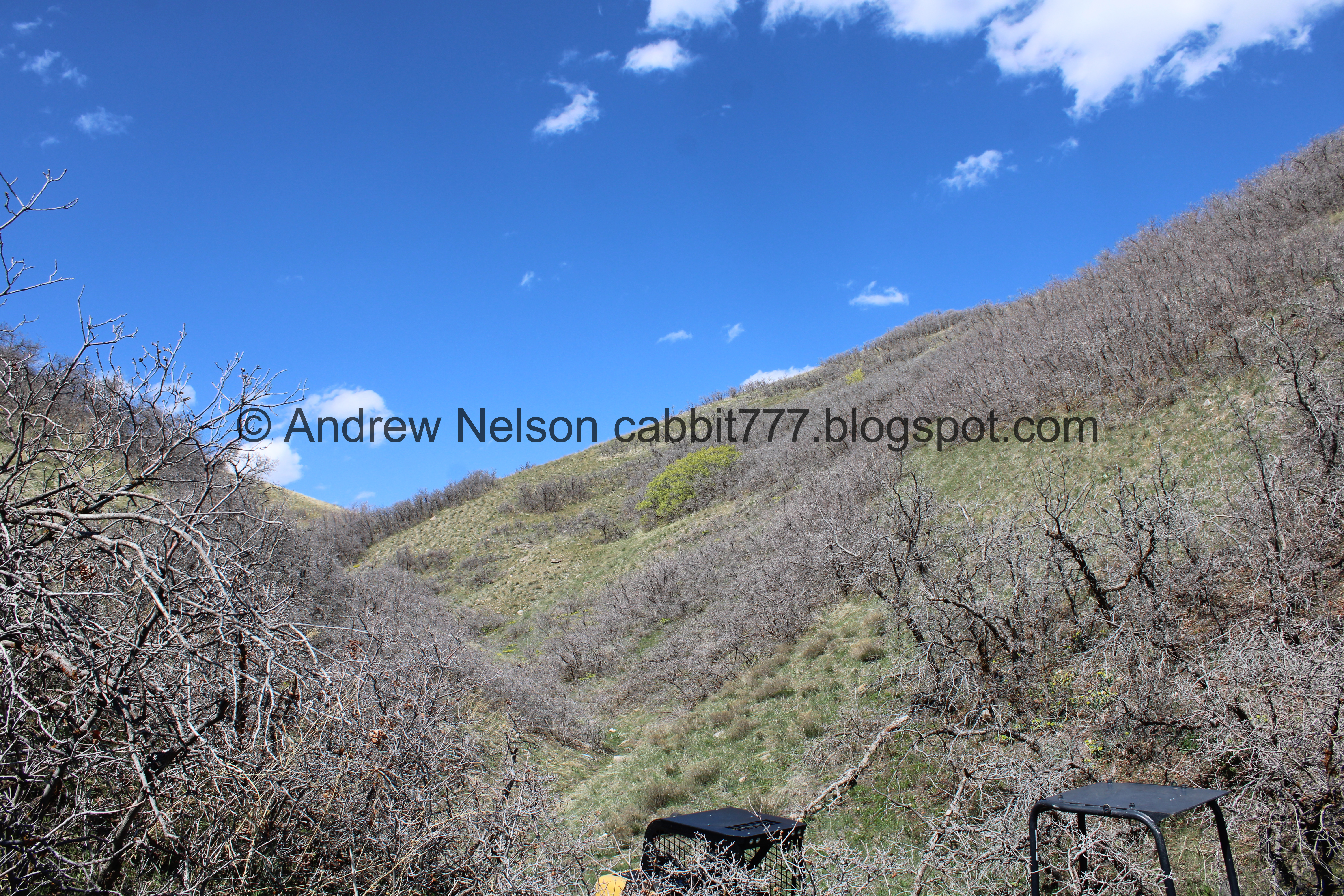
Scrub oaks.

Just starting to bud. Give it a week or 2 and they will be nice and green.

The valley.

The scar for the power line project.

The valley again.

Now officially on the BST Valleyview Trail. Just a half mile to the next junction. So, back to what are familiar with.

More balsamroot.

Milkvetch.

The scar and the trail we will be using.

Balsamroot.

Approaching a little hollow.

Scrub oak.

Green hills, blue skies.

The hollow.

Looking down.

Up.

Continuing along.

Tiny yellow flowers.


More balsamroot.

Through the scrub oak.

Nice and twisted.

Balsamroot.

The valley again. This trail sure lives up to it’s name.


More balsamroot. It just grows all over the place up here.

The valley again.
.jpg)
Another panoramic.

Hillside.

Continuing along.

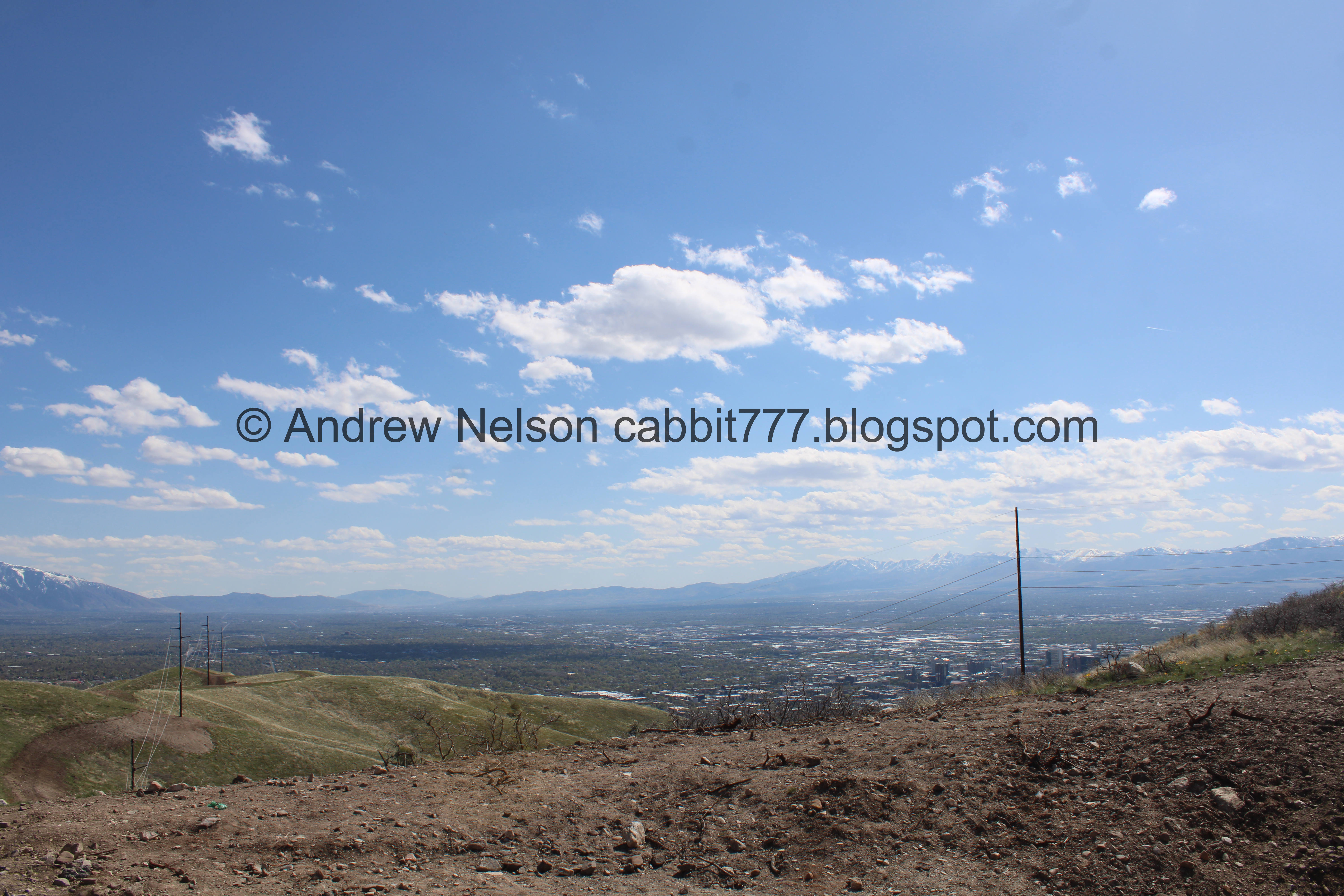
Starting to see downtown peeking out from around the hillsides.

The valley. You can see the trail we came up to the right.
.jpg)
Panoramic. Which shows the trail we will take down to the left, and the trail we came up to the right. Fun!

The valley.

Deer trail.

Myrtle spurge. This is a particularly noxious weed. It can cause rashes and burns, so it is best avoided.

The hill above.

Uh oh! I looks like there was a landslide across the way.

Phlox.

Somewhere around here we noticed that they appear to be widening this trail. Nice. I am not sure if it is related to the power line project, or just a subsequent project they are doing simultaneously.

I do appreciate it being a little more wide.

But it does kind of make me sad to see some of the trees being damaged.

More balsamroot.

More phlox.

In the corner of another hollow we found the equipment they are using up here.
Above.

The equipment again.

Continuing up the newly widened trail.

There is a lot of myrtle spurge through here.

Little bit more climbing.

More milkvetch.

Lots of spurge.

Here we get a pretty decent view of downtown.

Myrtle spurge in bloom. I can kind of see why people willingly put these in their gardens back in the 80's. They are kind of pretty. But considering how awful they are, I am really surprised that it was not nipped in the bud sooner than it was.

Balsamroot.

Balsamroot and milkvetch.

Wide trail.

Hill above.

Wide trail.

Myrtle spurge.

Lots of it.

Continuing along.

More scrub oak.

A nice bench to rest on.

Before long we reached the next junction on the East Terrace Trail. Right will get us back to the trailhead.
View to the south with the continuing scar.

There is a trail up to the top of this little peak as well.


View of downtown again.
.jpg)
Panoramic.

Avenues Twin Peaks again.

Heading down the East Terrace Trail. It looks like they are widening this trail as well. I seem to recall it being plenty wide before, but okay, maybe it needed to accommodate specific equipment.

Glacier lilies.

Closer.

Again. When I start finding these in the foothills, it is my sign that spring is here. Add to that I had to take my jacket off today and yep. Spring is here.

Their digging unearthed a section of red rock.

The landslide I thought it might have been natural when I spotted it from above. Now it appears to be associated with the construction.

You can see the scar directly below it.

Continuing down. You can see where we climbed up to the right.

Nice green ridge.

Closer look of where we came up.

Continuing down.

Pretty green foothills.

More scrub oak.

People on the ridge.

Heavy equipment.

Closer.

The scrub oaks are getting a little bigger down here.

Back down to the east trailhead.

Trail markers.

Trail Sign.

The top of Terrace Hills Dr. where the trailheads are.
Well, that ended up being a lot shorter than I had planned, so we decided to tack on a couple add ons.
I was a little disappointed I was not able to do the loop I planned, but I did have a longer and shorter alternate. I chose the shorter. It is a very popular area for hikers, runners, bikers, etc. But it wasn’t too crazy today. The views were great, and the weather was lovely. The current construction did not impact what we did too much, and in fact I like that they are widening some of the trails as well. The giant web of trails is a little daunting, but there are helpful signs. 8 out of 10 squirrels today.
As for difficulty, it is a bit of a climb, but nothing crazy. DR3.

Dogs are allowed, but should remain leashed. Please clean up after your furry friends.

No comments:
Post a Comment