.jpg)
The Potato Hill Loop is a series of 3 trails that make a loop around Potato Hill. The trail features amazing views of the Salt Lake Valley, scrub oak covered hill, a spring, wildflowers, and a good chance of seeing deer. This is a great trail this time of year to get yourself back into hiking mode for the warm weather. There are 2 spots that trigger my fear of heights, but I am able to power through them. This is a great trail and we've done it a few times now.

Quick Details:
Length: About 2.25 mile loop.
Trail Type: Loop. Shorter out and back options, connector.
Difficulty: DR3. It’s a bit of a climb, but its not too bad.
Elevation Gain: About 380 feet.
Restroom: Seasonal vault toilets. However, they also bring in a port o potty for winter, at least they did this and last year.
Dogs? Yes, leashed. Please clean up after your furry friends.
Other Info: the trail starts at the top, and the return trip is uphill. This can be a little tough if your aren’t used to it. You can start at the bottom from the Red Rock Trailhead. It looks like that will add about 2/10ths of a mile each way.
To Get Here:
From I15 Take exit 288, or 14600 S in Draper. Go left. Go almost a mile and turn right on Traverse Ridge Dr. About 2 miles later turn left into the small parking lot.
Go through the gate at the NW end of the parking lot and turn left. Signed for Red Potato Trail.

Steep Mountain (Passenger Seat Photography (PSP)).

Red Rock (PSP).

Potato Hill (PSP).

Traverse Ridge Road continuing its climb from the parking lot.
The Trail:

Trailhead kiosk. You want to take the left after this.

The sign here says it is extremely muddy. However, Draper has released a current conditions map on their trails website which said the trail was fine today. I guess they update the website better than the trail signs. Either way, it was not muddy at all today. They do ask though, if mud is sticking to your boots, tires, or hooves, you are damaging the trail and should turn back.

Potato Hill Peak. It’s a a fairly easy peak to summit, and they even updated the trail to make it easier. I’ve done it before, so we didn’t do it today.

The Red Potato Trail. I prefer to do this loop clockwise, starting with the Red Potato Trail. It seems like it is the easier climb back up, and you get the worst of the scary parts done right at the beginning.

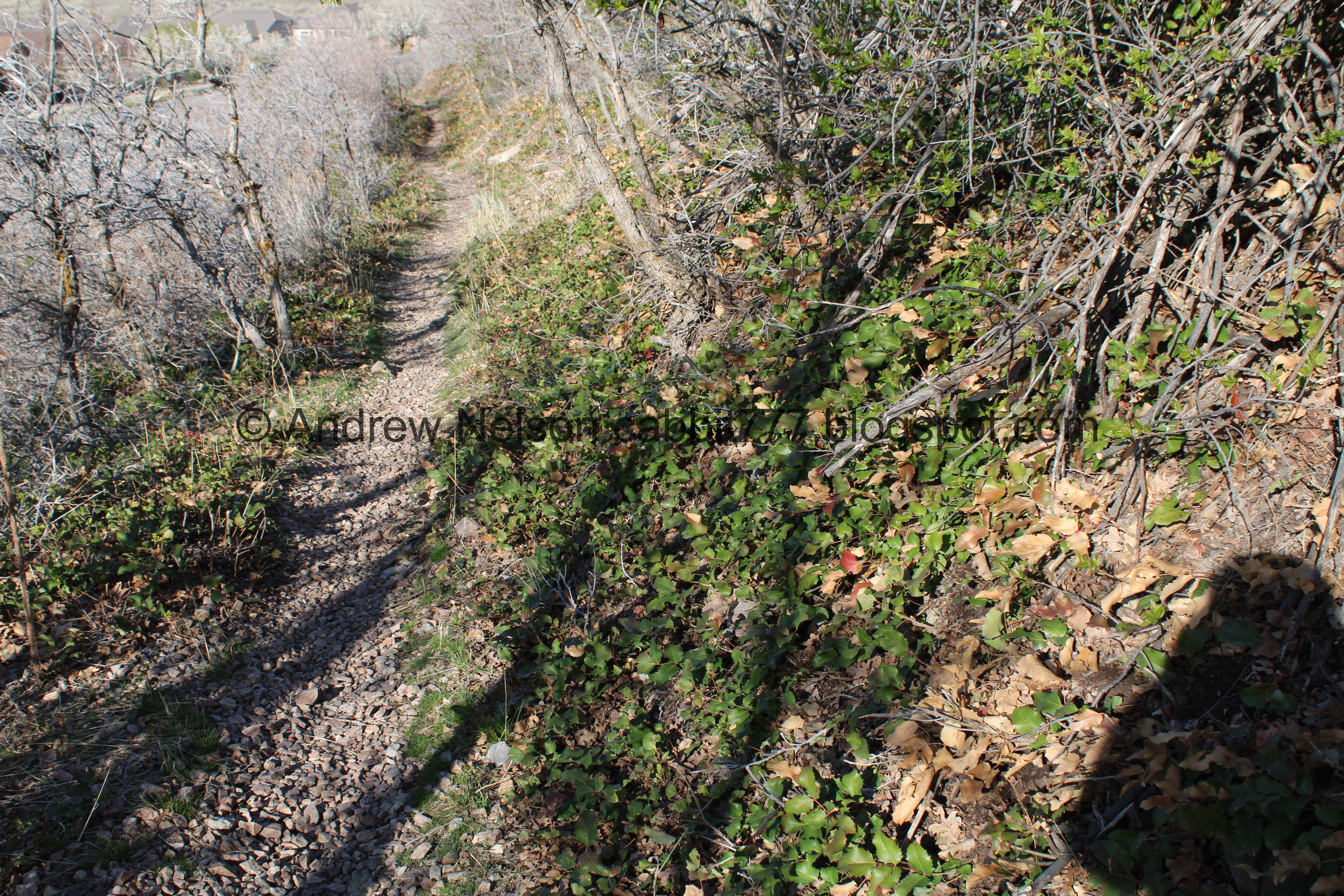
Into the scrub oak.

The first switch back.

Looking across the way into Little Valley.

Looking down the little hollow on the south side.

This is why they ask not to use the trails when they are super muddy. You leave foot prints that make the trail not smooth and causes more erosion.

The section I don’t like. I have made it through it several times now, you would think I would be okay by now but nope. Lizard brain still kicks in and freaks me out for a bit. But, its short so again, I made it through.

2nd switchback.

A little more rough , and then it mellows out. There is one more short spot on the way up I don’t like, but otherwise the rest of the trail is fine.

Random hole in the rock.

Third switchback.

View across the valley towards Antelope Island.

You can also make out The Claw from here.

Continuing down.

Wedding venue with a fancy gazebo, above the Spring Hollow Trail.

The valley again.
.jpg)
Panoramic.

More trail damage.

Some unlabeled reservoir of some sort.
.jpg)
Panoramic.

Continuing along.

Some kind of parsley I believe.

Scrub oak.

Trail split. Right will keep us on the Red Potato Trail. The general rule for this loop, going this way anyway, is just keep right. This would also technically be the fourth switchback.
Left is the Lexie Ethan Trail, which was my first idea to do today. Ultimately I decided that I would rather do a kind of scary trail I was familiar with versus one that I was not. But, maybe I will get to that one before it gets too warm.

Potato Hill and Mount Jordan.

Continuing down.

The valley again, with The Claw.
.jpg)
Another panoramic.

Scrub oak.

Potato Hill.

Again.

Small wetland below. We will cross over that shortly.
.jpg)
Another panoramic.

Fancy gazebo again.

We can see all the way out to Ben Lomond in Ogden. Wow. It looks a little hazy today, but if we can see that far it’s can’t be too bad.

Potato Hill again.

With the moon.

Some wildflowers getting ready to bloom. I have enough trouble identifying them after bloom, I am not even going to try pre-bloom.

Crossing a little spring.

It looks like there was an avalanche or slide here not too far back.

Which brought down a lot of boulders and debris.

Looking down. Now the trail below that is named Spring Hollow makes more sense! I assume this is upper Spring Hollow, which does appear to be dotted with a few springs on the way down.

Looking up. Lots of broken trees.

This channel is slightly wet, but is not flowing right now.

Down again, with some larger boulders that came down.

Looking back at the wetland. We will cross over it 2 more times along the way.

The fifth switchback.

The valley again.

Little closer. You can see The Claw again.

Lower Spring Hollow and the fancy gazebo again.

Back into the hollow. This part is pretty dry.

Looking back up. Still some damage, but not as severe as above.

The next section is flowing pretty good.

Itty bitty waterfall.

YAY!!! Glacier lilies!!! This is my sign that spring is here. It’s not perfect, they don’t mind being snowed on from what I have seen, but when I finally spot them myself, it seems to be spring.

They are handsome flowers.

At about 3/4 of a mile we have reached the Bonneville Shoreline Trail (BST). Again, hang a right. If you want to start from the bottom at the Red Rock Trailhead, here is where you will come up. It is about 2/10ths of a mile from here. This would be the sixth and final switchback for this side.

Closer look at the old sign.

Potato Hill again.

Same picture, but I highlighted the parts of the trail that triggers my fear of heights. Super short and doable. Again, I think it is easier to deal with going down, and get it out of the way at the beginning. I think I would struggle more on it after climbing all the way up there.

Shorter scrub oaks.

More glacier lilies.

Back to the wetland area.

The south side is flowing.

Lots of phragmites.

The north side is just muddy. I think this part could use a couple more stepping stones.

Looking up. There appears to be a little damage from the avalanche, but not as much as the upper sections.
.jpg)
Another panoramic. I took a few of these today haha. The view is just incredible!

Scrub oak.

Directly below Potato Hill now.

This section of the BST follows Mike Weir Drive, and you can definitely hear the cars along it, but its not awful.
.jpg)
Another panoramic.

We thought about checking out the cherry blossoms at the State Capitol today, but changed our minds. So it was nice to see a row of blossoming trees along Mike Weir Drive below today.

The first of several scree fields the trail crosses.

Better view of the blossoming trees.

Second scree field.
Some time around here we stopped going down, and slowly started going up again.

Looking up.

Creeping Oregon grape.

Again.
Lots of it. I see these all over the place, particularly around the foothills and benches.

Some red ones.

Continuing along.

3rd scree field. It is a bit larger, but the trail doesn’t cross it.

Well hello there deer friends. Oh my, they are looking awfully skinny. I hope they find some good food.

I was curious about this fence, and that is what made me spot our deer friends. I am pretty sure there is no longer a border issue here, can we remove the dang thing now?

The deer again.

Fourth scree pile which is just before the big one.

Fifth scree field, which is the largest one. Plus Mount Jordan.

Another smaller scree field.


More scrub oak.

Another little hollow, that also looks like it saw excess water sometime last year. This is the hollow we will be hiking through above towards the end.

Downstream.

The deer don’t care if the trail is muddy or not. They go where they want.

Silica patch. At least that is what it looks like, see the nearby Silica Pit.

Starting to climb again.

Found a small patch of phlox.

Downtown.

More glacier lilies.

Mount Jordan and Burnham Gorge.

This giant house was designed to look like a castle. well, it’s as big as one, might as well.


Scrub oak.

The valley.

Paraglider.

Back to switchbacks. This is the first one on this side.

More climb.

Scrub oaks.

Second switchback on this side.

Sage.

Scrub oak.

Left is a neighborhood connector, stay right to stay on the BST.

The castle house again. That attachment is bigger than my house.

Red-tailed hawk.

Box Elder Peak above the Corner Canyon saddle.

Another trail split. Left will follow the BST over to Corner Canyon. You want to hang right again and take the Potato Hill Trail back up. Technically this is the third switchback on this side too.

The other side of the directional sign.

More scrub oak.

Lots of deer tracks. We learned last time that the deer use the trails like we do. Then again, I am fairly sure a lot of trails through here started out as deer trails.

More climbing.

I have been trying to figure out where that random hill is, and I think I finally figured out it is 123rd South and above 13th East. Which makes sense, there is a bluff there.

More climbing.

Short section on this side that I don’t like.

Above the silica.

Then we hit the overlook.

Again.

It is a nice view point.
.jpg)
Panoramic.

Potato Hill.

The little hollow we will skirt on the way up to the saddle. After the viewpoint, the trail is back to being just fine for me.

More deer tracks.

Continuing up.

Potato Hill again.

The saddle.

More deer tracks.

The moon.

Scrub oak.

The valley.

Continuing up.

Potato Hill.

Forest and peak.

The valley.

The Potato Hill Peak.

The shadow of the peak.

The valley.

The peak again.

Final trail split. Again, hang a right to get back to the parking lot. Left leads to Little Valley, and Ann's Trail.

The tunnel under Traverse Ridge Road leading towards Little Valley.

The other side of the directional sign.

The peak again.

Last little push.

The peak again.

Again.

The parking lot.

Here is where the always go right rule does not apply, which should be obvious to get back to the parking lot go left. Right will lead to another overlook, and the peak. Like I said, I have done the peak before, and wasn’t up to doing it again today. Even though I have been wanting to check out the rerouted trail to it. Maybe someday.

The peak from the parking lot.

The trailhead sign.

The valley from Traverse Ridge Road (PSP).

Elevation marker for 5100 feet (PSP). Driving up and down Traverse Ridge Road is like driving up or down a canyon. So I guess treat it like one.
I really like this trail, even with the short spots I don’t like very much. The views are fantastic, we almost always see deer, and its not a very busy trail either, which is nice. 8 out of 10 squirrels today.
As for difficulty, it it pretty easy going, just a bit of a climb. DR3.
Dogs are allowed, but must remain leashed. Please clean up after your furry friends.

No comments:
Post a Comment