Knudsen Park is a relatively new park in Holladay. Aside from your standard park amenities, it features Big Cottonwood Creek, and exceptional mountain views. We actually recently dipped down into the park recently following the Big Cottonwood Trail. However, we did not do the full park loop, and I also noticed an off shoot that looked interesting. So, since I am currently on a mission to explore our creeks, I thought I would come back here again.
Quick Details:
Length: The main loop is only about 3/10ths of a mile, but we did some extra exploring and did .85 of a mile.
Trail Type: Loop, loop with spurs.
Difficulty: The main loop is paved and fairly flat, DR2. The spurs we did are a little more wild DR3.
Elevation Gain: We did about 32 feet.
Restroom: Yes, but I am not sure if they are open year round or not though.
Dogs? Yes, leashed. Please clean up after your furry friends.
Other Info:
To Get Here:
Take i215 to 6200 South, head west. Almost immediately turn left onto Holladay BLVD. Drive to the end.
The Cotton Bottom is sure hopping (snort) today (Passenger Seat Photography (PSP)).
The Trail:
Mount Olympus.
Heughs Canyon.
The neat pillars marking the entrance of the park, and the currant southwest end of the Big Cottonwood Trail. I am ever so hopeful that it will be expanded eventually.
Into the park. We decided to go right, or counter clockwise today.
One of the newish Big Cottonwood Trail markers.
Nice little grove.
These trees look more fall like than spring like.
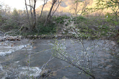
Big Cottonwood Creek.
Mountains and Big Cottonwood Canyon.
Mount Olympus.
Panoramic.
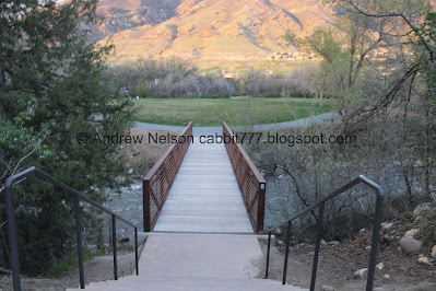
Bridge. I thought this was a neighborhood connector last time, but after playing around on the map it looked like there was more to it back there.
So, we decided to check it out.
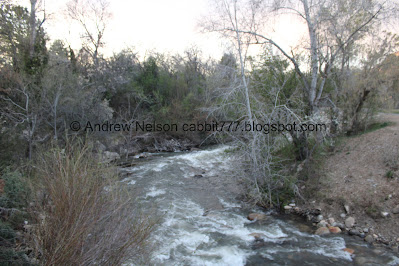
Downstream.
Upstream.
Random section with stone pavers. I wonder what the plan for this is.
There is an unpaved trail through the woods back here, so naturally we decided to explore a bit.
Short steeper section down towards the creek.
The creek.
Forest. It smells incredible through here.
This might be why haha. Google lens is leaning toward Pacific plum.
Some pretty periwinkle.
Random pond of some sort. I didn’t notice any inlet or outlet so it might be stagnant, but I can’t say for sure.
More forest.
The creek coming out from under a road bridge.
This little trail eventually connects to the Big Cottonwood Trail. We could have worked our way back to Knudsen Park (serious maybe 40ish feet to the left) but we decided to return the way we came.
Myrtle Spurge, a particularly nasty noxious weed. Seriously, avoid it at all costs it can cause painful rashes and burns.
Super steep trail up. I thought this might make a loop back here (and it probably does) but after scrambling up there was another even steeper section. So, I had to scramble back down. Oi. Not recommended.
More pretty flowering trees.
Pretty forest.
The creek.
Oregon grape.
More forest on another little spur trail.
Twin Peaks.
This little spur just took us towards the freeway, with a better view of Twin Peaks.
Heading back down.
Mount Olympus.
More Oregon grape.
Back to the stone paver slab.
Stone bench.
The steps back down to the bridge.
The bridge and Mount Olympus.
Downstream.
Upstream.
Mount Olympus again.
Culturally appropriate messaging right now.
Panoramic view of the mountains. Now we are back on the main loop again. That random off-shoot ended up being about 3/10ths of a mile.
Fun clouds. We were a bit worried we might get rained on, but did not.
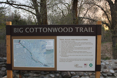
Big Cottonwood Trail kiosk.
The stone wall of the road bridge.
Built by a youth service in 2012.
It looks like they got to sign their project. Neat.
From here, you can continue following Big Cottonwood Creek upstream to the mouth of Big Cottonwood Canyon along the Big Cottonwood Trail, and then there are several places to access the creek within the canyon.
Back on the main loop.
Continuing along.
Little water play area. It is not active yet, so I was able to get a shot without people in it.
However, the nearby playground and pavilion, not so much. But, they are there.
Stinky tree, as we call them. Or well, Callery Pear to be accurate.
Landis recently learned that these trees use very little water, and grow very fast, so that is why they appear to be desirable. However, when they flower, they smell really, really bad. Some people say like rotting fish, rotting trash, and some have even more crass words to say and well, I won’t repeat that here. Landis does not like it, I can’t seem to smell it. I half wonder if it is a random gene like the one that makes cilantro taste like soap? Or maybe my sniffer is broken.
Aside from that, Landis mentions they are prone to disease, and readily spread disease to other native trees. So I am really surprised that it appears to be a tree that smarter cities are using.
Wow! Look at that sunset!
More Callery Pear. The entire playground is lined with them.
The wooded picnic area again.
More sunset.
Well, that does it for the main loop, but we decided to check out another random spur trail on the other side.
Spur trail.
More forest.
Again.
More sunset.
Low head dam. Super dangerous, so be sure to stay away.
It is pretty though, and sounds nice.
More forest.
The creek.
Lots of Oregon grape.
Neat old stone auto bridge.
End of the line at 6200 South. Big Cottonwood Creek flows through private areas for a while, before it hits the former site of the Cottonwood Mall, and below that Big Cottonwood Regional Park - Creekside Park.
Whelp, back the way we came.
The creek again.
Forest.
Cherry.
Mountains.
Ivy climbing the trees.
Back to the main loop and the neat pillars again.
More sunset.
More (PSP).
That is a nice little park, with a couple options to have lunch or dinner and a beer. I am happy we came back to explore it some more. Of course, we took so long here that by the time we got to my final destination of the day we had run out of light. Oh well, next time. But the views are great, the little hidden trail system is neat, and access to the creek is always nice. 8 out of 10 squirrels.
As for difficulty, the main loop is paved, so DR2 for that. 3 if you decide to explore the spurs.
Dogs are allowed, leashed. Please clean up after your firry friends.
.jpg)


.jpg)


.jpg)


No comments:
Post a Comment