.jpg)
We have 7 major creeks coming out of the canyons along the Wasatch Front on the east side of the Salt Lake Valley. They all eventually end up in the Jordan River, and eventually the Great Salt Lake. Unfortunately, our ancestors preferred to bury creeks and there is not a whole lot to explore in some of them. Thankfully now we are starting to realize how special they are, and how important riparian habitats are. I thought I would dedicate an article to the special places to enjoy our major creeks, I might even branch out to some of the smaller creeks as well (now, that is the plan for a Part 2, this was a bit more than anticipated).
This is going to be a stub article, that will link you to the specific areas where you can enjoy the creeks. So no introductory stats or directions here.
Here are the 7 major creeks from North to South:
City Creek
Red Butte Creek
Emigration Creek
Parleys Creek
Mill Creek
Big Cottonwood Creek
Little Cottonwood Creek
City Creek:
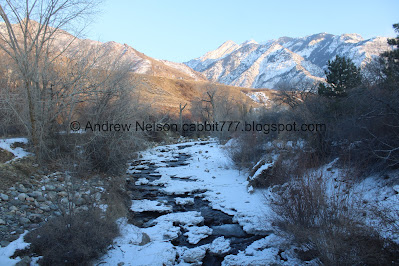
City Creek is approximately 14.6 miles long 2 miles of which are buried. It was the primary source of drinking water for Salt Lake City, and still supplies drinking water to the avenues, and north Salt Lake City. It flows through Salt Lake City.
Working from the top.

You can enjoy this creek from the top of City Creek Canyon.
Along City Creek Canyon.


Then down The Freedom Trail and Memory Grove.
Memory grove was severely damaged when City Creek flooded in the great flood of 1983.

Then it goes through City Creek Park. I recently learned that this is the first part of our creeks that they had buried to be daylighted in 1995! They did this after the great 1983 flood caused them to rethink how we manage our waterways.
As I understand it, the creek originally forked here, one fork heading south towards Washington Square and the primary stream heading west. They decided to channel it into the east fork, before burying it completely. Now City Creek disappears underground into a culvert here before it enters the Jordan River under North Temple. So far I have not had any luck seeing the City Creek Confluence. I suspect you might need a canoe to do so.


City Creek Center, opened in 2012. It replaced the old Crossroads Mall, which was demolished in 2006. They built a simulated creek through it to emulate the buried City Creek, but it is not the real thing. In fact it uses recirculated tap water. Such an opportunity lost to not properly daylight another section of the creek, even if it ran trough a mall. I guess technically it is a form of daylighting called Cultural Daylighting, recreating what once was, but it’s not the same to me. Anyway, I do not support City Creek Center due to the cult that built it, but I popped in to see the "creek" after a couple nearby things I was doing downtown.
Red Butte Creek
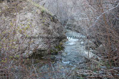
Red Butte Creek flows out of Red Butte Canyon which fortunately, and unfortunately is mostly closed as a wildlife preserve. Unfortunate that we cannot explore it, but fortunate as it remains one of the last undisturbed riparian areas in the Salt Lake Valley. It is the smallest canyon of the 7, and thus the shortest creek of the 7 creeks at only 10.6 miles long. 3.3 of which is buried. It flows through Salt Lake City.

Some of the creek can be enjoyed on the Red Butte Skyline Trail which skirts around the Red Butte Garden property.
It then flows through Red Butte Garden (fee area) we haven’t done that yet.


Update August 2025: We finally got around to exploring Red Butte Garden in June 2025.
Here is the bottom section of the creek in Red Butte Garden. I want to come back and explore the upper section along the Six Bridges trail.

Update December 2025: Came back and did the Six Bridges Trail one more small section in Red Butte Garden along the creek then it should be done.
Then it flows through the University of Utah and some private areas.

It then makes a brief appearance in Sunnyside Park
Then, another private section.


Then it flows through Miller Park, and the Adjacent Bonneville Glen Park.
Then some private areas, and it goes underground around 13th east. It joins Emigration Creek underground around there.

The combined creeks emerge briefly in Liberty Park to fill the pond there. I happened to visit when the pond was drained, but you can see the creeks flow across it. Might have to come back though.
Update July 2025:
.jpg)
The pond filled back up in summer time.

Where the creeks enter the pond.
.jpg)
Bonus: a neat fountain celebrating the 7 creeks. I forgot this thing existed until we came back! I found it to be pretty detailed.
You can see more on our return trip to Liberty Park here.
From there, both creeks disappear underground again. Parleys Creek joins them underground a little further west near State Street.

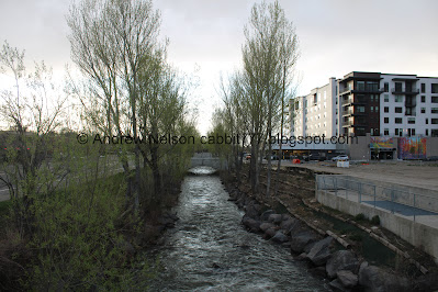
A short section of the now combined 3 creeks (Red Butte, Emigration, and Parleys) has been daylighted at the 3 Creeks Confluence entering the Jordan River near 13th South. It was daylighted in 2021.
Emigration Creek:
Emigration Creek of course comes out of Emigration Canyon. Where the pioneers entered the valley. This creek is 16.4 miles long with 4.9 miles of it buried. It flows through Salt Lake City.

You can enjoy Emigration Creek starting near the top in Killyon Canyon. Then of course along Emigration Canyon.

Near the mouth of the canyon you can enjoy it in Rotary Glen Park.

Then it flows through Hogle Zoo (fee area).

After it flows through some private areas, then it can again be accessed in Wasatch Hollow Preserve.

Then it flows through Blaine Natural Area, which was kind of meh, but still we saw more of the creek there.


Then it flows into Allen Park.

Update May 2026: There is a short section along the Westminster Emigration Creek Natural Area that can be explored.
From there it resumes slightly west through private areas for a block or so about ~600 feet before going underground, joining Red Butte Creek at about 11th east, making an appearance at Liberty Park then joining Parleys Creek near State Street before it is daylighted at 3 Creeks Confluence where it flows into the Jordan River.
Parleys Creek
Parleys Creek comes out of Parleys Canyon. The main canyon follows our major east/west freeway, i80 and the creek is mostly in a culvert beneath it. So not really any places to enjoy it in the canyon. However, below the mouth of the canyon is a different story.
Parleys Creek is 19.2 miles long. 8.8 of which is buried. It flows through Salt Lake City.


At the mouth of the canyon is Suicide Rock with the small glen around it to enjoy the creek. Fun fact: There used to be a reservoir here.

From here, you can follow Parleys Trail down through Parleys Historic Park,


and Hidden Hollow. After Hidden Hollow it goes through some private areas before going underground near State Street. Where it joins Red Butte, and Emigration Creek before being Daylighted at 3 Creeks Confluence where they flow into the Jordan River.
You can continue following Parleys Trail (away from the creek) down to the Jordan River to just south of the 3 Creeks Confluence.
Mill Creek
Like almost all of our creeks, it originates in a canyon with the same name. So, this comes out of Mill Creek Canyon. It is 20.2 miles long with 1/10th of a mile being buried. Wow. It flows through the cities of Mill Creek, and South Salt Lake (first of the 7 outside of Salt Lake City). The top of this creek can be reached at the Lower Big Water Trailhead.

On trails such as Old Red Pine Road. Then there are quite a few trails to enjoy throughout the canyon (Fee Area). As well as the canyon itself.
The creek appears to go through a lot of private areas.

It makes a comically brief appearance at Evergreen Park. Then a few more blocks of private areas.

Then it makes another brief appearance at Scott Avenue Park (AKA Ben Franklin Park).
More private areas.

Then another view at Kaleidoscope Park.

Then almost immediately at Fitts Park.
Then some private, and some industrial areas.

Before finally reaching the Mill Creek Confluence with the Jordan River near 2900 South.
Big Cottonwood Creek
The Cottonwood Creeks were not buried as much as the previous 5 creeks. Likely due to being settled later. Big Cottonwood Creek is approximately 25.3 miles long, with only 4/10ths of a mile being buried. It flows through the cities of Cottonwood Heights, Holladay, Millcreek, and Murray.

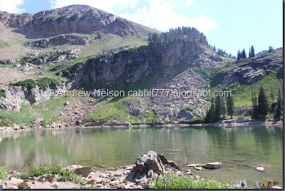
The headwaters for Big Cottonwood Creek are Lake Catherine,


and Silver Lake as they all combine and create Big Cottonwood Creek. The lakes average elevation is about 9600 feet.

There are quite a few options along the canyon to enjoy the creek, including Mill D as well as quite a few of the side creeks that join it.

Below the canyon is a pretty nice trail called the Big Cottonwood Trail that follows the creek down a ways to Knudsen Park.

After Knudsen Park, the creek goes through some private areas.
Then there is a quick section along Highland Drive at the site of the old Cottonwood Mall (RIP), which is more… city trail.
More private areas.

Then it flows through Big Cottonwood Regional Park - Creekside Park.
Then more private areas and some industrial areas.

I found a tiny park called Birkhill Park that it flows by.

Before long it reaches the Big Cottonwood Confluence with the Jordan River near 42nd South. It is about 4250 feet in elevation here here. An elevation change of 5350 feet! Last I checked the confluence was nothing special. However, it looks like there is space to do something special there, which I hope they do.
I tried to visit the confluence on the east side of the Jordan River and on both sides of Big Cottonwood Creek I was met with ’No Trespassing’ signs. Sigh. But, as I said, it looks like there is room to do something with it. So here is to hoping Murray makes it happen.
Little Cottonwood Creek
Little Cottonwood Creek is about 22.6 miles long with 7/10ths of a mile being buried. It flows through the cities of Alta, Cottonwood Heights, Midvale, and Murray.

Little Cottonwood Creeks headwaters are Cecret Lake (9875 feet in elevation) and several other springs located at the top of Little Cottonwood Canyon.

There are quite a few places to enjoy the creek throughout the canyon including Gloria Falls.

You can also enjoy the creek along the canyon bottom with the Little Cottonwood Trail that goes from about halfway up the canyon, down to the mouth of the canyon.

Below the mouth of the canyon, the creek goes through some private areas before flowing through The Quail Trail which continues into Quail Hollow Park.

Then through some private areas before it makes another appearance at Crestwood Park.

More private area and then emerging again at Wheeler Farm.

More private areas and then a good large swath of it can be enjoyed at Murray Park. Then more private area.
I have 1 more spot that I have identified as possibly being worth exploring.
Update July 2025
There is another section that you can currently explore at the former site of the 49th Street Galleria. However the future of this section does not appear to have been finalized yet so don't count on it.

Here is where it comes out from under i15

And another section.
Just below that is an established trail that appears to be finalized.

From the road.

And below it is a bit overgrown though. More images of this section here.


Then it drains into the Jordan River at the Little Cottonwood Confluence at Arrowhead Park near 48th South. As I understand it, Murray is currently working on a trail from Murray Park down to the confluence. So we have that to look forward to. Hopefully in my lifetime haha.
7 Creeks Summary
Unless I am missing some more stuff it would appear that I have explored most of the creeks as much as you can, unless there are some public areas that I have missed. I think I was pretty thorough though. Plus, it seems that city managers have finally caught on that we like our creeks, and new parks and trails slowly get created over the years. Not to mention the fact that the county is really trying to build more alternate commuter trails, and they do tend to prefer that they follow creeks when possible, so I bet there will be new ones eventually.
This article is a stub article, so there will not be any of the general final rating I typically do. But, I do love our creeks and am tempted to say 10.
Check out Part 2: Additional East Side Creeks.
No comments:
Post a Comment