.jpg)
The Dry Creek Trail is a trail along a section of Dry Creek in Sandy Utah. It features a creek, and mountain views. I totally randomly decided to do this trail today without any research other than I knew it went around South Town Mall er The Shops at South Town, so I was expecting a pretty similar experience to the Big Cottonwood Creek Trail around the former Cottonwood Mall. I was very pleasantly surprised to experience a little better than just a creek along a mall parking lot today (well, not completely).
I don’t think this trail is complete yet, but the signs are in place so it was a little confusing.

Quick Details:
Length: It’s about 2 miles out and back… if you stay on the direct route. I was kind of fumbling around with a lack of signs and ended up doing about 3.3 miles balloon with spurs.
Trail Type: Balloon with spurs, or a simple out and back.
Difficulty: DR3. It is mostly paved, but there are some spots that are not.
Elevation Gain: I did about 121 feet. I imagine the less meandered route would be a bit less.
Restroom: I am sure there are a few in the mall.
Dogs? Dogs are allowed leashed on city sidewalks. Please clean up after your furry friend.
Other Info:
To Get Here:
Take i15 to 106th South heading east. turn left on 120 West. Go left along Mall Ring Road for about a half mile (it becomes Monroe St). Turn Right on Mall Ring Road, find parking.
I just parked in the mall parking lot in the northwest corner.
The Trail:
So, I made my way down to the mall, just totally winging it today. When I arrived, I dinked around on the map on my phone until I found the creek.

Wait.. what? There is a little park here? I had absolutely no idea this would be here. So this was a super unexpected, but very welcome surprise!
This sign says Dimple Dell Park is only a mile to the east. Maybe as the crow flies, currently, the most direct route is about a mile to the Porter Rockwell Trail (PRT) that is about a half mile from the Porter Rockwell Trailhead for Dimple Dell. Or, there is an unpaved path that is about 2/10ths of a mile from the PRT to Dimple Dell, so 1.2 miles. I eventually discovered this trail is not complete, so maybe one day it will be that short.

Information on Sandy Cities attempt to clean up our waterways. Unfortunately, I can’t seem to locate what the plan for this area is.

Dry Creek. Wow, this is really nice here. When did this happen?
I know that the city worked with various water owners to help the creek flow throughout the year when conditions allow back in 2020.
Playing with google maps, it looks like this small park was built somewhere between 2018 and 2019. I can't seem to locate it's name.

The lower north side is not paved.

Mountains and moody skies.

Dry Creek being not so dry.

Fancy little bridge.
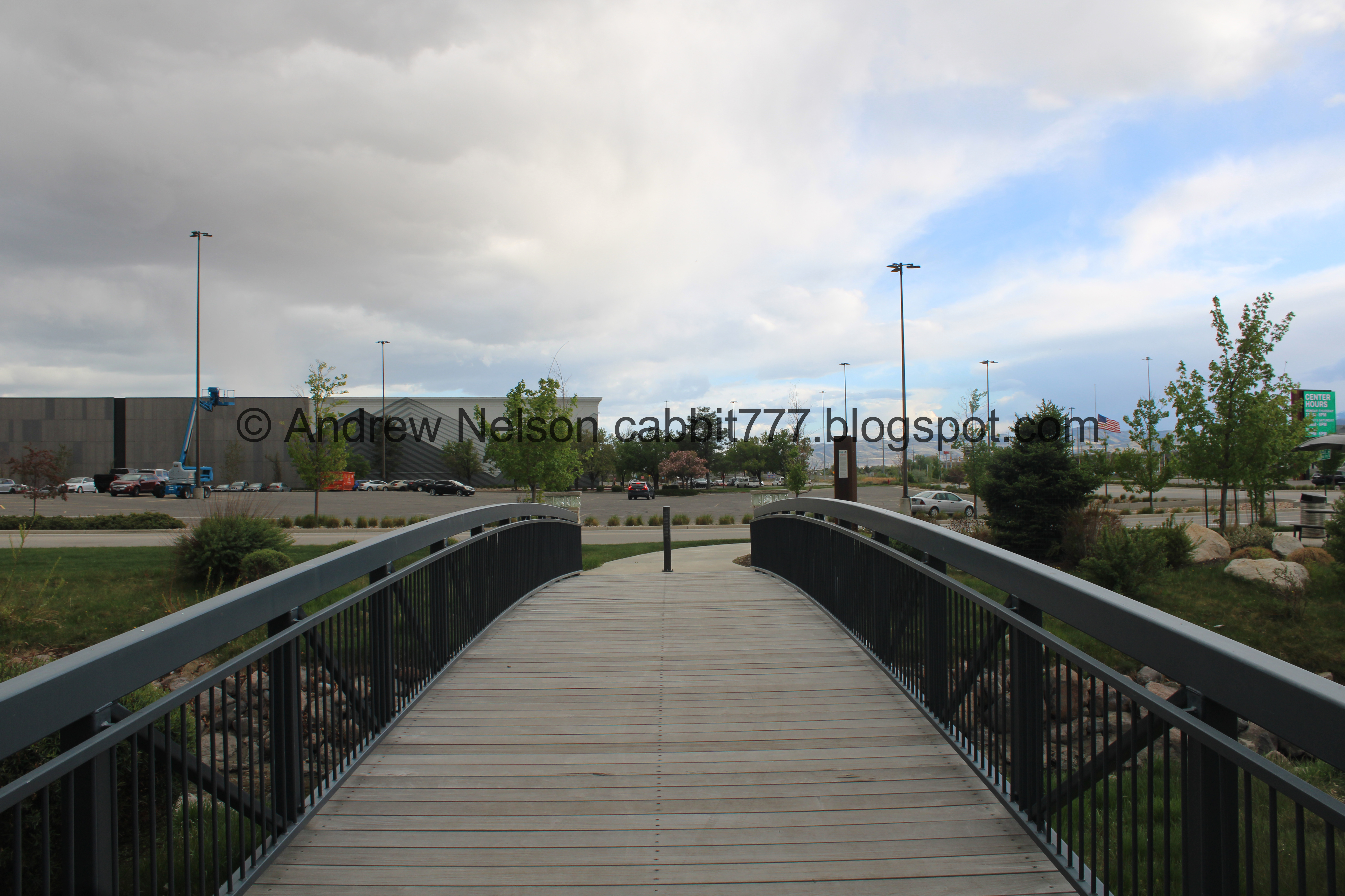
Crossing over it.

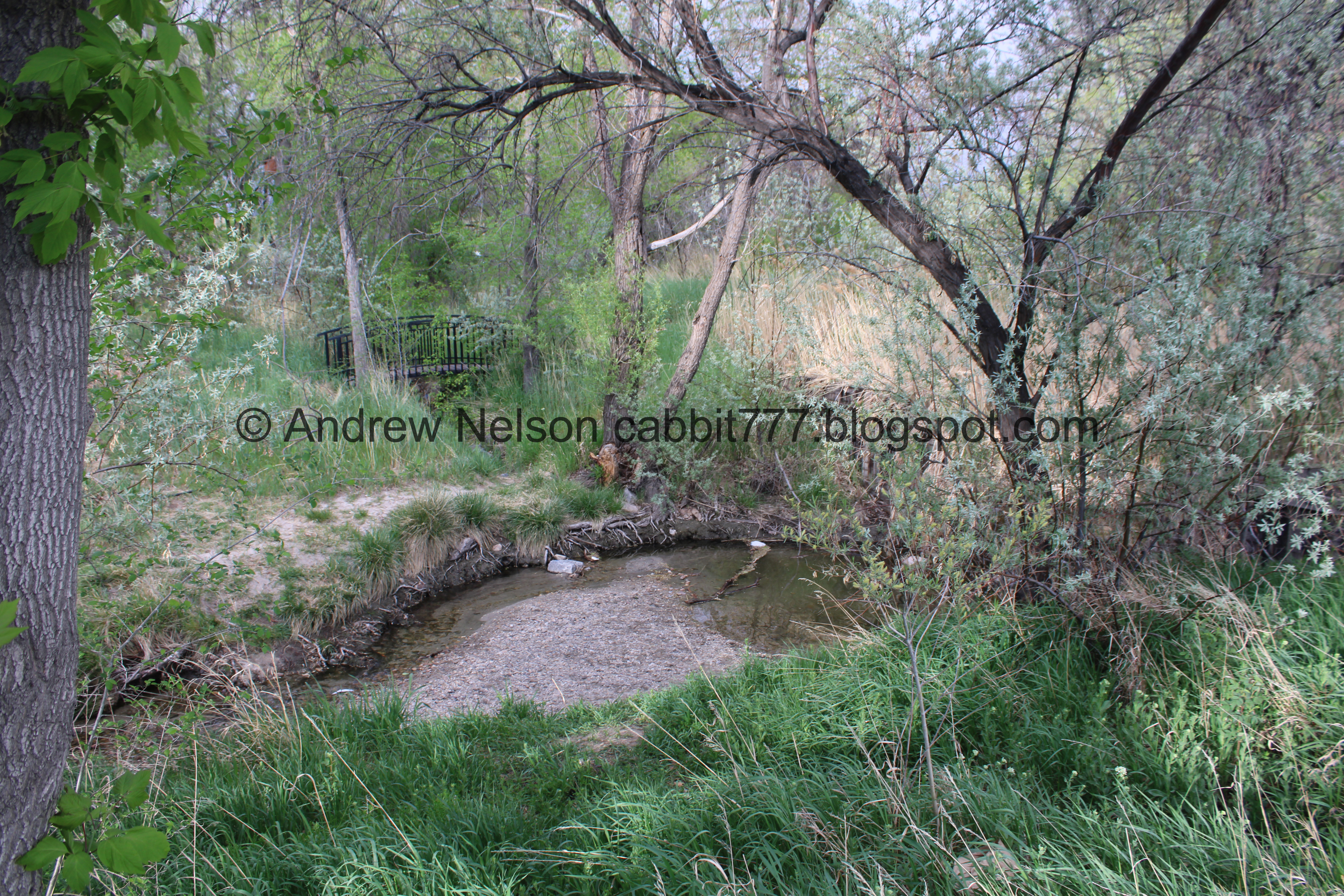
Downstream.

Upstream. I am still just blown away at this little park! It makes me happy that local governments have started to realize that our creeks are special, and are things to be enjoyed, rather than buried and forgotten as our ancestors did.

Dry Creek originates from 3 canyons. Bell Canyon, Middle Fork Dry Canyon and South Fork Dry Canyon. They combine in Dimple Dell Regional Park, and flow down to here, well, when resources allow. As I mentioned, they are trying to allow it to flow more often, but in dry years it can still certainly be dry.

The fairly new little park has some nice picnic areas too.

To the north is a wide open field that I think could be used for more park space. Here’s to hoping anyway.

Canada geese hanging out in the field.

More of the thin strip of a park.

The creek coming out of the culvert underneath Centennial Parkway.

The creek again.

The Mall, which is currently called The Shops at South Town, renamed from South Towne Center. Am I crazy? I swear it was called South Town Mall. Maybe that’s just what us local teenagers called it? This was yet another of my teenage haunts. weird, 90’s teenagers hung out in malls?
Anyway, quick bit of history: it was built in 1986 with ZCMI being it’s single anchor. Cineplex Odeon opened in 1990 and was the largest movie theater in the state at the time.
yadda yadda yadda….
In 2024 Smith Entertainment Group purchased the mall and plan to make it the training center and offices for the Utah Hockey Club. From the quick reading I did, it sounds like the mall was close to failing anyway, but it still just kind of irks me that this one asshole with a lot of money gets to decide its fate. But, I guess it is slightly better then what happened to Cottonwood Mall.
Anyway….

Back to the Centennial Parkway crossing, where this little park ends. However, it looks to me that they might have plans to expand it some.

Exhibit A. A sidewalk that starts to go into the wetland, and just stops. But, there is a construction net across it.

The creek again.

This section the creek is hard to see through the foliage.

Crossing the other Centennial Parkway (Two 1-way roads).

The sidewalk on this side going into the wetlands, which is called the Promenade Wetlands. That appears to be the furthest south part of a pretty long promenade from the Sandy City Hall building. That seems a bit excessive.

The creek on the other side.

Random dam/waterfall doohickey. I saw a few of these today, and I don’t get what they are really.

The creek.

Now it feels like we are walking along the mall parking lot… which, well, we are. It is a little better than the Former Cottonwood Mall though.

Where the creek flows under 10200 South. You can shave a 10th of a mile off by cutting through here, but you will skip a little of the creek.

Crossing 10200 South.

Interesting bridge.

The creek again.
Again.

There is a cute little bridge back there. I thought I might check out that side on the way back. Spoiler: I did not.

Another one of the weird dam thingies.

Continuing along Mall Ring Road.

More creek.

Another dam thingy.

Creek and trees.

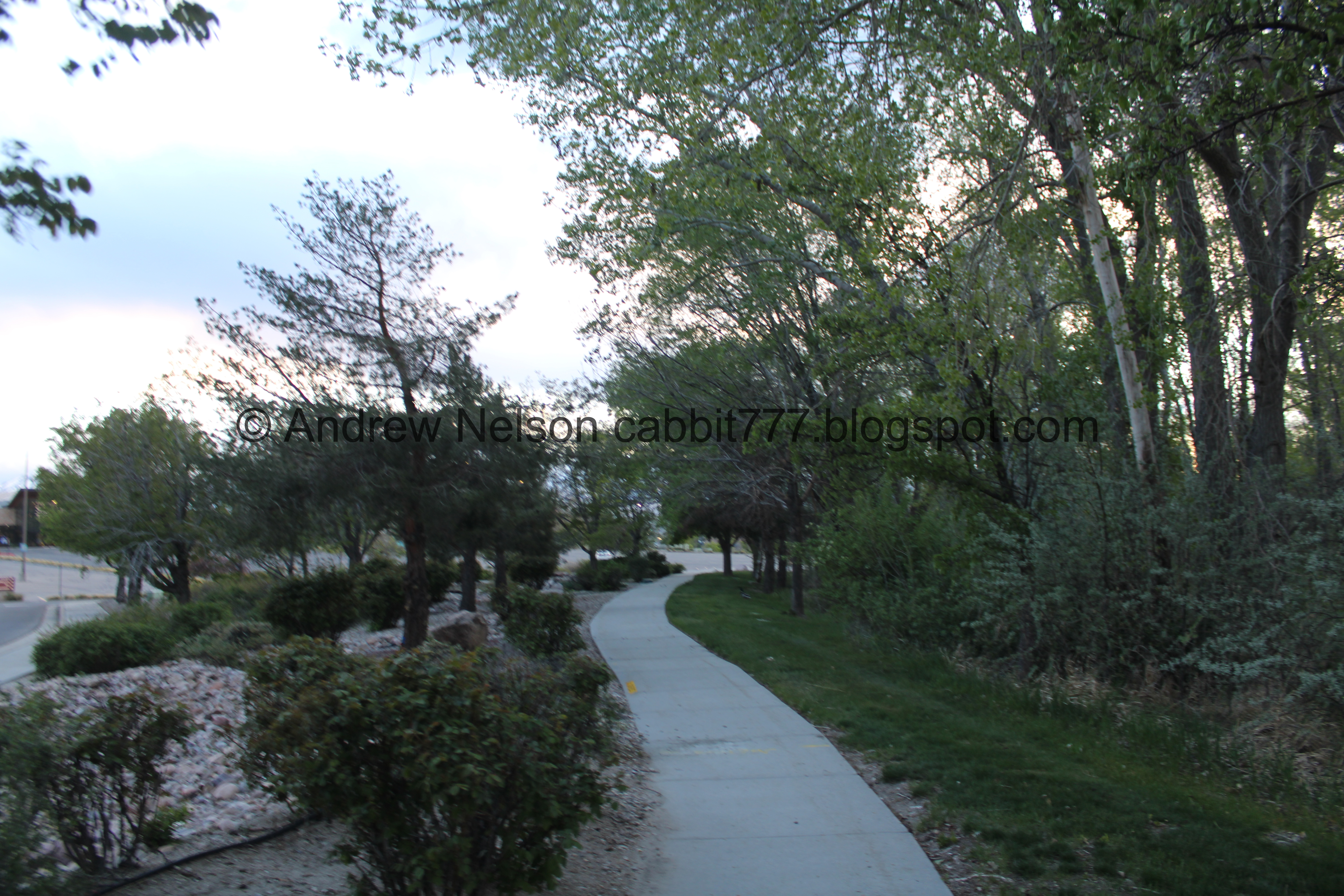
The sidewalk along the creek.

The creek again.

State Street. It looks like the creek is directly across from here, but I wasn’t about to try to Frogger my ass across State Street! The crossings north and south looked equidistant, I randomly decided to go north, which I did not realize at the time was absolutely the right option.

Following the creek north along State Street. Okay… maybe it didn’t go under the street yet?

Another little dam thingy.

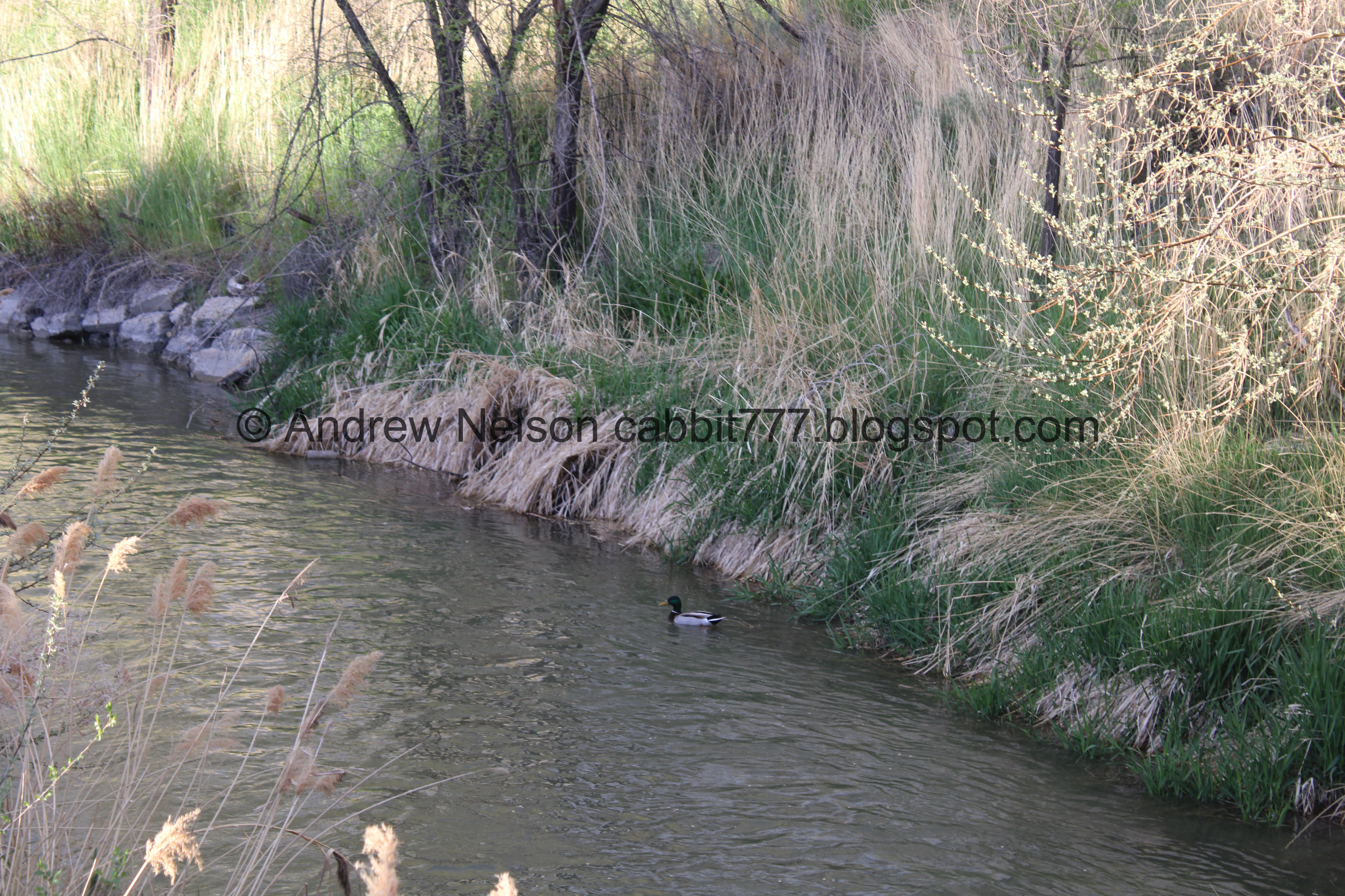
Duckies!

The Cairns. I need to look into it a little more, but from what I understand it is a planned idea to revitalize the area.

Another one of those odd bridges.
This is 10200 South and State Street. So hindsight being 2020, you want to cross both streets here. But, I was following the creek, so I just continued north for a minute.

Its pretty through here.

Then… what a second. The creek is flowing the wrong way here… what the heck?
Spoiler: It is no longer Dry Creek. Dry Creek and the Jordan and Salt Lake Canal played a little presto chango on me back at the previous crossing. But I took me a minute to really figure that out so I kept going for a bit.

Super pretty for a city street.

The canal, I still thought I was on the right track, even though it was flowing the wrong way.

Duckies.

Here the canal flows under State Street towards Memorial Lake Hills Cemetery and I really thought that this could not be right. So I pulled out my phone for like… the 5th time trying to figure out where I need to go and I finally noticed a street called Creek Run Way then I noticed the creek next to it. Okay, back the way we came. Only 460 feet off course haha. Again, this is what I get when I go random.

Back through the pretty section.
I didn’t take a picture of the 10200 South State Street crossing again.

Heading east on 10200 South.

On the other side I found the creek again. Hooray!

The creek.
I went back and forth as to which side I should go. I decided on right.

There is no sidewalk here. Just a dirt shoulder. But it is wide.

Quite faded ‘No Trespassing’ signs.


Which is a shame cause it looks pretty wild and pretty back there.

Continuing along the dirt shoulder.

Wait a minute…

I certainly did not expect to run across any deer today. Fun.

She is doing the typical ‘deer in the headlights’ thing.


The wild property again.

Dirt road across it.

Continuing along.

The East Jordan Canal.

The shoulder completely disappeared, but luckily it is not a busy road. Just a couple more feet to safer ground.

Moody clouds.

Tunnel under the Trax line. So, if you want the shortest route, go ahead and turn back here. I was exploring so I kept going.

Inside the tunnel.

Climbing up.

More moody clouds.

Milkvetch.

Well, now we are officially on the Porter Rockwell Trail. If you didn’t veer of course like I did, this should be just about a mile. Getting to Dimple Dell will be about another half mile, along paved trails at least. There is a dirt path somewhere around here that will be about 2/10ths of a mile to the bottom of Dimple Dell.
So at least for now, the sign at the beginning LIED!!!! Actually, I suspect that they might have plans to improve the trail, but just haven’t gotten around to it yet. Because, you know, government moves about as fast as molasses.
Also, there is no sign of the creek between here and Dimple Dell. It is definitely underground here.
It does emerge upstream in Dimple Dell, Where you can follow it all the way to Wasatch Boulevard. After that, Bell Canyon allows you to follow it the furthest.

Storms on the mountains. Oh, and I think that is the unpaved trail that leads to Dimple Dell to the south of a little gully that might have been the old creek bed (just a guess).

The creek to the west.

More storms.
.jpg)
Panoramic.

Continuing to the north.

More storms.

Looks like it might be clearing out.
.jpg)
Panoramic of the mountains again.

The Sandy City Dog Park.

Continuing north.

Almost missed the path to the east that leads to Dimple Dell/Porter Rockwell Trailhead.

Back to new paths. The tennis courts to the right appear to be being used as pickle ball courts at the moment.

Eventually I found a way down and across the Trax lines at the north end of the Sandy Civic Center Station.

Heading south again. I am still just kind of winging it, hoping I would find the other side of the creek.

Trax Train.

Along the apartment complex. This feels a little weird, but whatevs.

The mountains again.

Alright! This sign says the Dry Creek Trail is forward.

Gully below with the creek.

Into a wild area.

Little bridge.

Well, we are back to the East Jordan Canal.
Hindsight being 2020, if I had kept going, I would have hit 10200 South, and would have had a pretty strait forward route back…. but I was trying to find the trail. Which, again, hindsight, I don’t think exists yet.
Ducky!

The other side.
I turned back, and ran into another couple and asked them if they knew the way to go. They informed me this was their first time here, and they were just trying to follow the signs too. Oh boy.. okay, none of us know where to go. The signage here really freaking sucks.

Heading down this dirt road.

Before long it started to dawn on me that I was walking down the area that said No Trespassing from the other side (although quite faded). Crap… how did that happen?

The creek to the north.

Heading back up.

Storm in front of the mountains. Little Cottonwood Canyon center, Bell Canyon to the right. As I mentioned Bell Canyon is one of the sources of the creek.

Fun storm.

To the west.

Alright. Back to the apartment complex on the other side of the creek. I am still not sure where the main trail is supposed to be, but 3rd times the charm?

Looking back at where I entered the previous area that shows there are no 'No Trespassing’ signs that I missed. So… I don’t really know what is going on here. But, I have high hopes that maybe the city is working with this developer to expand the trail through here. They wouldn’t make signs without a better plan right? Right?

The gully with the creek below. There is a faint trail down to it, but uh… yeah that is a big no from me right now.

Interesting plant.

Skirting the outside of this apartment complex.

The gully below again.

Continuing along.

Brief view of the creek below.

Nice little forested section.

The creek again.

I decided to follow this thin path down towards the creek. Like I said, I was exploring!

Nice trees.

Continuing along.

Nice forest.

The creek.

The thin trail gets a little sketchy here so I decided to head back to the last split I saw which was not too far back.

Forest.

Eventually I found myself on the sidewalk along Creek Run Way, just below the apartment complex.

Dry Creek just to the left.

The creek before it goes underground again for a minute at 10200 South. Go ahead and cross it here to avoid the much busier crossing at State Street.

Fun clouds.

Old barn.

Fancy old barn with a cock on it.

On the other side of State Street. I didn’t take a picture but as mentioned, there is a light assisted crossing at 10200 South, so it is pretty safe, for a 6 lane road anyway.

Short section along State Street.

The creek is flowing the right way here.

Pretty trees.

Another one of the little wooden dam thingies.

Duckies.

The creek.

Storm clouds and virga.

Again.

The creek

The Jordan Salt Lake Canal.
Okay this solves some of my confusion earlier.

The canal crosses over Dry Creek here. Then it goes just a bit west, and parallels the creek until 10200 South where Dry Creek comes from underneath State Street, then the canal wiggles east.

Where the canal goes under State Street.
I sure am glad I decided against Frogger-ing across State Street earlier. I would have been a little mad when I eventually discovered I was following a canal. Yes, the irony is not lost on me.
Heading back into the mall along Mall Ring Road.

The creek. It was about here when I remembered I wanted to check out the other side, but I didn’t feel like backtracking again. I have done enough backtracking for one day. Plus, it was starting to get dark.

Ducky!

The creek again.

Maybe I did myself a favor because the other side looks like it might be a mess of desire paths, like the upper section, with no clear path along the creek.

Continuing along.

Moody clouds.

The mall.

Clouds.

The creek.

Back to the little park.

The creek.

The little park again.

More open space.

The west end of the park.

The little bridge.

Virga above the mall.

Downstream.

Upstream.

The far west end of the little park. This sign says the Jordan River Parkway is 1.5 miles from here. As far as I can see, there is no designated trail to that, But it is about 1.5 miles down 280 West (which used to be a road, but as of 2012 became a sidewalk) then 10000 South towards the Shields Lane Trailhead. It only follows the creek for another 2/10th of a mile though, before it goes under i15. Maybe I will check that out some day, but it doesn’t look super neat. But, it does appear to be more accurate than the other direction for now.
After flowing under i15 the creek flows through some private areas before it reaches Creekside Park, and then eventually making its way into the Jordan River below 9400 South at the Dry Creek Confluence.
I was going to add Creekside Park to todays adventure, but this took a bit longer than anticipated, so it will have to wait for another time. Plus, I think I might have seen some more area along this creek to possibly explore.
Anyway, this section of Dry Creek was surprisingly awesome! I absolutely did not expect the little park at the beginning. I honestly thought it was going to be a small creek along the malls parking lot, similar to what we did recently at the Former Cottonwood Mall. I was also surprised I could follow the creek up to the last known spot upstream, although currently a little… wonky. However, it looks like there is absolutely room to improve that section, so, crossing fingers. Currently, I found the trail to be lacking clear direction and signage though so I think I am going with 6 out of 10 squirrels.
As for difficulty, most of the trail is paved, some of it is not. Going with DR3.

Dogs are allowed on city sidewalks. Please clean up after your furry friends.
