.jpg)
The East Fork of Wheeler Creek is a nice trail following the upper east fork of Wheeler Creek through some lovely forests and valleys. There really isn’t much to this trail, so I think this time of year is the best time to do it and enjoy the incredible fall colors along the way. This trail can be done from the top down, as we did today, or from the bottom up, however that requires taking the somewhat scary Old Snowbasin Rd. We tried to do that a few months ago, but the trail was closed, so we ended up doing the main Wheeler Creek Trail that day. I was a little worried about starting at the top, and returning uphill, but this trail, well, at least what we did is pretty mellow so it wasn’t an issue. You have a couple options to make this a loop, including returning via the middle fork trail.

Quick Details:
Length: 3 miles one way or 6 out and back. We did 4 out and back.
Trail Type: Point to point, out and back, or loop options.
Difficulty: DR3. This was a pretty mild climb.
Elevation Gain: About 892 ft. We did about 600
Restroom: There are pit toilets at the Art Nord TH (lower) but none at the upper TH.
Dogs? Yes.
Other Info:
To Get Here:
Head up Weber Canyon. Take exit 92 for UT167. Go under the overpass and turn right. Follow the signs for snow basin with a left to stay on 167. Turn left on UT226. About 1.3 miles the pull out will be on the right. The TH is at the south end of the parking lot.

Oh boy the smoke and haze is really bad today. I hope the trail isn’t too tough (Passenger Seat Photography (PSP)).

Heading up Weber Canyon (PSP).


Some nice color (PSP).

Heading across UT226 towards Snowbasin (PSP).
The Trail:

The trailhead kiosk has absolutely no trail information. Also, at first glance it seems the trail starts to the left of it, which we ended up doing. But on the way up I realized the actual trail is to the right, at the south end of the parking lot.
Note: there is a sign that says Green Pond Trailhead. Which can be a little confusing, but the Green Pond Trail is across the street. This trail isn’t signed up here.

View from the trailhead.

Panoramic.

Heading down the trail.


Starting to see some great color.

Closeup.

A little garter or a small gopher snake.

More color.

Some of the aspens are even starting to turn.

I should probably add a warning. It’s the first good fall color hike, so there are going to be a lot of pictures of fall color haha.

Closeup.

That is an interesting bridge. The first of, many along this trail.


More color.

Trail split. We decided to continue down the East Fork trail. Now I need to come back and do the Middle Fork trail sometime. It appears to be shorter.


More color.

Closer.

Interesting crossing. I imagine its set up like this to allow water through. Considering the next segment appears to be a swampy area that seems to make sense.

Popped out of the forest into a clearing. But still have some lovely color.

Boardwalk. Must be a little swampy through here earlier in the year.

Little clearing.

Looking back towards the color.

Color across the way.

If you look really closely you can see a couple of deer hanging out over there. They are pretty far away and I didn’t bother with the telephoto lens for them, so don’t squint too much.

Looking back towards the peaks. The haze really sucks.

The East Fork Overlook. We stopped by there the first time we came up here.

The peaks again.

Panoramic showing all of the peaks above Snowbasin.

More color.

Back into the forest.

View of the Ogden Valley below. You can’t see it from here, but Pineview Reservoir is below that ridge.


Some aspens.

Colorful hillsides.

Some pale oranges.

When we did the Paper Airplane Trail, I discovered most of the trails around Powder Mountain were created by a mountain biking group. I wonder if the same thing happened here.

I love the reds!

Bridge number 2.

Found a random bench.

Another clearing.

More color.

Bridge number 3.


Aspens.


More color.

These are seriously the easiest switchbacks ever.

Bridge number 4.

Colorful tunnel.

Some nice orange.

Some reds.

Lovely mix of color.


Bridge number 5


More color.

Bridge number 6.

Looking back up canyon.

Bridge number 7. We were starting to joke that this is the trail of a thousand bridges. It was starting to rival Deuel Creek.


Loving the color.

What do we have here?

The telephoto lens was helpful here. We saw some wild turkeys.

Bridge number 8.

Pretty line of trees.

Now we have entered a wide clear valley.

Looking back towards the peaks.

The big clearing again.

Bridge number 9.

And number 10.

The big valley again.

Number 11.

The valley again.

Looking back towards the peaks.

We were starting to think about turning back, but decided to see what was across the bend.

The valley again.

Some more flowers hanging on.


Aspens.
We thought we could see the other end of the trail so we pushed on a little more.

More color.

Another valley, with the dry Wheeler Creek and some cows.

Well, what we thought was the other end of the trail turned out to be somewhat of a oasis effect. We decided 2 miles was our stopping point today but we pushed on a bit to the next corner to see more trail, and no evidence of the lower trailhead and called it. I am glad we did not push much further, as it turns out we still had another mile to go. If we had pushed on to that we would have been out after dark.

The ridge again.

Nice section.

Geranium leaves.

More color.


Back to the big clearing.

We found our turkey friends again. Not sure if this is the same flock, or a different, but likely the same one.


Oh my, there are quite a few of them. Definitely the biggest flock of wild turkeys we have seen.


Super fun. I thought I had taken a less zoomed picture of the entire flock, that had to be at least a dozen or so, but.. apparently not.

Patch of color.

I love getting a nice mix of color.


More color.

The mountains above.


Various fall colors.

The peaks above.

Nice big patch of reds and oranges.

More color.

Spent lupine.

More color.

\
Panoramic.


More pretty leaves.

The trail. Like it said, it seems to be built with mountain bikers in mind.

It also seems popular with horses.

Looking back down.


More color.

I’ve mentioned this before, but hiking pro tip, if you see this it means the rangers are trying to re-vegetate an old trail, and you should avoid it.


More color.

I can start making out a little bit more than just the silhouettes of the mountains.

Closer.
Panoramic.


More color.

Back to the boardwalk. Almost done.

Pretty.

Back to the trail split.


This is a particularly colorful section.

Holy giant hornet nest Batman!


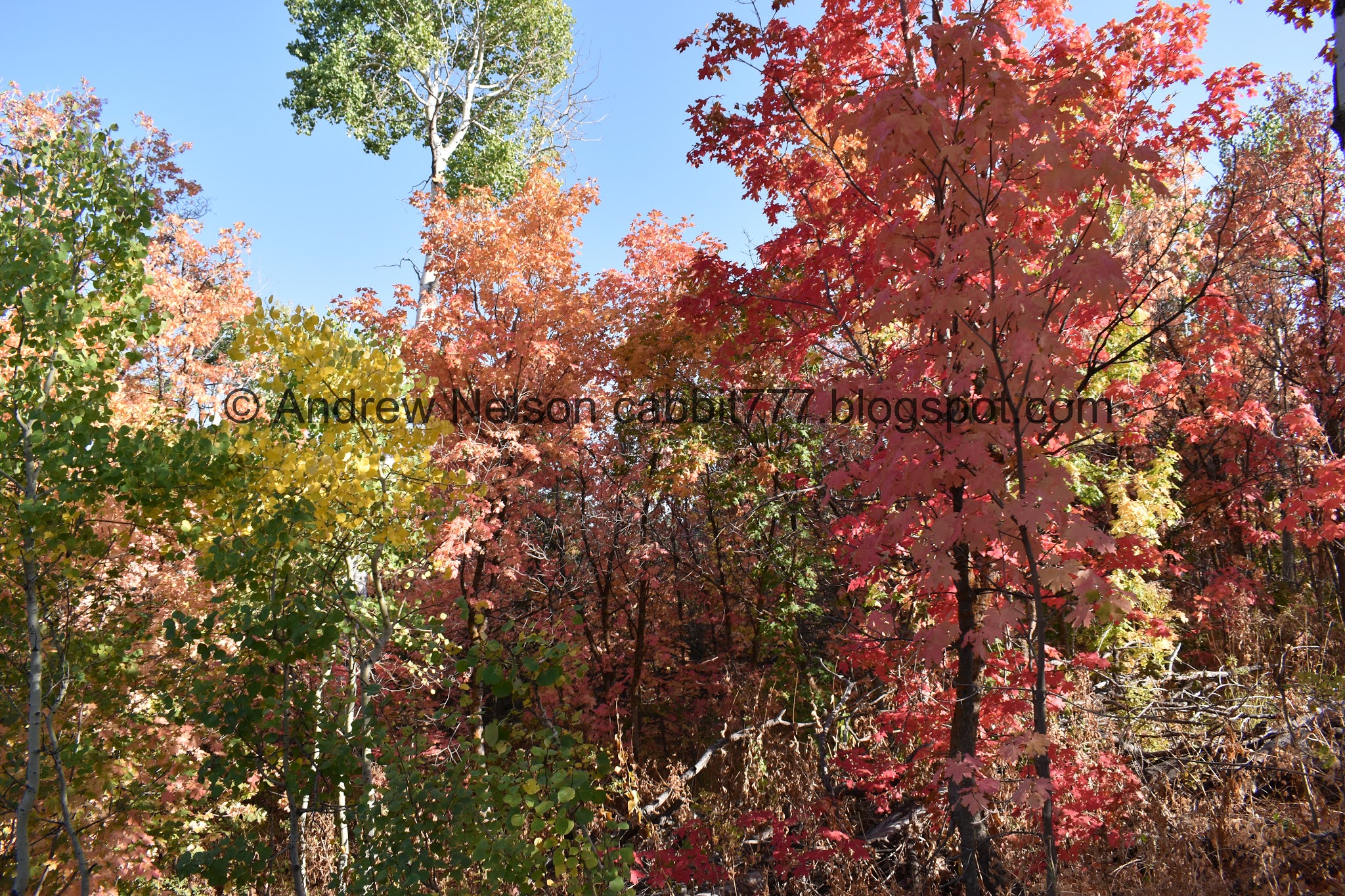
I love the vibrant reds, but I love getting a nice mix of color more.


It happens every year, but it is still just magical. The prime window is so short, that it almost feels alien walking around in it.


Back to the parking lot with the view.

Panoramic.

Some more color.

The peaks above again.

Heading down Weber Canyon (PSP).

Terrible shot of these water towers that I had never noticed before on HW89 (PSP).
That was a lovely hike with some great fall leave peeping. The trailhead was very busy, but there are a couple trails that split off from here, I think the majority of people were heading towards Green Pond, because we did not run into very many people at all, which is always a plus right now. I also enjoyed the various wildlife we say today. This trail was great with the fall color, and might be enjoyable during spring run off, but I can’t imagine enjoying it in the summer. Going with 9 out 10 squirrels.

As for difficulty, I was a little nervous with starting the trail at the top, but this one isn’t bad at all. DR3.
Dogs are allowed.
