.jpg)
The Albion Meadows are stunning meadows located above Alta in Little Cottonwood Canyon. This time of year the meadows explode into a riot of beautiful wildflowers, over 120 species! A couple of years ago Alta added a new trail from the Catherine Pass trailhead, down to the main meadows trail. The trail is almost exactly a half mile and you have several options to make it range from about a mile to what we did today.
We were just here last week, but the wildflowers were looking great, and I have been wanting to try the reroute for a while so we’re back.
Note: I was so fascinated by the flowers today that I uh, didn’t take many trail photos.

Quick Details:
Length: This loop is about 2.3 miles (we added a short spur) making it about 2.6
Trail Type: Loop, with shorter loop options, Balloon option, or out and back..
Difficulty: DR3, there is some climbing but not to bad.
Elevation Gain: About 440 feet.
Restroom: Yes, pit toilets at the trailhead(s).
Dogs? No. Little Cottonwood Canyon is watershed.
Other Info: There is a $10.00 fee to use the Summer Road. Also: the trail starts at the top which can be tricky for inexperienced hikers.
To Get Here:
Head to the top of Little Cottonwood Canyon. Stop by the ranger station and pay your fee. Continue up the Summer Road for about 1.6 miles to the Catherine Pass trailhead. Then hike down into the meadows.
Alternately, you can avoid the fee by parking at the Albion Base and hiking up from there. I have not done that to the reroute yet, but I would wager it is about the same distance as the original trail of about 3 miles out and back.
Lastly, if the shuttle ever returns you can also use that. It was killed in 2020 due to Covid, and has yet to return.

Heading up the canyon (Passenger Seat Photography (PSP)). Looks like we might get rained on.

Heading up the Summer Road while definitely getting rained on (PSP).

Well hello cutey (PSP). Get out of the road!
Lucky for us it was a quick summer storm. We waited it out in the car for about a minute and it passed.
The Trail:

From the parking lot you will head down the hill into the meadows.

The flowers appear to be starting to fade, but maybe these late summer storms will give them a little push.

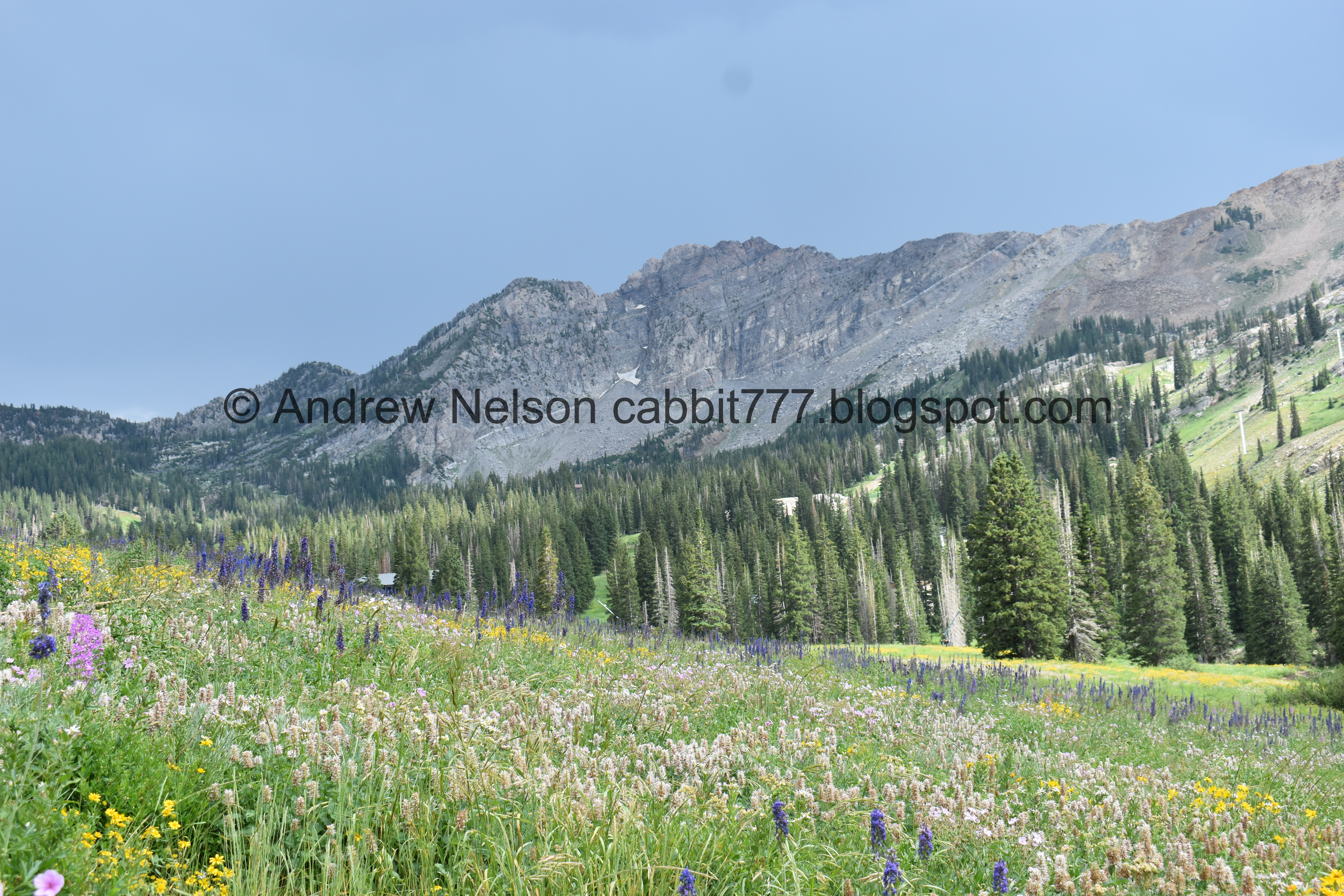
Devils Castle and Sugarloaf Peak.


Larkspur.

Nice little mix.

Some mint under the peaks.

Another nice mix.

The peaks again.

Another mix.

More larkspur.

Loads of them.

With the peaks.


Some nice mixes.

Some daisies.

Some kind of mint.

More larkspur.

Greeley Hill.

Another nice mix.

View across the canyon.

They have installed these wonderful little pull outs so that you can take a picture of someone amongst the flowers, without trampling any.

They work quite well!

While also offering a nice view.

Larkspur and peaks.

Lots of larkspur up here today.

Western coneflower.

Larkspur and coneflowers.


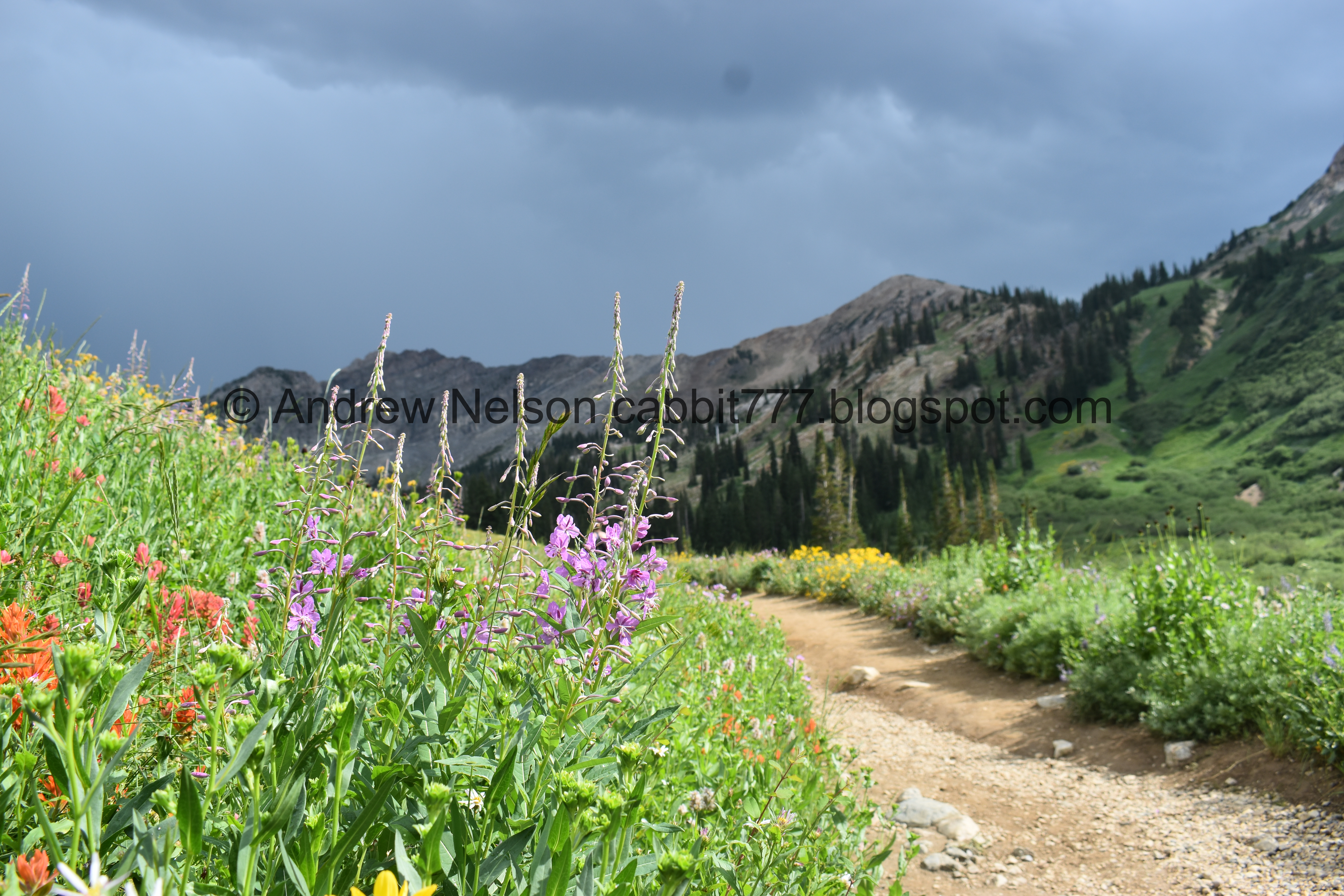
Some paintbrush.

More larkspur.

With the peaks.

Colorful hill and looking towards where we parked.

Another one of those photo pull outs.


Pretty meadow. And I believe that is Katherine Pass up there.

More paintbrush.

Devils Castle and Sugarloaf Peak again. Little worried a new storm is coming in.
By the way, have you ever been in a mountain cirque and hear a clap of thunder? Holy crap all the surrounding mountains amplify it tremendously.

Fireweed. One of my favorites.

Paintbrush.


More larkspur.

Lupine.

Geraniums.

The hillside again.

Nice mix.

The hill below.

Larkspur and peaks.

Random abandoned tripod. As a photographer I thought, how can you just abandon your tripod man? Then I remembered the crazy summer storm, and well, yeah, I can see that happening. Hopefully they came back and collected it.

Lovely mix of larkspur and arnica.

More geraniums.

Peaks again.

More larkspur.

Larkspur and fireweed.

Nice mix of color.

Stunning hillside.

The other direction. It is just stunning up here today!

Lots of larkspur.

Fireweed, larkspur, and mint.

With the peaks.
Devils Castle.


Colorful hills.

Fireweed.

Eventually we hit the main upper trail. You can go either way, we went right.

Looking at the colorful hills below the trailhead.

Some nice color.

Different shades of paintbrush, and oh snap, I caught some white ones! I wish I had noticed that, I would have gone in closer.

But here is a little crop. I follow a local wildflower group (don’t judge me haha) and someone posted some white paintbrush earlier, and I’ve been obsessed ever since. I am so glad I got a pic myself, even if I didn’t notice it in the moment.

Nice mix.

Field of arnica.

My brother thought an animal bedded down here, and while I agree that is a possibility, I thought it was trampled by thoughtless humans. I guess I have just seen so many humans not respecting the trails.

Different shades of paintbrush.

Fireweed, paintbrush, and mint.

Lupine.


Colorful hillside.

Color.
Fireweed and peaks.
Getting a little concerned we might get rained on.

I love the deep red ones.

Lupine.

Fireweed.

View down canyon.

The main upper trail is quite rocky.

There was a large group standing at the split so I didn’t get a shot of it, but it is across from this rock outcropping, and just before the main trail curves to the right. So, that is where you connect to the lower trail.

Normally we would take this trail up, but we wanted to continue out to the creek.

Old microwave tower.

Lupine.

Arnica.

Devils Castle and Sugarloaf Peak. Plus a view of the lower trail. It is a lot less rocky and a more gentle climb.

Paintbrush.

Geraniums.

More arnica.

Snow machine.

Big patch of fireweed.
With the peaks.

The view down.

Some kind of daisy?

The upper and lower trails aren’t super far from each other. Also, my brothers are not as interested in stopping to enjoy the sights as I am, and are having to constantly stop and wait for me.


More arnica.

With the peaks.

Colorful hill.

Mine tailings with a little deer.

More flowers.

Greeley Hill.

Gloomy skies.

Paintbrush.

Daisies.

Little gulley with Little Cottonwood Creek.
Now that I have done it both ways I think I prefer going up via the lower trail. Which is kind of confusing since both trails are the Upper Albion Basin Trail. Maybe I should refer to it as the south trail.

Lovely forest.

Uhg, again I failed to get a shot of the trail split. But you can take the split just before here for a shorter balloon option, which was my initial idea for the day, or, you can continue up to Alf’s and head left and make a shorter loop by heading up the service road. We kept going and made the longer loop today, cause my brother wanted a little variety. Ultimately, yeah it is a little longer, but I think it is the more mild climb.

Devils Castle.

Potgut.

Forest with a little deer.

Off she goes.

Daisies, I think.

Big patch of lupine.

With some paintbrush.

Little waterfall.
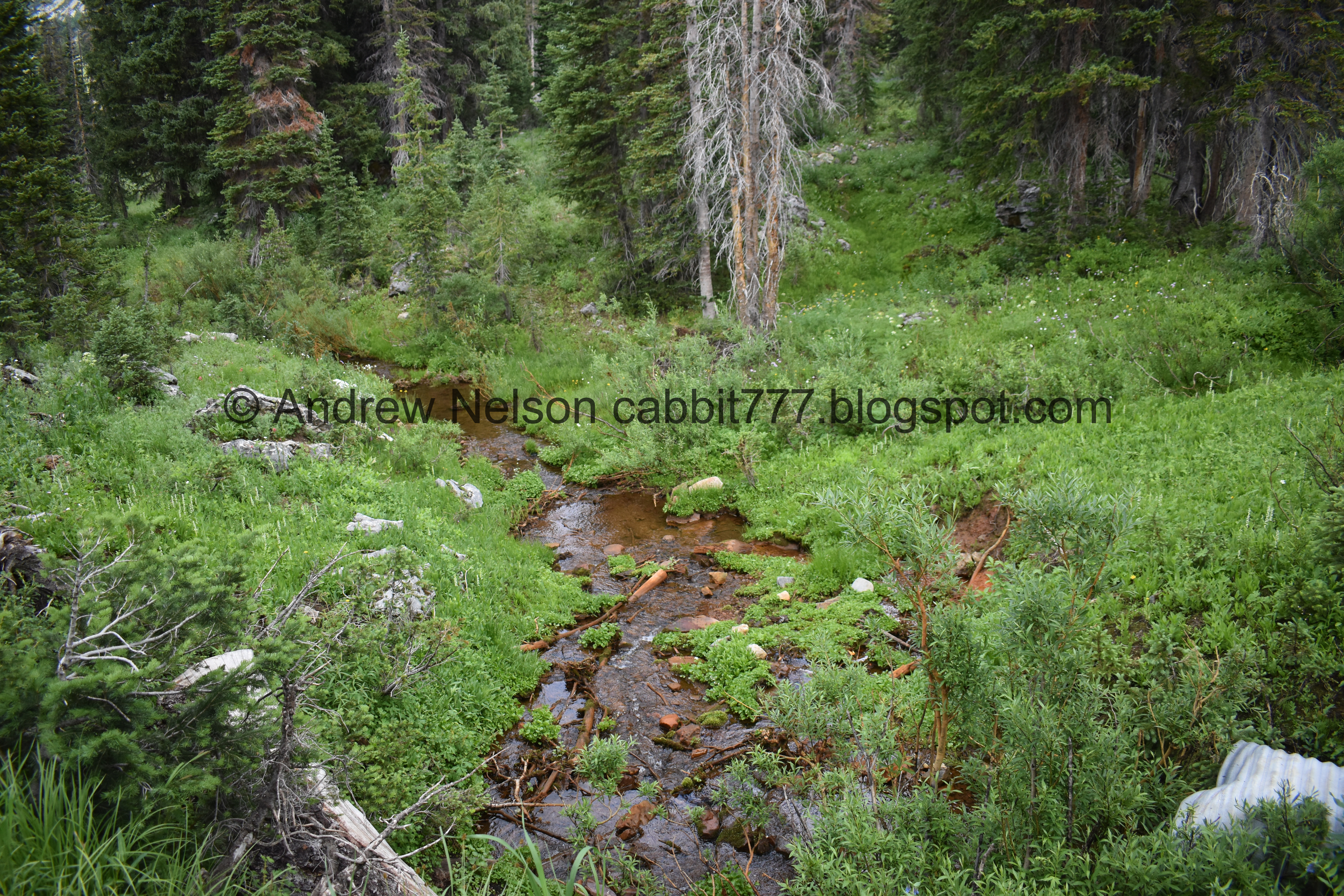
The creek again.

White bog orchid.

Columbine.

Monkshood.

Sugarloaf Peak above a spring.

Paintbrush.

Pretty trees.

Elephant heads.

More paintbrush.

More monkshood.

We made it up to the Cecret Lake trailhead.

We took the new Catherine To Cecret Connector trail to get us back to the Catherine Pass Trailhead.


Another good batch of lupine.

Huh. I have never heard of such a thing as a bearing tree. Unfortunately, all the info has faded, so I don’t know what year this was put up. But I did find it to be pretty interesting.
Looks it has something to do with borders between the forest and private property.


Tiny little creek with a bridge.

There are 4 or 5 additional small draining ditches that they used rocks to allow water through and still make it walkable. And yes, we are being ever so lightly rained on.
Eventually you will hit the Summer Road, go left, and then immediately take the next left to the service road.

Looking back towards Devils Castle.

Devils Castle and Sugarloaf Peak.

Colorful hill.

Paintbrush.

Forest.

Looks like this smaller storm is breaking up already.

Fireweeds with Greeley Hill.

Before long you will reach the 2nd part of the new Catherine to Cecret Connector, which will take you back to the trailhead.

View across the canyon again.

The peaks again.

Jacobs ladder.

More larkspur.

Nearing the trailhead. It’s a pretty gentle climb.

Mint.

More geraniums.

Larkspur.

Greeley Hill with the trail up to Germania Pass, one of these days I will check that one out.

The peaks again.

More mint.
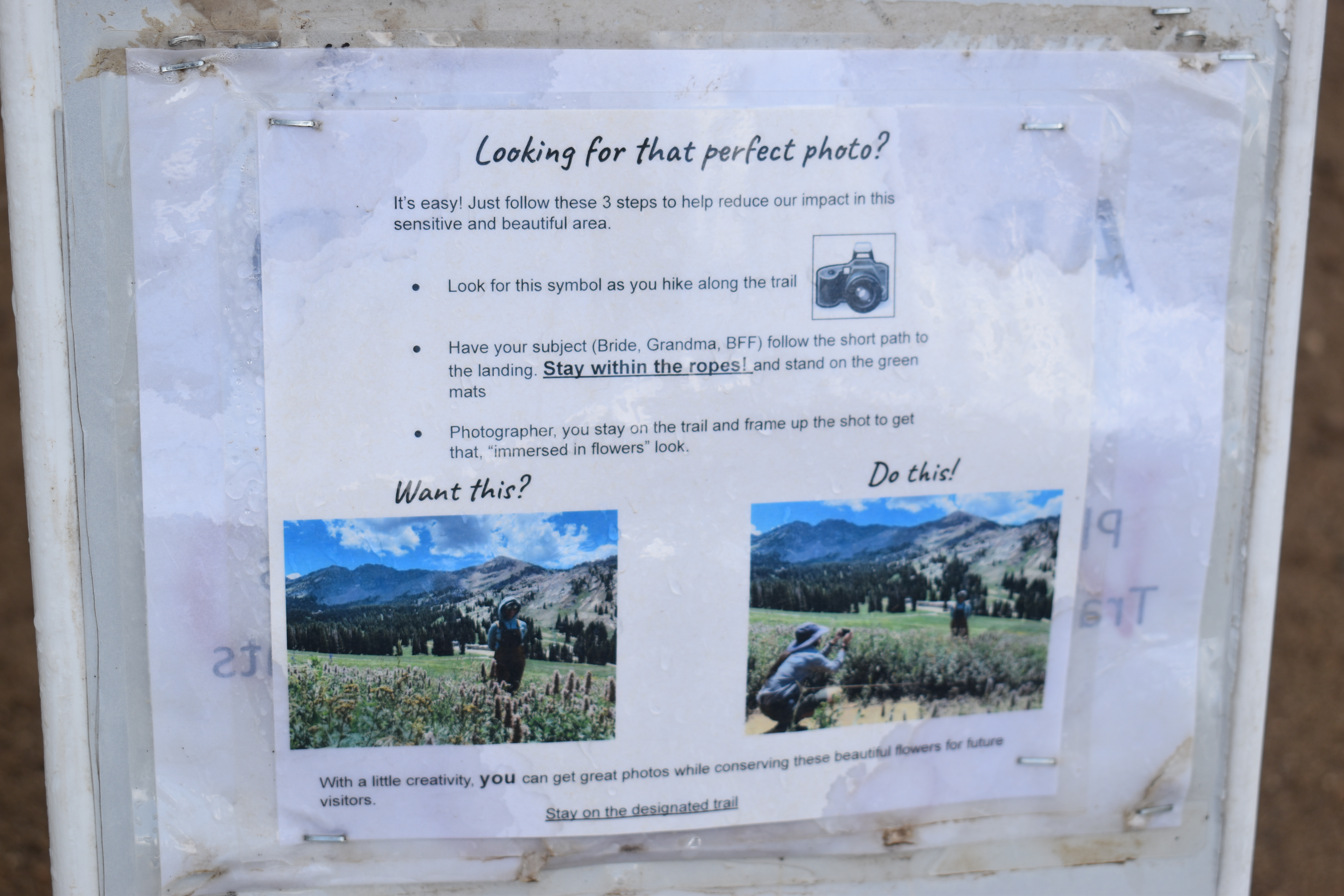
Oh! i didn’t notice this on the way down, but it talks about using the new cutouts to take pictures instead of trampling the wildflowers.

The final steps back up to the parking lot.

Heading back down the Summer Road (PSP).

Moody clouds above the basin.

View down.

I almost always take a picture at this spot heading down that shows the perfect U shaped canyon (PSP). It’s one of my favorite sights!
Well, now that I have finally done the reroute, I think it is the easiest and best way to experience the amazing wildflowers up here. And I confirmed it is a little easier to go up the south trail. The rain scared a lot of the crowds today so it wasn’t too busy. 9 out of 10 squirrels, losing 1 for the fee.
As for difficulty, the loop we did was pretty easy going. DR3.
Dogs are not allowed in Little Cottonwood Canyon, so be sure to leave Fido home.
