.jpg)
Rocky Mouth Waterfall is a fantastic little waterfall located in a narrow canyon in Sandy. The trail is super short, but is definitely a climb! It features a fantastic waterfall, a creek, a couple caves. Unfortunately, since it is such a short trail, it is quite popular with families with little kids. I always tend to forget that fact when I decide to do this trail again. I have been hiking to this waterfall since I was a kid, and would just call it my waterfall before it was officially named, or at least before I learned of its name. I used to drag anybody who was willing to come to it with me.

Quick Details:
Length: 8/10ths of a mile out and back. Plus what ever wandering you might do.
Trail Type: Out and back, future connector.
Difficulty: DR3. It is short, but it is a climb!
Elevation Gain: About 300 ft.
Restroom: No. Closest one I can think of would be at Big Willow Park to the south.
Dogs? No. This is within the watershed boundary.
To Get Here:
Take i15 to 90th s. Head east. Turn right on Wasatch Blvd. Look for the trailhead on the left. At 11250 South Wasatch Blvd.
The Trail:

Neat trailhead sign.

Trailhead kiosks.

The stairs of doom. There are 81 steps if you were curious.

Then you have to walk along the neighborhood for a little ways.

Looking into Rocky Mouth Canyon.

New switchbacks. They are working on connecting this canyon and Big Willow Canyon via the Bonneville Shoreline Trail. I think it might be done, but I am not sure.
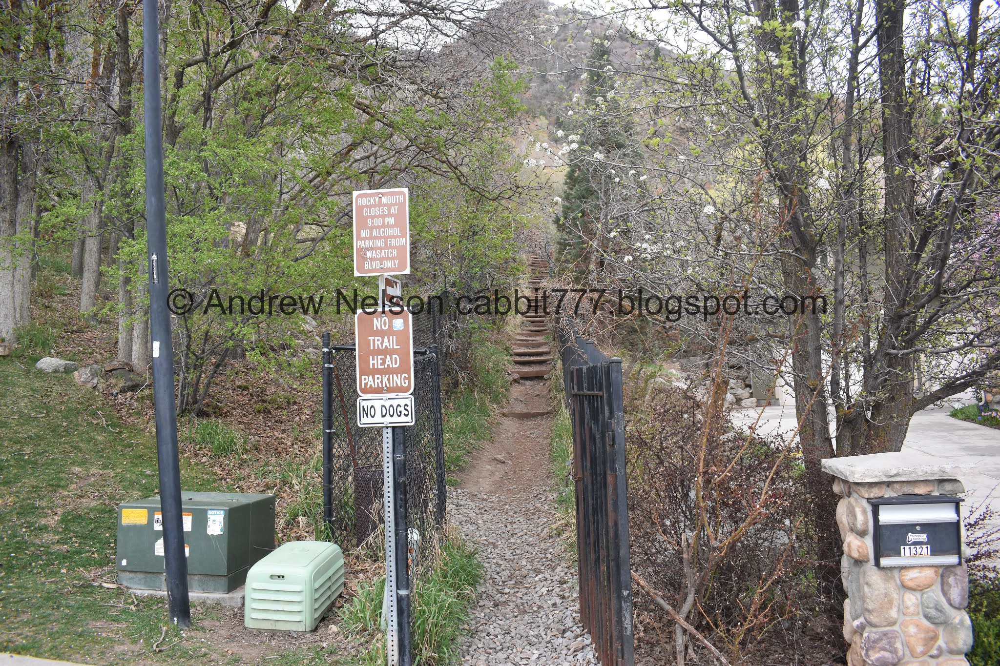
The original trailhead. I guess parking on the road became a problem for the residents so the new trailhead below was put in.

More stairs, oi. These are more for erosion control rather than assistance.

View down. And you can see the Kennecott Copper Pit across the way.

Phew! A little break from the climb.

The Bonneville Shoreline Trail. As mentioned this will lead to Big Willow Canyon. I am unsure if it is complete or not yet.
There is a good portion of the BST between Parleys Canyon and Draper that is not completed yet, but they are working on it! There are a couple spots that I am particularly interested in seeing completed.

The canyon again.

The bridge to cross the creek along the BST.

The creek again.

Forest.

The first little cave.

More forest. This is fairly similar to Waterfall Canyon.

First glimpse of the waterfall.

Second little cave.

Almost there.

After waiting for a family to get their pictures we were finally able to see the waterfall.

Its a neat waterfall! However it is particularly neat during run-off.

The lower tier.

Bit of a long exposure.

The lower tier again.

The upper tier.

The middle.

The top.
I just love this waterfall.
There were a few other people up here so I didn’t want to monopolize the waterfall, so we started to head back.

The upper cave. If my memory serves me correctly, this used to be deeper, but they sealed it off.

The creek below.

Decided to climb down to it.

Looking up.

The lower cave again.

Guano?
While I was dinking around we noticed one of the big families had come back down the trail, so I decided to go back and see if we had could have some more time with the waterfall.

Success! There was another family up here, but they had decided to hang out along the cliffs and have lunch or something. So we had some more time with the waterfall.

So pretty.

Waterfall.

The tippy tops.

The full thing again.

The lower tier again.

.The main drop.

Longer exposer.

Final parting shot.

View down canyon.

Some desert parsley.
I am a little surprised we didn’t see any glacier lilies though here. Maybe not high enough.

View down.


Turkey vultures.

Antelope Island off in the distance.

Back to the steps of doom.

Back to the neighborhood trail.

Neat old mining cart. Considering the upper cave looks like a mine that seems rather appropriate.

Back to the stairs of doom!
It’s a super short trail, but I just love it, mostly for the nostalgic value, but also, it is just a great waterfall set amongst some pretty cliffs. The wildflowers are starting to come up, but no blooms just yet. Like I mentioned, because it is so short it is popular with families with kids which can be a bit of an annoyance. Even considering that, it retains the 10 out of 10 squirrels.

As for difficulty, This one is a climb! but, it’s only 4/10s of a mile so we’ll keep it at DR3.
Dogs are not allowed due to this being within the watershed. So please keep Fido at home.
