.jpg)

Quick Details:
Length: 1.8 miles to the springs using the trail. About a 3.8 mile loop.
Trail Type: Out and back, loop or balloon options.
Difficulty: DR4. For the most part is is a gentle climb, with some more up sections, but it’s a constant up.
Elevation Gain: About 850 ft.
Restroom: There are flush toilette's at the trailhead.
Dogs? Yes, leashed.
To Get Here:
To get here, take i15 to exit 272 in Provo. Take that to Provo Canyon (stay in the left lane to get into the canyon). Head up the canyon past Bridal Veil Falls (if you haven't seen it, stop. It is an AMAZING waterfall and I believe it to be the tallest in Utah. Continue up the canyon to Vivian Park (about 5.4 miles from the mouth of the canyon) and take a right on South Fork Rd. Continue up the road for 3.3 miles. turn right at the National Forest Access sign and then it is .2 miles up to the end of the park to the upper parking lot.

I love the view of Cascade Mountain as we head towards Provo Canyon (Passenger Seat Photography (PSP)).

Heading into Provo Canyon (PSP).

Bridal Veil Falls (PSP). Definitely worth a stop.

Heading up East Fork (PSP). It’s a little thin and windy, but go the speed limit and its fine.
The Trail:

The beginning of the trail.

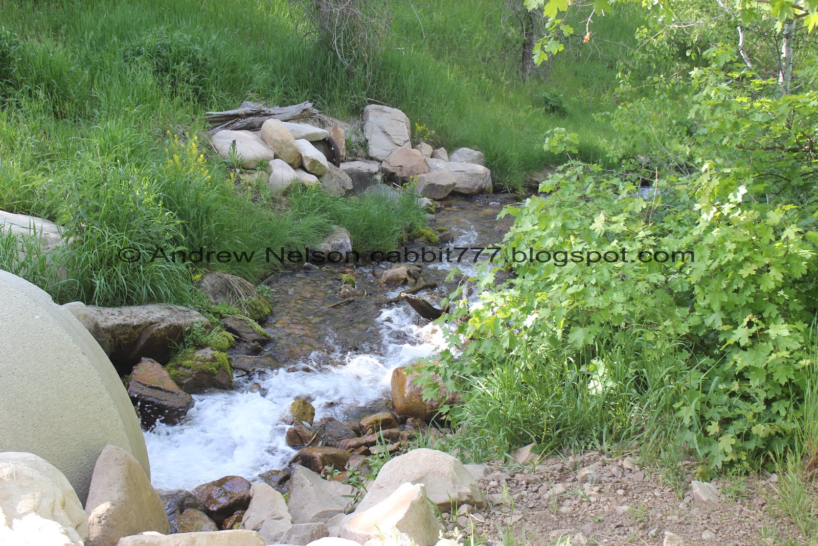
Following a nice creek.

Before long you start getting glimpses of the back side of Cascade Mountain.

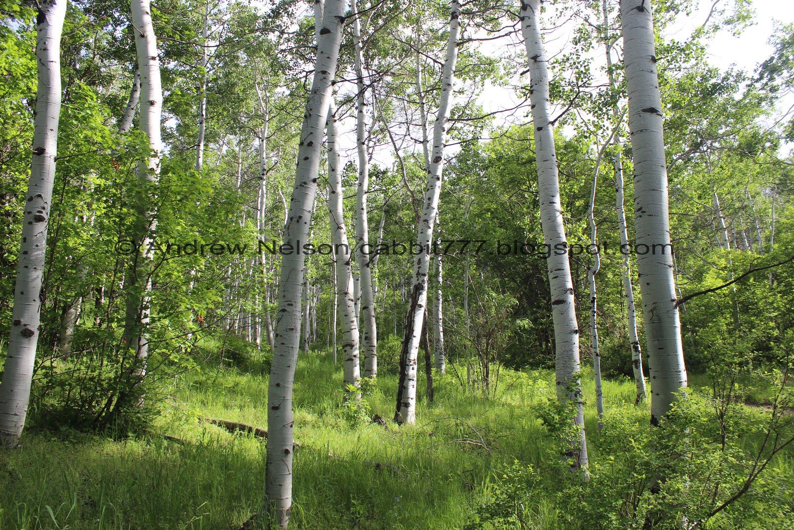
Pretty forest.

Random little rock lined sapling.

The first little bridge.

It seems a little ridiculous considering the tiny little stream it crosses.

The 2nd bridge.

This one crosses the main creek.


Lovely forest. There is plenty of shade on this trail.

The 3rd bridge.

Lovely little cascade.

Nice clear water.

Loving the forest today.

One of the many springs you will see up here.

4th bridge.


Lovely forest.

The big meadow. This is probably the only long segment without any shade. But it does offer a lovely view of Cascade Mountain.

It is a pretty meadow.

Looking back.

Very fragrant flowering tree.


Back into the forest.

Bridge number 5? 5.

Also a little silly.

Where 2 springs discharges meet.

The main creek.

This is currently the exciting big spring on the trail.

I love the flowers growing in it.

The top.
Crossing the main creek again. Not so much of a bridge as a buried pipe.

At about 1.5 miles you will come to the road/trail split. Both will get you there, the road is just a smidge longer. Usually we take the trail to the left, today we decided we would hike up the road from here.

This is the 2nd sign I have noticed this month that has had the top broken off since the last time we passed through. Weird. They were both old signs, so I am hoping natural wear and tear, and not vandals. This one looks like someone has tried to save what they could of it and re-secure it. It used to read: Big Springs Trail <-- --="" .5="" cascade="" m.="" saddle=""> 4.1 miles.

The road is plenty wide, and still offers a lot of shade.

The creek below.

Beautiful tree lined path.

Little waterfall behind this diversion dam.

From the side.


More pretty forest. Have I mentioned how much I like hiking in May?

We reached the Provo School District: Camp Big Springs. They do something special at one (or more?) of their schools and 5th graders go on a special field trip to put some of their science lessons to test out in nature. I think that is pretty cool. I previously assumed this was a scout camp.

.
Fun amphitheater.

A big ol raven.

The creek again.

Mossy rocks and the next stream crossing.

The road gets a little fainter through here, but still easy to follow.

A little bit of Cascade Mountain above the trees.

Keep an eye out for the next fork. You will take the thinner trail to the left just beyond this sign.
Also, I had no idea this hollow led to Rock Canyon on the other side of Cascade Mountain. That is kind of fun.

Trail split. This last section is wonderful.

Pretty flowers.

Pretty.

The trail is a little thin through here.

Boardwalk.

One of the remaining springs.

It starts just on the other side of the boardwalk.

Cow parsnip.

We made it to Big Springs. As you can see the city has capped them off.

Fun clouds.

One of the springs below is flowing. I wonder how many springs are actually up here.
Well, unfortunately a couple groups were already here and I didn’t want to get too close to people. I suppose if we had waited them out we might have been able to do a little more exploring, but we just decided to just head on back.


It is super pretty up here.

Pretty flowers.
More lovely forest.

Back on to the main trail. With a view down canyon.

Back down to the campground, there is a nice little waterfall. I noticed that bridge over the top of it, so a little exploring was in order.

Crossing over the creek.

We found some steps built in.

The little side stream.

Looking down the little waterfall.

From below again.

I somehow never noticed before that there is another spring in the campground.

Source.

Continuing down the road.

I really do love this time of year.

The creek again.

Pretty forest.

Back down to the trail/road split. I was fairly confidant that the road would get us back down to the trailhead. So, on a whim we try it out. I figured we are in a hollow, so as long as the trail doesn't start going uphill, it should get us where we need to go.

These are one of my favorite butterflies. They are wee, and they look fairly plain when they are closed, but then they open up they are a gorgeous blue color. Unfortunately I didn’t catch that today.

Here’s one from a trip up Big willow Canyon.


Its actually really pretty going down the road.


Some lovely wildflowers.

More forest.

Run off from another spring.

Looking across the hollow.

I don’t think the road would be the better way to come up. It seemed more steep than the trail.

Caterpillar nest.

Eventually we hit the big meadow, so I was feeling more confidant the road doesn’t stray far from the trail at all (it really doesn’t).

Looking back towards Cascade Mountain.


More forest.

Don’t forget to look up once in a while.

I swear I have seen one of these structures on just about every trail we have done this year. What are they? Why do people build them?

More forest.

We even get to see the creek.

Neat peak.

We made it back down to the parking lot. There is a short, slightly steep side trail that is a more direct, or you can keep following the road. It’s pretty obvious.

Heading down East Fork Canyon (PSP). Nice view of Mount Timpanogos.

Crossing over Provo River (PSP).

Back down Provo Canyon (PSP).
While I am still a little upset the city decided to destroy the main feature of the trail, I still really enjoy doing this trail. And it was exceptional in May. Beautiful forests, flowers, the creek is so clear. The remaining springs are lovely, and I always enjoy a good waterfall, no matter how big or small. The park and beginning of the trail was very busy, but not too far up it wasn’t very busy at all. We were also able to safely social distance most of the way so that is a plus. 9 out of 10 squirrels.
As for difficulty, Its a general easy incline, but it just keeps going. The road seemed worse. Going with a DR4.
Dogs are allowed, leashed. Please clean up after your furry friends.
