.jpg)
Waterfall Canyon is a pretty canyon located in Ogden that features, as you might have guessed, a waterfall. A huge 200 foot or so high waterfall. In the warmer months it is typically a trickle, but you might occasionally catch a great waterfall during run off after a good winter. In winter though, that trickle of a fall builds up a pretty spectacular frozen waterfall! It’s a little bit of a tougher trail, but it is worth it for the end result.
We got ourselves early Christmas presents, some micro spikes that were made by and for the same brand of boots we have. So, after a mishap with the cheap micro spikes we had here in Waterfall Canyon last winter, I thought what better place to test the new ones out in?
Quick Details:
Length: About 2.8 miles out and back.
Trail Type: Out and back, loop with spur options.
Difficulty: DR4. This is a lot of up!
Elevation Gain: About 1100 ft.
Restroom: Yes, however they are closed in the winter.
Dogs? Yes, leashed.
Other Info: Micro spikes or better strongly recommended in winter. It is steep, and icy.
Also: This trail is mostly on private property, and the owners have continued to allow people to use the trail. Please respect their wishes and keep out of the signed areas they wish to keep private. Also, please help all of us to continue having access to this trail. Treat is as you would want people to treat your yard. Don’t litter, pick up after your dogs, don’t graffiti, etc.
To Get Here:
From the south, the easiest route is to take i15 north to i89 in Farmington. Take i89 all the way through Davis County into Ogden and turn right onto Harrison Blvd. Take that to 30th St and turn right. Take the 1st left onto Tyler Ave. Then right on 29th st. Follow that up to the top and turn right into the 29th St. Trailhead.
Or take i15 to 31st st. turn left onto Harrison Blvd. Take that to 30th St and turn right. Take the 1st left onto Tyler Ave. Then right on 29th st. Follow that up to the top and turn right into the 29th St. Trailhead.
From the north, take i15 to 21st S. Take that to Harrison Blvd. turn right. Take a left on 28th St. Turn right on Tyler Ave. Left on 29th St. Follow that up to the top and turn right into the 29th St. Trailhead.

The pretty snowy mountains while we head north (Passenger Seat Photography (PSP)).

HW 89 is still a bit of a mess, but it is officially traffic signal free from Farmington to Weber Canyon (PSP). Traffic moves through here a lot more quickly now.

The South Ogden water towers (PSP).

I love this old “Welcome To Ogden” sign (PSP).

29th St. Trailhead sign (PSP). I feel like this is new.
The Trail:

Trailhead kiosk.

You want to follow signs for the Bonneville Shoreline Trail (BST).

Deep deer tracks.

This trail is quite popular and has already been packed down by some snowshoers.

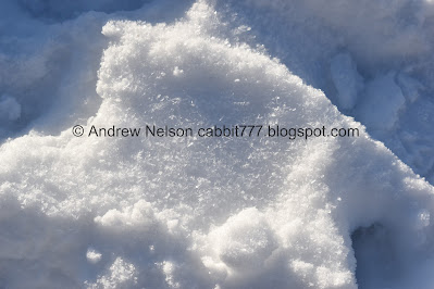
Interesting patterns in the snow on this steep hill.

A view across the Ogden Valley. Little hazy today.

At about 2/10ths of a mile you will reach the BST. Head right.

Looking back towards Ben Lomond. Also, the BST will take you to the 27th St Trailhead and beyond. You can also make a loop with the BST Scenic Route if you want.
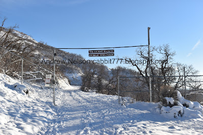
Not much further up you will reach the TR Guest Ranch property. Like I said, here is where you really need to treat the trail with kid gloves. Please do not be the reason they close it to the public.
Hoarfrost.

Continuing up along the old dirt road.

Scrub oak up on the hill side.

Looking back towards Ben Lomond.

The valley below again.
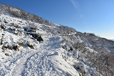
More of the climb.

Mount Ogden.

Hazy day today.

Panoramic view of the valley.

The old water towers. If it is not immediately obvious, these are definitely not the same ones we passed on the drive in.

Heading around the corner.

Officially in Waterfall Canyon.

Closer view.
Creek below.

Where the BST Scenic Route connects back to the BST. The other end connects back at Taylor Canyon. This time of year you can find the BST Christmas Tree along that path. You can also use it to make a loop if you want.

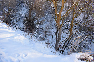
Snowy forest.

The lower bridge. As you can see, some people opted to bypass it. I would guess people with those big snowshoes.

The creek.
Trail split. The BST continues to the right, south towards Strongs Canyon. Forward is TR Guest Ranch private property. You want to go left to continue up the canyon.

Old wooden pipe.

Some old structure with icicles.
Guess I didn’t get a pic, but the middle bridge is here. Now the climb gets a bit more steep and rocky.

Icicles growing out of the cracks in the rock.

More snowy forest.

Hard to see with the snow, but it is a little steep and rocky through here.


More icicles.

Another steep climb.

Nearing the top of the first climb.

More icicles.

View down.

More snowy trees.

The creek again.

You get a little bit of a break from the climb through here.


The creek again.

Pretty snow laden trees.

Pretty forest.

Fun tree tunnel.

Fun snowy trees.

It’s just a winter wonderland up here.

The creek again.

Then, the creek is almost dry. I was a little confused at first until I remembered that the creek comes down the trail through here.

Little glimpse of that.

Striped rock.

View up canyon. Almost there.

Cliffs above.

The other side with a rock slide.

Some of the rockslide down on the trail.

Starting to get a glimpse of the waterfall.

I love the little windows in the snow on this branch.

Getting closer. I call this Dr. Seuss Peak, because it is weirdly curved like the peaks in his book.


The upper bridge, which absolutely nobody is using right now.

The creek again.
I didn’t take any pictures, but the final climb is quite the doozy. Particularly with all the snow.

First full view.

The top.
Video of the top.

From the base.

It so big that it is hard to get the entire thing in one shot.
The hillside is a little bit sketchy right now, but I managed to get a little ways back.

The other side of the canyon.
Unless there is a route I haven’t noticed, this is pretty much the end of the line unless you have climbing gear. I think that technically makes this a Box Canyon.

View down canyon.

Vertical panoramic which includes “Dr. Suess” peak.

Top of the waterfall with “Dr. Suess” peak.

Most of the waterfall.

Most of the waterfall again. It’s not quite as impressive as we have seen it before, but it is pretty darn neat.

Another vertical panoramic.

Most of it again.

View down again.


Various detail shots.
Another video.
For the life of me, I just could not capture the water running behind the ice on video. But here is the full waterfall.

Another view.

View down again.

Different lighting.
Well, it’s been fun, but I think we had better start heading back down.

Last parting view.

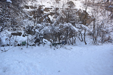
Another TR Guest Ranch private area.

View down again.

Back down to the completely unused upper bridge.

Heading down.

The creek.
Video

Cliffs above.

The creek again.

The cliffs again.

Snowy tree tunnel.

The creek.

Snowy trees.

View down.

Better.

Down to the middle bridge.

Back to the trail split. Right will take the BST back to the parking lot. Forward will take you along the BST towards Strongs Canyon, and does offer a couple loops back to the trailhead. Not sure how much longer that would be though.

Down the the lower bridge.

More icicles.

Another split. Right is the BST Scenic Route, which offers an additional loop option and a view of the BST Christmas Tree. Left will head back down to the trailhead.

View down again.

Pretty colors.

More.

Looking down canyon again.

Nearing the mouth of the canyon.

Great sunset tonight.

Valley view.

I am walking down a completely iced over track, and am not slipping at all. I am quite pleased with our new micro spikes.
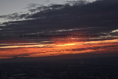
More sunset.

Valley view.

Panoramic.

The old water towers again.

Sunset again.

Haze under Ben Lomond.

Mount Ogden.

Fading sunset.
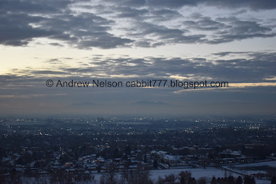
The city below.

Fun rock formations.

Leaving the TR Guest Ranch property.

Mount Ogden from the parking lot.
While the trail is relatively short, it is a relentless climb! However, viewing the massive frozen waterfall makes it worth it. The trail was not terribly busy today, and it was just a fun winter wonderland. Going with 9 out of 10 squirrels. removing one for the final steep assent.
As for difficulty, as I said it is a long climb. DR4.
Dogs are allowed, but must be leashed. Please clean up after your furry friends.
