Sunday, February 24, 2019

Davis Creek - Urban Nature Walk Section

There is a nice little nature trail along the lower section of Davis Creek in Farmington called the Urban Nature Walk Section. We’ve explored the much tougher upper sections of it before (link above), so I thought we would come check out the lower segment. It was a lot shorter than I was expecting. I thought it was 7/10 one way, but it is actually 7/10 of a mile out and back. So, really short. But it was a nice little stroll and a nice break away from the Legacy Parkway Trail we have been doing recently.


Quick Details:

Length: 7/10’s of a mile out and back.
Difficulty: DR3. Super easy.
Elevation Gain: 83 feet
Restroom: No
Dogs? Yes, please clean up after your furry friends.

To Get Here:

From NB i15 take exit 322. Take the right fork on the exit towards 200 w. Take the very first right onto Frontage road. Take that beyond the stop sign on Glovers lane and turn left onto 1150 S. Take the first left again on 110 west. Drive to the end of this street and find a place to park. You will se a paved path between houses with one of the Farmington Trail signs.

The Trail:


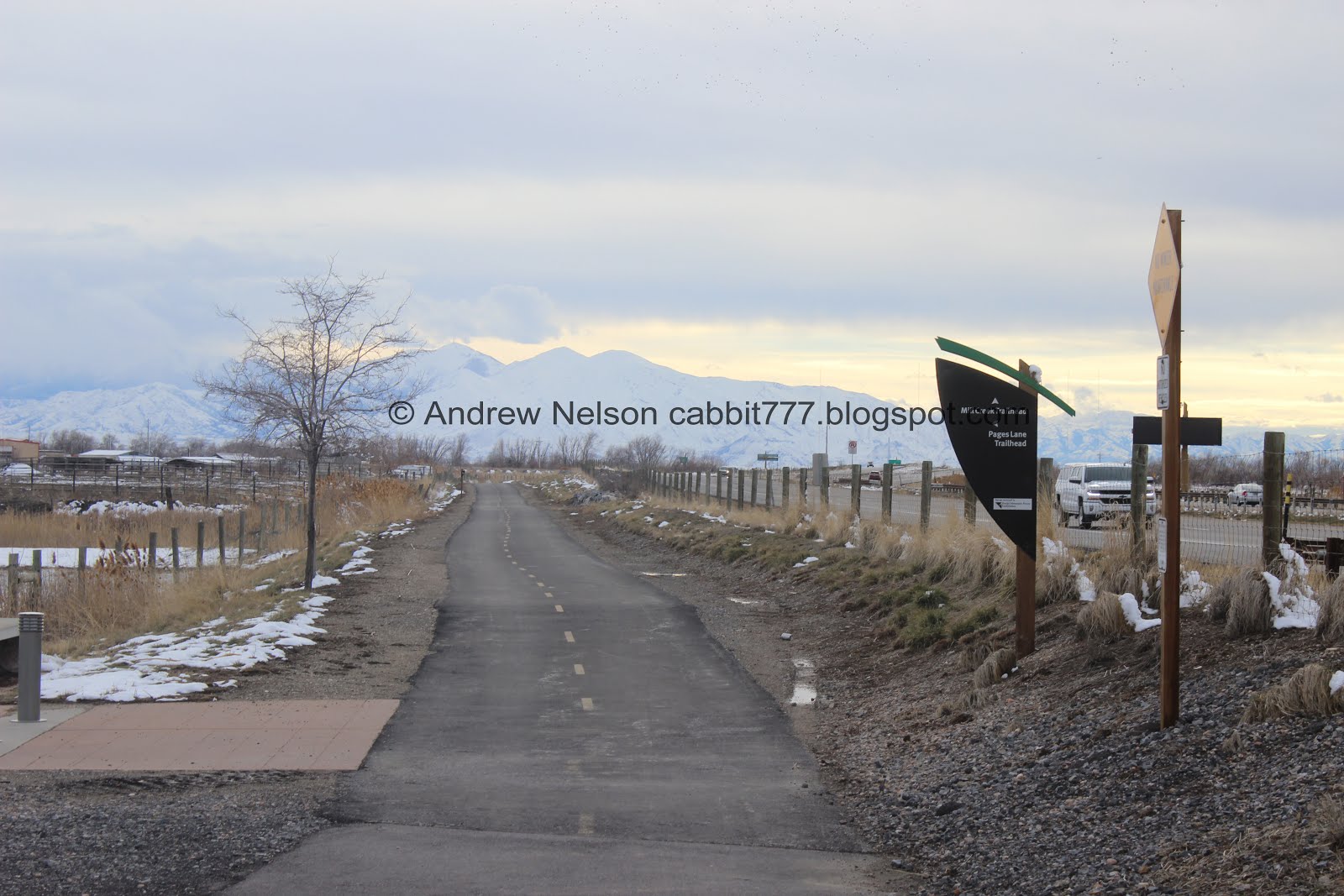
The trailhead at Sound Wall Park. You will take the right at that fork back there, otherwise you will end up on Frontage Road again.


Then the pavement ends and you have another fork. Both paths connect again later, but as you will see on the way back, the official trail is to the left.


Then you will be in some lovely woods, and you will see a couple random tree houses.


Where both paths meet again.


The the path skits this property line for a minute. Still lovely back here.


Davis Creek is dry down here right now. I guess in the spring it should be going.


Lovely view of the mountains.


Oh neat. I can’t recall the last time I have seen a tire swing! I decided not to give it a go, didn’t want to risk breaking something I am sure the locals kids enjoy.


A couple nice benches to rest on.


Eventually it opens up a bit and you get a nice view of the mountains.


I don’t think I got a better picture of it, but you can see the canyon Davis Creek comes down from to the right there.

Eventually the trail took us to a road, 200 e. This is officially the end of the line, but since I was expecting 7/10’s of a mile, and we had yet to go a half mile we looked to see if it continued. There was a thin trail that followed the gully up a little further, but now I know it is not the official trail. There wasn’t much to it either. I did not see any ‘Private Property’ or ‘No Trespassing’ signs, but, I am not sure if this was private or public land. So, continue at your own risk.


The path up next to this rock wall.


More thick woods.


Oh, there is a little bit of water in the creek up here.


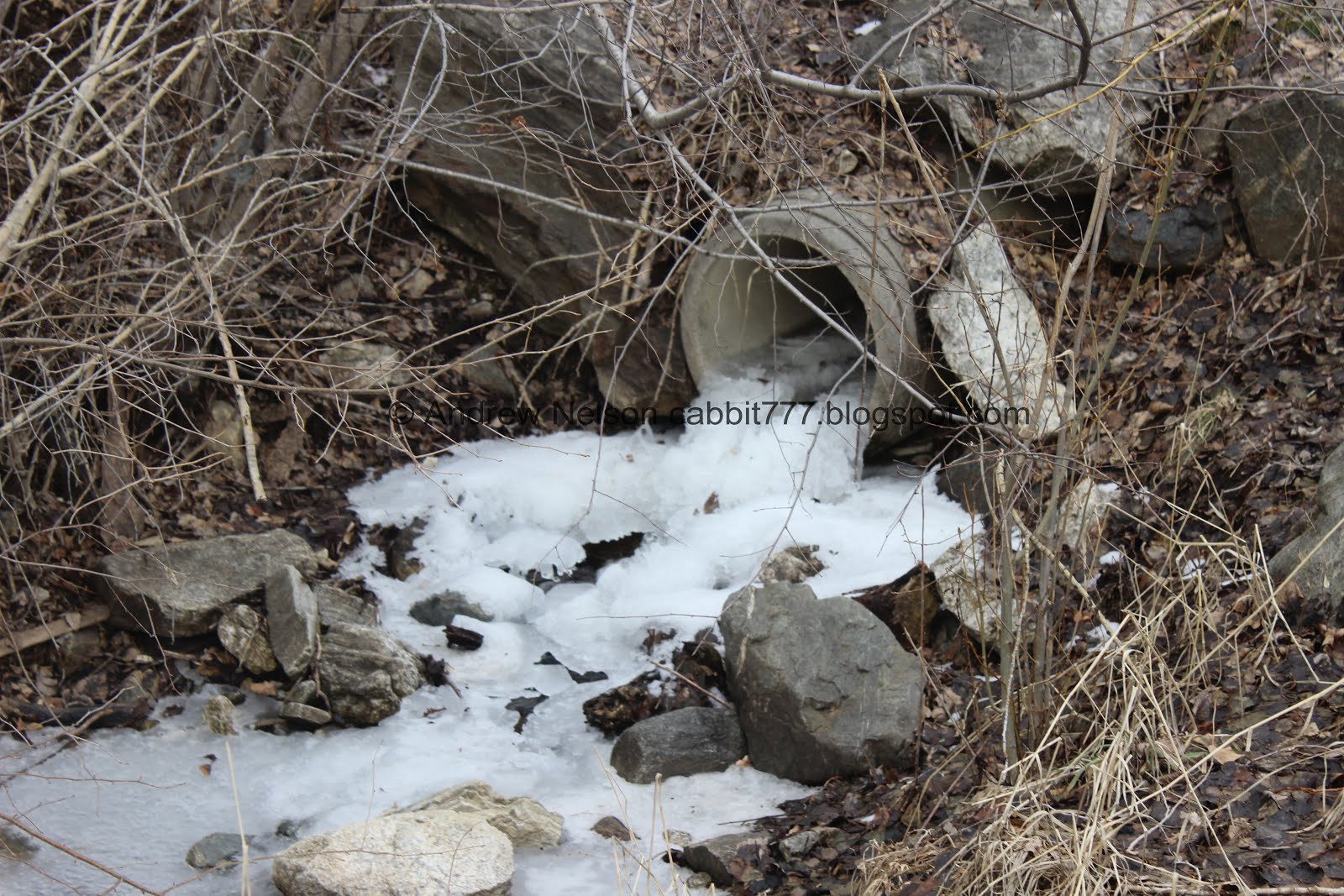
Little frozen waterfall.


I am pretty sure the trail we have been following is a deer trail, and maybe one the local kids use, and eventually it ended and looked like I might be veering into private property, so we called it.


Davis Creek again.


Red and green spiky leaves.


Back down to the road.

We added an additional .35 miles out and back with this random addition. I would say just skip it and turn around when you hit the road.


I didn’t have my telephoto lens in, and it was a little far away so I’m not sure, but I think this is a bald eagle flying away from Farmington Bay WMA up to the mountains for the night.


Back to the official trail.


Speaking of, you can see the ponds at Farmington Bay from here.


Back into the little gully,


Little bird in the brambles. I think it’s a little funny, these bushes are thick and thorny, yet when we get too close these little birds freak out and scramble to fly out of them. Honestly I think they are safer in them but I get they would just rather get away from us.


Back into the lovely woods.


The trail split. There is a trail sign pointing right, so that is the official trail, but the trail to the left will get you back as well.


Forest.


Tree houses, fun. I miss living near a gully. I mean, I don’t think I would be out there constructing tree houses anymore, but I do miss the little natural area to run around in and explore.

Well, that was a fun little trail system, disappointed it was shorter than expected, but it was lovely, and it’s a good option to get a quick nature fix in. Not a lot of people, quiet. It is between neighborhoods, but it’s not as bad as some other neighborhood trails can be. Eh, 6 out of 10 squirrels today.


As for difficulty, the official trail was wide, fairly flat and easy going with a mild climb. DR3.

Dogs are allowed. Please clean up after your furry friends.


Saturday, February 16, 2019

Legacy Parkway Trail: Pages Lane to Birnam Woods

The Legacy Parkway Trail is a 14 mile paved pathway from Farmington down through North Salt Lake. We have slowly been making our way up it this winter on days that are not ideal hiking days. We have done the far south end where it connects to the Jordan River Parkway. The Center St. To 2425 S Segment, and 2425 S to 5th south5th S to Mill Creek, and last year we did a loop starting at Mill Creek so we skipped that small 6/10’s of a mile section this time and started at Pages Lane. I also noticed we could take the Prospector Rail trail back and make it a good loop.


Quick Details:

Length: 1 Mile on Legacy Parkway Trail. .6 miles on prospector Rail Trail, about a half mile on the Onion Parkway Tr and then another .2 back on the legacy for a full 2.8 mile balloon trail. Note, you can start at Mill Creek TH and add another 1.2 miles for a full 4 miles
Difficulty: DR2. All paved, and flat.
Elevation Gain: Not enough to register. Couple feet max.
Restroom: Not at either TH.
Dogs? Yes, leashed on all 3 trails. Please clean up after your furry friend.

To Get Here:

Take 1600 N in West Bountiful as far west as it goes. It will end at the Pages Ln TH.

The Trail:


The sign at the Pages Lane Trailhead.


Onto the trail. Like most segments of the trail, it stays fairly close to Legacy Parkway.


Horses.


Kind of hard to see, but tons of crows and seagulls hanging around the Bountiful Landfill.


The mountains are looking lovely today.


The blackbirds have completely overtaken this tree.


Little creek, probably a canal.


Deuel Creek, Stone Creek and Barton Creek are all combined into this canal. I'm not 100% sure, but I think Barton Creek might be another name for Holbrook Creek.

Last time we did this segment we took the Onion Parkway there to the left back and made a loop. Today we will come back that way.


More mountains.


6.5 mile marker. The Legacy Parkway Trail has a marker for each half mile. I know the 5.5 one is just south of the Millcreek TH so the 6 must be between that and Pages Lane.


Mountains and clouds.


Wobbley segment.


I think this is a red tailed hawk. We saw one last time we were in the area. Although, considering what we see later, that is a little surprising.


Pretty mountains.


Mile marker 7. We have officially done half of the Legacy Parkway Trail now. Woo!


Which is just before the Birnam Woods Trailhead.


Birnam Woods Trailhead sign. BTW, there are no woods here. I've noticed a lot of neighborhoods around here are named after was was destroyed to make room for said neighborhood. It's a little sad really.

We could see the exit sign for Parrish Lane on the parkway so figured that trailhead wasn’t much further and decided to keep going. However, we made a wrong turn. I did not include this in the mileage I posted in the Quick Details above.


The signage along the parkway trail is usually pretty good, but they are missing one here. We went left, but I guess the Parrish Lane TH is right. Meh. Doesn't look like there's much to it, just a spur to connect the neighborhood that way to the trail.


Long tunnel under Legacy Parkway.


Cows in the Legacy Preserve.


Antelope Island.


7.5  mile marker.

From what I can tell, the Legacy Parkway Trail shares this segment of the Denver and Rio Grand Western Rail Trail. We have done a short bit of that when we did the Farmington Creek Fairgrounds Trail.

Well, we reached Parrish Lane and it looks like we could have made it back under Legacy Parkway, but that involved crossing the on ramp with no crosswalk. We decided not to do that and just went back the way we came. we added about 3500 feet out and back with the extra leg.


Back to the tunnel.


Back to the 4 way trail split. I guess this segment of the Denver and Rio Grand Rail Trail (AKA Rails to Trails Trail) is called the Prospector Rail Trail. That is only slightly confusing. You may have noticed a theme between all the names though. This was a railroad that was decommissioned and was turned into a trail.


Like the parkway trail it is paved, and flat.


This trail does cross a couple streets though.


West Bountiful trail sign.


This trail is through a neighborhood, that has a few farms along the way, and every other house had chickens. Here is the Lazy A Barn. I thought that was kind of silly.


More horses.


We have reached the Onion Parkway Trail. we still have not been east from here, maybe we’ll check it out some time, but to make the loop back to where we parked, right will get us back. You could make a full loop by continuing on to Pages Lane, but then that last bit will just be on the sidewalk next to the road.


Onion Parkway Trail.


Deuel, Barton and Stone Creeks. Shallow and clear.


There used to be a lot of trees in there, but it looks like they tore them all out, save for this one, for a new development. Oddly enough, I imagine the reason they left this one (next to the paved trail) will be a problem eventually. But, you know, developers know best!


Meh. This trail wasn’t terribly exciting to begin with but now it’s just meh. Once the houses go in it really won’t be very enjoyable at all.


The empty lot again. At least right now we can see the mountains.


Curious horse.


Back to the legacy Parkway Trail.


I love solar halos. I see them fairly often, but this is the first time I had a convenient cloud covering the sun. Solar, and lunar halos often indicate a storm is on the way. And yes, we do have a storm coming tomorrow.


Crows and seagulls above the landfill again.


Back to the trailhead. Again, love the mostly adequate signage, but would love to see mileage added.

Meh, this section of the Legacy Parkway was not my favorite. But I did enjoy the view of the mountains along the way. Going with 5 squirrels. As for the Prospector Rail Trail that one was pretty much the same, but between houses. 4 squirrels there.


Looking at the next segment, there appears to be a large gap between trailheads. I might have to split that one into 2 parts.

As for difficulty, all trails are flat and paved, super easy going. DR2.

Dogs are allowed, leashed. Please clean up after your furry friend.