.jpg)
Taylor Canyon is a pretty canyon located in Ogden that features wildflowers, wildlife, and a couple spring waterfalls. It is a long uphill trek that seems to get more and more steep the further you go, and as I understand it, there really isn’t a particularly great end prize. However the narrow canyon is pretty, and was not busy at all. I have been meaning to check it out for a couple of years now, and well, we had family business in Ogden today so I thought we would finally check it out.

Quick Details:
Length: It is 3.4 miles out and back, but we only did about 3.2, dang, so close.
Trail Type: Out and back.
Difficulty: DR4. This is a long steep climb.
Elevation Gain: 1545, we only did about 1151
Restroom: No.
Dogs? Yes, but must be leashed.
Other Info:
To Get Here:
From i15: Take the 31st St exit east to Harrison Blvd. Turn left. Turn right on 27th street. Follow that all the way to the end and park.
From 89 take that to Harrison Blvd. Turn left. Turn right on 27th street. Follow that all the way to the end and park. (Google says this is the shorter route, but with all the construction at the moment, I doubt that. Maybe when the construction is done).

Its a fun cloud day, and the mountains are super green right now (Passenger Seat Photography (PSP)).
The Trail:

Looking into Taylor Canyon from the trailhead.

Trail signs.

Technically you can go either way, but to the left, or the north route is more clearly marked. However, if you are familiar with the area, right will take you past the Taylor Canyon Pond.

Malan's Peak.

Taylor Canyon.

Cliffs above.

Neat rock formation.
Another reason I decided to do this trail today is a reviewer said it had a lot of shade. Uhm.. That is not the case for the first quarter mile or so haha.

Malan's again.

Man, that lizard has a long ass tail.

Dogbane.

View of the Ogden Valley below.

Turkey vulture.


Little closer.

At about a quarter of a mile you will reach the Bonneville Shoreline Trail. And wait.. there is a South Taylor Canyon, and a North Taylor Canyon? I wasn’t anticipating that. We decided south looked more shaded at the moment so went that way. However, now that I am looking at the map I think North might be a little bit shorter (maybe I should have paid better attention to the older sign). Both trails connect not too far up though so it doesn’t really matter.

Much more trees and shade.

The butterflies and dragonflies were taunting me today. Flying right by me, and never stopping to land. Then there was this nice guy. Thanks buddy.

Oh! We have two turkey vultures.


Closer. We are usually hiking a little higher elevation this time of year, so this is the latest in the year that I can recall seeing them, but it is still cool.

They are pretty easy to identify in that they have the 2 toned winds, and tiny heads.

They have been circling us for quite a while, and one flew directly overhead. I highly doubt they were stalking us, but there must have been something nearby.

Fun tree tunnel. I was starting to worry because we seemed to be leaving the canyon.

I’ve said it before, and I will say it again. Ogden absolutely WINS with their trail markers. They are aesthetic, they are good at directing you, and they even tell you about nearby features.
That said, head left here. In the wintertime, forward will take you to the Ogden BST Christmas Tree. Otherwise it is an alternate option to reach Waterfall Canyon.

Heading back into Taylor Canyon.

View down again.

Cliffs above.

Heading into the canyon.

I stopped to take a break in the shade of this tree only to have the everloving bejeebees scared out of me by a very upset mother humming bird. This is only the second time I have seen a hummingbird nest. Super cool!

She didn’t wander far, but I decided to give her some space.

Cliffs again.

Bridge that connects us to the north trail. Note that the creek is very dry.
The south trail does continue up for a little bit, and we considered going up it, but thankfully we decided to switch to the north trail. The south trail appears to just fizzle out at some point.

The wonderful Ogden trail sign was the deciding factor for us today. As it mentioned Upper Taylor Canyon being that way, and the left going back to the trailheads.

Much more shade now that we are in the canyon proper.


Woo. Overgrown trail.

Dry creek bed.

Greenery.
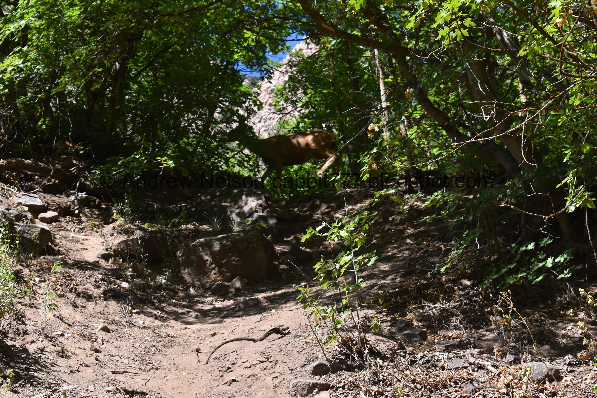
Oh, hello deer friend.

One of quite a few rocky areas.

Penstemon.

Pretty butterfly.

Mossy rock.

The trail.

Ooh! There is water in the creek bed here.

Little waterfall.

Little waterfall. This appears to be a spring.

Little closer.

More penstemon.

Huh. Water in the creek again.
Oh, there is a second waterfall spring.

The pair of springs reminds a lot of the Hanging Lake trail.

Then the creek is dry again.
I’m Just going to come out and say it. The spring waterfalls are the most exciting feature of the trail, and you might as well turn back after them.

Rocky section.

Orange tailings.


The trail next to the creek bed in the narrow canyon.

Trail split. You will want to turn around here. Seriously. But, if you want to continue in the canyon go forward here. Be warned, it starts getting steeper and steeper after here. Right will lead to Malan’s Peak and Malan’s Basin.

The trail towards Malan’s Peak.

Another rocky section.

Forest.

Overgrown and steep.

One of a few scree fields.

Cliffs.

Fun candelabra tree.
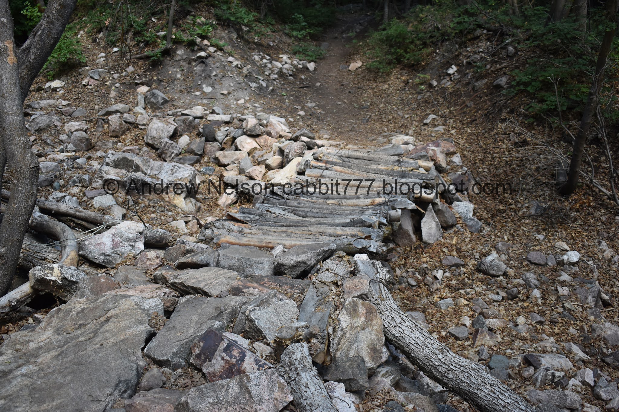
Neat old bridge.

View down.

Lush forest.

Somewhere around here I said if the trail gets much steeper, I am done. Apparently that was a lie.

Tree stars!!!! LOL actually these are thimbleberries.

Cliff above.

Water in the creek again.

Nice lush area.

Apparently due to this old busted wooden pipeline. Similar to what you can see in nearby Waterfall Canyon.

More of the climb.

Pretty forest.

Super overgrown.

Far side of the canyon. Take note of those bare trees on the ridge. I am pretty sure we can see them from the trailhead.

Cliffs on the other side.

More climb.

Neat rock out cropping.

With the ridge.

Overgrown.

More thimbleberries.

Another spring.

Nice little camping area below a cliff.

with the extreme drought we are experiencing, a reminder flag was planted here.

More thimbleberries.

Some kind of capped well.

This image did not quite capture how steep it really was, but we went “aw hell no” and decided we were done. I knew this trail doesn’t have a particular end prize, and is really about the hike through the woods. So yeah, no need to further exert ourselves. It might be because it was a hot day, but yeah, we just were not feeling it.

Thimbleberries.


Back to the cliff camp spot.

Loads and loads of thimbleberries.

Fun rock outcrop.

Taper tip onion.

Weird wall of rocks.


Forest.

Back down to the old broken pipe.

Fern.

Down to the neat old bridge.

Candelabra tree.

Pretty forest.

Another candelabra tree.

Its just so lush and overgrown in here.

Down to the split.

Squirrel.

In a little den.

Dogbane.

Back to the upper waterfall.

Oh yay. A butterfly decided to hold still for me. I think this is a Weidemeyer’s Admiral.

I believe this is nightshade.

Penstemon.

Back to the lower waterfall.

Crazy roots.

Tree tunnel.

Even crazier roots. It's practically a knot.


Trees.

Back to the lower trail split, and there is a trail counter here. We seem to be encountering these more and more often.
I had originally planned on going down the north canyon trail, but I was hoping I would see the hummingbird in her nest, so we went back down the south trail.

Crossing over the creek bed.

Well, mama heard us and took off before I could get a shot. But we found the nest again.

View of the valley again.

Again.

Little white butterfly. I think it is a Cabbage white.

Cliffs above.

Forest.

We startled another hummingbird. I seem to recall doing the same right about here on the way in and wonder if they might have been a nearby nest. Did a quick glance, but couldn’t find it, and don’t want to keep mama on her nerves, so we moved on.

Rock outcropping.

Lots of tapir tip onions.

Ben Lomond.

Old reservoir of some sort.

Looking back into the canyon. See the bare trees? That’s about how high we made it.
Well, that was bit tougher than I anticipated. I might be the heat, but it was really rough. With there not being a particular end prize it was a bit meh. Don’t get me wrong, the trail is pretty, and often times I can enjoy trails where the journey is the prize, and I still kind of did today. Plus I enjoyed that we only passed 2 or 3 people. And we saw some wildlife. 7 out of 10 squirrels.

I kind of want to see what how the Malan’s Peak trail is, its probably a bit much for me, but still want to check it out.
As for difficulty, This is a climb! DR4.
Dogs are allowed, but must remain leashed.
