.jpg)
Ghost Falls is a small waterfall located in Corner Canyon in Draper. The trail features a small waterfall, a creek, wildflowers, a good chance of wildlife, and a couple other random interesting things to see along the way. Its a little cooler today so I didn’t want to go to high, and I thought this trail might be good for some color. Unfortunately, it wasn’t so much today, but it was still a lovely hike. We have done this one a few times, but it's a nice one.
Quick Details:
Length: 2.84 out and back.
Trail Type: Out and back, balloon, or loop.
Difficulty: DR3 Its a pretty mild climb.
Elevation Gain: About 400 ft.
Restroom: Yes.
Dogs? No. Everything above the Bonneville Shoreline Trail (BST) is watershed.
Other Info: They strongly ask to not use the trail if it is muddy. If you can feel yourself sinking in, and/or are starting to collect mud on your shoes you are damaging the trail and should turn around. It’s wise to have a backup plan if there was a recent storm.
Also: There is a huge web of trails in this canyon. I recommend printing out the map, or having it available on your phone, particularly if it is your first time. Here is the 2021 version of the map, but I think they archive it every year, so you might have to google it.
To Get Here:
From i15 take the Bangerter Highway exit 289 go left. on 13800 S. About 1.7 miles turn right on 13th E. Go under the bridge and turn right onto Highland Dr. Take the first left onto Rambling Rd. At the traffic circle, take the first exit onto Mike Weir Dr. Turn left on Pinion Hill Ln. Turn right on Canyon Vista Ln. Turn left on Gray Fox Dr. Turn Right onto Coyote Hollow Ct. Go to the end and park.
You want to use the trail to the right of the restroom and TH kiosk and then immediately go left.
The Trail:
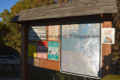
Trailhead kiosk.

Trail warnings and rules.

Follow signs for the Canyon Hollow Trail. There are multiple ways to get there, but I think this is the best way.

Sadly it appears most of the leaves are dead.


A couple spots of color.

Mount Jordan. Oh, and you can see Burnham Gorge here too.

The silica pit.

Leaf litter.


Some more color.

I feel like this is new.


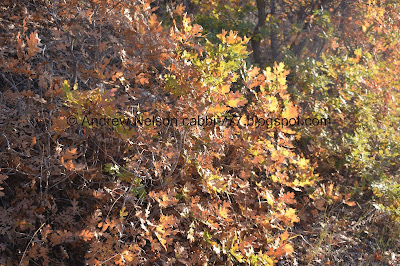
Some lovely oranges.

Little tunnel.

The reds are my favorite.

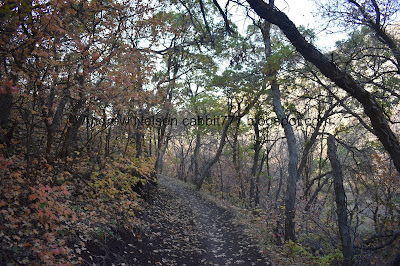
Forest.
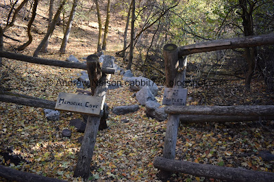
Memorial Cove. We went up there on the way back.

Carpet of leaves.

Looking down canyon. I suppose this might be why they call it Corner Canyon.

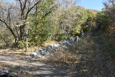
Eventually the trail becomes this old dirt road.

Some more color.

You can go this way and get there, in fact it is probably a little shorter. But, it’s a little thin on a steeper slope. So, I much prefer to stay on the Canyon Hollow Trail.

Continuing up the old dirt road. This is probably the steepest part of this trail.
The Canyon Hollow turn off. I think if you really wanted, you could keep going up the road a little further, but it’s prettier in the woods.


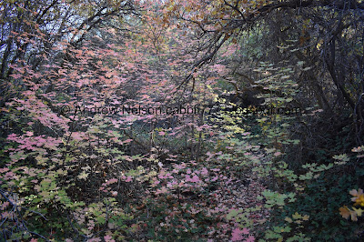
Pretty forest.

The first bridge.

Over a pretty deeply cut channel.

Yup, you could take the old dirt road up to here.

The 2nd bridge.


More forest.

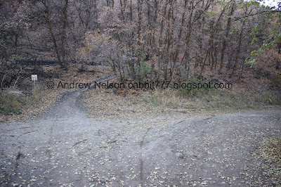
At this unsigned trail split you want to go left.


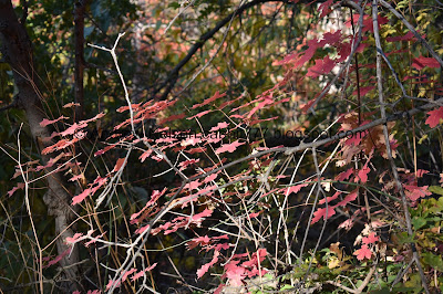
Nice splash of color.

More reds.

One of the 2 cars I am aware of in this canyon. We’ll get a little closer on the way down.

The other car.

More forest.

The 3rd bridge.

Not quite as deep of channel.

The 4th little bridge.

This one, as the smallest so far, is actually over a creek.

The 5th bridge, which means you have arrived.

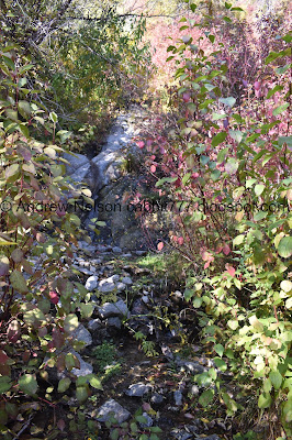
Barely a trickle. Which is kind of surprising actually considering the drought. It’s called Ghost Falls because it tends to dry up.

Cute little welcome sign.

See just a trickle.

Its a little hard to see through the foliage too. We usually do this trail in the spring to you know, actually catch the waterfall.
With the creek.

Little bit of color.
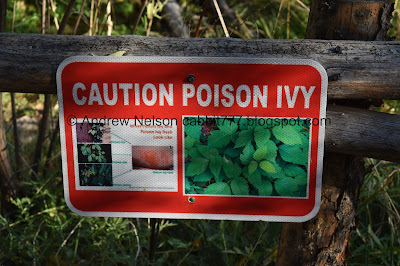
This is the only place I have ever been that had poison ivy warnings. I don’t know if its just not common here, or what.

View from the bridge again. Well, the waterfall is not terribly exciting today so we decided to head back down.

A lot of the trail splits are signed, but not all of them.
As I mentioned, you can make it a balloon or loop by heading down the Ghost Falls Trail, but I just prefer the Canyon Hallow route.

 |
Little bit of color.

Back down to the 3rd bridge.


Little bit more color.

There is a really short trail down to the lower car.

Which gets you a little closer.

The little creek.
More color.

Pretty fallen leaves.


More forest.


More color.


Closer.

Leaves.

Back down to the 2nd bridge.
Once you hit the old dirt road again, head right. Whatever you do don't cross and take that trail down, it is a fast downhill bike only trail. We accidentally made that mistake due to some construction that was going on up here and somehow missing the sign once.

Leaf littered floor.

Back down to the 1st bridge.

Standing out.


Forest.

Some color.

Trees.

View down into the canyon.

It’s quite hazy today, yuck.

We decided to check out Memorial Cove again. This will add about 2/10ths of a mile to the hike.

Fun stone steps.

Fun carpet of leaves.


I like to call this the witches bridge. Not the official name, but it looks like it to me.

It’s actually a lot sturdier than it looks from the side.

The tiny little side creek.

Ah, the weird teepee like structures I find randomly on different trails. This one is starting to fail.

The memorial of Memorial Cove. Thomas Whipple was a avid outdoorsman that promoted outdoor access.


Back down to the witches bridge.

The creek above.


Carpet of leaves.

Some reds.


Little spots of color. We’re back on the main Canyon Hollow Trail now.


Lit up.

More reds.


Couple closeups.

Ladybug!

More reds.

View down again.


Just because the goal is fall color doesn’t mean I can’t appreciate the green forest too.

More forest.
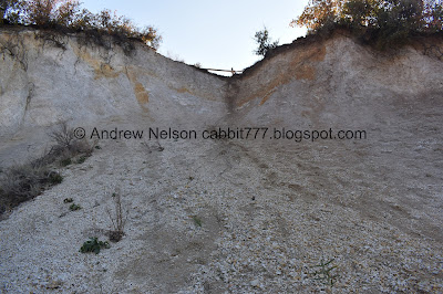
Back down to the Silica Pit.

Burnham Gorge.

A wildflower still hanging on.
More color.

Deer tracks. We almost always see deer up here, but not today.

More pretty maples.

Little tunnel.


Some pale color.

Sunflowers.

I love these signs. I kind if want one for my driveway.

Smokey valley, ugh (PSP).

We got some snow up on the higher peaks with the last storm (PSP).
I am a little sad the trail was kind of a bust for some good leaf peeping, but I do enjoy this trail. It wasn’t too busy, and it is really lovely. I was surprised to see some water in the waterfall today, so that was a nice extra bonus. 9 out of 10 squirrels.
As for difficulty, it really is a pretty mild climb. DR3.
Dogs are not allowed above the Bonneville Shoreline Trail here, so unfortunately dogs aren’t allowed on this particular trail.
