.jpg)
The Granite Flume is an amazing narrow canyon in the granite cliffs in Big Cottonwood Canyon. It is so narrow it is practically a slot canyon so that is cool we don’t have to travel all the way to southern Utah to experience one haha. It is quite a scramble to get to though.
As I was typing this up, I noticed there seems to be some confusion online as to whether this rock feature we explored is the Granite Flume, or if the Aqueduct Trail is called the Granite Flume. After doing a lot of digging, I think I am correct. That the flume is the rock feature, that is off of the Aqueduct Trail.
This is another “neat” thing I found just dinking around on Google Maps that I thought might be worth checking out. Sometimes this results in something neat, sometimes a wild goose chase, and sometimes a total dud. This time I think it was a win! And I am happy we came to check it out.

Quick Details:
Length: We did 1.5 miles out and back. However it appears to keep going.
Trail Type: Out and back.
Difficulty: This was QUITE the scramble. DR5.
Elevation Gain: We did about 590 feet, but it goes higher.
Restroom: There are restrooms at the Ledgemere Picnic Area or at the mouth of the canyon.
Dogs? No. Big Cottonwood Canyon is watershed.
Other Info:
To Get Here:
From Wasatch BLVD drive about 1.6 miles up Big Cottonwood Canyon to the Ledgemere Picnic Area. Park on the north side of the road in the large dirt parking lot.
The Trail:

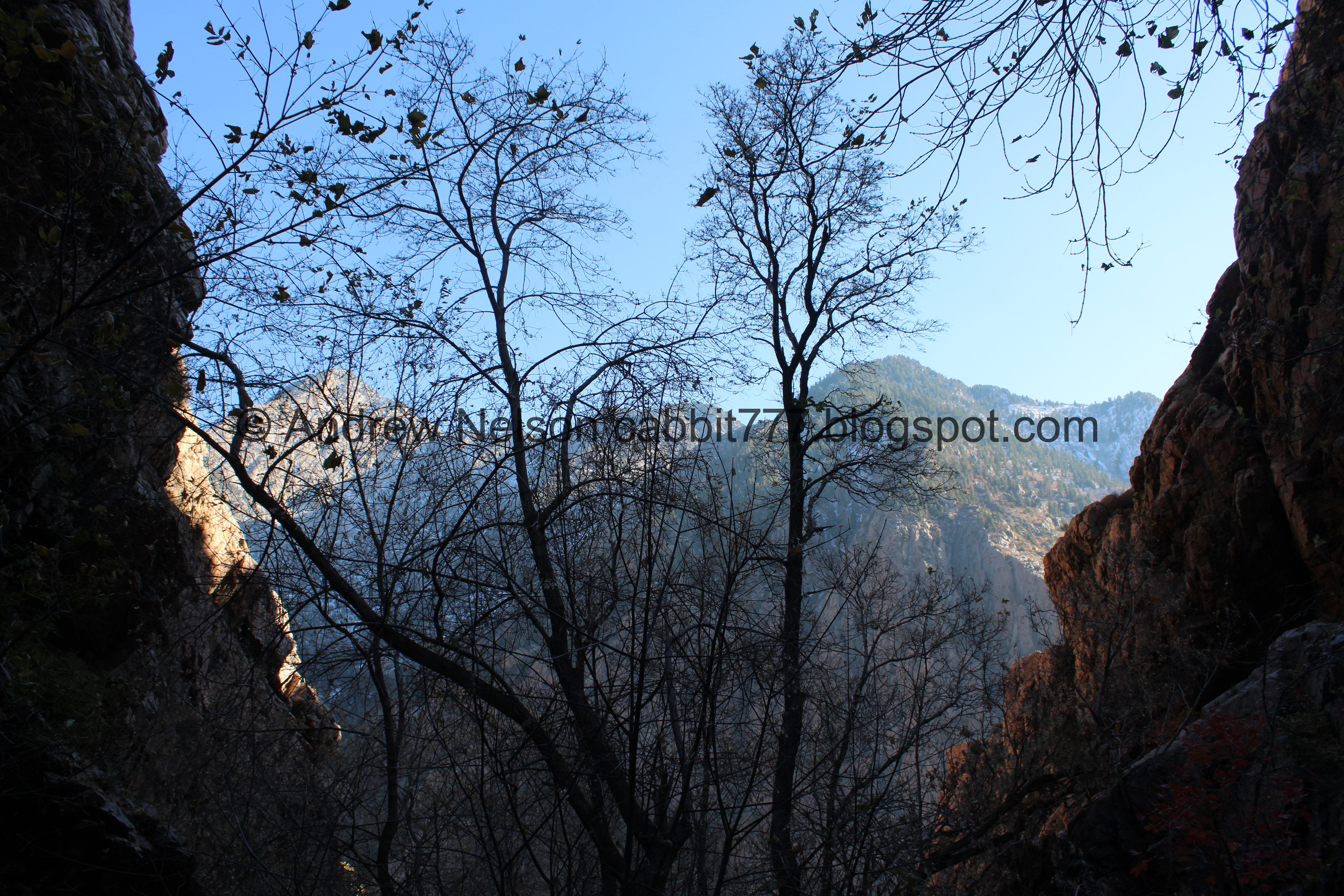
Cliffs to the south.

View up canyon.

The trail is on the east side of the parking lot.

Apparently it was paved at one point. Weird.


Little bit of color hanging on.

I was worried that I was going to struggle with my fear of heights on this trail, and well, I did, but I managed to get through the rough parts, well, down here anyway.

Trail rules. This is the only sign I saw today that even hints this is a trail, and it doesn't really offer much information.

Last little scary part, then it gets better.

The Aqueduct Trail. Which is what I planned to do, and maybe add the Granite Flume as a bonus. Well, that changed a little haha.
I also learned today, after some confusion, and further research, that what I have always called The Pipeline Trail, I have determined it is actually called the Aqueduct Trail possibly to distinguish itself against the Millcreek Pipeline Trail (which I have not really explored, but have passed by).

Then the trail comes to a wide area so its a lot more manageable.

First view of the flume. Well, that doesn’t look so bad!

There is a bit of a mess of trails up here, including an alternate way up from another pull out a little further down the canyon. It also looks like you can connect to it at the the slightly further up Birches Picnic Area. I have a feeling I picked the best one, but don't know for sure.

Pretty leaves.


Then the trail goes through a nice wooded part.

One problem with this time of year is the fallen leaves make some trails a little hard to find. However we managed to stay on track.

Enjoying the forest.

Before long we reached the Aqueduct Trail.

We can see the Granite Flume, but It was not immediately clear how to get into it. We wandered around a little bit before Landis suggested maybe it is on the other side of the hill to the left (west).

View across the canyon.

Heading across the Aqueduct Trail.

I don’t know if there is a more specific term, but some of the original support stones are still in place.

Across the little gully below the flume. We found a trail up into it here.

It would appear the flume is quite prone to avalanches.

Heading up into the flume.

Pretty big pile of mine tailings.

Myrtle spurge. This stuff is pretty noxious, so avoid touching it.

Heading into the flume.

Some more color.

Starting to get pretty narrow.

Deep crack.

View across the canyon again.

Lots of myrtle spurge.


Love the rock formations.

Gear left behind from rock climbers. That is probably how this formation was named. I have noticed quite a few random rock walls that have been named and shown on google maps.

Narrow canyon. It's no Jenny's Canyon but it is still neat!

Gnarly bird nest. I have learned this kind of nest is likely a magpie.

Looking up.

The narrow canyon again.

Cliff walls.

The trees get in the way of appreciating the narrow canyon.

Looking up again.

The canyon again.

Moss and plants growing on the cliff walls.

More color.

Looking back down.

Water coming out of the bottom of the cliff wall.


Cliff walls.

Looking out of the canyon.

Slightly up.

This branch looks like a praying mantis.

Down canyon again.

Cliff walls again.

It appears to keep going a little ways if you can scramble up above this, but it also looked like this was about the top of the Granite Flume. Landis popped up real quick and deemed it to not be worth the effort, but maybe we’ll come back sometime and check it out. So, this was the end of the line for us today.

Looking down again.

Looking up again. Its kind of hard to see in the picture, but you can see some lines the climbers have strung across the canyon.

Cliff walls.

Looking down again.

Cliff walls.

The canyon again.

Looking up again with the climbers lines.

Oh, I got a closer look at the lines.

The canyon again.

Some color.

Cliff walls.

Plants growing out of the cliffs.

Some moss too.

Cliffs.

Slowly making our way down. There were a couple spots that I thought to myself, wow, I scrambled UP that?!?!

Trees growing out of the cliffs.

Looking down again.

Lacking back up canyon.

Looking up.
Starting to be able to view across the canyon again.

Cliff walls.

Some nice reds.

Another tree growing out of the cliffs.

Nice colorful spot.

More plants growing out of the cliffs.

Nearing the bottom of the flume.


More color.

That boulder looks like the slightest nudge would knock it loose. It reminds me on a similar precarious boulder we found in Arches.


I just love the way the cliffs fracture and split.

Little bit more color.

Looking across the canyon again.

Color and cliffs.

Working our way down.

I can’t get enough of the cliffs.

Looking up into the flume again.

Navigating the debris.

More color.

Into the flume again.

Looking across the canyon again. I think that is Storm Mountain back there in the left.

Back to the mine tailings. We decided to scramble up to see the mine.

At the top.

It appears to have been covered in a rockslide. I am not sure if it was natural, or man caused.

View across the canyon again.
.jpg)
Panoramic.

Neat boulder. Landis saw a couple boulders he would have liked to place in the yard. I told him him he just has to carry them back to the car. :-p

Looking towards the mouth of Big Cottonwood Canyon.

Up canyon.

Lots of different colored rocks.

The tailings pile again.

More color.

Pretty gnarly tree breakage.
Back down to the Aqueduct Trail. I decided to try and go a little further along it.

Leftover lumber from some long lost structure. My guess is possibly from a type of bridge for the pipe across the gully below the flume. Like I said, total guess.
.jpg)
Panoramic across the canyon again.

Back to the Aqueduct Trail.

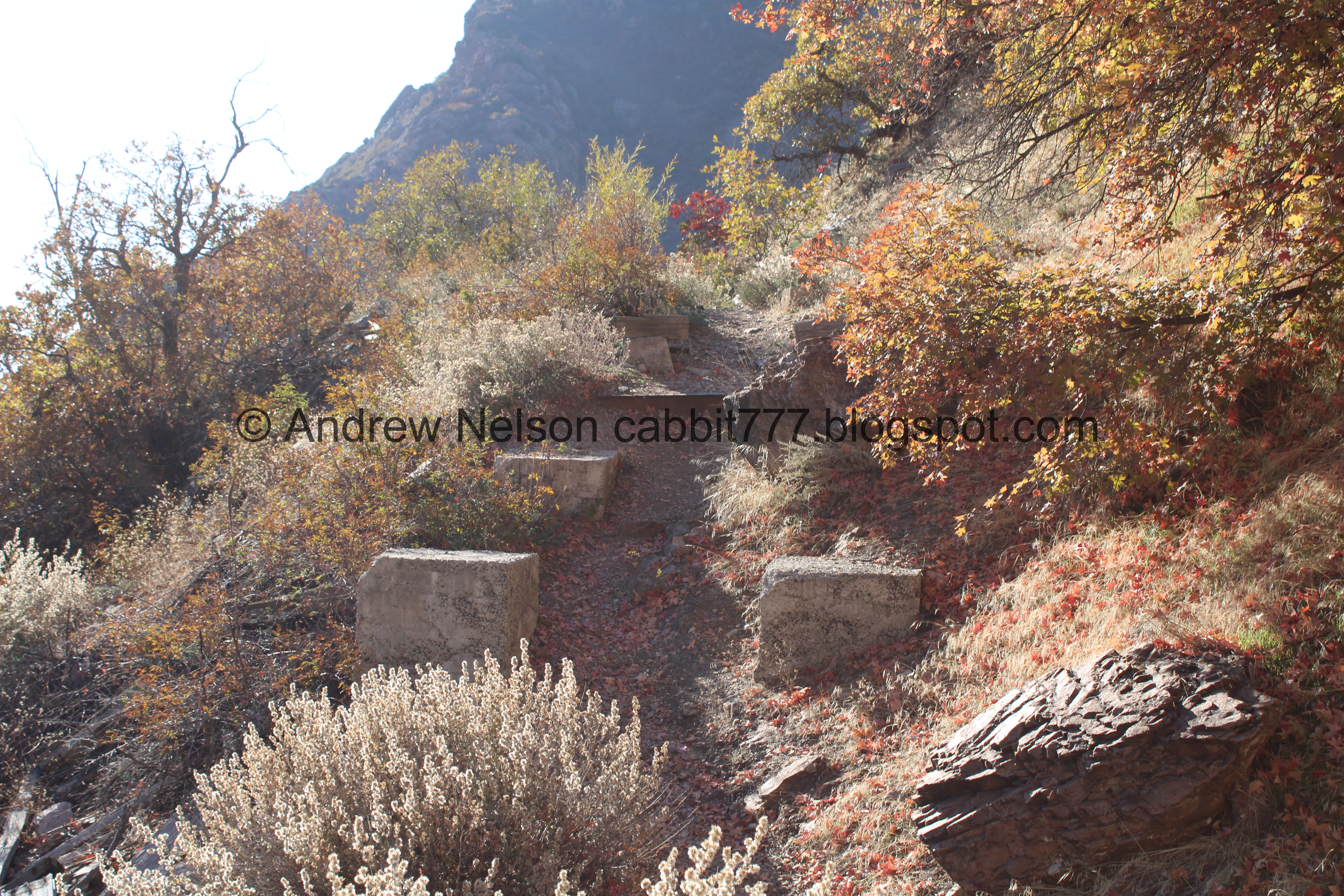
Closeup of one of the support blocks.

Continuing along the Aqueduct Trail.
The Aqueduct Trail is what is left of what was called The Big Cottonwood Conduit. Which was a large pipe to transport drinking water.
Some history:
Built in 1907, the conduit brought water from Big Cottonwood Canyon to Salt Lake City. The conduit traveled 7.23 miles to the mouth of Parleys Canyon where it joined that water system and then flowed to the 13th East Reservoir (13th east and 1st South, now the site of Reservoir Park. See Bonus Content at the bottom).
There were a lot of legal issues and drama that ensued over the years regarding rights and usage.
Another problem they had were drought years that did not provide enough water. So, additional reservoirs were planned in 1907. Lake Phoebe (now Lake Mary), Lake Martha, Lake Catherine and the Twin Lakes. Dams for those lakes were constructed by 1917 and they store a considerable amount of water, still in use today.
A random fun fact, SLC “exchanged” water rights by supplying the south valley farmers with water from the Jordan River via the various Canals.
In 1932 it was extended south and connected to the Little Cottonwood Conduit, which parts of still exist to this day. It was the cities main water supply for 75 years! In 1982 the original conduit was replaced and enlarged.
Source: (outside link).

Across the canyon.

You can see the Aqueduct Trail from below, so I knew it was pretty high up there and knew I would probably struggle on it. I was hoping it would be wide enough that I would be okay. However I really struggled with my fear of heights pretty quickly into it.

The mouth of the canyon.

Pretty red leaves.

Better view of the mouth of the canyon. You can see the end of the Aqueduct Trail to the right here. The end looks well, cliffy. I knew I wouldn’t do well on that part, but I had hoped I could go a little further along than this haha. However, I am not completely ruling out trying again.

A ridge on the other side.

Better view of the mouth of the canyon, and more of the Aqueduct Trail. I kept trying to convince myself to go further, but ultimately decided to just call it, so we turned back. Like I said, I am not opposed to trying again though.

More red leaves.

Heading back down.

Passing under the Granite Flume again.

More of the Aqueduct Trail.

More of the support stones.

With lots of fallen leaves.

A final look at the flume before heading down.

Some color.

There is a trail that parallels the Aqueduct Trail, but is just below it. Might need to look into that a bit more.

The other side.

Back into the woods.

Nekkid patch.

Faint trail through the thick layer of fallen leaves.


More forest.

View across the canyon again.

More color.

Trail down to the lower trailhead.

What I think might be Storm Mountain slightly up canyon.

Down canyon looking at the Aqueduct Trail again.

Looking down at the canyon road.

Quick sketchy area.

Some more color hanging on.

Across the canyon again.

A rock climber.

The last leg down.

Back to the cement.

Back to the parking lot.

View down canyon.

I noticed this steeper looking narrow chute across the way, and of course my first thought was “I wonder if I can get there” even though it looks much more steep.

Looking up canyon.
I am a little sad I wussed out on The Aqueduct Trail, I was really hoping to explore it more than we did today, but I am not ruling out a revisit. As for the Granite Flume, it was a little tough, but wow, I thought it was neat! Plus it was cool to explore a “slot canyon” without traveling to Southern Utah. Honestly, between the 2 trails I thought I would have struggled with my fear of heights doing the flume over the aqueduct but the lizard brains does what it does. Anyway it wasn’t too busy today, but it was a Monday so, yeah, fewer crowds than normal. I’m going with 9 out of 10 squirrels, losing 1 for difficulty, and lack of signage.
As for difficulty, I am definitely bumping this up to a DR5. There was some definite scrambling.
Dogs are not allowed in Big Cottonwood Canyon due to watershed restrictions. So be sure to leave Fido at home today.

Bonus Content: Reservoir Park (added 11/5/23)
This park is where the water from the Big Cottonwood Conduit eventually flowed and was stored for drinking water for Salt Lake City. It is located at 1300 East and 100 South. I happened to be in the area so I thought I would come check it out. I was hoping to find some historical markers, or information, but instead just found a park with a filled in reservoir. So, since there was not much to it, I just decided to tack it onto this post, rather than create a new post for it. I am glad we didn’t really go out of or way for it.

The reservoir at reservoir park has been filled in or maybe covered and now just looks like a sunken field.

Little closer.

From above. Like I said, not a whole lot to it. If there were any historical markers we did not find them.
Other than the filled in or covered reservoir, this is just your average park with a playground and tennis courts.
So, yep. Glad we didn’t go completely out of our way, but it was kind of cool to see the end of the line, so to speak. I wonder if there are any other signs of the conduit left between here and Big Cottonwood Canyon.