.jpg)
Butterfield Canyon is a scenic canyon located on the west side of the Salt Lake Valley. It features a mixed forest, wildflowers, and well, the side of a giant copper mine! There is a thin road you can drive on between June 2nd and Oct 31st, otherwise it is closed to vehicles. Last time we did this we hiked up the road during the winter closure and you could not do anything else with out trespassing. However, as of August of this year Kennecott has partnered with Salt Lake County and some new trails have been opened to the public.

Length: We did about 3.4 miles out and back, but it kept going.
Trail Type: Out and back
Difficulty: What we did was a good DR3.
Elevation Gain: We did about 350 ft.
Restroom: Not currently, however that may change with the new parking lot expected in November.
Dogs? Yes, leashed.
Other Info:
To Get Here:
Take Bacchus Hwy all the way south to the end. It will appear to take a sharp left onto 13055 S. But you will want to turn right here. Go up to the winter gate and find a parking spot. I found it to be pretty strait forward to take 90th south out west to Bacchus. But if you are coming from further south Bangerter to 126th south might be a better option, head west, then turn left on Main Street. Main street will eventually become 13055 S. So take it to the winter gate.


The giant Kennecott Coper Mine looms above as we head west (Passenger Seat Photography (PSP)).
The Trail:

Currently there is just road side parking, however they are currently building a new parking lot. Bonus view of Mount Timpanogos.

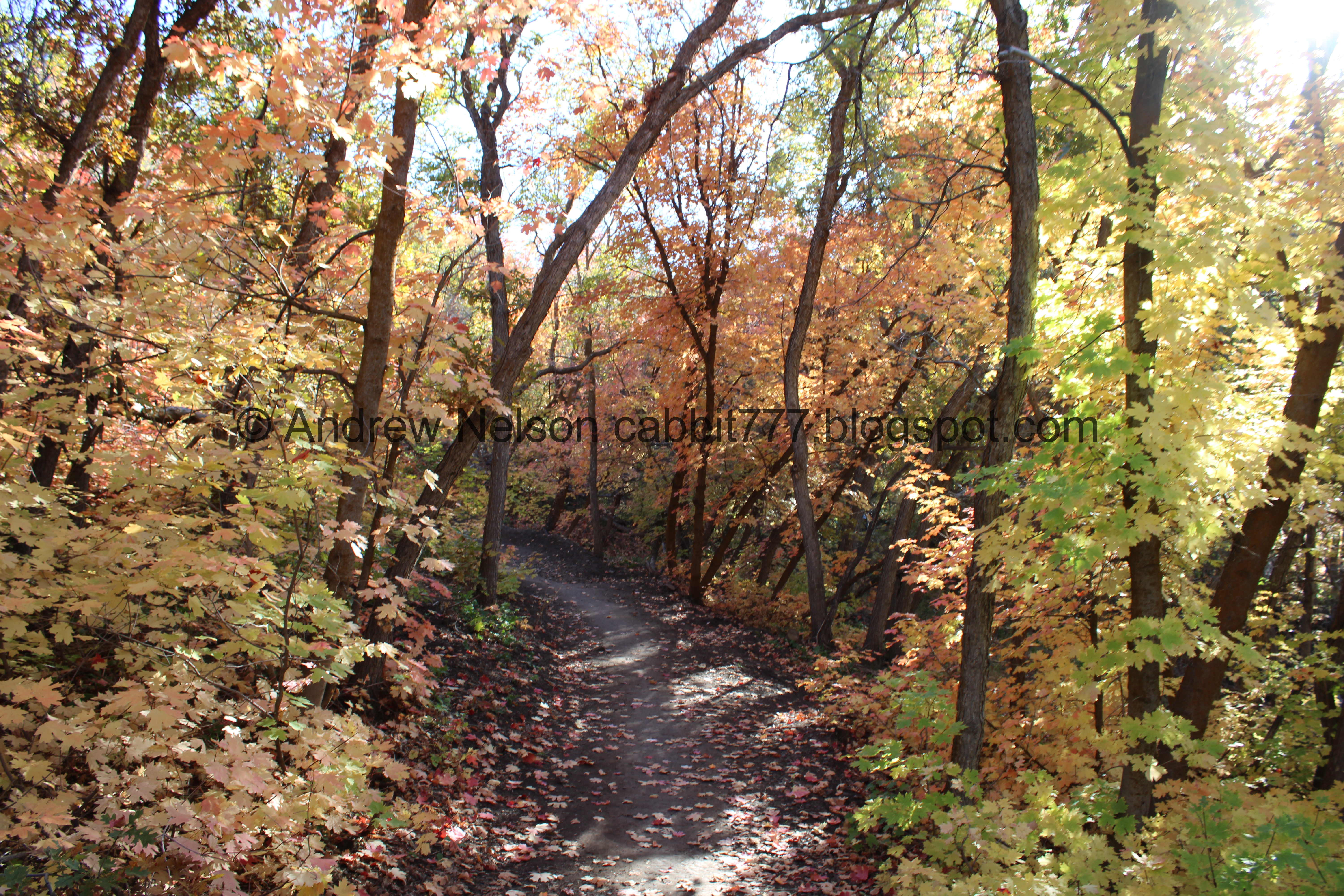
The canyon road. We picked up the trail just on the other side of the gate to the left.

Heading into the trees.

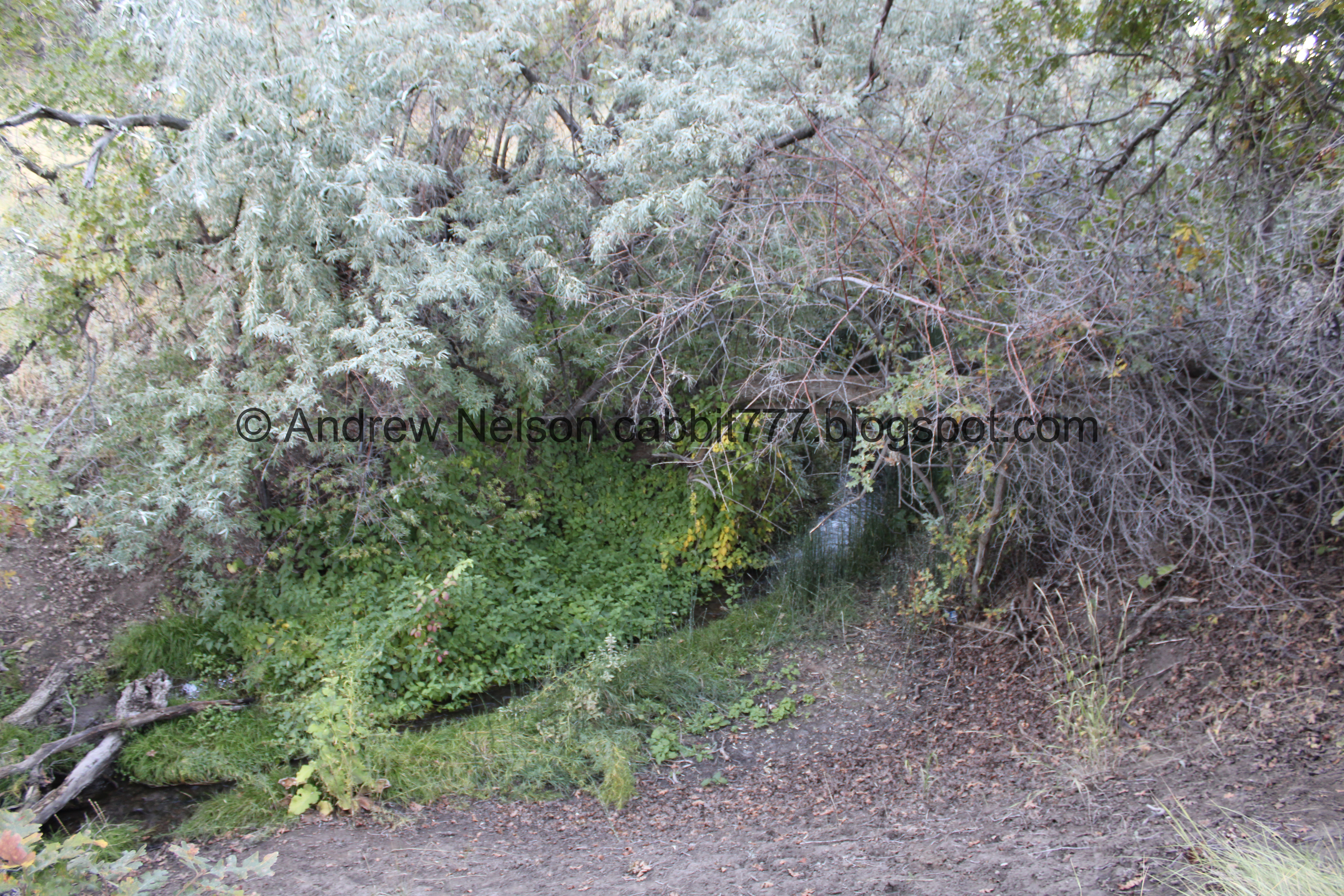
Old shoddy bridge over the creek. Luckily the creek is pretty small.

Then you pop out into a grassy plain.

View of the Kennecott Copper Mine.
Random fun fact: This mine is so big it swallowed an entire town called Bingham Canyon.

Snake.

The trail.

Some sunflowers still hanging on.

Little stand of trees.

Burdock.

More forest.

I was a little concerned we were not on an official trail until we came across these signs. Ok phew! Looking at this sign, it would appear we are on the Copper Rise Trail.

I was a little disappointed in the lack of color on this trail at first.


However, we slowly started to see some nice splashes of color.


Then boom! Lots of color.

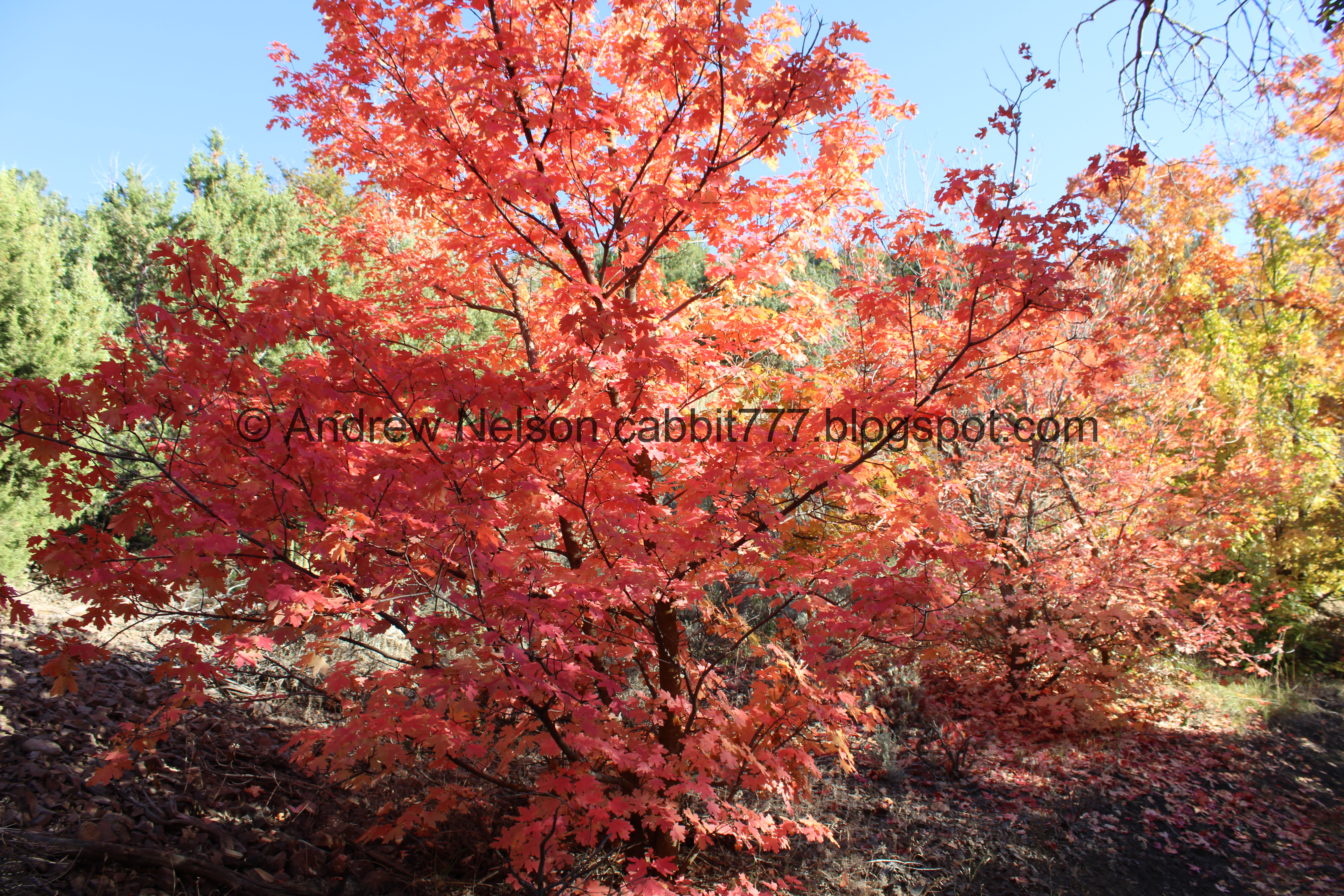
Some maple leaves.

Some oaks.

Pretty forest.


Lots of pretty color.


There really is something just magical about being in a forest this time of year. I wish it would last just a little longer. However, I guess that is what makes it so special, that it is so fleeting.

Giant wasp nest. There was a family with a kid holding a football who seemed to be making plans to toss it at the nest. I jokingly asked he wait just a few minutes for us to pass. Mom assured us it wasn’t gonna happen. o.O


More color.

Random lean-to. I swear I see one of these on just about every trail we do.


Super pretty.

Looking up.


More color.


Maple leaves.

Another little clearing. The trail looks like it has been groomed some. Which, I discovered after the fact is true; they built/groomed these trails this year.

The mine again.

Wispy flowers.

Partially turned tree.

More trail.

Bridge near a pull out on the road. I am pretty sure this is new.
Since there is a pull out from the road, this spot is a little busier than the rest of the trail.

The creek.

Some color.

The mine again.

Neat rock formation.

Some bright orange.

Rabbitbrush.

More color.

A second bridge. Which I think is also new.

Another little clearing.

Another wispy flower.

Another partially changed tree.

More of the clearing.

Some white daisy-like flowers still hanging on.

Into another stand of trees.

With some hints of color.

Looking up.

Another random lean-to.


More color.

The creek below.

More color.


The mine again.

More color.

Into the trees again.

Looking up.


Another colorful patch.

Looking up again.

Some pinks.


More forest.

Cacti.


More forest.


So magical.

Looking up.


I think this might have been the best spot for the day.

Super pretty.

Then we hit the switchback. Up until this point the trail was fairly flat and easy going. It stayed on the canyon bottom and followed the creek. I was hoping this was a quick switchback to go around an obstacle. Spoiler: unfortunately, it was not. This was about 1.6 miles up, so it is a respectable turn around point if you don’t want to climb.


Still in this colorful stand of trees for a little longer.


Then it opened up and allowed us to view the mine again.

Now the trail is along the side of the canyon. I don’t really like trails like this as they tend to trigger my fear of heights, but it seemed pretty wide and not too bad so I persisted for a bit.

The mine again.
.jpg)
Panoramic.

More color.

Yuck, it just seems to keep going.

I almost quit, but decided to see what happened around the bend here.

It just dipped into a side gully for a minute. However it did have a view of the mine.

They built a high berm here. I imagine to prevent bikes from flying off the mountain.

Small patch of color.

Nice view up Butterfield Canyon.

Through some junipers.

The mine again.
Well, I decided I had had enough. Like I said it wasn’t too bad, but it just seemed to keep going. 1) I wanted to frolic in a colorful forest today, and it did not appear that was going to happen this way. 2) I had no idea where this was taking me. For all I knew it could take us back towards the mouth of the canyon. If I knew what was ahead, I probably could have powered through.
Since the trails are still pretty new, I am not finding a whole lot of information, but what I did find was that it might have taken us up to some radio towers. Meh, we didn’t miss too much it would seem. However I am not opposed to possibly returning.

Juniper trees.

Another view up canyon.

Back to the high berm.

The mine again.
.jpg)
Another panoramic.

More color.


Some sad, dried up taper tip onions.

Pretty orange tree.

Pretty red.

The trail again.

Pretty purple daisy-like flowers still holding on.

The mine again.

More color.

The trail goes through a scree field.

Back into the color.


Red and yellow.


Peach.

Leaf litter.


More color.

More leaf litter.

Back down to the creek.


More forest.

Looking up.

More forest.

Some white flowers.

Below the scree field.


More forest.

Backlit trees.

The mine again.


More color.

I love the bent trees.

Aspens.

Colorful aspens.

One of the lean-tos.

More forest.

Looking up again.

Orange tree.

One of the clearings with a view of the mine again.
.jpg)
Another panoramic, now that we are in it’s shadow.

The mine again.

To the east.

Neat rock.


More color.

Back to the 2nd of the pair of bridges.


I wonder what these flowers are. They kind of look like lupine, but not.

Pretty tree.

More forest.


More color.

Looking up again.

More woods.

Up again.


More color.

Back down to the trail splits. We came from that trail to the left, so back that way.

Juniper tree.

More forest.

Another small clearing.

Sunflowers.

Looking back at the mine.
The creek again.

Lots of rabbitbrush.

The mountains on the other side of the valley.

I am a little surprised I found the trail-split we needed to get back.

Back to the sad bridge.

Back to the trailhead with a view of Mount Timpanogos.

There is no trespassing on the north side of the road, and it is signed as much. It used to be that way for the south side of the road, but it looks like those signs have been removed with the new agreement with Salt Lake County.

See, no signs on the south side.

Mountains on the other side of the valley as we head back (PSP).
.jpg)
A quick panoramic (PSP).
That was a fun adventure! I am glad Kennecott has worked with the county to open up some trails to allow us to explore the canyon safely while the road is still open. You can still hear the traffic on the road, particularly now during prime leaf peeping season, but it isn’t too bad. The trail is not terribly busy, except for the easy access spots where non hikers crowd in to get fall photos. Ultimately, I look forward to how the trail network might improve over the years. It was exciting to do a new trail too. 8 out of 10 squirrels. Losing 1 due to lack of information due to being such a new network of trails.
As for difficulty, what we did today is a good DR3. Most of it was a smooth gentle climb. The climb we did do was not too bad either.
Dogs are allowed, leashed. Please clean up after your furry friends!

No comments:
Post a Comment