.jpg)
Beacon Knob on Antelope Island is a great easy and mostly safe peak to bag. It has a pretty mild elevation gain, and features amazing views of both sides of the island, a little bit of history, and a very good chance of seeing wildlife. There is absolutely no shelter from the sun, so I don’t recommend doing it on a hot day, but it is great during a mild spring day. We've done this one before, but it is quite lovely, and it's been a couple years so we decided to do it again.


Quick Details:
Length: About 5 miles out and back (don’ get fooled by the sign, more info below).
Trail Type: out and back, loop option.
Difficulty: DR3. It is a pretty mild climb.
Elevation Gain: About 500 ft.
Restroom: No. Closest one is at the marina, or I found a porta potty at the Mountain View TH, but I am not sure how permanent that is.
Dogs? Yes, leashed. Please clean up after your furry friends. and also, be aware there is wildlife here. Even the most trained dogs can run off after wildlife and become a meal.
Other Info: Fee Area. $15.00 per car as of 2020, up from 10 bucks.
To Get Here:
Take i15 to the Antelope Drive exit in Layton and head west. Pay the causeway fee and cross the causeway. Once you hit the island, head left at the first junction. Take the first left again following the signs for the ranch. Take the first right signed for Rock Quarry.

Onto the causeway (Passenger Seat Photography (PSP)).
I didn’t take a picture on the way in, but they have added a 2nd lane at the fee station, only for day use passes using a credit card. It wasn’t too busy this time, but if it was like the last time we came out here I am sure if will speed things up quite a bit.

The Island from the causeway (PSP).

Dry lake bed (PSP). We had a pretty dismal winter, and are going to have a rough summer with drought conditions.

Finally hitting some water (PSP). You can see Lady Finger Point and Egg Island here.

You can see the fresh water mixing into the salt water just past the opening in the causeway (PSP).

Island Sign and one of the artistic bison statues that starting popping up during the Olympics (PSP).

We decided to drive down to the south end of the island first (PSP).

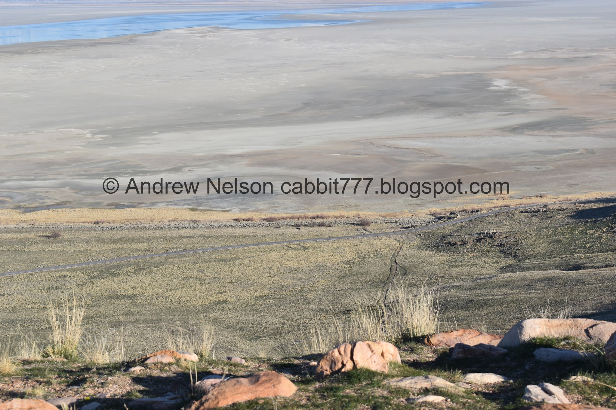
The lake is really low (PSP). That’s pretty much just the Jordan River flowing across the lake bed.

More of the lake (PSP). That little dot is a bison.

That is where we will be heading later (PSP). It’s not terribly impressive from here.

Frary Peak and Dooley Knob (PSP).

Stringham Peak and Frary Peak (PSP).

Nearing the south end of the road (PSP).
Fielding Garr Ranch was awfully busy, so we decided to skip it and head back to the Beacon Knob Trail.

Some bison off in the distance (PSP).

I wonder what these circular patches of plant life are (PSP. There are quite a few of them along the shores.


We saw a hawk on the way back (PSP). It was pretty high up, and I didn’t get th best shots, but leaning towards a red-tailed hawk.

More bison (PSP).

With the lake (PSP).

The lake widens up as we head further north (PSP).

Bison on the hill (PSP).
The Trail:

Trailhead sign.
Don’t let the 1.8 miles fool you. Now that I look at this a bit more closely, the 1.8 miles lead to the first junction. For some reason I thought it lead to the 2nd junction.

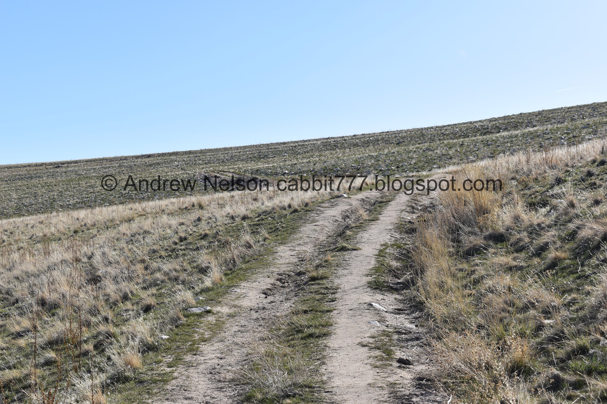
This is one of those fun trails you can see the destination from the beginning.

View of the lake and downtown SLC.

The gravel pit.

Some bison in the distance.

A few more on the other side.

Following the trail up towards the ridge.

The destination.

Looking back towards the lake.

Interesting early bloomer. Leaning towards a parsley of some sort. Leaning towards Pungent desert parsley.
When the trail switches back to the right, that is about the steepest part. It’s not too bad though.

Oi. little bit of a climb.

We had a pair of crows that pretty much escorted us for most of the trail. Or probably more likely, they happened to be hunting along the trail, and we kept disturbing them.
Aside from the classic caw caw crow sound that makes easily identifiable against ravens, note the tail shape, being a flat edge seals the deal. I really struggled distinguishing the two until I learned that. Raven have a pointed tail.

Looking out towards the lake again.

I love the rings of rocks.

Another bit of a climb here.

You can see the rings of rocks better here.

Last little push to the ridge.

Woo. Finally on the ridge. You gain most of the elevation in that first 3/4 mile! But, when you reach the ridge you get a bit of a break for a minute.

First view of Buffalo Point. It has been so long since I have done that. I definitely need to do it again.

I’m pretty sure that is Stringham Peak blocking the view of Frary Peak.

White Rock Bay.

Oh look! a herd of pronghorn antelope.

Of course by the time I got the telephoto lens on most of them had gotten too far down to see, and the one straggler was super far. Not too big of a surprise, they are the fastest land mammals in the western hemisphere.

Neat sphynx looking rock.

While I had the telephoto in, he are some bison.

The white rock of White Rock Bay.

Panoramic.
White Rock Bay and Bridger Bay, separated by buffalo Point.


Now we begin the 2nd climb! Its not too bad.

White Rock Bay again.

Better view of Buffalo Point.

More bison. I was starting to worry about how close to the trail they might be, and if we would have to make a wide arc around them, like the last time we did this trail. Luckily they were not as close to it as it appeared.

More of the climb.

Fun rocks.

To the west.

To the east.

Once you reach the top, it flattens out again. Phew!

Looking to the north.

Horse and bison tracks.

According to the signs, the first junction should be 1.8 miles, but my pedometer put it at 1.7, meh close enough.

Junction sign. It says it is another 4/10th of a mile to the Beacon Knob Spur, and then another 4/10’s of a mile to the peak. So according to the signs it should be about 2.6 miles. I suppose that is close enough.

It’s mostly flat between the 2 junctions, it’s kind of nice.

Skirting around Beacon Knob, which really isn’t much higher than where we are now.

Buffalo Point again.

Nice wide bench here.

Weird white rock.

Nice and flat. Oh, you can also see Elephant Head here. You can see that a little closer on the Bone Road Trail. One of these days I will continue out to it.

This point doesn’t appear to have a name, and I suppose it just associated with Beacon Knob.
This part of the trail it is fun to play: Bison, or rock haha.

Starting to be able to see more of the islands mountains.

At about 2.10 miles we reach the spur trail for Beacon Knob.

Another trail sign.

More up. Oi. Luckily it is not too bad.

Nice view into White Rock Bay.

First view of Dooley Knob another great peak to climb on the island.

More climbing.

Dooley Knob, Stringham Peak (I think?), and Elephant Head.
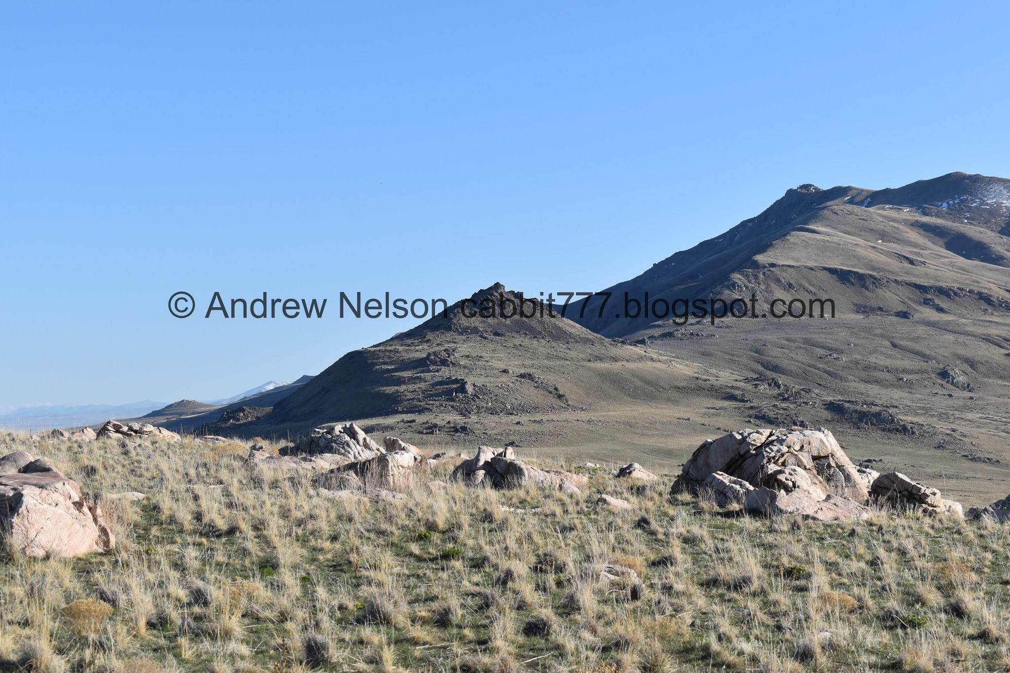
Closer look at Dooley Knob.

White Rock Bay again.

The mountains again.

The boulders loosely resemble the mountains behind them.

White Rock Bay again. Oh and we can see the white rock again.

First glimpse of the buildings on the peak.

Closer.

Almost there.
Woo! We made it! Huh, one of the towers seems to be a little bit skewed.

Here you can see the ruins of the original beacon. And the picnic area next to it.

This old building remains.


However, it appears to have been taken over by birds of some sort.

Window with a view.


The ruins of the original again.
There is a bit of a drop off on the southeast part of the peak. I didn’t dare to get much closer to the edge so I don’t really know how bad it is. I would recommend ensuring any little ones keep back.
But wow! Check out that view!
Panoramic. Pretty sure we have Layton and all the way down to Draper here.

Dooley Knob and the Antelope Island spine.


More view.

Time to put on the telephoto lens. Some bison below.

Downtown Salt Lake City.

Little zoomed out.

The new beacon, which I think is more of a weather station, and the ruins of the old beacon, which served as a waypoint along a long network of waypoints for planes in the late 1920’s.

The lake to the east again. Like I said, it is little more than the Jordan River flowing across the very low lake bed.

Huh. That looks like another old jeep trail that they have not turned into a hiking trail.
Panoramic. Layton to Draper.

Ruins.
Well, we made it to the peak, and enjoyed the views, but we should probably get going if we want to make it back before dark.

The islands spine again.

The west side of the lake is a lot more full than the east.

White Rock Bay, with the white rock.

The un-named point below beacon Knob, and Buffalo Point.

Elephant Head.

White Rock Bay again.

I love the random boulders strewn along the hills.

Last descent before rejoining the White Rock Loop Trail.

The un-named point.

The lake and more random boulders.


Bison.

Buffalo Point and Lady Finger Point.

The bison again.

Trail Junction. White Rock Loop continues to the left. We will head back down to the right on the Rock Quarry Trail.

Bison again.

The lake and Lady Finger Point again.

The rock quarry and the parking lot below.

Heading down.

Buffalo Point.

More of the pungent desert parsley. There are a bunch of them all along this trail.

I am not 100% sure, but I think this is a bison wallow. Bison like to roll around in the mud and sand for a few reasons, mostly as a pest control method.

Neat “Jenga” stack of rocks.

Back to the Sphinx looking rock.

A final look at White Rock Bay.

Another spot that I think might be a bison wallow.

Lake to the east.

The different layers of rocks again.

Bison by the lake.

Hikers on the ridge. I figure the distance and lighting makes it anonymous enough to include.

Bison.

Looking back at the peak we just climbed.

Another bison. I liked that we got to see them closely without a problem, and far enough that we didn’t have to make a wide arc around the trail like we had to do last time we did this trail.

In fact, I felt comfortable enough to pull out the telephoto lens.


Loving that I can enjoy the bison from a safe distance with the telephoto lens.

However. If they stop what they are doing to look at you, you are too close.
He actually only glanced at me, and then kept doing his thing, but still... Eeep, alright, moving along. Better safe than sorry.

Another bison wallowing. Yay! Glad I was able to catch this!

More bison.

Now this, this is too close to the trail. I am glad we are further down the trail and did not have to arc around them. But, if we were coming from the other direction we would have.
Note: Antelope Island has a lot of signs saying to please stay on the trail. However they would prefer you to be safe, and not bother wildlife. You are 100% in the right to go off trail to avoid getting too close to bison. It’s a win win. You are safe, the wildlife is safe.

The lake again.

One last look at the bison.

Back to the trail head.

Another look at the peak.

The causeway with the passthrough (PSP).

The lake and the mountains (PSP).

Lake and mountains again.

Sunset
Panoramic.

Looking back at the island (PSP).

Sunset behind us (PSP)

As we approach the fee station you can see the new lane they opened. (PSP).
This trail is quite a bit further than I anticipated, but was mild enough to not really notice. It’s a pretty easy, and mostly safe peak to bag (just ensure little ones stay away from drop off). It offered great views and some fun wildlife. 10 out of 10 squirrels.

As for difficulty, there is a bit of a climb, but for the most part its not bad. DR3.
Dogs are allowed, but must be leashed at all times. Please clean up after your furry friends!