.jpg)
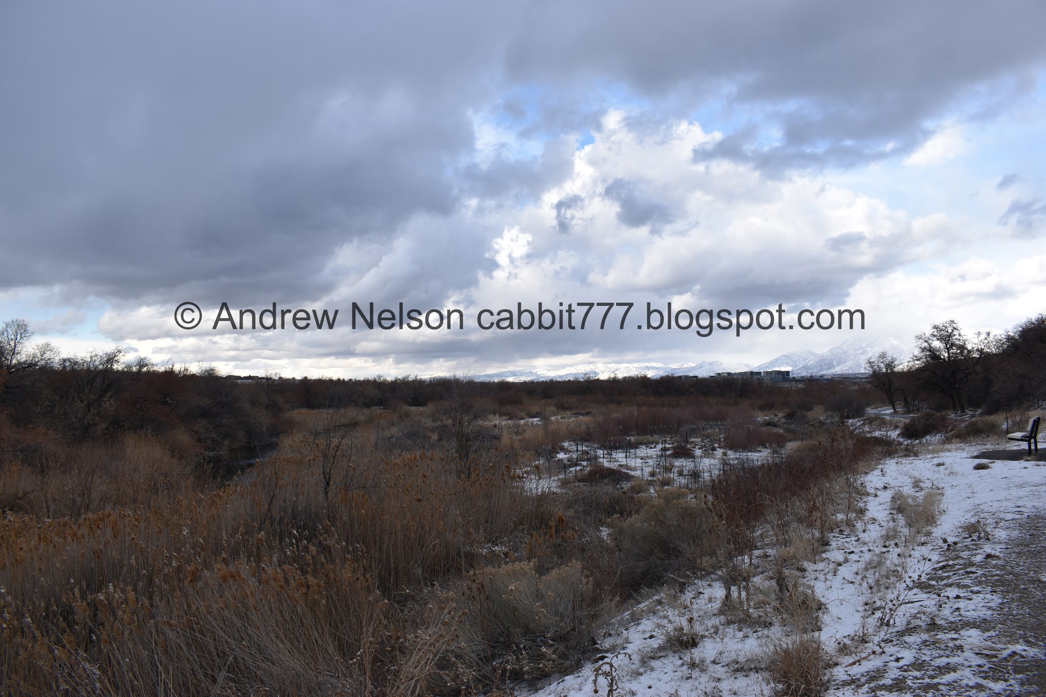
I have been slowly working my way along the Jordan River Parkway. It’s about 45 miles long so I have been doing it in smaller segments. Today I actually skipped forward a few segments and decided to check out the route through the Galena Preserve. I think this is my favorite segment. Since its a preserve there aren’t any buildings and it seems mostly undisturbed by man (except for the pathway). Plus I saw quite a few hawks today! Even though I grew up not too far from here, I have not really explored this part of the valley until now, so it’s kind of new and fun for me.

Quick Details:
Length: This segment is 1.5 miles along the JRP, but there is an additional half mile from the TH to the JRP. I ended up doing 4 miles out and back.
Trail Type: Out and back or point to point.
Difficulty: DR2. Its paved
Elevation Gain: About 150 feet.
Restroom: No. There is one at the Roi Hardy Park and Rotary Park TH’s to the north, or the Springview Farms TH to the south.
Dogs? Yes, leashed.
Other Info: Cities: Bluffdale, Draper. Mile Markers: 15
To Get Here:
Take i15 to 12600 S, head west. Turn left on 13th west. Take that for about 1.5 miles, there is a tight, steep S curve, the trail head will be on the left just after that.
The Trail:

Trailhead Sign.

Point Of The Mountain. The Bonneville Shoreline is so prominent on it.

Nice view into Corner Canyon.

View of the mountains to the north.

Little closer.


Entering a little forest.

First hawk of the day. I think it was a northern harrier.

Nice view of Mount Jordan.

Point of the Mountain again.

Water. It looks like it might come from a spring.

I am pretty sure this is the same hawk, so keeping the count at 1.

A half mile later, I finally reached the Jordan River Parkway. Seriously, a HALF MILE!?!?! I could tell the trailhead was a bit set back, but I wasn’t expecting that far! Oh well, at least it was pretty.

You can just see the Jordan River through the phragmites.

Better view with some duckies!

Speaking of ducks, here are a bunch of duck prints.

Bridge over the river.

View to the north.

View to the south.

Wow. I think I am going to enjoy this section.

Crossing the river means we have entered Draper.

Surprise, surprise, this area was up for development. Luckily in 2009 a conservation easement was made which preserved the area indefinitely. This is due to an archeology study done in 2006 that found a 2400 year old pit house and more than 28,000 artifacts.
Lovely view.

I wonder what these piles of sticks are for.

There is a little bit of a climb here.

View of the river below.

Fun clouds.

The river again.

More climbing. At least it is pretty gradual.

The climb does offer a nice overhead view of the river.

What do we have here.


The lighting isn’t the best, but I believe we have a red-tailed hawk here.


And he’s off!

Probably the shot of the day!


Fun to watch them zip around.
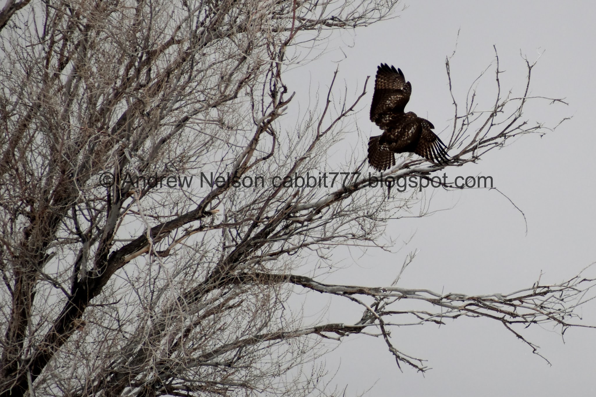

Incredible.


I am still leaning towards a red-tailed hawk, even if I can’t see most of the main identifying features. However, hawks are really hard to identify. Particularly when you didn’t get the best pictures. Red-tailed hawks are the most common hawks we have so, generally it is a safe bet to call a hawk a red-tailed unless everything seems wrong.

Before long I reached Avery Hot Spring. Kind of an odd spot for a hot spring, but here it is.

The river again.

Avery Hot Spring. According to some of the google reviews, it is 150 degrees. I imagine the city fenced it off to prevent any injury lawsuits.
I thought it would be more exciting after a fresh snow, but, it just looks like a regular spring today. Maybe need to try again on a colder day.

Not terribly exciting.


Little bit closer.

The spring next to the river.

My little hawk friend still hanging out.

Back to the JRP.

Looking back down at the spring.

Opening in the clouds allows a view of the Oquirrhs.

The river below.

We reached the top of the hill and will now be going back down.

Fun storm clouds.

Where the equestrian trail splits off of the main trail again.

Another hot spring?

JRP Mile Marker 15.

Hawk #3.

Neat looking storm.

View. Loving the open space.

Mountains.

Holy tumbleweeds Batman.

Mount Jordan.

Looking back behind me.. uh oh. I’m not sure if that is moving towards me or away. Thought about turning around, but ultimately pushed on.

Interesting old structure.

Little closer. This side trail appears to connect to the neighborhood above and is about 4/10ths of a mile.

Even closer.

Whoa. You can see Mount Timpanogos from here!

Hawk #4 and some ducks.

Kennecott Copper Pit. and Butterfield Canyon..

The Gelena Soo’nkahni Monument.

In 1991 before Bangerter Highway was constructed this area was surveyed. They found multiple geothermal features and 2 archaic aged habitat structures as well as numerous other artifacts. This monument honors Native American People in this area and nearby areas. Soo’nkahni is Shoshone for many homes.
The conservation easement is held by Utah Open Lands, owned by the Division of Forestry Fire and State Lands in collaboration with the numerous tribes of the state of Utah.
Each of the other pillars surrounding the center one talks of the different tribes around the state. It’s actually a lovely monument.

Mountains.

Corner Canyon Creek as it nears joining the Jordan River.

The Oquirrh Mountains.


The floodplain.

Hawk #5. Hard to identify a hawk from behind, however I have observed that Northern harriers tend to like to stay lower to the ground, so I am leaning towards that.
I am honestly surprised I spotted this guy, he was pretty far away.


Northern flicker. One of our prettier woodpeckers. I sometimes get these in my backyard.

Floodplain.

Fun clouds.

Floodplain again.

Pretty blue birds.

At about 2 miles I reached the eBay building. I could have pushed on and completed the last half mile to the next trailhead, but I decided not to push it today. All in all, I think I can squish the next couple trailheads into one and push on to this point in a good 2 mile segment so, eh, maybe it worked out in the end for me. But I guess we will see. Anyway, I decided to turn back here.

Looks like I would have hit a wooded section had I kept going.

Now that I got a decent shot, I think these are mountain blue birds.

Floodplain again.

Point of the Mountain.

Red-shouldered black bird. (not the best shot) these guys have one of the prettiest calls that I can think of.

Mount Jordan, Box Elder Peak and Mount Timpanogos peeking out just behind the hill.

Better view of Mount Timpanogos.

Point of the Mountain again.

Mount Jordan.

Hawk #6. this might be my new go to bird watch area!

More fun clouds.

Mount Jordan again.

Old tower. I wanted to get a bit closer but the No Trespassing sign stopped me. I know its more about covering their butt from liability than anything else, but eh. I am a rule follower. Plus, it really does look like a good sneeze could knock it over.

Hawk #7. Although this might be the same one as #6.


Again, leaning towards a red-tailed hawk.

Fun clouds.

I think this is a chickadee.

One of the hot springs.

Mile Marker 15 again.

Looking back across the preserve.

Kennecott again.

Hawk #8 (didn’t get a good shot of 7). This one looks like a Northern harrier to me, even if it is soaring a bit high.

Climbing the hill again.


The river below.

Avery Hot Spring again.

More of the river.


Back to the bridge over the river.

View south.

Re-entering Bluffdale.

Duckies!

More of the river.

Not the best shot, but a red shouldered black bird. These guys have a pretty song.

Down to the split to get back to the Arrow Trailhead.

More fun clouds.

View of the mountains.

Point of the Mountain again.

Heading through the small forest.

Fun mountain lighting.

More mountain views.

Back to the trailhead.

Geese coming in.
I really enjoyed this segment of the parkway. I think it might be my favorite so far. It’s pretty wild, offers some great views, and was great for bird watching today. Plus, it wasn’t very busy at all. 8 out of 10 squirrels.

As for difficulty, it is paved, and mostly flat with one hill. Going with a DR2.
Dogs are allowed, but must be leashed.
